

Rhode Island Route 138
Encyclopedia
Route 138 is a numbered State Highway running 45.2 miles (72.7 km) in Rhode Island
. It runs from the Connecticut
state line to the Massachusetts
state line and is the only state-numbered route that traverses the entire state.
over the Sakonnet River
until 1954.
Before the opening of the Jamestown
section of the Route 138 Expressway in 1994, Route 138 came off the Jamestown Bridge
and used Eldred Street (which has now been partially cut off by the Expressway) and East Shore Road to the Newport Pell Bridge
. As of 2005, there is still a Route 138 reassurance marker
northbound on East Shore Road just north of the Newport Pell Bridge
.
Prior to the construction of the Route 138 Expressway in North Kingstown
, Route 138 used Bridgetown Road east of U.S. 1
in South Kingstown
, then north on Route 1A
into North Kingstown
, then along an access road to the Jamestown-Verrazano Bridge
which was upgraded on the spot to the Route 138 Expressway.
There are two abandoned temporary ramps at the west end of the Jamestown Bridge
used by through traffic in the early 1990s. These ramps connected through traffic to the old bridge while the new one was being built. The new Jamestown Verrazzano Bridge opened in 1992.
The Route 138 Expressway was intended to extend west to Interstate 95
. For more information, see Interstate 895 (Rhode Island/Massachusetts).
Route 138 officially goes from being signed East/West to being signed North/South at the intersection of Admiral Kalbfus Road and West Main Road on the Middletown
/Newport
line.
and Middletown
, Rhode Island
. Route 138A is a "scenic route" highway that begins at the intersection of the Newport Bridge
Access Road (Route 138
) and J.T. Connell Highway, travels through downtown Newport
, past the Newport beaches, and north through Middletown
where it reconnects with Route 138
.
Most of the streets along Route 138A were built after 1965. Route 138A never represented an old alignment of Route 138
.
Rhode Island
The state of Rhode Island and Providence Plantations, more commonly referred to as Rhode Island , is a state in the New England region of the United States. It is the smallest U.S. state by area...
. It runs from the Connecticut
Connecticut
Connecticut is a state in the New England region of the northeastern United States. It is bordered by Rhode Island to the east, Massachusetts to the north, and the state of New York to the west and the south .Connecticut is named for the Connecticut River, the major U.S. river that approximately...
state line to the Massachusetts
Massachusetts
The Commonwealth of Massachusetts is a state in the New England region of the northeastern United States of America. It is bordered by Rhode Island and Connecticut to the south, New York to the west, and Vermont and New Hampshire to the north; at its east lies the Atlantic Ocean. As of the 2010...
state line and is the only state-numbered route that traverses the entire state.
Route description
Route 138 takes the following route through the State:- ExeterExeter, Rhode IslandExeter is a town in Washington County, Rhode Island, United States. Exeter extends east from the Connecticut border to the town of North Kingstown. It is bordered to the north by West Greenwich and East Greenwich, and to the south by Hopkinton, Richmond and South Kingstown. Exeter's postal code...
: 0.5 mile (0.80467 km); ConnecticutConnecticutConnecticut is a state in the New England region of the northeastern United States. It is bordered by Rhode Island to the east, Massachusetts to the north, and the state of New York to the west and the south .Connecticut is named for the Connecticut River, the major U.S. river that approximately...
State line at Route 138Route 138 (Connecticut)Route 138 is the portion of the long multi-state Route 138 within the state of Connecticut. It is one of several New England state highways that travel through three states while keeping their number designation. The route begins in Sprague at Route 97. From its western terminus up to the junction...
to HopkintonHopkinton, Rhode IslandHopkinton is a town in Washington County, Rhode Island, United States. The population was 8,188 at the 2010 census.The villages of Ashaway and Hope Valley are located in Hopkinton.-Geography:Hopkinton is found at 41.461 N latitude and 71.778 W longitude...
town line- Spring Street
- HopkintonHopkinton, Rhode IslandHopkinton is a town in Washington County, Rhode Island, United States. The population was 8,188 at the 2010 census.The villages of Ashaway and Hope Valley are located in Hopkinton.-Geography:Hopkinton is found at 41.461 N latitude and 71.778 W longitude...
: 5.2 miles (8.4 km); ExeterExeter, Rhode IslandExeter is a town in Washington County, Rhode Island, United States. Exeter extends east from the Connecticut border to the town of North Kingstown. It is bordered to the north by West Greenwich and East Greenwich, and to the south by Hopkinton, Richmond and South Kingstown. Exeter's postal code...
town line to RichmondRichmond, Rhode IslandRichmond is a town in Washington County, Rhode Island, United States. The population was 7,708 at the 2010 census. The villages of Alton, Arcadia, Carolina, Hope Valley, Kenyon, Shannock, Usquepaug, Woodville, and Wyoming are located in Richmond.-History:The town of Richmond was originally part...
town line- Spring Street, Nooseneck Hill Road and Main Street
- RichmondRichmond, Rhode IslandRichmond is a town in Washington County, Rhode Island, United States. The population was 7,708 at the 2010 census. The villages of Alton, Arcadia, Carolina, Hope Valley, Kenyon, Shannock, Usquepaug, Woodville, and Wyoming are located in Richmond.-History:The town of Richmond was originally part...
: 6 miles (9.7 km); HopkintonHopkinton, Rhode IslandHopkinton is a town in Washington County, Rhode Island, United States. The population was 8,188 at the 2010 census.The villages of Ashaway and Hope Valley are located in Hopkinton.-Geography:Hopkinton is found at 41.461 N latitude and 71.778 W longitude...
town line to South KingstownSouth Kingstown, Rhode IslandSouth Kingstown is a town in Washington County, Rhode Island, United States. The population was 30,639 at the 2010 census.South Kingstown includes the villages of Kingston, West Kingston, Wakefield, Peace Dale, Snug Harbor, Tuckertown, East Matunuck, Matunuck, Green Hill, and Perryville. Peace...
town line- Main Street and Kingstown Road
- South KingstownSouth Kingstown, Rhode IslandSouth Kingstown is a town in Washington County, Rhode Island, United States. The population was 30,639 at the 2010 census.South Kingstown includes the villages of Kingston, West Kingston, Wakefield, Peace Dale, Snug Harbor, Tuckertown, East Matunuck, Matunuck, Green Hill, and Perryville. Peace...
: 8.9 miles (14.3 km); RichmondRichmond, Rhode IslandRichmond is a town in Washington County, Rhode Island, United States. The population was 7,708 at the 2010 census. The villages of Alton, Arcadia, Carolina, Hope Valley, Kenyon, Shannock, Usquepaug, Woodville, and Wyoming are located in Richmond.-History:The town of Richmond was originally part...
town line to North KingstownNorth Kingstown, Rhode IslandNorth Kingstown is a town in Washington County, Rhode Island, United States. The population was 26,486 at the 2010 census. The famous American portraitist Gilbert Stuart was born in the village of Saunderstown, located in the southern region of North Kingstown....
town line- Usquepaugh Road, Kingstown Road, Moorsefield Road and Tower Hill Road
- North KingstownNorth Kingstown, Rhode IslandNorth Kingstown is a town in Washington County, Rhode Island, United States. The population was 26,486 at the 2010 census. The famous American portraitist Gilbert Stuart was born in the village of Saunderstown, located in the southern region of North Kingstown....
: 5 miles (8 km); South KingstownSouth Kingstown, Rhode IslandSouth Kingstown is a town in Washington County, Rhode Island, United States. The population was 30,639 at the 2010 census.South Kingstown includes the villages of Kingston, West Kingston, Wakefield, Peace Dale, Snug Harbor, Tuckertown, East Matunuck, Matunuck, Green Hill, and Perryville. Peace...
town line to JamestownJamestown, Rhode IslandJamestown is a town located in Newport County, Rhode Island, in the United States. The population was 5,405 at the 2010 census. Jamestown is situated almost entirely on Conanicut Island, the second largest island in Narragansett Bay.-History:...
town line- Tower Hill Road and Route 138 Expressway
- JamestownJamestown, Rhode IslandJamestown is a town located in Newport County, Rhode Island, in the United States. The population was 5,405 at the 2010 census. Jamestown is situated almost entirely on Conanicut Island, the second largest island in Narragansett Bay.-History:...
: 3.2 miles (5.1 km); North KingstownNorth Kingstown, Rhode IslandNorth Kingstown is a town in Washington County, Rhode Island, United States. The population was 26,486 at the 2010 census. The famous American portraitist Gilbert Stuart was born in the village of Saunderstown, located in the southern region of North Kingstown....
town line to NewportNewport, Rhode IslandNewport is a city on Aquidneck Island in Newport County, Rhode Island, United States, about south of Providence. Known as a New England summer resort and for the famous Newport Mansions, it is the home of Salve Regina University and Naval Station Newport which houses the United States Naval War...
city line- Route 138 Expressway
- NewportNewport, Rhode IslandNewport is a city on Aquidneck Island in Newport County, Rhode Island, United States, about south of Providence. Known as a New England summer resort and for the famous Newport Mansions, it is the home of Salve Regina University and Naval Station Newport which houses the United States Naval War...
: 1.6 miles (2.6 km); JamestownJamestown, Rhode IslandJamestown is a town located in Newport County, Rhode Island, in the United States. The population was 5,405 at the 2010 census. Jamestown is situated almost entirely on Conanicut Island, the second largest island in Narragansett Bay.-History:...
town line to MiddletownMiddletown, Rhode IslandMiddletown is a town in Newport County, Rhode Island, United States. The population was 16,150 at the 2010 census. It lies to the south of Portsmouth and to the north of Newport on Aquidneck Island, hence the name "Middletown."-Geography:...
town line- Route 138 Expressway and Admiral Kalbfus Road
- MiddletownMiddletown, Rhode IslandMiddletown is a town in Newport County, Rhode Island, United States. The population was 16,150 at the 2010 census. It lies to the south of Portsmouth and to the north of Newport on Aquidneck Island, hence the name "Middletown."-Geography:...
: 3.2 miles (5.1 km); NewportNewport, Rhode IslandNewport is a city on Aquidneck Island in Newport County, Rhode Island, United States, about south of Providence. Known as a New England summer resort and for the famous Newport Mansions, it is the home of Salve Regina University and Naval Station Newport which houses the United States Naval War...
city line to PortsmouthPortsmouth, Rhode IslandPortsmouth is a town in Newport County, Rhode Island, United States. The population was 17,389 at the 2010 U.S. Census.-Geography:According to the United States Census Bureau, the town has a total area of , of which, of it is land and of it is water. Most of its land area lies on Aquidneck...
town line- West Main Road and East Main Road
- PortsmouthPortsmouth, Rhode IslandPortsmouth is a town in Newport County, Rhode Island, United States. The population was 17,389 at the 2010 U.S. Census.-Geography:According to the United States Census Bureau, the town has a total area of , of which, of it is land and of it is water. Most of its land area lies on Aquidneck...
: 8.5 miles (13.7 km); MiddletownMiddletown, Rhode IslandMiddletown is a town in Newport County, Rhode Island, United States. The population was 16,150 at the 2010 census. It lies to the south of Portsmouth and to the north of Newport on Aquidneck Island, hence the name "Middletown."-Geography:...
town line to Tiverton town line- East Main Road and Fall River Expressway
- Tiverton: 3.1 miles (5 km); PortsmouthPortsmouth, Rhode IslandPortsmouth is a town in Newport County, Rhode Island, United States. The population was 17,389 at the 2010 U.S. Census.-Geography:According to the United States Census Bureau, the town has a total area of , of which, of it is land and of it is water. Most of its land area lies on Aquidneck...
town line to MassachusettsMassachusettsThe Commonwealth of Massachusetts is a state in the New England region of the northeastern United States of America. It is bordered by Rhode Island and Connecticut to the south, New York to the west, and Vermont and New Hampshire to the north; at its east lies the Atlantic Ocean. As of the 2010...
State line at Route 138Route 138 (Massachusetts)Route 138 is a north–south state highway in Massachusetts. From Milton, Route 138 runs south through the following towns/cities:* Canton * Stoughton...
- Fall River Expressway and Main Road
Exit list
All exits are unnumbered.| County | City | Mile | Destinations | Notes |
|---|---|---|---|---|
| Washington Washington County, Rhode Island Washington County, commonly known colloquially as South County, is a county located in the southwestern part of the U.S. state of Rhode Island. Washington County borders Kent County to the north, New London County in Connecticut to the west, Suffolk County in New York to the southwest, the Atlantic... |
North Kingstown North Kingstown, Rhode Island North Kingstown is a town in Washington County, Rhode Island, United States. The population was 26,486 at the 2010 census. The famous American portraitist Gilbert Stuart was born in the village of Saunderstown, located in the southern region of North Kingstown.... |
? |  U.S. Route 1 U.S. Route 1U.S. Route 1 in Rhode Island In the U.S. state of Rhode Island, U.S. Route 1 is a major north–south state highway through Providence. Staying close to the Atlantic Ocean and Narragansett Bay, it is a longer route than Interstate 95, and many portions are a four-lane divided highway.... - Westerly, Providence Providence, Rhode Island Providence is the capital and most populous city of Rhode Island and was one of the first cities established in the United States. Located in Providence County, it is the third largest city in the New England region... |
Freeway begins |
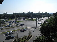
| ? |  Route 1A - Wickford Route 1A - WickfordWickford, Rhode Island Wickford is a small village in the town of North Kingstown, Rhode Island, United States, which is named after Wickford in Essex, England. Wickford is located on the west side of Narragansett Bay, just about a 20 minute drive across two bridges from Newport, Rhode Island... , Narragansett Narragansett, Rhode Island Narragansett is a town in Washington County, Rhode Island, United States. The population was 15,868 at the 2010 census, but there is a greater population in the summer. The nickname for the town is "Gansett". The town of Narragansett occupies a narrow strip of land running along the eastern bank... |
|||
| Jamestown Verrazzano Bridge | ||||
| Newport Newport County, Rhode Island -National protected areas:* Sachuest Point National Wildlife Refuge* Touro Synagogue National Historic Site-History:Newport County was constituted on June 22, 1703, as one of the two original counties of the Colony of Rhode Island and Providence Plantations. As originally established, Newport... |
Jamestown Jamestown, Rhode Island Jamestown is a town located in Newport County, Rhode Island, in the United States. The population was 5,405 at the 2010 census. Jamestown is situated almost entirely on Conanicut Island, the second largest island in Narragansett Bay.-History:... |
? | Helm Street/Beacon Avenue - Jamestown Jamestown, Rhode Island Jamestown is a town located in Newport County, Rhode Island, in the United States. The population was 5,405 at the 2010 census. Jamestown is situated almost entirely on Conanicut Island, the second largest island in Narragansett Bay.-History:... |
|
| ? | Conanicus Avenue/East Shore Road - Historic Jamestown Jamestown, Rhode Island Jamestown is a town located in Newport County, Rhode Island, in the United States. The population was 5,405 at the 2010 census. Jamestown is situated almost entirely on Conanicut Island, the second largest island in Narragansett Bay.-History:... |
|||
| Claiborne Pell Newport Bridge Claiborne Pell Newport Bridge The Claiborne Pell Bridge, commonly known as the Newport Bridge, is a suspension bridge operated by the Rhode Island Turnpike and Bridge Authority that spans the East Passage of the Narragansett Bay in Rhode Island , connecting the City of Newport on Aquidneck Island and the Town of Jamestown on... (toll) |
||||
| Newport Newport, Rhode Island Newport is a city on Aquidneck Island in Newport County, Rhode Island, United States, about south of Providence. Known as a New England summer resort and for the famous Newport Mansions, it is the home of Salve Regina University and Naval Station Newport which houses the United States Naval War... |
? | J.T. Connell Road - Scenic Newport Newport, Rhode Island Newport is a city on Aquidneck Island in Newport County, Rhode Island, United States, about south of Providence. Known as a New England summer resort and for the famous Newport Mansions, it is the home of Salve Regina University and Naval Station Newport which houses the United States Naval War... |
||
| ? | Admiral Kalbfus Road - Newport Newport, Rhode Island Newport is a city on Aquidneck Island in Newport County, Rhode Island, United States, about south of Providence. Known as a New England summer resort and for the famous Newport Mansions, it is the home of Salve Regina University and Naval Station Newport which houses the United States Naval War... , Middletown Middletown, Rhode Island Middletown is a town in Newport County, Rhode Island, United States. The population was 16,150 at the 2010 census. It lies to the south of Portsmouth and to the north of Newport on Aquidneck Island, hence the name "Middletown."-Geography:... |
Freeway ends | ||
History
Route 138 used the Stone BridgeStone Bridge (Rhode Island)
The Stone Bridge was a bridge built in 1907 in Rhode Island that carried RI 138 over the Sakonnet River between Portsmouth and Tiverton. It was destroyed by Hurricane Carol in 1954, and replaced in 1956 by the Sakonnet River Bridge, located 0.8 mi to the north.-History:According to the...
over the Sakonnet River
Sakonnet River
The Sakonnet River is a tidal strait, in the U.S. state of Rhode Island. It flows approximately 23 km between Mount Hope Bay and Rhode Island Sound...
until 1954.
Before the opening of the Jamestown
Jamestown, Rhode Island
Jamestown is a town located in Newport County, Rhode Island, in the United States. The population was 5,405 at the 2010 census. Jamestown is situated almost entirely on Conanicut Island, the second largest island in Narragansett Bay.-History:...
section of the Route 138 Expressway in 1994, Route 138 came off the Jamestown Bridge
Jamestown Bridge
The Jamestown Bridge, usually referred to as the Old Jamestown Bridge to avoid confusion with its replacement, the new Jamestown Verrazzano Bridge, was a cantilever truss bridge that connected Conanicut Island to mainland North Kingstown, Rhode Island, spanning the West passage of Narragansett Bay...
and used Eldred Street (which has now been partially cut off by the Expressway) and East Shore Road to the Newport Pell Bridge
Claiborne Pell Newport Bridge
The Claiborne Pell Bridge, commonly known as the Newport Bridge, is a suspension bridge operated by the Rhode Island Turnpike and Bridge Authority that spans the East Passage of the Narragansett Bay in Rhode Island , connecting the City of Newport on Aquidneck Island and the Town of Jamestown on...
. As of 2005, there is still a Route 138 reassurance marker
Reassurance marker
A reassurance marker or road identification sign is a road sign that repeats the name or number of the current route. Typically posted at intervals alongside a numbered highway, the signs are intended to reassure drivers that they are traveling on the desired road .- North America :In the United...
northbound on East Shore Road just north of the Newport Pell Bridge
Claiborne Pell Newport Bridge
The Claiborne Pell Bridge, commonly known as the Newport Bridge, is a suspension bridge operated by the Rhode Island Turnpike and Bridge Authority that spans the East Passage of the Narragansett Bay in Rhode Island , connecting the City of Newport on Aquidneck Island and the Town of Jamestown on...
.
Prior to the construction of the Route 138 Expressway in North Kingstown
North Kingstown, Rhode Island
North Kingstown is a town in Washington County, Rhode Island, United States. The population was 26,486 at the 2010 census. The famous American portraitist Gilbert Stuart was born in the village of Saunderstown, located in the southern region of North Kingstown....
, Route 138 used Bridgetown Road east of U.S. 1
U.S. Route 1 in Rhode Island
In the U.S. state of Rhode Island, U.S. Route 1 is a major north–south state highway through Providence. Staying close to the Atlantic Ocean and Narragansett Bay, it is a longer route than Interstate 95, and many portions are a four-lane divided highway....
in South Kingstown
South Kingstown, Rhode Island
South Kingstown is a town in Washington County, Rhode Island, United States. The population was 30,639 at the 2010 census.South Kingstown includes the villages of Kingston, West Kingston, Wakefield, Peace Dale, Snug Harbor, Tuckertown, East Matunuck, Matunuck, Green Hill, and Perryville. Peace...
, then north on Route 1A
Route 1A (Rhode Island)
Route 1A is a numbered state highway in Rhode Island, running in five sections.-Route:Route 1A follows U.S. 1 closely through South County. It can be separated into five sections:...
into North Kingstown
North Kingstown, Rhode Island
North Kingstown is a town in Washington County, Rhode Island, United States. The population was 26,486 at the 2010 census. The famous American portraitist Gilbert Stuart was born in the village of Saunderstown, located in the southern region of North Kingstown....
, then along an access road to the Jamestown-Verrazano Bridge
Jamestown-Verrazano Bridge
The Jamestown Verrazzano Bridge spans the West Passage of Narragansett Bay in Rhode Island, United States...
which was upgraded on the spot to the Route 138 Expressway.
There are two abandoned temporary ramps at the west end of the Jamestown Bridge
Jamestown Bridge
The Jamestown Bridge, usually referred to as the Old Jamestown Bridge to avoid confusion with its replacement, the new Jamestown Verrazzano Bridge, was a cantilever truss bridge that connected Conanicut Island to mainland North Kingstown, Rhode Island, spanning the West passage of Narragansett Bay...
used by through traffic in the early 1990s. These ramps connected through traffic to the old bridge while the new one was being built. The new Jamestown Verrazzano Bridge opened in 1992.
The Route 138 Expressway was intended to extend west to Interstate 95
Interstate 95 in Rhode Island
Interstate 95, the main north–south Interstate Highway on the east coast of the United States, runs generally southwest-northeast through the U.S. state of Rhode Island. It runs from the border with Connecticut near Westerly through Warwick and Providence and to the Massachusetts state line...
. For more information, see Interstate 895 (Rhode Island/Massachusetts).
Route 138 officially goes from being signed East/West to being signed North/South at the intersection of Admiral Kalbfus Road and West Main Road on the Middletown
Middletown, Rhode Island
Middletown is a town in Newport County, Rhode Island, United States. The population was 16,150 at the 2010 census. It lies to the south of Portsmouth and to the north of Newport on Aquidneck Island, hence the name "Middletown."-Geography:...
/Newport
Newport, Rhode Island
Newport is a city on Aquidneck Island in Newport County, Rhode Island, United States, about south of Providence. Known as a New England summer resort and for the famous Newport Mansions, it is the home of Salve Regina University and Naval Station Newport which houses the United States Naval War...
line.
RI 138A
Route 138A is a numbered state highway running 4.7 miles (7.6 km) through NewportNewport, Rhode Island
Newport is a city on Aquidneck Island in Newport County, Rhode Island, United States, about south of Providence. Known as a New England summer resort and for the famous Newport Mansions, it is the home of Salve Regina University and Naval Station Newport which houses the United States Naval War...
and Middletown
Middletown, Rhode Island
Middletown is a town in Newport County, Rhode Island, United States. The population was 16,150 at the 2010 census. It lies to the south of Portsmouth and to the north of Newport on Aquidneck Island, hence the name "Middletown."-Geography:...
, Rhode Island
Rhode Island
The state of Rhode Island and Providence Plantations, more commonly referred to as Rhode Island , is a state in the New England region of the United States. It is the smallest U.S. state by area...
. Route 138A is a "scenic route" highway that begins at the intersection of the Newport Bridge
Claiborne Pell Newport Bridge
The Claiborne Pell Bridge, commonly known as the Newport Bridge, is a suspension bridge operated by the Rhode Island Turnpike and Bridge Authority that spans the East Passage of the Narragansett Bay in Rhode Island , connecting the City of Newport on Aquidneck Island and the Town of Jamestown on...
Access Road (Route 138
Route 138 (Rhode Island)
Route 138 is a numbered State Highway running in Rhode Island. It runs from the Connecticut state line to the Massachusetts state line and is the only state-numbered route that traverses the entire state.-Route description:...
) and J.T. Connell Highway, travels through downtown Newport
Newport, Rhode Island
Newport is a city on Aquidneck Island in Newport County, Rhode Island, United States, about south of Providence. Known as a New England summer resort and for the famous Newport Mansions, it is the home of Salve Regina University and Naval Station Newport which houses the United States Naval War...
, past the Newport beaches, and north through Middletown
Middletown, Rhode Island
Middletown is a town in Newport County, Rhode Island, United States. The population was 16,150 at the 2010 census. It lies to the south of Portsmouth and to the north of Newport on Aquidneck Island, hence the name "Middletown."-Geography:...
where it reconnects with Route 138
Route 138 (Rhode Island)
Route 138 is a numbered State Highway running in Rhode Island. It runs from the Connecticut state line to the Massachusetts state line and is the only state-numbered route that traverses the entire state.-Route description:...
.
- In NewportNewport, Rhode IslandNewport is a city on Aquidneck Island in Newport County, Rhode Island, United States, about south of Providence. Known as a New England summer resort and for the famous Newport Mansions, it is the home of Salve Regina University and Naval Station Newport which houses the United States Naval War...
: 2.2 miles—beginning at the Newport BridgeClaiborne Pell Newport BridgeThe Claiborne Pell Bridge, commonly known as the Newport Bridge, is a suspension bridge operated by the Rhode Island Turnpike and Bridge Authority that spans the East Passage of the Narragansett Bay in Rhode Island , connecting the City of Newport on Aquidneck Island and the Town of Jamestown on...
Access Road, along J.T. Connell Highway, Farewell Street, America's Cup Avenue, Memorial Boulevard West, and Memorial Boulevard to the Middletown town line. - In MiddletownMiddletown, Rhode IslandMiddletown is a town in Newport County, Rhode Island, United States. The population was 16,150 at the 2010 census. It lies to the south of Portsmouth and to the north of Newport on Aquidneck Island, hence the name "Middletown."-Geography:...
: 2.5 miles—beginning at the Newport city line, along Aquidneck Avenue to Route 138Route 138 (Rhode Island)Route 138 is a numbered State Highway running in Rhode Island. It runs from the Connecticut state line to the Massachusetts state line and is the only state-numbered route that traverses the entire state.-Route description:...
(East Main Road).
Most of the streets along Route 138A were built after 1965. Route 138A never represented an old alignment of Route 138
Route 138 (Rhode Island)
Route 138 is a numbered State Highway running in Rhode Island. It runs from the Connecticut state line to the Massachusetts state line and is the only state-numbered route that traverses the entire state.-Route description:...
.