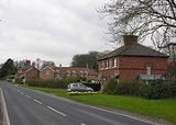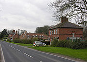
Raywell
Encyclopedia
Raywell is a hamlet
in the East Riding of Yorkshire
, England
.
It is situated approximately 7 miles (11.3 km) north west of Hull
city centre and 2 miles (3.2 km) north of Swanland
.
 It is located on the crossroads of Westfields Road and Riplingham Road. These roads link Riplingham
(South Cave
), Eppleworth
(Cottingham
) and Kirk Ella
.
Raywell forms part of the civil parish of Skidby
.
It consists of a farm and an old manor house.
It is most noted as a local Scout/Girl guides site. Locally it is also noted because a number of walks that start there.
Hamlet (place)
A hamlet is usually a rural settlement which is too small to be considered a village, though sometimes the word is used for a different sort of community. Historically, when a hamlet became large enough to justify building a church, it was then classified as a village...
in the East Riding of Yorkshire
East Riding of Yorkshire
The East Riding of Yorkshire, or simply East Yorkshire, is a local government district with unitary authority status, and a ceremonial county of England. For ceremonial purposes the county also includes the city of Kingston upon Hull, which is a separate unitary authority...
, England
England
England is a country that is part of the United Kingdom. It shares land borders with Scotland to the north and Wales to the west; the Irish Sea is to the north west, the Celtic Sea to the south west, with the North Sea to the east and the English Channel to the south separating it from continental...
.
It is situated approximately 7 miles (11.3 km) north west of Hull
Kingston upon Hull
Kingston upon Hull , usually referred to as Hull, is a city and unitary authority area in the ceremonial county of the East Riding of Yorkshire, England. It stands on the River Hull at its junction with the Humber estuary, 25 miles inland from the North Sea. Hull has a resident population of...
city centre and 2 miles (3.2 km) north of Swanland
Swanland
Swanland is a village and civil parish in the East Riding of Yorkshire in England. The village is about to the west of Kingston upon Hull city centre and north of the Humber Estuary on the B1231 road. To the east lies West Ella, to the west, separated by farmland, lies Melton and to the south...
.

Riplingham
Riplingham is a little hamlet in the East Riding of Yorkshire, England.It is situated approximately south west of Beverley and east of South Cave.It is situated on the crossroads that link , South Cave, Welton, North Newbald and Raywell....
(South Cave
South Cave
South Cave is a town and civil parish in the East Riding of Yorkshire, England. It lies approximately to the west of Hull city centre on the A1034 road just to the north of the A63 road. North Cave is approximately to the north west.- Overview :...
), Eppleworth
Eppleworth
Eppleworth is a hamlet in the East Riding of Yorkshire, England. It is situated on Westfields Road and lies to the south of Skidby and to the west of Cottingham. Further west along Westfields Road lies Raywell.It forms part of the civil parish of Skidby....
(Cottingham
Cottingham, East Riding of Yorkshire
Cottingham is a village and civil parish in the East Riding of Yorkshire, England. It lies just to the north-west of the city of Kingston upon Hull...
) and Kirk Ella
Kirk Ella
Kirk Ella is a village in the East Riding of Yorkshire, England and is located around west of the city of Kingston upon Hull. Together with West Ella it forms the civil parish of Kirk Ella and West Ella....
.
Raywell forms part of the civil parish of Skidby
Skidby
Skidby is a small village and civil parish in the East Riding of Yorkshire, England. It is situated approximately north west of Hull city centre and south of Beverley. It lies just to the west of the A164 road which makes it very accessible....
.
It consists of a farm and an old manor house.
It is most noted as a local Scout/Girl guides site. Locally it is also noted because a number of walks that start there.

