
R418 road
Encyclopedia
The R418 road is a regional road
in Ireland
, which runs north-south from the R448
at Kilcullen to Athy
, County Kildare
, and then to the N81 in Tullow
, County Carlow
.
En route it meets and shortly later leaves the N78
in the town of Athy
, and also crosses R448
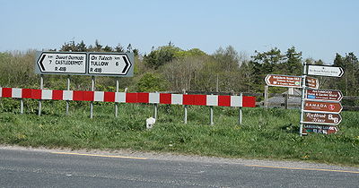
in the town of Castledermot
. The section between Athy and Kilcullen was formerly part of the N78 until the latter was rerouted to Mullamast as part of the M9 motorway
project.
The route is 50 km (31.1 mi) long.
Regional road
A regional road in Ireland is a class of road not forming a major route , but nevertheless forming a link in the national route network. There are over 11,600 kilometres of regional roads. Regional roads are numbered with three digit route numbers, prefixed by "R" A regional road in Ireland is a...
in Ireland
Republic of Ireland
Ireland , described as the Republic of Ireland , is a sovereign state in Europe occupying approximately five-sixths of the island of the same name. Its capital is Dublin. Ireland, which had a population of 4.58 million in 2011, is a constitutional republic governed as a parliamentary democracy,...
, which runs north-south from the R448
R448 road
The R448 road is a regional road in Ireland. It is the designation given to sections of the former N9 national primary road when they are bypassed by sections of new highway.-References:* – Department of Transport...
at Kilcullen to Athy
Athy
The town developed from a 12th century Anglo-Norman settlement to an important British military outpost on the border of the Pale.The first town charter dates from the 16th century and the town hall was constructed in the early 18th century...
, County Kildare
County Kildare
County Kildare is a county in Ireland. It is part of the Mid-East Region and is also located in the province of Leinster. It is named after the town of Kildare. Kildare County Council is the local authority for the county...
, and then to the N81 in Tullow
Tullow
Tullow is a town in County Carlow, Ireland. It is located on the River Slaney where the N81 road intersects with the R762.-History:There is a statue of Father John Murphy, one of the leaders of the 1798 Rebellion, who was captured near Tullow and executed in the Market Square on 2 July...
, County Carlow
County Carlow
County Carlow is a county in Ireland. It is part of the South-East Region and is also located in the province of Leinster. It is named after the town of Carlow, which lies on the River Barrow. Carlow County Council is the local authority for the county...
.
En route it meets and shortly later leaves the N78
N78 road (Ireland)
The N78 road is a national secondary road in Ireland. The 50km long road links the N77 national secondary road north of Kilkenny, County Kilkenny to the M9 national primary route at Mullamast in County Kildare. En route it passes through the towns of Castlecomer in County Kilkenny, Ballylynan in...
in the town of Athy
Athy
The town developed from a 12th century Anglo-Norman settlement to an important British military outpost on the border of the Pale.The first town charter dates from the 16th century and the town hall was constructed in the early 18th century...
, and also crosses R448
R448 road
The R448 road is a regional road in Ireland. It is the designation given to sections of the former N9 national primary road when they are bypassed by sections of new highway.-References:* – Department of Transport...
in the town of Castledermot
Castledermot
Castledermot is an inland village in the south-east of Ireland in County Kildare, about from Dublin, and from the town of Carlow. The N9 road from Dublin to Waterford passes through the village but completion of a bypass is due during 2010.-Demographics:...
. The section between Athy and Kilcullen was formerly part of the N78 until the latter was rerouted to Mullamast as part of the M9 motorway
M9 motorway (Ireland)
The M9 motorway is a motorway in Ireland linking the M7 at Kilcullen to Waterford. Opened in sections between 1994 and 2010, the final section opened on 9 September 2010....
project.
The route is 50 km (31.1 mi) long.