
R412 road
Encyclopedia
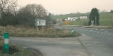
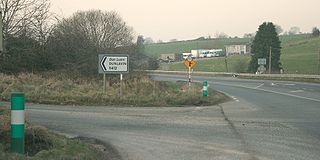
The R412 road is a regional road
in Ireland
, which runs north-south from the R448
in County Kildare
to the N81 in County Wicklow
. En route is passes through the town of Dunlavin
where it is joined by the road from Glendalough
which crosses over the Wicklow Gap
.
The route is 20 km (12.4 mi) long.
Regional road
A regional road in Ireland is a class of road not forming a major route , but nevertheless forming a link in the national route network. There are over 11,600 kilometres of regional roads. Regional roads are numbered with three digit route numbers, prefixed by "R" A regional road in Ireland is a...
in Ireland
Republic of Ireland
Ireland , described as the Republic of Ireland , is a sovereign state in Europe occupying approximately five-sixths of the island of the same name. Its capital is Dublin. Ireland, which had a population of 4.58 million in 2011, is a constitutional republic governed as a parliamentary democracy,...
, which runs north-south from the R448
R448 road
The R448 road is a regional road in Ireland. It is the designation given to sections of the former N9 national primary road when they are bypassed by sections of new highway.-References:* – Department of Transport...
in County Kildare
County Kildare
County Kildare is a county in Ireland. It is part of the Mid-East Region and is also located in the province of Leinster. It is named after the town of Kildare. Kildare County Council is the local authority for the county...
to the N81 in County Wicklow
County Wicklow
County Wicklow is a county in Ireland. It is part of the Mid-East Region and is also located in the province of Leinster. It is named after the town of Wicklow, which derives from the Old Norse name Víkingalág or Wykynlo. Wicklow County Council is the local authority for the county...
. En route is passes through the town of Dunlavin
Dunlavin
Dunlavin is a village in County Wicklow, Ireland, situated about thirty miles south west of Dublin. It is centred on the junction of the R412 and R756 regional roads...
where it is joined by the road from Glendalough
Glendalough
Glendalough or Glendaloch is a glacial valley in County Wicklow, Ireland. It is renowned for its Early Medieval monastic settlement founded in the 6th century by St Kevin, a hermit priest, and partly destroyed in 1398 by English troops....
which crosses over the Wicklow Gap
R756 road
The R756 road is a regional road in Ireland running west-east from Dunlavin to Laragh. Its entire length is within County Wicklow crossing east/west through the Wicklow Gap ....
.
The route is 20 km (12.4 mi) long.