
Quebec route 389
Encyclopedia
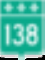
Quebec's Route 389 connects Route 138
adjacent to Baie-Comeau with the Newfoundland and Labrador
border, connecting with the Trans-Labrador Highway
(Newfoundland and Labrador provincial highway 500) to Wabush and Labrador City, and beyond to Goose Bay
. On its way it skirts the eastern shore of Manicouagan Reservoir
.
completed portions from Route 138 to the Manic 5 hydroelectric project site (km 212), now known as the Daniel-Johnson Dam
.
From km 212, the highway follows a path traditionally used by aboriginal people and explorers, with access to the Hart Jaune Hydroelectric Complex at km 390. The town of Gagnon
, now torn down, was at km 394.
Starting at km 482, the "Fire Lake Mine Road" section was built by unemployed workers during a labour dispute, influenced by the presence of the railway owned by the Québec Cartier Mining Company
. This section of paved road is notoriously known as "the trail."
From km 482 to the provincial border at km 570 (354 miles from Baie Comeau), the road is an accident-prone section notorious for its poor surface and sharp curves (the joke being you can see your own taillights). Local citizens in adjacent Labrador have been urging realignment of this road, a vital work if it were to be the routing to a fixed link to Newfoundland.
On 9 April 2009, the Quebec government announced that $438 million will be spent for work to improve the highway from the south end as far as Fermont http://www.pdac.ca/pdac/misc/090326.html, with major upgrading and repair work. This will include a significant reroute in the Fire Lake-Fermont section far to the southeast between approximately Km 508 and Km 565, rejoining the existing route by way of the Fermont access road and no longer routing through Mont-Wright. Work is expected to take fully 10 years, although planning of improvements to this northernmost section began almost immediately. http://www.mtq.gouv.qc.ca/portal/page/portal/entreprises/zone_fournisseurs/c_affaires/pr_routiers/amelioration_route389
Bridge over the Pékans River (around km 550) is popular starting point for the canoe trips
down the Moisie River
.
At km 562 is the town of Fermont
, a mining town with a population of 2,918, and last Quebec port-of-call before entering Newfoundland and Labrador
. Labrador City is 23 km further along what is now Highway 500
, Wabush is 5 km east of that on Highway 503 (which ends in Wabush). The Happy Valley/Goose Bay ferry terminal is located 526 km east of Wabush, along the shores of Lake Melville, with access to the Atlantic Ocean
. The Labrador City/Fermont area border crossing is roughly the half-way point of the approximately 16 hour drive between the junction of Routes 138 & 389 in Baie-Comeau and the end of Route 500 (and adjunct Route 520) in Happy Valley – Goose Bay, Newfoundland and Labrador
.
Quebec route 138
Route 138 is a major highway in the Canadian province of Quebec, following the entire north shore of the Saint Lawrence River past Montreal to the eastern terminus in Natashquan on the Gulf of Saint Lawrence. The western terminus is in Elgin, at the border with New York State south-west of Montreal...
adjacent to Baie-Comeau with the Newfoundland and Labrador
Newfoundland and Labrador
Newfoundland and Labrador is the easternmost province of Canada. Situated in the country's Atlantic region, it incorporates the island of Newfoundland and mainland Labrador with a combined area of . As of April 2011, the province's estimated population is 508,400...
border, connecting with the Trans-Labrador Highway
Trans-Labrador Highway
The Trans-Labrador Highway is a Canadian highway located in the province of Newfoundland and Labrador. It is the primary public road in Labrador and one of the few in that part of the province....
(Newfoundland and Labrador provincial highway 500) to Wabush and Labrador City, and beyond to Goose Bay
Goose Bay
Goose Bay may refer to:* Happy Valley – Goose Bay, Newfoundland and Labrador, Canada* Goose Bay , Canada...
. On its way it skirts the eastern shore of Manicouagan Reservoir
Manicouagan Reservoir
Manicouagan Reservoir is an annular lake in central Quebec, Canada. The lake covers an area of 1,942 km², and its eastern shore is accessible via Route 389. The island in the centre of the lake is known as René-Levasseur Island, and its highest point is Mount Babel...
.
Description
The Quebec North Shore Company and Hydro-QuébecHydro-Québec
Hydro-Québec is a government-owned public utility established in 1944 by the Government of Quebec. Based in Montreal, the company is in charge of the generation, transmission and distribution of electricity across Quebec....
completed portions from Route 138 to the Manic 5 hydroelectric project site (km 212), now known as the Daniel-Johnson Dam
Daniel-Johnson Dam
The Daniel-Johnson Dam , formerly known as Manic-5, is a multiple arch buttress dam on the Manicouagan River which creates Manicouagan Reservoir. The dam is composed of 14 buttresses and 13 arches and is north of Baie-Comeau in Quebec, Canada...
.
From km 212, the highway follows a path traditionally used by aboriginal people and explorers, with access to the Hart Jaune Hydroelectric Complex at km 390. The town of Gagnon
Gagnon, Quebec
Gagnon, Quebec is a ghost town on Barbel Lake, formerly a mining town, in the Côte-Nord region of Quebec, Canada. Formerly an incorporated municipality, it is now part of the unorganized territory of Rivière-Mouchalagane....
, now torn down, was at km 394.
Starting at km 482, the "Fire Lake Mine Road" section was built by unemployed workers during a labour dispute, influenced by the presence of the railway owned by the Québec Cartier Mining Company
Québec Cartier Mining Company
Québec Cartier Mining Company was one of the leading producers of iron ore products in North America, now part of ArcelorMittal.The company was founded in the late 1950s by multiple Canadian and American investors, based in Quebec, Canada. The first open pit mine was located in Lac-Jeanine, Quebec....
. This section of paved road is notoriously known as "the trail."
From km 482 to the provincial border at km 570 (354 miles from Baie Comeau), the road is an accident-prone section notorious for its poor surface and sharp curves (the joke being you can see your own taillights). Local citizens in adjacent Labrador have been urging realignment of this road, a vital work if it were to be the routing to a fixed link to Newfoundland.
On 9 April 2009, the Quebec government announced that $438 million will be spent for work to improve the highway from the south end as far as Fermont http://www.pdac.ca/pdac/misc/090326.html, with major upgrading and repair work. This will include a significant reroute in the Fire Lake-Fermont section far to the southeast between approximately Km 508 and Km 565, rejoining the existing route by way of the Fermont access road and no longer routing through Mont-Wright. Work is expected to take fully 10 years, although planning of improvements to this northernmost section began almost immediately. http://www.mtq.gouv.qc.ca/portal/page/portal/entreprises/zone_fournisseurs/c_affaires/pr_routiers/amelioration_route389
Bridge over the Pékans River (around km 550) is popular starting point for the canoe trips
Canoe camping
Canoe camping is a combination of canoeing and camping. It is similar to backpacking, but canoe campers travel by canoes or kayaks...
down the Moisie River
Moisie River
The Moisie River is a river in eastern Quebec. Called and known as the Nahanni of the East, it is one of the most beautiful wild rivers of North America. It flows south from Lake Opocopa near the Labrador border to the north shore of the Saint Lawrence River east of Sept-Îles, Quebec. The town of...
.
At km 562 is the town of Fermont
Fermont, Quebec
Fermont is a town in northeastern Quebec, Canada, near the Quebec-Labrador border about from Labrador City on Route 389, which connects to the Trans-Labrador Highway...
, a mining town with a population of 2,918, and last Quebec port-of-call before entering Newfoundland and Labrador
Newfoundland and Labrador
Newfoundland and Labrador is the easternmost province of Canada. Situated in the country's Atlantic region, it incorporates the island of Newfoundland and mainland Labrador with a combined area of . As of April 2011, the province's estimated population is 508,400...
. Labrador City is 23 km further along what is now Highway 500
Trans-Labrador Highway
The Trans-Labrador Highway is a Canadian highway located in the province of Newfoundland and Labrador. It is the primary public road in Labrador and one of the few in that part of the province....
, Wabush is 5 km east of that on Highway 503 (which ends in Wabush). The Happy Valley/Goose Bay ferry terminal is located 526 km east of Wabush, along the shores of Lake Melville, with access to the Atlantic Ocean
Atlantic Ocean
The Atlantic Ocean is the second-largest of the world's oceanic divisions. With a total area of about , it covers approximately 20% of the Earth's surface and about 26% of its water surface area...
. The Labrador City/Fermont area border crossing is roughly the half-way point of the approximately 16 hour drive between the junction of Routes 138 & 389 in Baie-Comeau and the end of Route 500 (and adjunct Route 520) in Happy Valley – Goose Bay, Newfoundland and Labrador
Newfoundland and Labrador
Newfoundland and Labrador is the easternmost province of Canada. Situated in the country's Atlantic region, it incorporates the island of Newfoundland and mainland Labrador with a combined area of . As of April 2011, the province's estimated population is 508,400...
.
Municipalities along Route 389
The road passes through the following municipalities and unorganized territories from south to north:- Baie-Comeau
- Rivière-aux-OutardesRivière-aux-Outardes, QuebecRivière-aux-Outardes is an unorganized territory in the Côte-Nord region of Quebec, Canada. It makes up almost 95% of the Manicouagan Regional County Municipality....
- Rivière-MouchalaganeRivière-Mouchalagane, QuebecRivière-Mouchalagane is an unorganized territory in the Côte-Nord region of Quebec, Canada, part of Caniapiscau Regional County Municipality.The ghost town of Gagnon is located in the territory along Quebec Route 389 which also provides access to Fermont and Labrador City.The eponymous Mouchalagane...
- FermontFermont, QuebecFermont is a town in northeastern Quebec, Canada, near the Quebec-Labrador border about from Labrador City on Route 389, which connects to the Trans-Labrador Highway...