
Quebec Route 390
Encyclopedia
Route 390 is a provincial highway located in the Abitibi-Témiscamingue
region in southwestern Quebec
, Canada. The 40-kilometer highway runs from Palmarolle
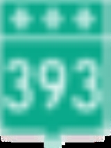
at the junction of Route 393
and ends in Taschereau
at the junction of Route 111
. It also intersects with Route 101
in Poularies
Abitibi-Témiscamingue
Abitibi-Témiscamingue is a region located in western Quebec, Canada, along the border with Ontario. It became part of the province in 1898. It has a land area of 57,674.26 km2 . As of the 2006 census, the population of the region was 143,872 inhabitants.-History:The land was first occupied...
region in southwestern Quebec
Quebec
Quebec or is a province in east-central Canada. It is the only Canadian province with a predominantly French-speaking population and the only one whose sole official language is French at the provincial level....
, Canada. The 40-kilometer highway runs from Palmarolle
Palmarolle, Quebec
Palmarolle is a municipality in northwestern Quebec, Canada, in the Abitibi-Ouest Regional County Municipality. It covers 118.36 km² and had a population of 1,446 in the Canada 2006 Census. It is considered to have the best agricultural land of the entire Abitibi region.-History:The area began...
at the junction of Route 393
Quebec Route 393
Route 393 is a Quebec provincial highway located in the province's Abitibi-Témiscamingue and Nord-du-Québec regions. The highway runs from the junction of Route 101 in the Rouyn-Noranda suburb of Destor and ends in Val-Paradis in the municipality of Baie-James...
and ends in Taschereau
Taschereau, Quebec
Taschereau is a municipality in northwestern Quebec, Canada in the Abitibi-Ouest Regional County Municipality. It covers 265.62 km² and had a population of 1,004 in the Canada 2006 Census.The municipality was incorporated on December 27, 2001....
at the junction of Route 111
Quebec Route 111
Route 111 is a north/south highway on the north shore of the Saint-Lawrence River in the Abitibi-Témiscamingue region of Quebec, Canada. Its northern terminus is in the municipality of Baie-James at the junction of Route 393, and its southern terminus is in Val-d'Or at the junction of Route...
. It also intersects with Route 101
Quebec route 101
Route 101 is a highway in northwestern Quebec running in a north to south direction.In the north the highway begins at Route 111 in Macamic and ends at Témiscaming, a town bordering with Thorne, Ontario on the Ottawa River...
in Poularies
Poularies, Quebec
Poularies is a municipality in northwestern Quebec, Canada in the Abitibi-Ouest Regional County Municipality. It covers 164.95 km² and had a population of 736 in the Canada 2006 Census.The municipality was incorporated on May 7, 1924.-Demographics:...
External links
- Official Transports Quebec Map
- http://maps.google.com/maps?f=d&saddr=1E+Avenue+E%2FRTE-390+%4048.661140,+-79.199320&daddr=48.663417,-78.690712+to:Rue+Principale%2FRTE-390+%4048.662549,+-78.681131&hl=en&geocode=5783691440097749412,48.661140,-79.199320%3B12408200436020391983,48.662549,-78.681131&mra=dpe&mrcr=0&mrsp=1&sz=16&via=1&dirflg=h&sll=48.661362,-78.688159&sspn=0.00652,0.019312&ie=UTF8&ll=48.658314,-78.807678&spn=0.417278,1.235962&z=10Route 390] on Google Maps