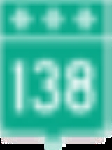
Quebec Route 360
Encyclopedia
Route 360 is a provincial highway located in the Capitale-Nationale
region in the south central part of the province of Quebec
. The highway runs from Quebec City
's Beauport
sector and ends at the junction of Route 138
northeast of Saint-Tite-des-Caps
in the Charlevoix region. For a large portion of its length it runs right beside Route 138, overlapping it briefly near Beaupré
. The road also travels through significant portions of the Charlevoix touristic area and also crosses Mont-Sainte-Anne
ski resort and the Montmorency Falls
located at the Montmorency River
which connects the Saint Lawrence River
nearby.
Capitale-Nationale
Capitale-Nationale is one of 17 administrative regions of Quebec, Canada. Quebec City, Quebec's centre of government, is located in this region. It has a land area of 18,638.7 km2...
region in the south central part of the province of Quebec
Quebec
Quebec or is a province in east-central Canada. It is the only Canadian province with a predominantly French-speaking population and the only one whose sole official language is French at the provincial level....
. The highway runs from Quebec City
Quebec City
Quebec , also Québec, Quebec City or Québec City is the capital of the Canadian province of Quebec and is located within the Capitale-Nationale region. It is the second most populous city in Quebec after Montreal, which is about to the southwest...
's Beauport
Beauport, Quebec
Beauport is a borough of Quebec City, Quebec, Canada on the Saint Lawrence River.Beauport is a northeastern suburb of Quebec City. Manufactures include paint, construction materials, printers, and hospital supplies. Food transportation is important to the economy...
sector and ends at the junction of Route 138
Quebec route 138
Route 138 is a major highway in the Canadian province of Quebec, following the entire north shore of the Saint Lawrence River past Montreal to the eastern terminus in Natashquan on the Gulf of Saint Lawrence. The western terminus is in Elgin, at the border with New York State south-west of Montreal...
northeast of Saint-Tite-des-Caps
Saint-Tite-des-Caps, Quebec
Saint-Tite-des-Caps is a municipality in La Côte-de-Beaupré Regional County Municipality in Quebec, Canada. Located on Route 138 to Baie-Saint-Paul, this road climbs up sharply to about to reach the town nestled in a valley...
in the Charlevoix region. For a large portion of its length it runs right beside Route 138, overlapping it briefly near Beaupré
Beaupré, Quebec
Beaupré is a ville in the Canadian province of Quebec, located in La Côte-de-Beaupré Regional County Municipality. The town is along the Saint Lawrence River and Route 138 at the mouth of the Sainte-Anne-du-Nord River....
. The road also travels through significant portions of the Charlevoix touristic area and also crosses Mont-Sainte-Anne
Mont-Sainte-Anne
Mont-Sainte-Anne is a ski resort in the city of Beaupré, Quebec, Canada, located about northeast of Quebec City. The mountain has a summit elevation of 800 metres above sea level and a vertical drop of 625 m . There are 66 trails covering on three different sides of the mountain...
ski resort and the Montmorency Falls
Montmorency Falls
The Montmorency Falls are a large waterfall on the Montmorency River in Quebec, Canada. The falls are located on the boundary between the borough of Beauport, Quebec City, and Boischatel, about 12 km from the heart of old Quebec City...
located at the Montmorency River
Montmorency River
The Montmorency River is a river in the Capitale-Nationale region of Quebec, Canada. It drains into the Saint Lawrence River, about downstream from Quebec City. It is especially known for the impressive Montmorency Falls near its mouth....
which connects the Saint Lawrence River
Saint Lawrence River
The Saint Lawrence is a large river flowing approximately from southwest to northeast in the middle latitudes of North America, connecting the Great Lakes with the Atlantic Ocean. It is the primary drainage conveyor of the Great Lakes Basin...
nearby.
Towns along Route 360
- Quebec City (including the Beauport sector)
- BoischatelBoischatel, QuebecBoischatel is a municipality in the Capitale-Nationale region of Quebec, Canada. Michel Guimond, current whip of the Bloc Québécois, first started his political career here as a city councillor. The town was originally called Saint-Jean-de-Boischatel....
- L'Ange-GardienL'Ange-Gardien, Capitale-Nationale, QuebecL'Ange-Gardien is a municipality in the Capitale-Nationale region of Quebec, Canada. It is part of the La Côte-de-Beaupré Regional County Municipality....
- Château-RicherChâteau-Richer, QuebecChâteau-Richer is a small town situated in the Capitale-Nationale region of Quebec, Canada. Located on the north shore of the Saint Lawrence River east of Quebec City, Château-Richer is the seat for the Côte-de-Beaupré Regional County Municipality....
- Sainte-Anne-de-BeaupréSainte-Anne-de-Beaupré, QuebecSainte-Anne-de-Beaupré is a town in La Côte-de-Beaupré Regional County Municipality, Quebec, Canada, along the Saint Lawrence River, north-east of the Quebec City. The population was 2,803 according to the Canada 2006 Census...
- Beaupré
- Saint-Férréol-des-Neiges
- Saint-Tite-des-Caps
External links
- Official Transports Quebec Map
- http://maps.google.com/maps?f=d&saddr=Boulevard+Ste-Anne+%4046.840570,+-71.220400&daddr=Avenue+Royale+%4046.871190,+-71.176350+to:Avenue+Royale+%4046.880660,+-71.163350+to:Avenue+Royale+%4046.898322,+-71.133079+to:Avenue+Royale+%4046.931982,+-71.064746+to:Avenue+Royale+%4046.974660,+-71.014012+to:Avenue+Royale+%4047.015207,+-70.952445+to:Avenue+Royale+%4047.030978,+-70.912744+to:Avenue+Royale+%4047.097686,+-70.871031+to:47.190026,-70.736235&hl=en&geocode=18445448446155693500,46.840570,-71.220400%3B2075319744314919175,46.871190,-71.176350%3B11850051514257653054,46.880660,-71.163350%3B6822157156072863523,46.898322,-71.133079%3B1577553319486705782,46.931982,-71.064746%3B8055024412374246820,46.974660,-71.014012%3B15185909137141563058,47.015207,-70.952445%3B9178576099827989699,47.030978,-70.912744%3B13104943067257631931,47.097686,-70.871031%3B17464381407020687647,47.189179,-70.737505&mra=dme&mrcr=0&mrsp=9&sz=17&via=1,2,3,4,5,6,7,8&dirflg=h&sll=47.188881,-70.736729&sspn=0.003354,0.009656&ie=UTF8&ll=47.013035,-70.84259&spn=0.430723,1.235962&z=10Route 360] on Google Maps

