
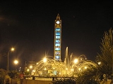
Pucallpa
Encyclopedia
Peru
Peru , officially the Republic of Peru , is a country in western South America. It is bordered on the north by Ecuador and Colombia, on the east by Brazil, on the southeast by Bolivia, on the south by Chile, and on the west by the Pacific Ocean....
located on the banks of the Ucayali River, a major tributary of the Amazon River
Amazon River
The Amazon of South America is the second longest river in the world and by far the largest by waterflow with an average discharge greater than the next seven largest rivers combined...
. It is the capital of the Ucayali region
Ucayali Region
Ucayali is an inland region in Peru. Located in the Amazon rainforest, its name is derived from the Ucayali River. The regional capital is the city of Pucallpa.-Boundaries:...
, the Coronel Portillo Province
Coronel Portillo Province
Coronel Portillo is the second largest of four provinces in the Ucayali Region in Peru. Its capital is Pucallpa.-Political division:The province is divided into seven districts , each of which is headed by a mayor...
and the Calleria District
Callería District
Callería District is one of the seven districts of the province Coronel Portillo in Peru.-References:...
.
Pucallpa was founded in the 1840s by Franciscan
Franciscan
Most Franciscans are members of Roman Catholic religious orders founded by Saint Francis of Assisi. Besides Roman Catholic communities, there are also Old Catholic, Anglican, Lutheran, ecumenical and Non-denominational Franciscan communities....
missionaries who settled several families of the Shipibo-Conibo
Shipibo-Conibo
-Population:The name refers to two languages spoken by these ethnic groups. They are primarily a riverine people living in the Amazon basin, primarily along the Ucayali River. Contact with western sources – including the governments of Peru and Brazil – has been sporadic over the past three...
ethnic group. For several decades it remained a small settlement as it was isolated from the rest of the country by the Amazon Rainforest
Amazon Rainforest
The Amazon Rainforest , also known in English as Amazonia or the Amazon Jungle, is a moist broadleaf forest that covers most of the Amazon Basin of South America...
and the Andes
Andes
The Andes is the world's longest continental mountain range. It is a continual range of highlands along the western coast of South America. This range is about long, about to wide , and of an average height of about .Along its length, the Andes is split into several ranges, which are separated...
mountain range. From the 1880s through the 1920s a railway project to connect Pucallpa with the rest of the country via the Ferrocarril Central Andino
Ferrocarril Central Andino
Ferrocarril Central Andino is the consortium which operates the Ferrovías Central railway in Peru linking the Pacific port of Callao and the capital Lima with Huancayo and Cerro de Pasco...
was started and dropped several time until it was finally abandoned. Pucallpa's isolation finally ended in 1945 with the completion of a highway to Lima
Lima
Lima is the capital and the largest city of Peru. It is located in the valleys of the Chillón, Rímac and Lurín rivers, in the central part of the country, on a desert coast overlooking the Pacific Ocean. Together with the seaport of Callao, it forms a contiguous urban area known as the Lima...
through Tingo Maria
Tingo Maria
Tingo María is the capital of Leoncio Prado Province in the Huánuco Region in central Peru. It has an urban population of around 55,000 ....
. The highway allowed the commercialization of regional products to the rest of the country, thus improving the economic outlook of the region and its capital, Pucallpa. However, the heavy rainfalls of the Amazon Rainforest remain a problem as they erode the highway and can even cut it by causing flash flood
Flash flood
A flash flood is a rapid flooding of geomorphic low-lying areas—washes, rivers, dry lakes and basins. It may be caused by heavy rain associated with a storm, hurricane, or tropical storm or meltwater from ice or snow flowing over ice sheets or snowfields...
s.
Pucallpa is served by air through the Captain Rolden International Airport
Captain Rolden International Airport
FAP Captain David Abenzur Rengifo International Airport is an airport serving the city of Pucallpa, Peru. It is operated by CORPAC S.A., a government-run organization that oversees the management of Peruvian airports. Captain Rengifo Airport is the main airport serving the Ucayali Region of...
and by river through its port Pucallpillo near the center of the city. During the high water season, the floating ports of La Hoyada and Puerto Italia are used for riverine communications. Pucallpa is connected by road to Lima
Lima
Lima is the capital and the largest city of Peru. It is located in the valleys of the Chillón, Rímac and Lurín rivers, in the central part of the country, on a desert coast overlooking the Pacific Ocean. Together with the seaport of Callao, it forms a contiguous urban area known as the Lima...
via the cities Huánuco
Huánuco
-Famous Natives:* Daniel Alomía Robles - Musical composer and ethnologist born in 1871, famous for El Cóndor Pasa* Johan Fano- Professional football player-External links:*** - Catholic Encyclopedia article...
and Cerro de Pasco
Cerro de Pasco
Cerro de Pasco is a city in central Peru. It is the capital of the Pasco region, and an important mining center. It is connected by road and by rail to the city of Lima.- Overview :...
.