

Polkelly Castle
Encyclopedia
Polkelly Castle, also Pokelly was an ancient castle located near Fenwick
, at NS 4568 4524, in the medieval free Barony of Polkelly, lying north of Kilmarnock
, Parish of Fenwick
, East Ayrshire
, Scotland
. The castle is recorded as Powkelly (c1747), Pockelly (c1775), Pow-Kaillie, Ponekell, Polnekel, Pollockelly, Pokellie, Polkelly. The name is given c1564 as Powkellie when it was held by the Cunninghams of Cunninghamhead
.
s. The estate was important to the Lairds of Rowallan as it gave uninhibited access to the large and important grazing lands of Macharnock Moor, now Glenouther Moor.
In the charter of confirmation of 1512 the feudal Barony of Polkelly comprised Darclavoch, Clonherb, Clunch, with its mill, Le Gre, Drumboy, the lands of Balgray, with its tower, fortalice, manor, and mill, and the common of Mauchirnoch (Glenouther).
Dobie records that the Mures held Pow-Kaillie which extended to 2400 acres, two-thirds of which were arable.
The origins of the lands of Polkelly and Rowallan as a unit may date back to the British period of the Kingdom of Strathclyde, as indicated by certain anomalies and coincidences in the boundaries of these lands.
. It became of minor importance when Balgray became the principal messuage
of the free barony of Polkelly in 1512. The castle lay close to the Balgray Mill Burn.
The castle remains were removed in the 1850s and used to create a road, only leaving the motte, measuring 23m by 16m.
 A Gulielmus (William) de Lambristoune
was a witness to a charter conveying the lands of Pokellie (Pokelly) from Sir Gilchrist More to a Ronald Mure at a date around 1280. During the reign of Alexander III
(1241–1286) Sir Gilchrist Mure held Pokelly and had to shelter there until the King was able to subdue Sir Walter Cuming. For the sake of peace and security Sir Gilchrist married his daughter Isabella to Sir Walter.
In 1399 Sir Adam Mure held the castle and upon his death it passed to his second son, the eldest obtaining Rowallan. The lands of Limflare and Lowdoune Hill were included in the inheritance.
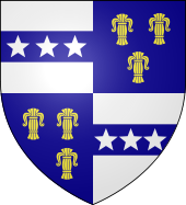
The castle and Barony of Polkelly was mainly held by the medieval Mure family
, however Robert Mure of Polkelly had died by 1511, leaving his daughter Margaret, Lady Polkelly, as the sole heir. Margaret married Robert Cunningham of Cunninghamhead in March 1512. The stars of the Mures were added to the armorial bearings of the Cunninghams. After 50 to 60 years the family sold Polkelly to Thomas Cochran of Kilmaronock and in 1699 it passed to his brother William. David, the first Earl of Glasgow then acquired the property and it was held by James, Earl of Glasgow in the 1870s. In the 1860s the ruins are described as the strong house of Polkelly and the remnants lay on the rising ground north of Muiryet.
In the late 15th century a Mure of Polkelly is recorded as being a royal administrator, collecting royal rents in east central Scotland.
It is suggested that tensions had not arisen earlier as previously Polkelly was passed to younger sons of the Mures upon their marriage and this came with an allocation of rights on the moor.
Cleuche lay within the Barony of Powkellie (sic) and now appears as Clunch on OS maps. Dareloch, once recorded as Darclavoch, may derive from Dir-clach meaning a land of stones. Drumboy was once named Drumbuy and had previously belonged to the Barony of Strathannan in Lanarkshire.
and as a response to this act thirty hagbutters
were despatched to garrison the house and fortalice of Pokelly.
In March 1793 James Dunlop of Polkelly was the proprietor of Gardrum.
Robert Craufurd of Craufurdland married Elizabeth Muir, daughter of the Laird of Pokelly in the 15th century and had three sons.
Upon the death of Hugh Muir of Pokelly, Archibald Craufurd of Craufurdland married his widow, who was the eldest daughter of Archibald Boyd of Narston and Bonshaw. They had tow sons and a daughter.
Diana Cunninghame was an only daughter of Sir David Cunninghame of Robertland. Diana married Thomas Cochrane of Polkelly in the mid 17th century and much of the estate was sold at around this time.
A David Poe is recorded as being of "Polkelly, a farm bordering Fenwick and Stewarton, seven miles from Irvine". this David Poe, an outlaw and covanteer of Ayrshire in 1666 who escaped to Ireland and had progeny there, is a likely ancestor of Edgar Allen Poe.
Dobie records that the Macharnock River gave rise to the name of the Kilmarmock Water. He also states that the site of a battle between the Douglas and De Mowbray :
Another Polkelly exists in South Lanarkshire, not far from Carstairs
.
Fenwick, East Ayrshire
Fenwick is a village in East Ayrshire, Scotland, UK. As of 2001, its population was 863.Fenwick is the terminus of the M77 following its extension which was opened in April 2005, at the beginning of the Kilmarnock bypass....
, at NS 4568 4524, in the medieval free Barony of Polkelly, lying north of Kilmarnock
Kilmarnock
Kilmarnock is a large burgh in East Ayrshire, Scotland, with a population of 44,734. It is the second largest town in Ayrshire. The River Irvine runs through its eastern section, and the Kilmarnock Water passes through it, giving rise to the name 'Bank Street'...
, Parish of Fenwick
Fenwick, East Ayrshire
Fenwick is a village in East Ayrshire, Scotland, UK. As of 2001, its population was 863.Fenwick is the terminus of the M77 following its extension which was opened in April 2005, at the beginning of the Kilmarnock bypass....
, East Ayrshire
East Ayrshire
East Ayrshire is one of 32 council areas of Scotland. It borders on to North Ayrshire, East Renfrewshire, South Lanarkshire, South Ayrshire and Dumfries and Galloway...
, Scotland
Scotland
Scotland is a country that is part of the United Kingdom. Occupying the northern third of the island of Great Britain, it shares a border with England to the south and is bounded by the North Sea to the east, the Atlantic Ocean to the north and west, and the North Channel and Irish Sea to the...
. The castle is recorded as Powkelly (c1747), Pockelly (c1775), Pow-Kaillie, Ponekell, Polnekel, Pollockelly, Pokellie, Polkelly. The name is given c1564 as Powkellie when it was held by the Cunninghams of Cunninghamhead
Cunninghamhead Estate
The Cunninghamhead Estate is in the 21st century mainly a residential caravan park with two private residences near Irvine, Scotland. It was once a private estate, owned by a sequence of recorded families since around 1418. The Mansion House, one of Britain's lost houses, was built in 1747; it was...
.
The Lands of Polkelly
Prior to the 1390s the evidence suggests that the lands of Polkelly were in the hands of the ComynClan Cumming
Clan Cumming, also known as Clan Comyn, is a Scottish clan from the central Highlands that played a major role in the history of 13th century Scotland and in the Wars of Scottish Independence and were instrumental in defeating the English at the Battle of Roslin in 1303...
s. The estate was important to the Lairds of Rowallan as it gave uninhibited access to the large and important grazing lands of Macharnock Moor, now Glenouther Moor.
In the charter of confirmation of 1512 the feudal Barony of Polkelly comprised Darclavoch, Clonherb, Clunch, with its mill, Le Gre, Drumboy, the lands of Balgray, with its tower, fortalice, manor, and mill, and the common of Mauchirnoch (Glenouther).
Dobie records that the Mures held Pow-Kaillie which extended to 2400 acres, two-thirds of which were arable.
The origins of the lands of Polkelly and Rowallan as a unit may date back to the British period of the Kingdom of Strathclyde, as indicated by certain anomalies and coincidences in the boundaries of these lands.
The castle
Polkelly became the secondary power centre within the feudal Barony of RowallanRowallan Castle
Rowallan Castle is an ancient castle located near Kilmaurs, at NS 4347 4242, about north of Kilmarnock, East Ayrshire, Scotland. The castle stands on the banks of the Carmel Water, which may at one time have run much closer to the low eminence upon which the original castle stood, justifying the...
. It became of minor importance when Balgray became the principal messuage
Messuage
In law, the term messuage equates to a dwelling-house and includes outbuildings, orchard, curtilage or court-yard and garden. At one time messuage supposedly had a more extensive meaning than that conveyed by the words house or site, but such distinction no longer survives.A capital messuage is the...
of the free barony of Polkelly in 1512. The castle lay close to the Balgray Mill Burn.
The castle remains were removed in the 1850s and used to create a road, only leaving the motte, measuring 23m by 16m.
Lairds
Lambroughton
Lambroughton is a village in the old Barony of Kilmaurs, North Ayrshire, Scotland. This is a rural area famous for its milk and cheese production and the Ayrshire or Dunlop breed of cattle.-Origins of the name:...
was a witness to a charter conveying the lands of Pokellie (Pokelly) from Sir Gilchrist More to a Ronald Mure at a date around 1280. During the reign of Alexander III
Alexander III of Scotland
Alexander III was King of Scots from 1249 to his death.-Life:...
(1241–1286) Sir Gilchrist Mure held Pokelly and had to shelter there until the King was able to subdue Sir Walter Cuming. For the sake of peace and security Sir Gilchrist married his daughter Isabella to Sir Walter.
In 1399 Sir Adam Mure held the castle and upon his death it passed to his second son, the eldest obtaining Rowallan. The lands of Limflare and Lowdoune Hill were included in the inheritance.
The castle and Barony of Polkelly was mainly held by the medieval Mure family
Clan Muir
Clan Muir is an Armigerous Scottish clan, meaning that the clan doesn't have a chief recognized by the Court of the Lord Lyon. Historically, the surnames Muir, Mure, and Moore can be considered septs of Clann Campbell and septs of Clan Gordon in the highlands. The spelling variation More/Moore is...
, however Robert Mure of Polkelly had died by 1511, leaving his daughter Margaret, Lady Polkelly, as the sole heir. Margaret married Robert Cunningham of Cunninghamhead in March 1512. The stars of the Mures were added to the armorial bearings of the Cunninghams. After 50 to 60 years the family sold Polkelly to Thomas Cochran of Kilmaronock and in 1699 it passed to his brother William. David, the first Earl of Glasgow then acquired the property and it was held by James, Earl of Glasgow in the 1870s. In the 1860s the ruins are described as the strong house of Polkelly and the remnants lay on the rising ground north of Muiryet.
In the late 15th century a Mure of Polkelly is recorded as being a royal administrator, collecting royal rents in east central Scotland.
Moor of Machirnock (Glenouther)
Tensions arose between the Cunninghams and Mures over their rights regarding grazing, etc on the very large and valuable area of common grazing to the north of Polkelly known as Machirnock or Maucharnock, now Glenouther. A royal letter of 1534 states that the Cunninghams had not been invested in the moor and it was decided that the souming was split between Polkelly and Rowallan. The souming was the number or proportion of cattle which each tenant was entitled to keep on the common grazing. In 1594 William Mure of Rowallan complained of the excess of Polkelly's grazing cattle and geese on the moor, despite having obtained a caution of lawburrows on May 20, 1593. Lawburrows was a letter in the monarch's name under the signet seal to the effect that a particular person had shown cause to dread harm from another, and that therefore this other complained of was commanded to find "sufficient caution and surety" that the complainer would be free from any violence on his part.It is suggested that tensions had not arisen earlier as previously Polkelly was passed to younger sons of the Mures upon their marriage and this came with an allocation of rights on the moor.
Cartographic evidence
Blaeu's map dating from Timothy Pont's survey of the early 17th century records a tower without any woodland policies. Armstrong's map of 1775 shows two buildings recorded as Pockelly, but neither shown as a castle or mansion. Pokelly Hall is shown for the first time on Thomson's Map of 1832. Then 1890 OS map shows Pokelly Castle within an enclosure close to the Balgray Mill Burn and situated on a road system linked to Gardrum Mill, Gainford, Crofthead and Fenwick. The name Pathelly Hall is sometimes used for Pokelly Hall in old accounts.Cleuche lay within the Barony of Powkellie (sic) and now appears as Clunch on OS maps. Dareloch, once recorded as Darclavoch, may derive from Dir-clach meaning a land of stones. Drumboy was once named Drumbuy and had previously belonged to the Barony of Strathannan in Lanarkshire.
Micro-history
In 1590 a band of pirates harassed shipping near Ailsa CraigAilsa Craig
Ailsa Craig is an island of 219.69 acres in the outer Firth of Clyde, Scotland where blue hone granite was quarried to make curling stones. "Ailsa" is pronounced "ale-sa", with the first syllable stressed...
and as a response to this act thirty hagbutters
Arquebus
The arquebus , or "hook tube", is an early muzzle-loaded firearm used in the 15th to 17th centuries. The word was originally modeled on the German hakenbüchse; this produced haquebute...
were despatched to garrison the house and fortalice of Pokelly.
In March 1793 James Dunlop of Polkelly was the proprietor of Gardrum.
Robert Craufurd of Craufurdland married Elizabeth Muir, daughter of the Laird of Pokelly in the 15th century and had three sons.
Upon the death of Hugh Muir of Pokelly, Archibald Craufurd of Craufurdland married his widow, who was the eldest daughter of Archibald Boyd of Narston and Bonshaw. They had tow sons and a daughter.
Diana Cunninghame was an only daughter of Sir David Cunninghame of Robertland. Diana married Thomas Cochrane of Polkelly in the mid 17th century and much of the estate was sold at around this time.
A David Poe is recorded as being of "Polkelly, a farm bordering Fenwick and Stewarton, seven miles from Irvine". this David Poe, an outlaw and covanteer of Ayrshire in 1666 who escaped to Ireland and had progeny there, is a likely ancestor of Edgar Allen Poe.
Dobie records that the Macharnock River gave rise to the name of the Kilmarmock Water. He also states that the site of a battle between the Douglas and De Mowbray :
"Syne till a strait place gan he ga, That is in Makyrnokis way, The Netherford it hat perfay; It lyis betuix marraisses twa, Qhuhar that na horss or lyve may ga." |
Another Polkelly exists in South Lanarkshire, not far from Carstairs
Carstairs
The name Carstairs refers to a pair of villages located some 4–5 miles east of the town of Lanark in the administrative region of South Lanarkshire in southern Scotland....
.