

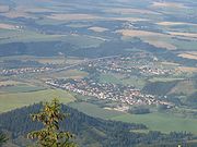
Podtatranská kotlina
Encyclopedia
Basin
Basin may refer to:* Basin , a poem about Charlemagne's childhood* basin , the area of a drydock which can be flooded and drained* basin of attraction , an area of a nonlinear system with an attractor...
in northern Slovakia
Slovakia
The Slovak Republic is a landlocked state in Central Europe. It has a population of over five million and an area of about . Slovakia is bordered by the Czech Republic and Austria to the west, Poland to the north, Ukraine to the east and Hungary to the south...
, part of the Fatra-Tatra Area
Fatra-Tatra Area
The Fatra-Tatra Area or the Tatra-Fatra Belt of core mountains is a part of the Inner Western Carpathians, a subprovince of the Western Carpathians. Most of the area lies in Slovakia with small parts reaching into Austria and Poland...
, which belongs to the Inner Western Carpathians.
Towns and cities include Ružomberok, Liptovský Mikuláš
Liptovský Mikuláš
Liptovský Mikuláš is a town in northern Slovakia, on the Váh River. It lies in the Liptov region, in Liptov Basin near the Low Tatra and Tatra mountains...
, Liptovský Hrádok
Liptovský Hrádok
Liptovský Hrádok is a town in northern Slovakia, in the region of Liptov.-History:First mentioned in 1341, Liptovský Hrádok was named after the nearby castle. The castle, also known as Liptovský Hrádok, was built originally for use of the forestry commission, hunters of the area and the...
, Svit
Svit
Svit is a small town and municipality in Poprad District in the Prešov Region in northern Slovakia. It lies west of the city of Poprad, at the foothills of the High Tatras.-History:Svit is one of the youngest Slovak towns...
, Poprad
Poprad
Poprad is a city in northern Slovakia at the foot of the High Tatra Mountains famous for its picturesque historic centre and as a holiday resort. It is the biggest town of the Spiš region and the tenth largest city in Slovakia with a population of approximately 55,000.The Poprad-Tatry Airport is...
, Kežmarok
Kežmarok
Kežmarok is a town in the Spiš region of eastern Slovakia , on the Poprad River.-History:...
, Spišská Belá
Spišská Belá
Spišská Belá is a town in the Kežmarok District in the Prešov Region in Spiš in northern Slovakia.-History:The town was first mentioned in historical records in 1263. The town received town rights in 1271. Scientist and inventor Joseph Petzval was born here in 1807. The town center has been...
and Podolínec
Podolínec
Podolínec is a town in the Stará Ľubovňa District of the Prešov Region in northern Slovakia.-History:Originally Podoliniec belonged to Poland and was part of the Ziema Sądecka land...
.
Location and characteristics
It borders:
- Tatras in the north
- Spišská Magura in the north-east
- Levoča Hills in the east
- Kozie chrbty in the south-east
- Low Tatras in the south
- Greater FatraGreater FatraGreater Fatra or Veľká Fatra is a mountain range in the Western Carpathians in Slovakia. In the geomorphological system, it is a part of the Fatra-Tatra Area. It is situated approximately among the towns of Ružomberok, Harmanec, Turčianske Teplice and Martin...
in the south-west - Choč MountainsChoč MountainsThe Choč Mountains are a range of mountains in north-central Slovakia, a portion of the Fatra-Tatra Area of the Inner Western Carpathians. The range is 24 kilometers long and on average only 4 kilometers wide...
in the north-west
The basin is divided into three sub-divisions: Liptovská kotlina (Liptov
Liptov
Liptó is the name of a historic administrative county of the Kingdom of Hungary. Its territory is presently in northern Slovakia.-Geography:...
Basin), Popradská kotlina (Poprad
Poprad River
thumb|The Poprad by Spišská Belá in Kežmarok districtthumb|The Poprad forming the Polish-Slovakian borderThe Poprad is a river in northern Slovakia and southern Poland, and a tributary of the Dunajec River...
Basin) and Tatranské predhorie, also called podhorie (Tatra Piedmont).
The border between the former named basins is also the drainage divide; the Váh
Váh
The Váh is the longest river in entire Slovakia. A left tributary of the Danube river, the Váh is 406 km long, including its Čierny Váh branch...
River drains western part of the area and flows into Danube
Danube
The Danube is a river in the Central Europe and the Europe's second longest river after the Volga. It is classified as an international waterway....
, which flows into the Black Sea
Black Sea
The Black Sea is bounded by Europe, Anatolia and the Caucasus and is ultimately connected to the Atlantic Ocean via the Mediterranean and the Aegean seas and various straits. The Bosphorus strait connects it to the Sea of Marmara, and the strait of the Dardanelles connects that sea to the Aegean...
, and the Poprad River drains the eastern part and flows through Dunajec into Vistula
Vistula
The Vistula is the longest and the most important river in Poland, at 1,047 km in length. The watershed area of the Vistula is , of which lies within Poland ....
, which flows into the Baltic Sea
Baltic Sea
The Baltic Sea is a brackish mediterranean sea located in Northern Europe, from 53°N to 66°N latitude and from 20°E to 26°E longitude. It is bounded by the Scandinavian Peninsula, the mainland of Europe, and the Danish islands. It drains into the Kattegat by way of the Øresund, the Great Belt and...
.
The average altitude of the basin is from 700 to 800 m AMSL
Above mean sea level
The term above mean sea level refers to the elevation or altitude of any object, relative to the average sea level datum. AMSL is used extensively in radio by engineers to determine the coverage area a station will be able to reach...
; the lowest point is near Ružomberok
Ružomberok
Ružomberok is a town in northern Slovakia, in the historical Liptov region. It has a population of around 30,000-Geography:...
at 475 m and the highest near Štrba
Štrba
Štrba is a village in the Poprad District, Prešov Region, northern Slovakia. It is situated in the Sub-Tatra Basin, which separates the High Tatras and Low Tatras at the European continental divide between the Baltic and the Black Sea. It is approximately 16 km west of the city of...
at around 900 m.
Originally a forest
Forest
A forest, also referred to as a wood or the woods, is an area with a high density of trees. As with cities, depending where you are in the world, what is considered a forest may vary significantly in size and have various classification according to how and what of the forest is composed...
ed land, the basin has been transferred for agricultural use, with more varied relief being turned into meadow
Meadow
A meadow is a field vegetated primarily by grass and other non-woody plants . The term is from Old English mædwe. In agriculture a meadow is grassland which is not grazed by domestic livestock but rather allowed to grow unchecked in order to make hay...
s and pasture
Pasture
Pasture is land used for grazing. Pasture lands in the narrow sense are enclosed tracts of farmland, grazed by domesticated livestock, such as horses, cattle, sheep or swine. The vegetation of tended pasture, forage, consists mainly of grasses, with an interspersion of legumes and other forbs...
s.