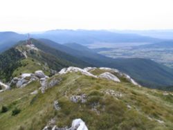
Plješevica
Encyclopedia

Mountain
Image:Himalaya_annotated.jpg|thumb|right|The Himalayan mountain range with Mount Everestrect 58 14 160 49 Chomo Lonzorect 200 28 335 52 Makalurect 378 24 566 45 Mount Everestrect 188 581 920 656 Tibetan Plateaurect 250 406 340 427 Rong River...
in Croatia
Croatia
Croatia , officially the Republic of Croatia , is a unitary democratic parliamentary republic in Europe at the crossroads of the Mitteleuropa, the Balkans, and the Mediterranean. Its capital and largest city is Zagreb. The country is divided into 20 counties and the city of Zagreb. Croatia covers ...
and on the border with Bosnia and Herzegovina
Bosnia and Herzegovina
Bosnia and Herzegovina , sometimes called Bosnia-Herzegovina or simply Bosnia, is a country in Southern Europe, on the Balkan Peninsula. Bordered by Croatia to the north, west and south, Serbia to the east, and Montenegro to the southeast, Bosnia and Herzegovina is almost landlocked, except for the...
, part of the Dinaric Alps
Dinaric Alps
The Dinaric Alps or Dinarides form a mountain chain in Southern Europe, spanning areas of Slovenia, Croatia, Bosnia and Herzegovina, Serbia, Kosovo, Albania and Montenegro....
. It stretches in the direction north–south, and it extends from the mountain pass that separates it from Mala Kapela
Mala Kapela
Mala Kapela is a mountain in Croatia, part of the Dinaric Alps. It stretches in the direction northwest-southeast, and it extends from the mountain pass called "Kapela" or "Vrh Kapele" that separates it from Velika Kapela, down to the mountain pass that connects Otočac and Plitvice and from then...
, along the Krbava
Krbava
Krbava is a region of mountainous Croatia. It can be considered either located east of Lika, or indeed as the eastern part of Lika. The town of Udbina is the central settlement of the Krbava karst field....
field to the west and the Una River canyon to the east, and ending near Gračac
Gracac
Gračac is a village and a municipality in the southern part of Lika, Croatia. It is located south of Udbina, northeast of Obrovac, northwest of Knin and southeast of Gospić...
where it touches on Velebit
Velebit
Velebit is the largest though not the highest mountain range in Croatia. Its highest peak is the Vaganski vrh at 1757 m.The range forms a part of the Dinaric Alps and is located along the Adriatic coast, separating it from Lika in the interior...
.
Željava Air Base
Željava Air Base
Željava Air Base, situated on the border between Croatia and Bosnia and Herzegovina under Plješevica Mountain, near the town of Bihać in Bosnia and Herzegovina, was the largest underground airport and military airbase in the former Yugoslavia and one of the largest in Europe.-History:Construction...
is located inside Plješevica, the largest underground airbase in SFR Yugoslavia.
The highest peaks:
- Ozeblin at 1657 meters, in the central part of the mount
- Gornja Plješevica at 1649 meters, located in the northern part
- Plješevički Kabao at 1618 meters, in the north-central region
There are additional peaks that extend from Plješevica, notably Kremen at 1591 meters in the south and Mrsin at 1269 meters in the north.

