
Pennsylvania Route 106
Encyclopedia
Pennsylvania Traffic Route 106 (also known as PA 106) is a 20.69 miles (33.3 km) long state highway
located in both Susquehanna
and Lackawanna counties in Pennsylvania
. Route 106 begins at a fork from U.S. Route 11
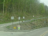
in the community of Kingsley
. The route heads southeasterly for most of its length, interchanging with Interstate 81
in Lenox Township
. Route 106 continues into the city of Carbondale
, where the designation terminates at U.S. Route 6 Business (North Main Street), the former alignment of U.S. Route 6
through Carbondale.
Route 106 is one of five portions of the original U.S. Route 106, a spur of U.S. Route 6 through Pennsylvania. Route 106 went from U.S. Route 309 in Wyalusing
to the New York
state line in Damascus Township
along current-day Route 652
. The designation was eliminated in 1972 and replaced by Route 106 from Kingsley to Carbondale, Route 652 from Indian Orchard to Darbytown and Route 706
from Wyalusing to Nichols.
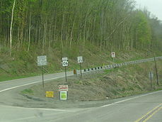
in the community of Kingsley, Pennsylvania
. The route heads to the southeast, paralleling U.S. Route 11 through forestry until the intersection with Jeffers Road, where it turns away from Route 11 and enters fields. The route makes several curves to the southeast and east, crossing through several large fields and industries. The route keeps turning to the southeast, re-entering the deep woods and passing a large pond near West Lenox. In West Lenox, Route 106 passes through forestry and residences until leaving the community for more forestry. After paralleling Creek Road for a distance, Route 106 enters the small community of Lenox, where the highway intersects Route 92
near some industry. A short distance later, the highway interchanges with Interstate 81
at Interchange 211. After Interstate 81, Route 106 continues paralleling the interstate through forestry. The highway continues eastward, paralleling Stone Road into East Lenox, Pennsylvania.
After crossing from East Lenox, Route 106 continues southeastward through fields and soon into a region of residences. The southeastern stretch continues for several miles into the community of West Clifford
. There, Route 106 passes some homes and intersects with Route 374
. The two designations become concurrent, paralleling the alignment of the Milford and Owego Turnpike Road through West Clifford. Routes 106 and 374 head southward and soon turn southwestward through forestry, until clearing into the community of Royal. In the small community, Routes 106 and 374 fork, with Route 374 heading southwestward to Glenwood and Route 106 heading southeastward through Royal. Route 106 continues further, entering deep woods once again after leaving Royal. At the intersection with Cemetery Road, the highway enters a large cemetery and into Clifford. There, the route crosses through a large residential and commercial community, intersecting with Susquehanna Quadrant Route 2008. The route continues southeastward through the residential area before crossing the county line into Lackawanna County
.
. The route continues further, passing through a lumber yard, where it turns southward and further southeastward into the community of Finch Hill. In Finch Hill, Route 106 passes Our Mother of Sorrows Cemetery and intersects with Route 247
(Lakeland Drive) in the center of the town. After Route 247, Route 106 passes through a small residential district before reaching the Homestead Golf Course. The route passes along the southern side of the golf course and turns eastward after passing to the north of Merli-Sarnoski Park. After leaving the golf course behind, Route 106 makes a gradual turn to the southeast at Crystal Lake Road. There, the highway becomes known as Fall Brook Road, and turns southward through forestry. At the intersection with 43rd Street, Route 106 enters the city of Carbondale
. The route, known now as Fallbrook Street, continues on a southeastern trend, entering a large residential district north of the business district. At the intersection with Dundaff Street, it turns southward again, paralleling a nearby river. At the intersection with River Street, Route 106 turns eastward along Salem Avenue, crosses the river and intersects with U.S. Route 6 Business (North Main Street) in Carbondale. At that intersection, the Route 106 designation terminates while Salem Avenue continues as Quadrant Route 1019 through Carbondale.
in Carbondale. However, this designation was short-lived, and in 1928, the alignment was taken over as the centerpiece to U.S. Route 106, a U.S. Highway which began in the community of Wyalusing, Pennsylvania
at U.S. Route 309. The piece that is now PA 106 began in the community of Kingsley and went to the city of Carbondale. The route remained intact for almost 45 years, and in 1972, the U.S. Route 106 designation was decommissioned and replaced by all new designations of Pennsylvania Route 706
, PA 106, and Pennsylvania Route 652
.
State highway
State highway, state road or state route can refer to one of three related concepts, two of them related to a state or provincial government in a country that is divided into states or provinces :#A...
located in both Susquehanna
Susquehanna County, Pennsylvania
-Demographics:As of the census of 2000, there were 42,238 people, 16,529 households, and 11,785 families residing in the county. The population density was 51 people per square mile . There were 21,829 housing units at an average density of 26 per square mile...
and Lackawanna counties in Pennsylvania
Pennsylvania
The Commonwealth of Pennsylvania is a U.S. state that is located in the Northeastern and Mid-Atlantic regions of the United States. The state borders Delaware and Maryland to the south, West Virginia to the southwest, Ohio to the west, New York and Ontario, Canada, to the north, and New Jersey to...
. Route 106 begins at a fork from U.S. Route 11
U.S. Route 11 in Pennsylvania
U.S. Route 11 roughly parallels Interstate 81 in the U.S. state of Pennsylvania. It serves Harrisburg and Scranton. Between those two cities, US 11 follows the Susquehanna River, while I-81 follows a shorter route over the mountains.-Route description:...
in the community of Kingsley
Kingsley, Pennsylvania
Kingsley is in Harford Township, Susquehanna County, Pennsylvania, United States. Kingsley is located in the Endless Mountains of Northeastern Pennsylvania. It is in rural Susquehanna County. The current population is about 50. The town itself is very small but the outskirts extend up to ten miles...
. The route heads southeasterly for most of its length, interchanging with Interstate 81
Interstate 81 in Pennsylvania
Interstate 81 is an long north–south Interstate Highway, stretching from Dandridge, Tennessee to Fisher's Landing, New York at the US/Canadian border...
in Lenox Township
Lenox Township, Pennsylvania
Lenox Township is a township in Susquehanna County, Pennsylvania, United States. The population was 1,832 at the 2000 census.-Geography:According to the United States Census Bureau, the township has a total area of , of which, of it is land and of it is water.-Demographics:As of the census of...
. Route 106 continues into the city of Carbondale
Carbondale, Pennsylvania
Carbondale is a city in Lackawanna County, Pennsylvania, United States. Carbondale is located approximately 15 miles due northeast of the city of Scranton in Northeastern Pennsylvania...
, where the designation terminates at U.S. Route 6 Business (North Main Street), the former alignment of U.S. Route 6
U.S. Route 6 in Pennsylvania
U.S. Route 6 travels east–west near the north edge of the U.S. state of Pennsylvania from the Ohio state line near Pymatuning Reservoir east to the Mid-Delaware Bridge over the Delaware River into Port Jervis, New York. It is the longest highway segment in the Commonwealth. Most of it is a...
through Carbondale.
Route 106 is one of five portions of the original U.S. Route 106, a spur of U.S. Route 6 through Pennsylvania. Route 106 went from U.S. Route 309 in Wyalusing
Wyalusing, Pennsylvania
Wyalusing is a borough in Bradford County, Pennsylvania, United States. The population was 564 at the 2000 census.- History :The history of Wyalusing dates back centuries and was originally known as M'chwihilusing. Before 1750 the settlement was known as Gahontoto and was home to the native...
to the New York
New York
New York is a state in the Northeastern region of the United States. It is the nation's third most populous state. New York is bordered by New Jersey and Pennsylvania to the south, and by Connecticut, Massachusetts and Vermont to the east...
state line in Damascus Township
Damascus Township, Pennsylvania
Damascus Township is a township in Wayne County, Pennsylvania, United States. The population was 3,662 at the 2000 census.-Geography:According to the United States Census Bureau, the township has a total area of , of which, of it is land and of it is water.-Demographics:As of the census of 2000,...
along current-day Route 652
Pennsylvania Route 652
Pennsylvania Route 652, designated by the Pennsylvania Department of Transportation as State Route 0652, is a long east–west state highway located in the northeast Pennsylvania county of Wayne. The western terminus of the route is at U.S. Route 6 in the Texas Township community of Indian...
. The designation was eliminated in 1972 and replaced by Route 106 from Kingsley to Carbondale, Route 652 from Indian Orchard to Darbytown and Route 706
Pennsylvania Route 706
Pennsylvania Route 706 is a long state highway in Pennsylvania. The western terminus is at U.S. Route 6 in Wyalusing, and the eastern terminus is at U.S. Route 11 in Milford.- Major intersections :- History :...
from Wyalusing to Nichols.
Route description
Susquehanna County
Route 106 begins at an intersection with U.S. Route 11U.S. Route 11 in Pennsylvania
U.S. Route 11 roughly parallels Interstate 81 in the U.S. state of Pennsylvania. It serves Harrisburg and Scranton. Between those two cities, US 11 follows the Susquehanna River, while I-81 follows a shorter route over the mountains.-Route description:...
in the community of Kingsley, Pennsylvania
Kingsley, Pennsylvania
Kingsley is in Harford Township, Susquehanna County, Pennsylvania, United States. Kingsley is located in the Endless Mountains of Northeastern Pennsylvania. It is in rural Susquehanna County. The current population is about 50. The town itself is very small but the outskirts extend up to ten miles...
. The route heads to the southeast, paralleling U.S. Route 11 through forestry until the intersection with Jeffers Road, where it turns away from Route 11 and enters fields. The route makes several curves to the southeast and east, crossing through several large fields and industries. The route keeps turning to the southeast, re-entering the deep woods and passing a large pond near West Lenox. In West Lenox, Route 106 passes through forestry and residences until leaving the community for more forestry. After paralleling Creek Road for a distance, Route 106 enters the small community of Lenox, where the highway intersects Route 92
Pennsylvania Route 92
Pennsylvania Route 92 is a long north–south state highway located in northeast Pennsylvania. The southern terminus of the route is at U.S. Route 11 in West Pittston. The northern terminus is at the New York-Pennsylvania border in Oakland Township, where PA 92 continues northward as New York...
near some industry. A short distance later, the highway interchanges with Interstate 81
Interstate 81 in Pennsylvania
Interstate 81 is an long north–south Interstate Highway, stretching from Dandridge, Tennessee to Fisher's Landing, New York at the US/Canadian border...
at Interchange 211. After Interstate 81, Route 106 continues paralleling the interstate through forestry. The highway continues eastward, paralleling Stone Road into East Lenox, Pennsylvania.
After crossing from East Lenox, Route 106 continues southeastward through fields and soon into a region of residences. The southeastern stretch continues for several miles into the community of West Clifford
Clifford Township, Pennsylvania
Clifford Township is a township in Susquehanna County, Pennsylvania, United States. The population was 2,381 at the 2000 census.-Geography:According to the United States Census Bureau, the township has a total area of , of which, of it is land and of it is water.-Demographics:As of the census of...
. There, Route 106 passes some homes and intersects with Route 374
Pennsylvania Route 374
Pennsylvania Route 374 is an long state highway located in Susquehanna county in Pennsylvania. The western terminus is at PA 92 in Glenwood. The eastern terminus is at PA 171/PA 371 near Union Dale....
. The two designations become concurrent, paralleling the alignment of the Milford and Owego Turnpike Road through West Clifford. Routes 106 and 374 head southward and soon turn southwestward through forestry, until clearing into the community of Royal. In the small community, Routes 106 and 374 fork, with Route 374 heading southwestward to Glenwood and Route 106 heading southeastward through Royal. Route 106 continues further, entering deep woods once again after leaving Royal. At the intersection with Cemetery Road, the highway enters a large cemetery and into Clifford. There, the route crosses through a large residential and commercial community, intersecting with Susquehanna Quadrant Route 2008. The route continues southeastward through the residential area before crossing the county line into Lackawanna County
Lackawanna County, Pennsylvania
As of the census of 2000, there were 213,295 people, 86,218 households, and 55,783 families residing in the county. The population density was 465 people per square mile . There were 95,362 housing units at an average density of 208 per square mile...
.
Lackawanna County
After crossing into Lackawanna County, Route 106 continues on a southeastern trend, crossing through homes before returning to the deep forestry in Greenfield TownshipGreenfield Township, Lackawanna County, Pennsylvania
Greenfield Township is a township in Lackawanna County, Pennsylvania, United States. The population was 2,105 at the 2010 census. It is one of the five municipalities comprised by the Lakeland School District. Township government consists of a board of Supervisors...
. The route continues further, passing through a lumber yard, where it turns southward and further southeastward into the community of Finch Hill. In Finch Hill, Route 106 passes Our Mother of Sorrows Cemetery and intersects with Route 247
Pennsylvania Route 247
Pennsylvania Route 247 is an 50 mile long state highway located in Lackawanna, Susquehanna, and Wayne counties in Pennsylvania. The southern terminus is at I 84 in Mount Cobb. The northern terminus is at PA 370 in Preston Park, Pennsylvania....
(Lakeland Drive) in the center of the town. After Route 247, Route 106 passes through a small residential district before reaching the Homestead Golf Course. The route passes along the southern side of the golf course and turns eastward after passing to the north of Merli-Sarnoski Park. After leaving the golf course behind, Route 106 makes a gradual turn to the southeast at Crystal Lake Road. There, the highway becomes known as Fall Brook Road, and turns southward through forestry. At the intersection with 43rd Street, Route 106 enters the city of Carbondale
Carbondale, Pennsylvania
Carbondale is a city in Lackawanna County, Pennsylvania, United States. Carbondale is located approximately 15 miles due northeast of the city of Scranton in Northeastern Pennsylvania...
. The route, known now as Fallbrook Street, continues on a southeastern trend, entering a large residential district north of the business district. At the intersection with Dundaff Street, it turns southward again, paralleling a nearby river. At the intersection with River Street, Route 106 turns eastward along Salem Avenue, crosses the river and intersects with U.S. Route 6 Business (North Main Street) in Carbondale. At that intersection, the Route 106 designation terminates while Salem Avenue continues as Quadrant Route 1019 through Carbondale.
History
Pennsylvania Route 106 was originally an alignment of Pennsylvania Route 47 designated in 1927. This alignment stretched from U.S. Route 11 in Kingsley to the intersection with U.S. Route 6U.S. Route 6 in Pennsylvania
U.S. Route 6 travels east–west near the north edge of the U.S. state of Pennsylvania from the Ohio state line near Pymatuning Reservoir east to the Mid-Delaware Bridge over the Delaware River into Port Jervis, New York. It is the longest highway segment in the Commonwealth. Most of it is a...
in Carbondale. However, this designation was short-lived, and in 1928, the alignment was taken over as the centerpiece to U.S. Route 106, a U.S. Highway which began in the community of Wyalusing, Pennsylvania
Wyalusing, Pennsylvania
Wyalusing is a borough in Bradford County, Pennsylvania, United States. The population was 564 at the 2000 census.- History :The history of Wyalusing dates back centuries and was originally known as M'chwihilusing. Before 1750 the settlement was known as Gahontoto and was home to the native...
at U.S. Route 309. The piece that is now PA 106 began in the community of Kingsley and went to the city of Carbondale. The route remained intact for almost 45 years, and in 1972, the U.S. Route 106 designation was decommissioned and replaced by all new designations of Pennsylvania Route 706
Pennsylvania Route 706
Pennsylvania Route 706 is a long state highway in Pennsylvania. The western terminus is at U.S. Route 6 in Wyalusing, and the eastern terminus is at U.S. Route 11 in Milford.- Major intersections :- History :...
, PA 106, and Pennsylvania Route 652
Pennsylvania Route 652
Pennsylvania Route 652, designated by the Pennsylvania Department of Transportation as State Route 0652, is a long east–west state highway located in the northeast Pennsylvania county of Wayne. The western terminus of the route is at U.S. Route 6 in the Texas Township community of Indian...
.
Major intersections
See also
- Pennsylvania Route 706Pennsylvania Route 706Pennsylvania Route 706 is a long state highway in Pennsylvania. The western terminus is at U.S. Route 6 in Wyalusing, and the eastern terminus is at U.S. Route 11 in Milford.- Major intersections :- History :...
- Pennsylvania Route 652Pennsylvania Route 652Pennsylvania Route 652, designated by the Pennsylvania Department of Transportation as State Route 0652, is a long east–west state highway located in the northeast Pennsylvania county of Wayne. The western terminus of the route is at U.S. Route 6 in the Texas Township community of Indian...
- U.S. Route 6 in PennsylvaniaU.S. Route 6 in PennsylvaniaU.S. Route 6 travels east–west near the north edge of the U.S. state of Pennsylvania from the Ohio state line near Pymatuning Reservoir east to the Mid-Delaware Bridge over the Delaware River into Port Jervis, New York. It is the longest highway segment in the Commonwealth. Most of it is a...