
Parafield Gardens, South Australia
Encyclopedia
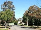
Parafield Gardens is a suburb of Adelaide
, South Australia
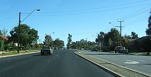
. The suburb is largely residential, with a pocket of industrial land in the southwest corner. There are two small shopping centres in the area, one on Salisbury Highway
which has a Foodland (South Australia)
, and another on Sheperdson Road which has an Independent Grocers of Australia.
people occupied the land around Parafield Gardens prior to European settlement. An Aboriginal heritage site within the Greenfield Industrial Estate indicates that Aboriginal settlement may have existed in the area for thousands of years.
In 1881 the government proposed the creation of a general cemetery on the land now occupied by the Pine Lakes Estate (to the south of the intersection of Salisbury Highway
and Kings Road). The plan was abandoned, and in 1906 the land became used as an experimental agricultural farm, followed by a poultry farm in 1911. At this stage, the area between Salisbury Highway and Martins Road was known as Parafield Farm, although this name transformed over the years to become Parafield Gardens.
In 1958, Matters & Co. offered residential land in the area bounded by Salisbury Highway, Shepherdson Road, Sutherland Avenue, and Catalina Avenue. In the 1970s the South Australian Housing Trust
began building properties in the area.
Parafield Gardens Post Office opened on 25 September 1961.
 Parafield Gardens has five schools in its area and four of which are public. Karrendi Primary School is a public primary school on Bradman Road. Parafield Gardens High School, founded in 1969, is a public secondary school situated next to Parafield Gardens R-7 School, a public primary school like Karrendi except larger. Parafield Gardens Primary, Parafield Gardens High and the private primary school, Holy Family Catholic School are all on Sheperdson Road. A fourth primary school, The Pines School, is located on Andrew Smith Drive.
Adelaide
Adelaide is the capital city of South Australia and the fifth-largest city in Australia. Adelaide has an estimated population of more than 1.2 million...
, South Australia
South Australia
South Australia is a state of Australia in the southern central part of the country. It covers some of the most arid parts of the continent; with a total land area of , it is the fourth largest of Australia's six states and two territories.South Australia shares borders with all of the mainland...
. The suburb is largely residential, with a pocket of industrial land in the southwest corner. There are two small shopping centres in the area, one on Salisbury Highway
Salisbury Highway
The Salisbury Highway, , is a 12 kilometre major connecting road in the northern suburbs of the Adelaide metropolitan area....
which has a Foodland (South Australia)
Foodland (South Australia)
Foodland is an Australian supermarket brand with over one hundred and twenty locations, primarily in South Australia and the Northern Territory. Most Foodland stores are supplied by IGA. These supermarkets are generally larger than IGA-branded ones...
, and another on Sheperdson Road which has an Independent Grocers of Australia.
History
AboriginalIndigenous Australians
Indigenous Australians are the original inhabitants of the Australian continent and nearby islands. The Aboriginal Indigenous Australians migrated from the Indian continent around 75,000 to 100,000 years ago....
people occupied the land around Parafield Gardens prior to European settlement. An Aboriginal heritage site within the Greenfield Industrial Estate indicates that Aboriginal settlement may have existed in the area for thousands of years.
In 1881 the government proposed the creation of a general cemetery on the land now occupied by the Pine Lakes Estate (to the south of the intersection of Salisbury Highway
Salisbury Highway
The Salisbury Highway, , is a 12 kilometre major connecting road in the northern suburbs of the Adelaide metropolitan area....
and Kings Road). The plan was abandoned, and in 1906 the land became used as an experimental agricultural farm, followed by a poultry farm in 1911. At this stage, the area between Salisbury Highway and Martins Road was known as Parafield Farm, although this name transformed over the years to become Parafield Gardens.
In 1958, Matters & Co. offered residential land in the area bounded by Salisbury Highway, Shepherdson Road, Sutherland Avenue, and Catalina Avenue. In the 1970s the South Australian Housing Trust
South Australian Housing Trust
The South Australian Housing Trust was a statutory authority established by the of the Government of South Australia responsible for providing low-cost rental housing to working people and their families.-History:...
began building properties in the area.
Parafield Gardens Post Office opened on 25 September 1961.
Schools