
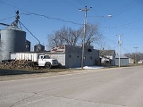
Orchard, Iowa
Encyclopedia
Orchard is a city in Mitchell County
, Iowa
, United States
. The population was 88 at the 2000 census.
that produced lithographic limestone
. Production in these quarries peaked during World War I
when access to German lithographic limestone was cut off. In 1915, Lithograph City had 15 houses, a hotel, a dance hall and a museum. After the war, use of stone blocks in lithography
declined, the city was renamed Devonia, and by 1938, no trace of the town remained.
According to the United States Census Bureau
, the city has a total area of 0.1 square mile (0.258998811 km²), all of it land.
of 2000, there were 88 people, 33 households, and 23 families residing in the city. The population density
was 994.7 people per square mile (377.5/km²). There were 35 housing units at an average density of 395.6 per square mile (150.2/km²). The racial makeup of the city was 100.00% White.
There were 33 households out of which 30.3% had children under the age of 18 living with them, 60.6% were married couples
living together, 9.1% had a female householder with no husband present, and 27.3% were non-families. 21.2% of all households were made up of individuals and 9.1% had someone living alone who was 65 years of age or older. The average household size was 2.67 and the average family size was 2.92.
In the city the population was spread out with 29.5% under the age of 18, 6.8% from 18 to 24, 28.4% from 25 to 44, 15.9% from 45 to 64, and 19.3% who were 65 years of age or older. The median age was 36 years. For every 100 females there were 100.0 males. For every 100 females age 18 and over, there were 106.7 males.
The median income for a household in the city was $19,583, and the median income for a family was $21,250. Males had a median income of $32,500 versus $22,083 for females. The per capita income
for the city was $10,148. There were 22.2% of families and 25.3% of the population living below the poverty line, including 25.0% of under eighteens and 38.1% of those over 64.
Mitchell County, Iowa
-2010 census:The 2010 census recorded a population of 10,776 in the county, with a population density of . There were 4,850 housing units, of which 4,395 were occupied.-2000 census:According to the U.S...
, Iowa
Iowa
Iowa is a state located in the Midwestern United States, an area often referred to as the "American Heartland". It derives its name from the Ioway people, one of the many American Indian tribes that occupied the state at the time of European exploration. Iowa was a part of the French colony of New...
, United States
United States
The United States of America is a federal constitutional republic comprising fifty states and a federal district...
. The population was 88 at the 2000 census.
History
The ghost town of Lithograph City, about 2 miles southwest of Orchard, was founded in the early 1900s adjacent to quarriesQuarry
A quarry is a type of open-pit mine from which rock or minerals are extracted. Quarries are generally used for extracting building materials, such as dimension stone, construction aggregate, riprap, sand, and gravel. They are often collocated with concrete and asphalt plants due to the requirement...
that produced lithographic limestone
Lithographic Limestone
Lithographic limestone is hard limestone that is sufficiently fine-grained, homogeneous and defect free to be used for lithography. Geologists use the term lithographic texture to refer to a grain size under 1/250 mm...
. Production in these quarries peaked during World War I
World War I
World War I , which was predominantly called the World War or the Great War from its occurrence until 1939, and the First World War or World War I thereafter, was a major war centred in Europe that began on 28 July 1914 and lasted until 11 November 1918...
when access to German lithographic limestone was cut off. In 1915, Lithograph City had 15 houses, a hotel, a dance hall and a museum. After the war, use of stone blocks in lithography
Lithography
Lithography is a method for printing using a stone or a metal plate with a completely smooth surface...
declined, the city was renamed Devonia, and by 1938, no trace of the town remained.
Geography
Orchard is located at 43°13′37"N 92°46′28"W (43.226995, -92.774567).According to the United States Census Bureau
United States Census Bureau
The United States Census Bureau is the government agency that is responsible for the United States Census. It also gathers other national demographic and economic data...
, the city has a total area of 0.1 square mile (0.258998811 km²), all of it land.
Demographics
As of the censusCensus
A census is the procedure of systematically acquiring and recording information about the members of a given population. It is a regularly occurring and official count of a particular population. The term is used mostly in connection with national population and housing censuses; other common...
of 2000, there were 88 people, 33 households, and 23 families residing in the city. The population density
Population density
Population density is a measurement of population per unit area or unit volume. It is frequently applied to living organisms, and particularly to humans...
was 994.7 people per square mile (377.5/km²). There were 35 housing units at an average density of 395.6 per square mile (150.2/km²). The racial makeup of the city was 100.00% White.
There were 33 households out of which 30.3% had children under the age of 18 living with them, 60.6% were married couples
Marriage
Marriage is a social union or legal contract between people that creates kinship. It is an institution in which interpersonal relationships, usually intimate and sexual, are acknowledged in a variety of ways, depending on the culture or subculture in which it is found...
living together, 9.1% had a female householder with no husband present, and 27.3% were non-families. 21.2% of all households were made up of individuals and 9.1% had someone living alone who was 65 years of age or older. The average household size was 2.67 and the average family size was 2.92.
In the city the population was spread out with 29.5% under the age of 18, 6.8% from 18 to 24, 28.4% from 25 to 44, 15.9% from 45 to 64, and 19.3% who were 65 years of age or older. The median age was 36 years. For every 100 females there were 100.0 males. For every 100 females age 18 and over, there were 106.7 males.
The median income for a household in the city was $19,583, and the median income for a family was $21,250. Males had a median income of $32,500 versus $22,083 for females. The per capita income
Per capita income
Per capita income or income per person is a measure of mean income within an economic aggregate, such as a country or city. It is calculated by taking a measure of all sources of income in the aggregate and dividing it by the total population...
for the city was $10,148. There were 22.2% of families and 25.3% of the population living below the poverty line, including 25.0% of under eighteens and 38.1% of those over 64.