Opalchenie Peak
Encyclopedia

Vinson Plateau
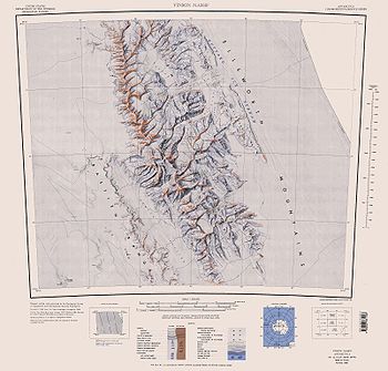
Vinson Plateau is the summit plateau of Vinson Massif, Sentinel Range in Ellsworth Mountains, Antarctica. It extends for 9 km between Goodge Col and Hammer Col linking it to the north-central part of Sentinel Range to the north-northwest and to Craddock Massif to the south-southeast respectively,...
, Sentinel Range
Sentinel Range
The Sentinel Range is a major mountain range situated northward of Minnesota Glacier and forming the northern half of the Ellsworth Mountains in Antarctica. The range trends NNW-SSE for about and is 24 to 48 km wide...
in Ellsworth Mountains
Ellsworth Mountains
The Ellsworth Mountains are the highest mountain ranges in Antarctica, forming a long and wide chain of mountains in a north to south configuration on the western margin of the Ronne Ice Shelf. They are bisected by Minnesota Glacier to form the northern Sentinel Range and the southern Heritage...
, Antarctica. It has precipitous and partly ice-free south slopes, and is of low prominence except to the south, where two parallel ridges descend steeply southwestwards with Donnellan Glacier
Donnellan Glacier
Donnellan Glacier is a glacier steep valley glacier fed by highland ice adjacent to Opalchenie Peak and Fukushima Peak on the summit Vinson Plateau, Sentinel Range in Ellsworth Mountains, Antarctica...
flowing in between and Mount Slaughter
Mount Slaughter
Mount Slaughter is an ice-free peak, rising to 3,600 m on a spur trending southwest from Opalchenie Peak on Vinson Plateau, Sentinel Range, in the Ellsworth Mountains, Antarctica. It is surmounting the head of Donnellan Glacier to the northwest and Gildea Glacier to the south. Mapped by United...
rising on the more southerly ridge.
The peak is named after the Bulgarian Volunteer Force
Opalchentsi
Opalchentsi were Bulgarian voluntary army units, who took part in the Serbo-Turkish War of 1876 and the Russo-Turkish War of 1877–1878. The people in these units were called opalchenets-pobornik meaning "volunteer combatant"....
in the 1877-1878 Russo-Turkish War and the Macedonian-Adrianople Volunteer Force
Macedonian-Adrianopolitan Volunteer Corps
The Macedonian-Adrianopolitan Volunteer Corps was a volunteer corps of the Bulgarian Army during the Balkan Wars. It was formed on 23 September 1912 and consisted of Bulgarian volunteers from Macedonia and Thrace, regions still under Ottoman rule, and thus not subject to Bulgarian military...
in the 1912-1913 Balkan Wars
Balkan Wars
The Balkan Wars were two conflicts that took place in the Balkans in south-eastern Europe in 1912 and 1913.By the early 20th century, Montenegro, Bulgaria, Greece and Serbia, the countries of the Balkan League, had achieved their independence from the Ottoman Empire, but large parts of their ethnic...
, ‘opalchenie’ being the Bulgarian for ‘volunteer force’.
Location
Opalchenie Peak is located at 78°34′02"S 85°34′53"W, which is 2.66 km south-southeast of Silverstein PeakSilverstein Peak
Silverstein Peak is a prominent high peak on the west edge of the ice-covered Vinson Plateau in the Sentinel Range of Ellsworth Mountains, Antarctica....
, 990 m south of Fukushima Peak
Fukushima Peak
Fukushima Peak is a high, pointed rocky peak on the near the south edge of the ice-covered Vinson Plateau in the Sentinel Range of Ellsworth Mountains, Antarctica....
, 7.49 km northwest of Mount Rutford
Mount Rutford
Mount Rutford is a sharp peak that rises to and marks the highest point on Craddock Massif in the Sentinel Range, Ellsworth Mountains. The peak stands just north of Bugueño Pinnacle and 2.1 mi north of Mount Craddock, with which this naming is associated...
, 4.09 km north by east of Mount Slaughter and 7.41 km east of Brichebor Peak
Brichebor Peak (Antarctica)
Brichebor Peak is the peak rising to 2900 m in Vinson Massif, Sentinel Range in Ellsworth Mountains, Antarctica, situated at the end of a side ridge descending southwestwards from Príncipe de Asturias Peak...
. US mapping in 1961, updated in 1988.
Maps
- Vinson Massif. Scale 1:250 000 topographic map. Reston, Virginia: US Geological Survey, 1988.

