
Ohioville, Pennsylvania
Encyclopedia
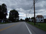
Ohioville is a borough in Beaver County
, Pennsylvania
, United States
. The population was 3,759 at the 2000 census.
.
According to the United States Census Bureau
, the borough has a total area of 23.7 square miles (61.4 km²), of which, 23.4 square miles (60.6 km²) of it is land and 0.3 square mile (0.776996433 km²) of it (1.43%) is water.
of 2000, there were 3,759 people, 1,371 households, and 1,095 families residing in the borough. The population density
was 160.9 people per square mile (62.1/km²). There were 1,439 housing units at an average density of 61.6 per square mile (23.8/km²). The racial makeup of the borough was 97.15% White, 2.00% African American, 0.03% Native American, 0.08% Asian, 0.24% from other races
, and 0.51% from two or more races. Hispanic or Latino of any race were 0.80% of the population.
There were 1,371 households out of which 34.2% had children under the age of 18 living with them, 66.8% were married couples
living together, 9.0% had a female householder with no husband present, and 20.1% were non-families. 17.2% of all households were made up of individuals and 9.2% had someone living alone who was 65 years of age or older. The average household size was 2.70 and the average family size was 3.04.
In the borough the population was spread out with 25.0% under the age of 18, 6.7% from 18 to 24, 27.5% from 25 to 44, 26.3% from 45 to 64, and 14.5% who were 65 years of age or older. The median age was 40 years. For every 100 females there were 97.1 males. For every 100 females age 18 and over, there were 96.4 males.
The median income for a household in the borough was $39,962, and the median income for a family was $48,995. Males had a median income of $36,146 versus $22,324 for females. The per capita income
for the borough was $17,837. About 2.9% of families and 5.5% of the population were below the poverty line, including 8.6% of those under age 18 and 3.0% of those age 65 or over.
Originally known as Ohio Township, the borough was once home to a ferry run by Maryland native Thomas Smith. This ferry transported passengers from the north side of the Ohio to the south, and back again. Near the ferry, a spring of "bituminous oil" arose that would play a crucial role in the township's development. At one time there were also several Indian pictographs. (These are currently underwater.)
In 1811, Four Mile United Presbyterian Church was founded. Located on Tuscarawas Road (whose name derives from the old Tuscarora hunting trail), the church was originally named Four Mile Square Church.
In 1816, Ohioville lost some of its territory to Brighton Township. With the establishment of Glasgow Borough (1854) and Industry Township (1856), and Midland (1906) even more land was lost.
Finally, in 1960, Ohio Township was incorporated as Ohioville Borough.
with Route 68 in Ohioville, near Midland. It is, according to legend, home to many supernatural phenomena.
Beaver County, Pennsylvania
-Demographics:As of the census of 2000, there were 181,412 people, 72,576 households, and 50,512 families residing in the county. The population density was 418 people per square mile . There were 77,765 housing units at an average density of 179 per square mile...
, Pennsylvania
Pennsylvania
The Commonwealth of Pennsylvania is a U.S. state that is located in the Northeastern and Mid-Atlantic regions of the United States. The state borders Delaware and Maryland to the south, West Virginia to the southwest, Ohio to the west, New York and Ontario, Canada, to the north, and New Jersey to...
, United States
United States
The United States of America is a federal constitutional republic comprising fifty states and a federal district...
. The population was 3,759 at the 2000 census.
Geography
Ohioville is located at 40°40′46"N 80°28′17"W (40.679398, -80.471512), in part along the Ohio RiverOhio River
The Ohio River is the largest tributary, by volume, of the Mississippi River. At the confluence, the Ohio is even bigger than the Mississippi and, thus, is hydrologically the main stream of the whole river system, including the Allegheny River further upstream...
.
According to the United States Census Bureau
United States Census Bureau
The United States Census Bureau is the government agency that is responsible for the United States Census. It also gathers other national demographic and economic data...
, the borough has a total area of 23.7 square miles (61.4 km²), of which, 23.4 square miles (60.6 km²) of it is land and 0.3 square mile (0.776996433 km²) of it (1.43%) is water.
Demographics
As of the censusCensus
A census is the procedure of systematically acquiring and recording information about the members of a given population. It is a regularly occurring and official count of a particular population. The term is used mostly in connection with national population and housing censuses; other common...
of 2000, there were 3,759 people, 1,371 households, and 1,095 families residing in the borough. The population density
Population density
Population density is a measurement of population per unit area or unit volume. It is frequently applied to living organisms, and particularly to humans...
was 160.9 people per square mile (62.1/km²). There were 1,439 housing units at an average density of 61.6 per square mile (23.8/km²). The racial makeup of the borough was 97.15% White, 2.00% African American, 0.03% Native American, 0.08% Asian, 0.24% from other races
Race (United States Census)
Race and ethnicity in the United States Census, as defined by the Federal Office of Management and Budget and the United States Census Bureau, are self-identification data items in which residents choose the race or races with which they most closely identify, and indicate whether or not they are...
, and 0.51% from two or more races. Hispanic or Latino of any race were 0.80% of the population.
There were 1,371 households out of which 34.2% had children under the age of 18 living with them, 66.8% were married couples
Marriage
Marriage is a social union or legal contract between people that creates kinship. It is an institution in which interpersonal relationships, usually intimate and sexual, are acknowledged in a variety of ways, depending on the culture or subculture in which it is found...
living together, 9.0% had a female householder with no husband present, and 20.1% were non-families. 17.2% of all households were made up of individuals and 9.2% had someone living alone who was 65 years of age or older. The average household size was 2.70 and the average family size was 3.04.
In the borough the population was spread out with 25.0% under the age of 18, 6.7% from 18 to 24, 27.5% from 25 to 44, 26.3% from 45 to 64, and 14.5% who were 65 years of age or older. The median age was 40 years. For every 100 females there were 97.1 males. For every 100 females age 18 and over, there were 96.4 males.
The median income for a household in the borough was $39,962, and the median income for a family was $48,995. Males had a median income of $36,146 versus $22,324 for females. The per capita income
Per capita income
Per capita income or income per person is a measure of mean income within an economic aggregate, such as a country or city. It is calculated by taking a measure of all sources of income in the aggregate and dividing it by the total population...
for the borough was $17,837. About 2.9% of families and 5.5% of the population were below the poverty line, including 8.6% of those under age 18 and 3.0% of those age 65 or over.
History
Ohioville Township was formed in 1805 from parts of South Beaver Township. The region had, in years past, been home to numerous tribes of Native Americans, most notably the Archaic and Woodland Epoch, of Iroquionian extraction. Prior to William Penn's arrival in the region, the Iroquios tribe of the Five Nations used the region for hunting.Originally known as Ohio Township, the borough was once home to a ferry run by Maryland native Thomas Smith. This ferry transported passengers from the north side of the Ohio to the south, and back again. Near the ferry, a spring of "bituminous oil" arose that would play a crucial role in the township's development. At one time there were also several Indian pictographs. (These are currently underwater.)
Early communities
Blackhawk village was a small community on the South Beaver Township line. Its first post office was established sometime after 1837. Even earlier, the New Salem United Presbyterian Church was established circa 1798, around the same time as Big Beaver's Mount Pleasant Church.In 1811, Four Mile United Presbyterian Church was founded. Located on Tuscarawas Road (whose name derives from the old Tuscarora hunting trail), the church was originally named Four Mile Square Church.
In 1816, Ohioville lost some of its territory to Brighton Township. With the establishment of Glasgow Borough (1854) and Industry Township (1856), and Midland (1906) even more land was lost.
Finally, in 1960, Ohio Township was incorporated as Ohioville Borough.
Local legends
It is no surprise, given the rich history of the region and the multitude of peoples who have lived in the South Beaver area, that many local stories and legends have been handed down over the years. One of the more notable stories is that of Kelly Road. The road connects Engle Road in IndustryIndustry, Pennsylvania
Industry is a borough in Beaver County, Pennsylvania, along the Ohio River. As of the 2000 census, the borough population was 1,921.- History :...
with Route 68 in Ohioville, near Midland. It is, according to legend, home to many supernatural phenomena.