

Ohio State Route 63
Encyclopedia
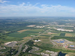
Monroe, Ohio
Monroe is a city located in east central Butler and west central Warren counties in the southwestern part of the U.S. state of Ohio. As of 2007, the city population was 7,655, up from 4,008 in 1990....
and ends in Lebanon, Ohio
Lebanon, Ohio
The population at the 2010 census was 20,033. As of the census of 2000, there were 16,962 people residing in the city. The population density was 1,440.6 people per square mile . There were 6,218 housing units at an average density of 528.1 per square mile...
. This road runs through what was once Union Village, a large historical Shaker settlement.
Route 63 is signed as Main Street on its eastern portion, between I-75 and downtown Lebanon
Lebanon, Ohio
The population at the 2010 census was 20,033. As of the census of 2000, there were 16,962 people residing in the city. The population density was 1,440.6 people per square mile . There were 6,218 housing units at an average density of 528.1 per square mile...
. Route 63 is signed as Hamilton-Lebanon Road on its western portion, between I-75 and SR 4. Before the construction of the Butler County Veterans Highway, Route 63 in combination with Route 4 provided the quickest connection between Lebanon
Lebanon, Ohio
The population at the 2010 census was 20,033. As of the census of 2000, there were 16,962 people residing in the city. The population density was 1,440.6 people per square mile . There were 6,218 housing units at an average density of 528.1 per square mile...
and Hamilton
Hamilton, Ohio
Hamilton is a city in Butler County, southwestern Ohio, United States. The population was 62,447 at the 2010 census. It is the county seat of Butler County. The city is part of the Cincinnati metropolitan area....
.