

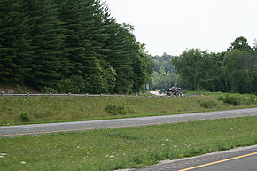
Ohio State Route 160
Encyclopedia
State highway
State highway, state road or state route can refer to one of three related concepts, two of them related to a state or provincial government in a country that is divided into states or provinces :#A...
in the southeastern portion of the U.S. state
U.S. state
A U.S. state is any one of the 50 federated states of the United States of America that share sovereignty with the federal government. Because of this shared sovereignty, an American is a citizen both of the federal entity and of his or her state of domicile. Four states use the official title of...
of Ohio
Ohio
Ohio is a Midwestern state in the United States. The 34th largest state by area in the U.S.,it is the 7th‑most populous with over 11.5 million residents, containing several major American cities and seven metropolitan areas with populations of 500,000 or more.The state's capital is Columbus...
. Its southern terminus is at State Route 7 in Gallipolis
Gallipolis, Ohio
As of the census of 2000, there were 4,180 people, 1,847 households, and 1,004 families residing in the village. The population density was 1,156.2 people per square mile . There were 2,056 housing units at an average density of 568.7 per square mile...
, and the route heads north. It meets U.S. Route 35 at an interchange with various collector and distributor ramps. From there, the route passes through Vinton
Vinton, Ohio
Vinton is a village in Gallia County, Ohio, United States. The population was 324 at the 2000 census. It is part of the Point Pleasant, WV–OH Micropolitan Statistical Area.-Geography:Vinton is located at ....
in northern Gallia County
Gallia County, Ohio
As of the census of 2000, there were 31,069 people, 12,060 households, and 8,586 families residing in the county. The population density was 66 people per square mile . There were 13,498 housing units at an average density of 29 per square mile...
. Following an intersection with State Route 32, the route heads in a more westerly direction until it meets and its northern terminus is at State Route 93 in Hamden
Hamden, Ohio
Hamden is a village in Vinton County, Ohio, United States. The population was 871 at the 2000 census.-Geography:Hamden is located at .According to the United States Census Bureau, the village has a total area of , all of it land....
.
History
- 1926 – Original route certified; routed from 3 miles (4.8 km) north of GallipolisGallipolis, OhioAs of the census of 2000, there were 4,180 people, 1,847 households, and 1,004 families residing in the village. The population density was 1,156.2 people per square mile . There were 2,056 housing units at an average density of 568.7 per square mile...
to HamdenHamden, OhioHamden is a village in Vinton County, Ohio, United States. The population was 871 at the 2000 census.-Geography:Hamden is located at .According to the United States Census Bureau, the village has a total area of , all of it land....
along the previous alignment of State Route 142 from 3 miles (4.8 km) north of Gallipolis to 4 miles (6.4 km) north of Radcliff, and along a previously unnumbered road from 4 miles (6.4 km) north of Radcliff to Hamden. - 1970 – Extended south to Gallipolis along the previous alignment of U.S. Route 35 (which was the former State Route 11 before 1926).