

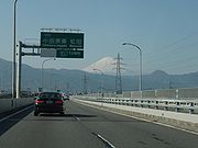
Odawara-Atsugi Road
Encyclopedia
The is a 4-laned toll road
in Kanagawa Prefecture
, Japan
. It is owned and managed by Central Nippon Expressway Company
.
and is classified as a road for (motor vehicles must have a displacement of at least 125 cc).
The road connects western Kanagawa Prefecture (including the popular onsen
resort town of Hakone
) with Tokyo
through the Tōmei Expressway
. The route parallels Route 1
until Ōiso
, where it then follows a northeasterly route through Hiratsuka
and Isehara
before terminating in Atsugi.
The road was opened in 1969 with 2 lanes. Expansion to 4 lanes was completed in 1978.
For toll collection purposes the road is divided into an Odawara section and an Atsugi section, with Ōiso Interchange as the dividing point. The toll for a normal passenger car to use one section is 350 yen.
Toll road
A toll road is a privately or publicly built road for which a driver pays a toll for use. Structures for which tolls are charged include toll bridges and toll tunnels. Non-toll roads are financed using other sources of revenue, most typically fuel tax or general tax funds...
in Kanagawa Prefecture
Kanagawa Prefecture
is a prefecture located in the southern Kantō region of Japan. The capital is Yokohama. Kanagawa is part of the Greater Tokyo Area.-History:The prefecture has some archaeological sites going back to the Jōmon period...
, Japan
Japan
Japan is an island nation in East Asia. Located in the Pacific Ocean, it lies to the east of the Sea of Japan, China, North Korea, South Korea and Russia, stretching from the Sea of Okhotsk in the north to the East China Sea and Taiwan in the south...
. It is owned and managed by Central Nippon Expressway Company
Central Nippon Expressway Company
The , abbreviated as , is one of the main operators of expressways and toll roads in Japan. It is headquartered in Nagoya, Aichi Prefecture.The company was established on October 1, 2005 as a result of the privatization of Japan Highway Public Corporation. The company manages roadways mainly in the...
.
Overview
Officially the road is designated as National Route 271. The entire road is built to a standard similar to that of an urban expresswayExpressways of Japan
The expressways of Japan make up a large network of freeway-standard toll roads.- History :Following World War II, Japan's economic revival led to a massive increase in personal automobile use...
and is classified as a road for (motor vehicles must have a displacement of at least 125 cc).
The road connects western Kanagawa Prefecture (including the popular onsen
Onsen
An is a term for hot springs in the Japanese language, though the term is often used to describe the bathing facilities and inns around the hot springs. As a volcanically active country, Japan has thousands of onsen scattered along its length and breadth...
resort town of Hakone
Hakone, Kanagawa
is a town in Ashigarashimo District in Kanagawa Prefecture, Japan. As of 2010, the town had an estimated population of 13,339 and a density of 144 persons per km². The total area was 92.82 km².-Geography:...
) with Tokyo
Tokyo
, ; officially , is one of the 47 prefectures of Japan. Tokyo is the capital of Japan, the center of the Greater Tokyo Area, and the largest metropolitan area of Japan. It is the seat of the Japanese government and the Imperial Palace, and the home of the Japanese Imperial Family...
through the Tōmei Expressway
Tomei Expressway
The is a national expressway on the island of Honshū in Japan. It is operated by Central Nippon Expressway Company. It is a part of Asian Highway Network -Naming:The word Tōmei is an acronym consisting of two kanji characters...
. The route parallels Route 1
Route 1 (Japan)
National Route 1 is a major highway on the island of Honshū in Japan. It connects Chūō, Tokyo in the Kantō region with the city of Osaka, Osaka Prefecture in the Kansai region, passing through the Chūbu region en route. It follows the old Tōkaidō westward from Tokyo to Kyoto, and the old Kyo Kaidō...
until Ōiso
Oiso, Kanagawa
is a town located in Naka District, Kanagawa Prefecture, Japan. As of 2010, the town had an estimated population of 32,725 and a density of 1,910 persons per km². The total area was 17.18 km².-Geography:...
, where it then follows a northeasterly route through Hiratsuka
Hiratsuka, Kanagawa
is a city located in Kanagawa Prefecture, Japan. As of 2010, the city had an estimated population of 259,991 and the density of 3,830 persons per km²...
and Isehara
Isehara, Kanagawa
is a city located in central Kanagawa Prefecture, Japan. As of 2010, Isehara had an estimated population of 100,976 and a density of 1,820 persons per km². The total area was 55.52 km². There is School of Medicine, Tokai University.-Geography:...
before terminating in Atsugi.
The road was opened in 1969 with 2 lanes. Expansion to 4 lanes was completed in 1978.
For toll collection purposes the road is divided into an Odawara section and an Atsugi section, with Ōiso Interchange as the dividing point. The toll for a normal passenger car to use one section is 350 yen.
List of interchanges and features
- IC - interchangeInterchange (road)In the field of road transport, an interchange is a road junction that typically uses grade separation, and one or more ramps, to permit traffic on at least one highway to pass through the junction without directly crossing any other traffic stream. It differs from a standard intersection, at which...
, PA - parking area, TB - toll gate
| Name | Connections | Dist. from Origin |
Notes | Speed Limit | Location (all in Kanagawa Kanagawa Prefecture is a prefecture located in the southern Kantō region of Japan. The capital is Yokohama. Kanagawa is part of the Greater Tokyo Area.-History:The prefecture has some archaeological sites going back to the Jōmon period... ) |
|---|---|---|---|---|---|
| Odawara-nishi IC |  .svg.png) Seishō Bypass Seishō BypassSeisho Bypass The is a toll road in Kanagawa Prefecture, Japan. It is owned and managed by Central Nippon Expressway Company.-Overview:Officially the road is designated as a bypass for National Route 1... |
0.0 | 60 km/h | Odawara Odawara, Kanagawa is a city located in western Kanagawa Prefecture, Japan. As of 2010, the city had an estimated population of 198,466 with a population density of 1,740 persons per km² . The total area was .-Geography:... |
|
| Ogikubo IC | 1.8 | Odawara-bound exit, Atsugi-bound entrance only | |||
| Odawara-higashi IC |  National Route 255 National Route 255 |
6.7 | |||
| Odawara Toll Plaza/ PA |
↓ | PA: Odawara-bound only | |||
| Ninomiya IC | 13.7 | Ninomiya Ninomiya, Kanagawa is a town located in Naka District, Kanagawa Prefecture, Japan. As of 2010, the town had an estimated population of 29,709 and a density of 3,270 persons per km²... |
|||
| Ōiso IC/ PA |
17.2 | PA: Atsugi-bound only | Ōiso Oiso, Kanagawa is a town located in Naka District, Kanagawa Prefecture, Japan. As of 2010, the town had an estimated population of 32,725 and a density of 1,910 persons per km². The total area was 17.18 km².-Geography:... |
||
| 80 km/h | |||||
| Hiratsuka Toll Gate | ↓ | Hiratsuka Hiratsuka, Kanagawa is a city located in Kanagawa Prefecture, Japan. As of 2010, the city had an estimated population of 259,991 and the density of 3,830 persons per km²... |
|||
| Hiratsuka IC/ PA |
Pref. Route 62 (Hiratsuka Hadano Route) | 23.2 | PA: Odawara-bound only | ||
| Isehara IC | Pref. Route 44 (Isehara Fujisawa Route) | 26.8 | Atsugi-bound exit, Odawara-bound entrance only | Isehara Isehara, Kanagawa is a city located in central Kanagawa Prefecture, Japan. As of 2010, Isehara had an estimated population of 100,976 and a density of 1,820 persons per km². The total area was 55.52 km². There is School of Medicine, Tokai University.-Geography:... |
|
| Atsugi-nishi IC | Pref. Route 604 (Aikō Ishida Teishajō Sakai Route) | 30.8 | Atsugi Atsugi, Kanagawa is a city located in central Kanagawa Prefecture, Japan. As of 2010, the city has an estimated population of 225,622 and a population density of 2,410 persons per km². The total area was 93.83 km²... |
||
| 60 km/h | |||||
| Atsugi IC | Tōmei Expressway Tomei Expressway The is a national expressway on the island of Honshū in Japan. It is operated by Central Nippon Expressway Company. It is a part of Asian Highway Network -Naming:The word Tōmei is an acronym consisting of two kanji characters...  National Route 129 National Route 129 |
33.1 | Route 129 inaccessible from Odawara | ||