North Carolina Scenic Byways
Encyclopedia

North Carolina
North Carolina is a state located in the southeastern United States. The state borders South Carolina and Georgia to the south, Tennessee to the west and Virginia to the north. North Carolina contains 100 counties. Its capital is Raleigh, and its largest city is Charlotte...
that travel through areas of scenic, historic, and cultural significance. The intent of this system is to provide travelers with a safe an interesting alternate route.
Blue Ridge Parkway
The Blue Ridge ParkwayBlue Ridge Parkway
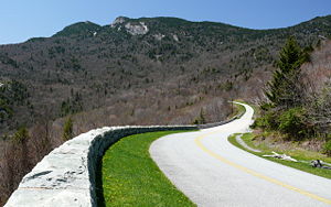
The Blue Ridge Parkway is a National Parkway and All-American Road in the United States, noted for its scenic beauty. It runs for 469 miles , mostly along the famous Blue Ridge, a major mountain chain that is part of the Appalachian Mountains...
is considered the original scenic byway. The parkway's 252 miles (405.6 km) in North Carolina are recognized as an "All American Road" for its spectacular mountain and valley vistas, waterfalls, and colorful flower and foliage displays. Various activities are available along the route and five campgrounds for overnight visitors. The highest point is at Richland-Balsam Gap
Richland Balsam
Richland Balsam is a mountain in the Great Balsam Mountains in the U.S. state of North Carolina. Rising to an elevation of , it is the highest mountain in the Great Balsam range and is among the 20 highest summits in the Appalachian range. The Blue Ridge Parkway reaches an elevation of —...
at 6053 feet (1,845 m).
Scenic byways
| Region | Name | Highways | Notes |
|---|---|---|---|
| Mountain | Waterfall Byway | ||
| Mountain | Nantahala Byway | ||
| Mountain | Cherohala Skyway Cherohala Skyway The Cherohala Skyway is a National Scenic Byway that connects Tellico Plains, Tennessee, to Robbinsville, North Carolina in the southeastern United States. Its name is a portmanteau of Cherokee and Nantahala, the two national forests through which it passes... |
Also a National Scenic Byway National Scenic Byway A National Scenic Byway is a road recognized by the United States Department of Transportation for its archeological, cultural, historic, natural, recreational, and/or scenic qualities. The program was established by Congress in 1991 to preserve and protect the nation's scenic but often... |
|
| Mountain | Indian Lakes Scenic Byway | ||
| Mountain | Whitewater Way | ||
| Mountain | Forest Heritage Scenic Byway | ||
| Mountain | Appalachian Medley | ||
| Mountain | French Broad Overview | ||
| Mountain | Historic Flat Rock Scenic Byway | ||
| Mountain | Drovers Road | ||
| Mountain | Black Mountain Rag | ||
| Mountain | Pacolet River Byway | ||
| Mountain | South Mountain Scenery | ||
| Mountain | Mission Crossing | ||
| Mountain | Little Parkway | ||
| Mountain | New River Valley Byway | ||
| Mountain | I-26 Scenic Highway | ||
| Mountain | U.S. 421 Scenic Byway | ||
| Mountain | Pisgah Loop Scenic Byway | ||
| Mountain | Upper Yadkin Way | ||
| Piedmont | Hanging Rock Scenic Byway | ||
| Piedmont | Colonial Heritage Byway | ||
| Piedmont | Football Road | ||
| Piedmont | Crowders Mountain Drive | ||
| Piedmont | Mill Bridge Scenic Byway | ||
| Piedmont | Uwharrie Scenic Road | ||
| Piedmont | Rolling Kansas Byway | ||
| Piedmont | Pee Dee Valley Drive | ||
| Piedmont | Grassy Island Crossing | ||
| Piedmont | Sandhills Scenic Drive | ||
| Piedmont | Birkhead Wilderness Route | ||
| Piedmont | Flint Hill Ramble | ||
| Piedmont | Indian Heritage Trail | ||
| Piedmont | Pottery Road | ||
| Piedmont | Devil's Stompin' Ground Road | ||
| Piedmont | North Durham Country Byway | ||
| Piedmont | Averasboro Battlefield Scenic Byway | ||
| Piedmont | Scots-Welsh Heritage Byway | ||
| Coastal Plain | Blue-Gray Scenic Byway | ||
| Coastal Plain | Meteor Lakes Byway | ||
| Coastal Plain | Green Swamp Byway | ||
| Coastal Plain | Brunswick Town Road | ||
| Coastal Plain | Cape Fear Historic Byway | ||
| Coastal Plain | Lafayette's Tour | ||
| Coastal Plain | Tar Heel Trace | ||
| Coastal Plain | Edenton-Windsor Loop | ||
| Coastal Plain | Perquimans Crossing | ||
| Coastal Plain | Pamlico Scenic Byway | ||
| Coastal Plain | Alligator River Route | ||
| Coastal Plain | Roanoke Voyages Corridor | ||
| Coastal Plain | Outer Banks Scenic Byway | ||

