
North Bend, Washington
Encyclopedia
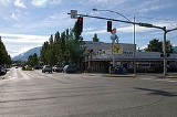
North Bend is a city in King County, Washington
, United States
. The town was made famous by David Lynch
's television series Twin Peaks
(also filmed in nearby Snoqualmie
.) Since the Weyerhaeuser
sawmill closed, North Bend has become an upscale bedroom community for the Eastside
of Seattle, Washington
, with property values more than doubling from 1997 to 2006. The population as of 5,731 at the 2010 census.
North Bend is home to Nintendo North Bend
, the main North America
n production facility and distribution center for the video game console
manufacturer Nintendo
. Based on per capita income
, one of the more reliable measures of affluence, North Bend ranks 52nd of 522 areas in the state of Washington to be ranked. The city's ZIP code
is 98045.
 The Native Americans who inhabited the Snoqualmie Valley, led by Chief Patkanim
, sided with settlers in the wars of the 1850s and, with the Treaty of Point Elliott
, lost such title as settlers acknowledged. Some of the soldiers in those wars, such as the brothers
and sisters Kellogg, established cabins near their blockhouses; however the first permanent settler in the valley was Jeremiah Borst
, in 1858.
In 1865, Matts Peterson homesteaded the site that ultimately became North Bend. Deeply in debt, he sold the property to Borst and moved east of the mountains. Borst wrote to Will Taylor
, who had left the area to go mining in California, and offered him the Peterson place in exchange for labor. Taylor returned and prospered as a farmer and operator of a trading post. He platted North Bend as Snoqualmiehttp://www.snovalley.org/vl_history.html but because another nearby town had the same name, renamed it Mountain View.http://www.historylink.org/essays/output.cfm?file_id=423 However, the Post Office Department
objected to the name Mountain View, so it was renamed North Bend after its location near the north bend of the South Fork of the Snoqualmie River
. North Bend was officially incorporated on March 12, 1909.
, the city has a total area of 2.9 square miles (7.6 km²), all of it land.
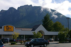
North Bend is located in the foothills of the Cascade Range
just 31 miles (49.9 km) east of Seattle in the upper valley of the Snoqualmie River
. Nearby Mount Si
looms over the town. To the south is Rattlesnake Ridge
. The nearest town, Snoqualmie, Washington
, is located about 3 miles (4.8 km) to the northwest. Mount Si
is the most prominent geological feature arising on the outskirts of North Bend. It stands at 4167 feet (1,270.1 m) and towers above the town, itself at around 440 ft (134.1 m). A 4 miles (6.4 km) trail zig zags up to the summit with a vertical climb of 3500 feet (1,066.8 m).
North Bend annexed Tanner, Washington
and the Stilson area July 6, 2009.
 As of the census
of 2000, there were 4,746 people, 1,841 households, and 1,286 families residing in the city. The population density
was 1,611.6 people per square mile (623.3/km²). There were 1,889 housing units at an average density of 641.4 per square mile (248.1/km²). The racial makeup of the city was 92.01% White, 0.70% African American, 1.03% Native American, 2.23% Asian, 0.17% Pacific Islander, 1.45% from other races
, and 2.40% from two or more races. Hispanic or Latino of any race were 3.79% of the population.
There were 1,841 households out of which 37.8% had children under the age of 18 living with them, 57.1% were married couples
living together, 8.8% had a female householder with no husband present, and 30.1% were non-families. 23.7% of all households were made up of individuals and 10.8% had someone living alone who was 65 years of age or older. The average household size was 2.53 and the average family size was 3.01.
In the city the population was 27.3% under the age of 18, 6.7% from 18 to 24, 37.1% from 25 to 44, 18.4% from 45 to 64, and 10.6% who were 65 years of age or older. The median age was 34 years. For every 100 females there were 97.5 males. For every 100 females age 18 and over, there were 94.0 males. The median income for a household in the city was $61,534, and the median income for a family was $69,402. Males had a median income of $57,333 versus $38,401 for females. The per capita income
for the city was $28,229. About 2.1% of families and 4.7% of the population were below the poverty line, including 5.1% of those under age 18 and 3.0% of those age 65 or over.
. There is regular bus service provided by King County Metro Transit on routes MT 209 to Issaquah and MT 215 to downtown Seattle. Metro buses are outfitted with bike racks. There are a number of van pools to Redmond, Bellevue, Seattle, and Renton. Snoqualmie Valley Transportation provides door-to-door transportation for the public in North Bend, Snoqualmie, Preston, Fall City, Carnation, Duvall and Monroe.
North Bend has a fairly modest trail system. The Snoqualmie Valley Regional Trail
stretches from Duvall, WA through Carnation, WA, Fall City, WA, Snoqualmie, WA, through North Bend, WA to Rattlesnake Lake
. This 31.5 miles (50.7 km) trail connects to the John Wayne Pioneer Trail
(which goes clear across Washington to the Idaho border) and to the City of Snoqualmie's extensive trail network. North Bend also has its own city trail system in downtown, the Si View neighborhood and along the South Fork of the Snoqualmie River in several places.
and Seattle
. In addition, it does have a growing tourism economy centered around the Factory Outlet Shops and the Northwest Train Museum's train activities. North Bend also has about 400 employees working for Nintendo North Bend
.
King County, Washington
King County is a county located in the U.S. state of Washington. The population in the 2010 census was 1,931,249. King is the most populous county in Washington, and the 14th most populous in the United States....
, United States
United States
The United States of America is a federal constitutional republic comprising fifty states and a federal district...
. The town was made famous by David Lynch
David Lynch
David Keith Lynch is an American filmmaker, television director, visual artist, musician and occasional actor. Known for his surrealist films, he has developed his own unique cinematic style, which has been dubbed "Lynchian", and which is characterized by its dream imagery and meticulous sound...
's television series Twin Peaks
Twin Peaks
Twin Peaks is an American television serial drama created by David Lynch and Mark Frost. The series follows the investigation headed by FBI Special Agent Dale Cooper , of the murder of a popular teenager and homecoming queen, Laura Palmer...
(also filmed in nearby Snoqualmie
Snoqualmie, Washington
Snoqualmie is a city next to Snoqualmie Falls in King County, Washington. The city is home to the Northwest Railway Museum. The population was of 10,670 at the 2010 census...
.) Since the Weyerhaeuser
Weyerhaeuser
Weyerhaeuser is one of the largest pulp and paper companies in the world. It is the world's largest private sector owner of softwood timberland; and the second largest owner of United States timberland, behind Plum Creek Timber...
sawmill closed, North Bend has become an upscale bedroom community for the Eastside
Eastside (King County, Washington)
File:Seattle-lakewashington-lakesammamish.PNG|250px|right|The Eastside is to the right of Seattle.# rough city boundariespoly 137 256 148 256 158 194 172 179 172 237 212 266 133 266Renton...
of Seattle, Washington
Seattle, Washington
Seattle is the county seat of King County, Washington. With 608,660 residents as of the 2010 Census, Seattle is the largest city in the Northwestern United States. The Seattle metropolitan area of about 3.4 million inhabitants is the 15th largest metropolitan area in the country...
, with property values more than doubling from 1997 to 2006. The population as of 5,731 at the 2010 census.
North Bend is home to Nintendo North Bend
Nintendo North Bend
Nintendo North Bend is the main North American production facility and one of the distribution centers for the video game console manufacturer Nintendo, located in North Bend, Washington, the United States of America. There is another distribution center, located in Atlanta, and usually handles...
, the main North America
North America
North America is a continent wholly within the Northern Hemisphere and almost wholly within the Western Hemisphere. It is also considered a northern subcontinent of the Americas...
n production facility and distribution center for the video game console
Video game console
A video game console is an interactive entertainment computer or customized computer system that produces a video display signal which can be used with a display device to display a video game...
manufacturer Nintendo
Nintendo
is a multinational corporation located in Kyoto, Japan. Founded on September 23, 1889 by Fusajiro Yamauchi, it produced handmade hanafuda cards. By 1963, the company had tried several small niche businesses, such as a cab company and a love hotel....
. Based on per capita income
Washington locations by per capita income
Washington is the twelfth richest state in the United States of America, with a per capita income of $22,973 and a personal per capita income of $33,332 .-Washington counties ranked by per capita income:...
, one of the more reliable measures of affluence, North Bend ranks 52nd of 522 areas in the state of Washington to be ranked. The city's ZIP code
ZIP Code
ZIP codes are a system of postal codes used by the United States Postal Service since 1963. The term ZIP, an acronym for Zone Improvement Plan, is properly written in capital letters and was chosen to suggest that the mail travels more efficiently, and therefore more quickly, when senders use the...
is 98045.
History
Patkanim
Patkanim was chief of the Snoqualmoo and Snohomish tribe in what is now modern Washington State....
, sided with settlers in the wars of the 1850s and, with the Treaty of Point Elliott
Treaty of Point Elliott
The Treaty of Point Elliott of 1855, or the Point Elliott Treaty,—also known as Treaty of Point Elliot / Point Elliott Treaty—is the lands settlement treaty between the United States government and the nominal Native American tribes of the greater Puget Sound region in the recently-formed...
, lost such title as settlers acknowledged. Some of the soldiers in those wars, such as the brothers
and sisters Kellogg, established cabins near their blockhouses; however the first permanent settler in the valley was Jeremiah Borst
Jeremiah Borst
Jeremiah Borst was the first permanent white settler in the region and is considered to be the father of the Snoqualmie Valley community....
, in 1858.
In 1865, Matts Peterson homesteaded the site that ultimately became North Bend. Deeply in debt, he sold the property to Borst and moved east of the mountains. Borst wrote to Will Taylor
Will Taylor
Will Taylor, was a land speculator and the founder of North Bend, Washington in February 1889.William H. Taylor was born in Iowa on February 12, 1853 to a large family. In 1872 his family moved to the Snoqualmie Valley. William Taylor took a job peeling potatoes and washing dishes in the...
, who had left the area to go mining in California, and offered him the Peterson place in exchange for labor. Taylor returned and prospered as a farmer and operator of a trading post. He platted North Bend as Snoqualmiehttp://www.snovalley.org/vl_history.html but because another nearby town had the same name, renamed it Mountain View.http://www.historylink.org/essays/output.cfm?file_id=423 However, the Post Office Department
United States Postal Service
The United States Postal Service is an independent agency of the United States government responsible for providing postal service in the United States...
objected to the name Mountain View, so it was renamed North Bend after its location near the north bend of the South Fork of the Snoqualmie River
Snoqualmie River
The Snoqualmie River is a long river in King County and Snohomish County in the U.S. state of Washington. The river's three main tributaries are the North, Middle, and South Forks, which drain the west side of the Cascade Mountains near the town of North Bend and join near the town of Snoqualmie...
. North Bend was officially incorporated on March 12, 1909.
Geography
North Bend is located at 47°29′38"N 121°47′10"W (47.493831, -121.786247). According to the United States Census BureauUnited States Census Bureau
The United States Census Bureau is the government agency that is responsible for the United States Census. It also gathers other national demographic and economic data...
, the city has a total area of 2.9 square miles (7.6 km²), all of it land.
North Bend is located in the foothills of the Cascade Range
Cascade Range
The Cascade Range is a major mountain range of western North America, extending from southern British Columbia through Washington and Oregon to Northern California. It includes both non-volcanic mountains, such as the North Cascades, and the notable volcanoes known as the High Cascades...
just 31 miles (49.9 km) east of Seattle in the upper valley of the Snoqualmie River
Snoqualmie River
The Snoqualmie River is a long river in King County and Snohomish County in the U.S. state of Washington. The river's three main tributaries are the North, Middle, and South Forks, which drain the west side of the Cascade Mountains near the town of North Bend and join near the town of Snoqualmie...
. Nearby Mount Si
Mount Si
Mount Si is a mountain in the U.S. state of Washington. It lies on the western margin of the Cascade Range just above the coastal plains around Puget Sound, and towers over the nearby town of North Bend. The mountain was named after local homesteader Josiah "Uncle Si" Merritt...
looms over the town. To the south is Rattlesnake Ridge
Rattlesnake Ridge
Rattlesnake Ridge is a mountain ridge located south of North Bend, Washington, United States. The western end is near the intersection of State Route 18 and I-90 in Snoqualmie, Washington and runs southeast about or by trail...
. The nearest town, Snoqualmie, Washington
Snoqualmie, Washington
Snoqualmie is a city next to Snoqualmie Falls in King County, Washington. The city is home to the Northwest Railway Museum. The population was of 10,670 at the 2010 census...
, is located about 3 miles (4.8 km) to the northwest. Mount Si
Mount Si
Mount Si is a mountain in the U.S. state of Washington. It lies on the western margin of the Cascade Range just above the coastal plains around Puget Sound, and towers over the nearby town of North Bend. The mountain was named after local homesteader Josiah "Uncle Si" Merritt...
is the most prominent geological feature arising on the outskirts of North Bend. It stands at 4167 feet (1,270.1 m) and towers above the town, itself at around 440 ft (134.1 m). A 4 miles (6.4 km) trail zig zags up to the summit with a vertical climb of 3500 feet (1,066.8 m).
North Bend annexed Tanner, Washington
Tanner, Washington
Tanner is a Census-Designated Place in east King County, Washington.Based on per capita income, one of the more reliable measures of affluence, Tanner ranks 46th of 522 areas in the state of Washington to be ranked.-Geography:...
and the Stilson area July 6, 2009.
Surrounding Cities and Communities
North Bend Climate
North Bend's climate is warm and generally dry during the summer when high temperatures tend to be in the 70s and 80s and cool during the winter when high temperatures tend to be in the 40s. The all-time record high temperature is 105 °F (40.6 °C) set in 2009. The warmest month of the year is July with an average maximum temperature of 77 °F (25 °C), while the coldest month of the year is January with an average minimum temperature of 33 °F (0.555555555559977 °C). The annual average precipitation in North Bend is 59.1 inches (1,501.1 mm) with 12.8 inches (325.1 mm) of snowfall. Winter months tend to be wetter than summer months.Demographics
Census
A census is the procedure of systematically acquiring and recording information about the members of a given population. It is a regularly occurring and official count of a particular population. The term is used mostly in connection with national population and housing censuses; other common...
of 2000, there were 4,746 people, 1,841 households, and 1,286 families residing in the city. The population density
Population density
Population density is a measurement of population per unit area or unit volume. It is frequently applied to living organisms, and particularly to humans...
was 1,611.6 people per square mile (623.3/km²). There were 1,889 housing units at an average density of 641.4 per square mile (248.1/km²). The racial makeup of the city was 92.01% White, 0.70% African American, 1.03% Native American, 2.23% Asian, 0.17% Pacific Islander, 1.45% from other races
Race (United States Census)
Race and ethnicity in the United States Census, as defined by the Federal Office of Management and Budget and the United States Census Bureau, are self-identification data items in which residents choose the race or races with which they most closely identify, and indicate whether or not they are...
, and 2.40% from two or more races. Hispanic or Latino of any race were 3.79% of the population.
There were 1,841 households out of which 37.8% had children under the age of 18 living with them, 57.1% were married couples
Marriage
Marriage is a social union or legal contract between people that creates kinship. It is an institution in which interpersonal relationships, usually intimate and sexual, are acknowledged in a variety of ways, depending on the culture or subculture in which it is found...
living together, 8.8% had a female householder with no husband present, and 30.1% were non-families. 23.7% of all households were made up of individuals and 10.8% had someone living alone who was 65 years of age or older. The average household size was 2.53 and the average family size was 3.01.
In the city the population was 27.3% under the age of 18, 6.7% from 18 to 24, 37.1% from 25 to 44, 18.4% from 45 to 64, and 10.6% who were 65 years of age or older. The median age was 34 years. For every 100 females there were 97.5 males. For every 100 females age 18 and over, there were 94.0 males. The median income for a household in the city was $61,534, and the median income for a family was $69,402. Males had a median income of $57,333 versus $38,401 for females. The per capita income
Per capita income
Per capita income or income per person is a measure of mean income within an economic aggregate, such as a country or city. It is calculated by taking a measure of all sources of income in the aggregate and dividing it by the total population...
for the city was $28,229. About 2.1% of families and 4.7% of the population were below the poverty line, including 5.1% of those under age 18 and 3.0% of those age 65 or over.
North Bend Theatre
On April 9, 1941 the North Bend Theatre opened its doors. It has continued operating as an independent movie theater since that day. In 1999, the theatre underwent a major renovation to make it more modern. During this renovation every part of the building was improved without sacrificing the distinctive character of this 1941 Art Deco theatre.Valley Center Stage
Valley Center Stage is a community theater that promotes the performing arts in all its aspects. The theater has regular shows featuring classics and comedy. In addition, the theater offers opportunities to valley residents to participate in the theater productions.Snoqualmie Valley Historical Museum
The Snoqualmie Valley Historical Museum, operated by the Snoqualmie Valley Historical Society, has been sharing the history of the Snoqualmie Valley for over 50 years.Transportation
North Bend is located 30 miles (48.3 km) east of Seattle on Interstate 90 freeway, which runs from Seattle to BostonBoston
Boston is the capital of and largest city in Massachusetts, and is one of the oldest cities in the United States. The largest city in New England, Boston is regarded as the unofficial "Capital of New England" for its economic and cultural impact on the entire New England region. The city proper had...
. There is regular bus service provided by King County Metro Transit on routes MT 209 to Issaquah and MT 215 to downtown Seattle. Metro buses are outfitted with bike racks. There are a number of van pools to Redmond, Bellevue, Seattle, and Renton. Snoqualmie Valley Transportation provides door-to-door transportation for the public in North Bend, Snoqualmie, Preston, Fall City, Carnation, Duvall and Monroe.
North Bend has a fairly modest trail system. The Snoqualmie Valley Regional Trail
Snoqualmie Valley Regional Trail
The Snoqualmie Valley Regional Trail is a King County administered trail that connects with the John Wayne Pioneer Trail in Iron Horse State Park. The trail follows a portion of the former alignment of the Chicago, Milwaukee, St...
stretches from Duvall, WA through Carnation, WA, Fall City, WA, Snoqualmie, WA, through North Bend, WA to Rattlesnake Lake
Rattlesnake Lake
Rattlesnake Lake is a lake in King County, Washington, located in Rattlesnake Mountain Scenic Area some east of Seattle.-History:The town of Moncton existed in 1906–1915 around the northern edge of Rattlesnake Lake. In the spring of 1915 it was destroyed by flooding caused by seepage of water from...
. This 31.5 miles (50.7 km) trail connects to the John Wayne Pioneer Trail
John Wayne Pioneer Trail
The John Wayne Pioneer Trail follows the former roadbed of the Chicago, Milwaukee, St. Paul and Pacific Railroad for across two-thirds of Washington from the western slopes of the Cascade Mountains to the Idaho border. The Chicago, Milwaukee, St...
(which goes clear across Washington to the Idaho border) and to the City of Snoqualmie's extensive trail network. North Bend also has its own city trail system in downtown, the Si View neighborhood and along the South Fork of the Snoqualmie River in several places.
Economy
North Bend is for the largest part a bedroom community to BellevueBellevue, Washington
Bellevue is a city in the Eastside region of King County, Washington, United States, across Lake Washington from Seattle. Long known as a suburb or satellite city of Seattle, it is now categorized as an edge city or a boomburb. The population was 122,363 at the 2010 census.Downtown Bellevue is...
and Seattle
Seattle, Washington
Seattle is the county seat of King County, Washington. With 608,660 residents as of the 2010 Census, Seattle is the largest city in the Northwestern United States. The Seattle metropolitan area of about 3.4 million inhabitants is the 15th largest metropolitan area in the country...
. In addition, it does have a growing tourism economy centered around the Factory Outlet Shops and the Northwest Train Museum's train activities. North Bend also has about 400 employees working for Nintendo North Bend
Nintendo North Bend
Nintendo North Bend is the main North American production facility and one of the distribution centers for the video game console manufacturer Nintendo, located in North Bend, Washington, the United States of America. There is another distribution center, located in Atlanta, and usually handles...
.
Landmarks
King County and the City of North Bend have designated the following landmarks:| Landmark | Built | Listed | Address | Photo |
|---|---|---|---|---|
| Camp North Bend (Camp Waskowitz) | 1935 | 1992 | 45509 SE 150th Street, North Bend |  |
| Si View Pool and Activity Center (WPA Park Building) | 1938-40 | 1984 | 400 SE Orchard Dr., North Bend | 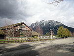 |
| North Bend Historic Commercial District | 1889–1960 | 2000 | Bendigo Blvd. & No. Bend Way | 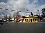 |
| Tollgate Farmhouse | c.1890 | 2002 | SR 202 (near Boalch Avenue) | 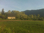 |
See also
- Tanner, WashingtonTanner, WashingtonTanner is a Census-Designated Place in east King County, Washington.Based on per capita income, one of the more reliable measures of affluence, Tanner ranks 46th of 522 areas in the state of Washington to be ranked.-Geography:...
- Riverbend, WashingtonRiverbend, WashingtonRiverbend is a census-designated place in King County, Washington, United States. The population was 2,132 at the 2010 census.Based on per capita income, one of the more reliable measures of affluence, Riverbend ranks 87th of 522 areas in the state of Washington to be ranked.-Geography:Riverbend...
- Cascade RangeCascade RangeThe Cascade Range is a major mountain range of western North America, extending from southern British Columbia through Washington and Oregon to Northern California. It includes both non-volcanic mountains, such as the North Cascades, and the notable volcanoes known as the High Cascades...
- Alpine Lakes WildernessAlpine Lakes WildernessThe Alpine Lakes Wilderness is a large wilderness area spanning the Cascade Range of Washington state in the United States. The wilderness is located in parts of Wenatchee National Forest and Snoqualmie National Forest, and is approximately bounded by Interstate 90 and Snoqualmie Pass to the south...
- Franklin FallsFranklin FallsFranklin Falls is a waterfall on the South fork of the Snoqualmie River, the first of three major waterfalls on the South Fork Snoqualmie River. The falls are located near Snoqualmie Pass in Kittitas County, Washington, United States, between the north and south lanes of Interstate 90, just east of...
- Interstate 90 in WashingtonInterstate 90 in WashingtonInterstate 90 , a transcontinental Interstate Highway from Seattle, Washington, to Boston, Massachusetts, crosses the state of Washington before crossing the Idaho state line between Spokane and Post Falls...
- Iron Horse State ParkIron Horse State ParkIron Horse State Park, part of the Washington State Park System, is a state park located in the Cascade Mountains and Yakima River Valley, between Cedar Falls on the west and the Columbia River on the east....
- Little SiLittle SiLittle Si is a hill in the US state of Washington, named after its taller neighbor, Mount Si. It has an elevation of . and lies on the western margin of the Cascade Range just east of the town of North Bend...
- Mount Washington (Cascades)Mount Washington (Cascades)Mount Washington is a small mountain in the US state of Washington roughly east-southeast of Seattle, Washington along Interstate 90. It lies on the western margin of the Cascade Range just above the coastal plains around Puget Sound, and is southwest of nearby town of North Bend.Once known as...
- Mount SiMount SiMount Si is a mountain in the U.S. state of Washington. It lies on the western margin of the Cascade Range just above the coastal plains around Puget Sound, and towers over the nearby town of North Bend. The mountain was named after local homesteader Josiah "Uncle Si" Merritt...
- Olallie State ParkOlallie State ParkThe Olallie State Park is a day-use park in Washington around part of the Snoqualmie River. The most prominent feature of the park is Twin Falls.- Location :...
- Rattlesnake LakeRattlesnake LakeRattlesnake Lake is a lake in King County, Washington, located in Rattlesnake Mountain Scenic Area some east of Seattle.-History:The town of Moncton existed in 1906–1915 around the northern edge of Rattlesnake Lake. In the spring of 1915 it was destroyed by flooding caused by seepage of water from...
- Rattlesnake RidgeRattlesnake RidgeRattlesnake Ridge is a mountain ridge located south of North Bend, Washington, United States. The western end is near the intersection of State Route 18 and I-90 in Snoqualmie, Washington and runs southeast about or by trail...
- Snoqualmie FallsSnoqualmie FallsSnoqualmie Falls is a 268 ft waterfall on the Snoqualmie River between Snoqualmie and Fall City, Washington, USA. It is one of Washington's most popular scenic attractions, but is perhaps best known internationally for its appearance in the cult television series Twin Peaks...
- Snoqualmie PassSnoqualmie PassSnoqualmie Pass is a mountain pass that carries Interstate 90 through the Cascade Range in the U.S. State of Washington. The elevation of the pass summit is , and is on the county line between Kittitas County and King County...
- Snoqualmie RiverSnoqualmie RiverThe Snoqualmie River is a long river in King County and Snohomish County in the U.S. state of Washington. The river's three main tributaries are the North, Middle, and South Forks, which drain the west side of the Cascade Mountains near the town of North Bend and join near the town of Snoqualmie...
- Twin Falls (Washington)Twin Falls (Washington)Twin Falls is a waterfall on the South fork of the Snoqualmie River, off exit 34 on I-90 in the Olallie State Park.-See also:* Snoqualmie River* Olallie State Park* Middle Twin Falls* Upper Twin Falls-External links:* , Washington State Parks*...
- Weeks FallsWeeks Fallsthumb|300px|right|Sign by Weeks Falls Hydro PlantWeeks Falls is a waterfall on the South fork of the Snoqualmie River, located just south of Interstate 90 at exit 38. The falls are at the end of the road that goes past the Olallie State Park ranger headquarters...