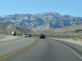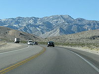
Nevada State Route 160
Encyclopedia

.jpg)
State highway
State highway, state road or state route can refer to one of three related concepts, two of them related to a state or provincial government in a country that is divided into states or provinces :#A...
in southern Nevada
Nevada
Nevada is a state in the western, mountain west, and southwestern regions of the United States. With an area of and a population of about 2.7 million, it is the 7th-largest and 35th-most populous state. Over two-thirds of Nevada's people live in the Las Vegas metropolitan area, which contains its...
, USA. It connects the southern Las Vegas Valley to U.S. Route 95 northwest of the city via the Pahrump Valley
Pahrump Valley
Pahrump Valley is a Mojave Desert valley west of Las Vegas and the Spring Mountains massif in southern Nye County, Nevada, and eastern San Bernardino County, California. Pahrump, Nevada, is in the valley's center and the Tecopa and Chicago Valleys are immediately to the west...
. The southern part of the route sees heavy traffic, mostly due to Pahrump
Pahrump, Nevada
-Demographics:As of the census of 2000, there were 24,631 people, 10,153 households, and 7,127 families residing in the CDP. The population density was 82.7 people per square mile . There were 11,651 housing units at an average density of 39.1 per square mile...
's continued growth as a Las Vegas bedroom community.
The route is known as Blue Diamond Road within the Las Vegas area, with the remainder referred to as the Pahrump Valley Highway.
A portion of the route was originally part of State Route 16 prior to 1978.
Route description
State Route 160 begins in southern Las Vegas at its intersection with Las Vegas BoulevardLas Vegas Boulevard
State Route 604 is the route number designation for parts of Las Vegas Boulevard, a major north–south road in the Las Vegas metropolitan area of Nevada in the United States best known for the Las Vegas Strip and its casinos. Formerly carrying U.S...
(former SR 604) and East Windmill Lane. It runs southwest towards the Red Rock Canyon National Conservation Area
Red Rock Canyon National Conservation Area
Red Rock Canyon National Conservation Area in Nevada is an area managed by the Bureau of Land Management as part of its National Landscape Conservation System, and protected as a National Conservation Area. It is located about west of Las Vegas, and easily seen from the Las Vegas Strip...
and over Mountain Springs Summit
Mountain Springs Summit
Mountain Springs Summit [el. ] is a mountain pass in the Spring Mountains of Southern Nevada in the United States.The pass is at the summit of a ridge of the Spring Mountains between the Mount Charleston area and the rest of the Mojave Desert and is located on the border of the Humboldt-Toiyabe...
(elevation 5502 feet (1,677 m)) before turning northwest towards Pahrump. Outside of Pahrump, SR 160 heads almost due north to reach its northern terminus at US 95.
History
State Route 160 was originally part of State Route 16 from Pahrump north to US 95. State Route 16 was one of Nevada’s original state highways dating from the 1920s. It began at the Nevada/California border south of Pahrump and ran north to the city over Hidden Hills Ranch Road. From there, it continued north over present-day State Route 160.In 1978, the section from Pahrump to US 95 became part of the newly created State Route 160. The section from the California border to Pahrump remained as State Route 16 until it was removed in 1981.
In 2007, State Route 160 was realigned slightly over I-15 in southern Las Vegas. The highway was moved a short distance to the south between Valley View Boulevard and Las Vegas Boulevard, realigning the southeastern terminus with East Windmill Lane at the intersection of Las Vegas Boulevard. The project also reconstructed the ramps of the aging interchange, allowing for better traffic flow to and from I-15.
Major intersections
- Note: Mileposts in Nevada reset at county lines; the start and end mileposts for each county are given in the county column.
| County | Location | Mile | Roads Intersected | Notes |
|---|---|---|---|---|
| Clark Clark County, Nevada -Demographics:As of the census of 2000, there were 1,375,765 people, 512,253 households, and 339,693 families residing within the MSA. The racial makeup of the MSA was 71.6% White , 9.1% Black, 5.7% Asian, 0.8% American Indian and 12.8% of other or mixed race. 22.0% were Hispanic of any race... |
0.00 | Las Vegas Boulevard Las Vegas Boulevard State Route 604 is the route number designation for parts of Las Vegas Boulevard, a major north–south road in the Las Vegas metropolitan area of Nevada in the United States best known for the Las Vegas Strip and its casinos. Formerly carrying U.S... |
Eastern terminus; road continues east as Windmill Lane | |
| – Los Angeles Los Angeles, California Los Angeles , with a population at the 2010 United States Census of 3,792,621, is the most populous city in California, USA and the second most populous in the United States, after New York City. It has an area of , and is located in Southern California... , Salt Lake City Salt Lake City, Utah Salt Lake City is the capital and the most populous city of the U.S. state of Utah. The name of the city is often shortened to Salt Lake or SLC. With a population of 186,440 as of the 2010 Census, the city lies in the Salt Lake City metropolitan area, which has a total population of 1,124,197... |
Interchange | |||
| Rainbow Boulevard | Former SR 595 Nevada State Route 595 State Route 595 comprises a portion of Rainbow Boulevard, a north–south section line arterial in the Las Vegas metropolitan area.-State route description:... |
|||
| , Red Rock Red Rock Canyon National Conservation Area Red Rock Canyon National Conservation Area in Nevada is an area managed by the Bureau of Land Management as part of its National Landscape Conservation System, and protected as a National Conservation Area. It is located about west of Las Vegas, and easily seen from the Las Vegas Strip... |
||||
| Nye Nye County, Nevada -National protected areas:* Ash Meadows National Wildlife Refuge* Death Valley National Park * Humboldt-Toiyabe National Forest * Spring Mountains National Recreation Area -Demographics:... |
Pahrump Pahrump, Nevada -Demographics:As of the census of 2000, there were 24,631 people, 10,153 households, and 7,127 families residing in the CDP. The population density was 82.7 people per square mile . There were 11,651 housing units at an average density of 39.1 per square mile... |
~10 | – Shoshone Shoshone, California Shoshone is a census-designated place in Inyo County, California, United States. Shoshone is located on the Tonopah and Tidewater Railroad east of Epaulet Peak, at an elevation of 1585 feet . The population was 31 at the 2010 census, down from 52 at the 2000 census.The town was founded in 1910... , Death Valley Death Valley National Park Death Valley National Park is a national park in the U.S. states of California and Nevada located east of the Sierra Nevada in the arid Great Basin of the United States. The park protects the northwest corner of the Mojave Desert and contains a diverse desert environment of salt-flats, sand dunes,... |
|
| 37.22 | Western terminus |

