
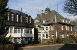
Neuenrade
Encyclopedia
Neuenrade is a town in North Rhine-Westphalia
, Germany
, located in the hills of the Sauerland
in the Märkischer Kreis
.
The municipal territory includes the villages of Affeln
, Berentrop, Blintrop and Küntrop
.
.
By 1890/91 the municipalities Werdohl and Ohle had grown so much that they left the Amt Neuenrade, the local administrative unit. The Amt thereafter was composed of only Neuenrade and Dahle.
The Amt Neuenrade was dissolved, effective on January 1, 1969. The municipality Dahle was incorporated into Altena
, while the municipality Küntrop from the Amt Balve was incorporated into the city Neuenrade. In 1975 the city was further enlarged with the municipalities Affeln
, Altenaffeln and Blintrop from the Amt Balve.
After the communal reform of 1975 the city changed their coat of arms. In the bottom of the shield the black cross of the bishops of Cologne was added, representing the municipalities of the former Amt Balve which historically belonged to Kurköln. The new coat of arms was granted on March 23, 1979, based on a design by Professor Hußmann.
The Amt Neuenrade also had a coat of arms. It was granted on January 13, 1938, and was designed by Waldemar Mallek based on an idea of Dr. Fritz Thomée. It resembled the coat of arms of the city Neuenrade, the bottom part showed a mill wheel. As a municipality Dahle had no traditional heraldic symbol. The mill wheel was chosen symbolizing the traditional industries at the Nette River.
municipality Dinxperlo
. In 1984 it was converted into a town twinning
. The partnership was reaffirmed in 2005 by the municipality Aalten
, of which Dinxperlo had become part that year. Since 1990 it is also twinned with Klingenthal
in Saxony
.
North Rhine-Westphalia
North Rhine-Westphalia is the most populous state of Germany, with four of the country's ten largest cities. The state was formed in 1946 as a merger of the northern Rhineland and Westphalia, both formerly part of Prussia. Its capital is Düsseldorf. The state is currently run by a coalition of the...
, Germany
Germany
Germany , officially the Federal Republic of Germany , is a federal parliamentary republic in Europe. The country consists of 16 states while the capital and largest city is Berlin. Germany covers an area of 357,021 km2 and has a largely temperate seasonal climate...
, located in the hills of the Sauerland
Sauerland
The Sauerland is a rural, hilly area spreading across most of the south-eastern part of North Rhine-Westphalia, in parts heavily forested and, apart from the major valleys, sparsely inhabited...
in the Märkischer Kreis
Märkischer Kreis
The Märkischer Kreis is a district in central North Rhine-Westphalia, Germany. Neighbouring districts are Unna, Soest, Hochsauerland, Olpe, Oberbergischer Kreis, Ennepe-Ruhr, and the city of Hagen.-History:...
.
Geography
The highest elevation in the town area is the Kohlberg with an altitude of 514 m above sea level. The lowest elevation is at Hölmecke with 190 m. The town covers an area of 54.12 km², most of which is forests (29.41 km²) and farm land (18.18 km²).The municipal territory includes the villages of Affeln
Affeln
Affeln is a German village in Neuenrade, a municipality in Märkischer Kreis, North Rhine-Westphalia. Until 1975 it was an autonomous municipality.-Geography:It is located in Homert Natural Park in the east of Neuenrade and in north of Plettenberg....
, Berentrop, Blintrop and Küntrop
Küntrop
Küntrop is a German village in Neuenrade, a municipality in Märkischer Kreis, North Rhine-Westphalia. Until 1969 it was an autonomous municipality and, as of 2010, its population was of 1,498.-Geography:...
.
History
Around 1220 the place was first mentioned in a document, then named Rode. The village consisted of about 12 farms. In 1353 the city was fortified. In 1355 it received the cityrights from count Engelbert IIIEngelbert III of the Mark
Engelbert III of the Mark was the Count of Mark from 1347 until 1391.Adolph was the eldest son of Count Adolph II of the Marck and Margaret of Cleves. After his father died in 1347, Engelbert III ruled the County of Mark, mainly from Burg Blankenstein in 1393.In his time, he was the leading...
.
By 1890/91 the municipalities Werdohl and Ohle had grown so much that they left the Amt Neuenrade, the local administrative unit. The Amt thereafter was composed of only Neuenrade and Dahle.
The Amt Neuenrade was dissolved, effective on January 1, 1969. The municipality Dahle was incorporated into Altena
Altena
Altena is a town in the district of Märkischer Kreis, North Rhine-Westphalia, Germany. The town's castle is the origin for the later Dukes of Berg. Altena is situated on the Lenne river valley, in the northern streches of the Sauerland.-History:...
, while the municipality Küntrop from the Amt Balve was incorporated into the city Neuenrade. In 1975 the city was further enlarged with the municipalities Affeln
Affeln
Affeln is a German village in Neuenrade, a municipality in Märkischer Kreis, North Rhine-Westphalia. Until 1975 it was an autonomous municipality.-Geography:It is located in Homert Natural Park in the east of Neuenrade and in north of Plettenberg....
, Altenaffeln and Blintrop from the Amt Balve.
Coat of arms
The coat of arms is based on the coat of arms of the counts of the Mark, showing a chequered red-white bar on a yellow shield. The oldest version of the coat of arms is known from a wood carving in the city church dated from the 16th century; it showed Saint Mary on top of the coat of arms of the Mark. Later the Mary picture was moved inside the shield. It was officially granted on November 25, 1912.After the communal reform of 1975 the city changed their coat of arms. In the bottom of the shield the black cross of the bishops of Cologne was added, representing the municipalities of the former Amt Balve which historically belonged to Kurköln. The new coat of arms was granted on March 23, 1979, based on a design by Professor Hußmann.
The Amt Neuenrade also had a coat of arms. It was granted on January 13, 1938, and was designed by Waldemar Mallek based on an idea of Dr. Fritz Thomée. It resembled the coat of arms of the city Neuenrade, the bottom part showed a mill wheel. As a municipality Dahle had no traditional heraldic symbol. The mill wheel was chosen symbolizing the traditional industries at the Nette River.
International relations
Since 1978 Neuenrade has a city friendship with the DutchNetherlands
The Netherlands is a constituent country of the Kingdom of the Netherlands, located mainly in North-West Europe and with several islands in the Caribbean. Mainland Netherlands borders the North Sea to the north and west, Belgium to the south, and Germany to the east, and shares maritime borders...
municipality Dinxperlo
Dinxperlo
Dinxperlo is a town and former municipality in the eastern Netherlands , situated directly at the border with Germany. Since 1 January 2005, Dinxperlo is a part of the municipality of Aalten....
. In 1984 it was converted into a town twinning
Town twinning
Twin towns and sister cities are two of many terms used to describe the cooperative agreements between towns, cities, and even counties in geographically and politically distinct areas to promote cultural and commercial ties.- Terminology :...
. The partnership was reaffirmed in 2005 by the municipality Aalten
Aalten
Aalten is a municipality and a village in the eastern Netherlands. The former municipalities of Bredevoort and Dinxperlo have been merged with Aalten....
, of which Dinxperlo had become part that year. Since 1990 it is also twinned with Klingenthal
Klingenthal
Klingenthal is a town in the Vogtlandkreis district, in the Free State of Saxony, south-eastern Germany. It is situated directly on the border with the Czech Republic opposite the Czech town of Kraslice, 29 km southeast of Plauen, and 33 km northwest of Karlovy Vary.The Aschberg towers above the...
in Saxony
Saxony
The Free State of Saxony is a landlocked state of Germany, contingent with Brandenburg, Saxony Anhalt, Thuringia, Bavaria, the Czech Republic and Poland. It is the tenth-largest German state in area, with of Germany's sixteen states....
.
Personalities
- Hermann WilkenHermann WilkenHermann Wilken , also known as Hermann Witekind and with the pseudonym of Augustin Lercheimer, was a German humanist and mathematician.-Biography:...
(1522-1603, humanist and mathematician) - Esther Riecke-Volkmann (b. 1969, artist)