
Nebraska Highway 36
Encyclopedia
Nebraska Highway 36 is a highway
in Nebraska
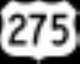
. Its western terminus is at U.S. Highway 275 southeast of Fremont
and its eastern terminus is at U.S. Highway 75 in Omaha
.
at a freeway intersection with U.S. Highway 275 between Valley
and Fremont
. After a brief northeasterly routing, it turns east into farmland, passes the Elkhorn River
and meets Nebraska Highway 31. It continues east from there and turns southeast towards Bennington
. After passing through the northern edge of Bennington, it goes east, turns southeast briefly, and meets Nebraska Highway 133
. It continues east, passes through the northern edge of Glenn Cunningham Lake
and turns southeasterly. It becomes a four-lane divided highway as it enters increasing residential areas, passes under Interstate 680
and meets its end at U.S. Highway 75 just south of that highway's intersection with I-680 in the Florence
neighborhood of Omaha
. Within the city limits of Omaha, it is McKinley Avenue.
to connect with unsigned Iowa Highway 988. That year, Interstate 680 was designated to use the bridge.
.
Highway
A highway is any public road. In American English, the term is common and almost always designates major roads. In British English, the term designates any road open to the public. Any interconnected set of highways can be variously referred to as a "highway system", a "highway network", or a...
in Nebraska
Nebraska
Nebraska is a state on the Great Plains of the Midwestern United States. The state's capital is Lincoln and its largest city is Omaha, on the Missouri River....
. Its western terminus is at U.S. Highway 275 southeast of Fremont
Fremont, Nebraska
Fremont is a city in and the county seat of Dodge County, Nebraska, United States, near Omaha in the eastern part of the state. The population was 26,397 at the 2010 census....
and its eastern terminus is at U.S. Highway 75 in Omaha
Omaha, Nebraska
Omaha is the largest city in the state of Nebraska, United States, and is the county seat of Douglas County. It is located in the Midwestern United States on the Missouri River, about 20 miles north of the mouth of the Platte River...
.
Route description
Nebraska Highway 36 begins in far northwestern Douglas CountyDouglas County, Nebraska
-Demographics:As of the census of 2000, there were 463,585 people, 182,194 households, and 115,146 families residing in the county. The population density was 1,401 people per square mile . There were 192,672 housing units at an average density of 582 per square mile...
at a freeway intersection with U.S. Highway 275 between Valley
Valley, Nebraska
Valley is a city in Douglas County, Nebraska, United States. The population was 1,788 at the 2000 census.Valley is the hometown of Gail Rock, who used it as the basis for the small town Clear Rock in her Addie Mills books, of which "The House Without a Christmas Tree" is best known.The Town of...
and Fremont
Fremont, Nebraska
Fremont is a city in and the county seat of Dodge County, Nebraska, United States, near Omaha in the eastern part of the state. The population was 26,397 at the 2010 census....
. After a brief northeasterly routing, it turns east into farmland, passes the Elkhorn River
Elkhorn River
The Elkhorn River originates in the eastern Sandhills of Nebraska and is one of the largest tributaries of the Platte River, flowing and joining the Platte just southwest of Omaha, approximately 1 mile south and 3 miles west of Gretna.Located in northeast and north-central Nebraska, the Elkhorn...
and meets Nebraska Highway 31. It continues east from there and turns southeast towards Bennington
Bennington, Nebraska
Bennington is a city in Douglas County, Nebraska, United States. The population was 937 at the 2000 census.-Geography:Bennington is located at .According to the United States Census Bureau, the city has a total area of , all land....
. After passing through the northern edge of Bennington, it goes east, turns southeast briefly, and meets Nebraska Highway 133
Nebraska Highway 133
Nebraska Highway 133 is a highway in eastern Nebraska. Its southern terminus is at an intersection with U.S. Highway 6 in Omaha. Its northern terminus is at an intersection with U.S...
. It continues east, passes through the northern edge of Glenn Cunningham Lake
Glenn Cunningham Lake
Glenn Cunningham Lake is located in Omaha, Nebraska, United States. The park is located along 96th Street with entrances at State Highway 36, State Street, 96th Street and Rainwood Road. The lake is a part of Little Papillion Creek, which is part of the Papillion Creek watershed.Glenn Cunningham...
and turns southeasterly. It becomes a four-lane divided highway as it enters increasing residential areas, passes under Interstate 680
Interstate 680 (Iowa-Nebraska)
Interstate 680 in Nebraska and Iowa is the northern bypass freeway for the Omaha, Nebraska-Council Bluffs, Iowa metropolitan area. I-680 spans from its western terminus in western Omaha to its eastern terminus near Neola, Iowa. For a stretch, I-680 is co-signed with Interstate 29...
and meets its end at U.S. Highway 75 just south of that highway's intersection with I-680 in the Florence
Florence, Nebraska
Florence is a neighborhood in Omaha, Nebraska on the city's north end and originally one of the oldest cities in Nebraska. It was incorporated by the Nebraska Territorial Legislature on March 10, 1857. The site of Winter Quarters for Mormon migrants traveling west, it has the oldest cemetery for...
neighborhood of Omaha
Omaha, Nebraska
Omaha is the largest city in the state of Nebraska, United States, and is the county seat of Douglas County. It is located in the Midwestern United States on the Missouri River, about 20 miles north of the mouth of the Platte River...
. Within the city limits of Omaha, it is McKinley Avenue.
History
Prior to 1977, Nebraska Highway 36 extended east over the Mormon BridgeMormon Bridge (Omaha)
The Mormon Bridge are two truss bridges that cross the Missouri River connecting Pottawattamie County, Iowa with Florence in the north end of Omaha, Nebraska via Interstate 680 .-About:...
to connect with unsigned Iowa Highway 988. That year, Interstate 680 was designated to use the bridge.
Major intersections
The entire route is in Douglas CountyDouglas County, Nebraska
-Demographics:As of the census of 2000, there were 463,585 people, 182,194 households, and 115,146 families residing in the county. The population density was 1,401 people per square mile . There were 192,672 housing units at an average density of 582 per square mile...
.
| Location | Mile | Junction | Notes |
|---|---|---|---|
| 0.00 | Begin state maintenance | Western terminus | |
| 0.17-0.19 | Interchange | ||
| 9.91 | |||
| Washington Washington, Nebraska Washington is a village in Washington County, Nebraska, United States. The population was 126 at the 2000 census.-Geography:Washington is located at .... |
10.84 | ||
| 17.53 | |||
| Omaha Omaha, Nebraska Omaha is the largest city in the state of Nebraska, United States, and is the county seat of Douglas County. It is located in the Midwestern United States on the Missouri River, about 20 miles north of the mouth of the Platte River... |
23.80 | Eastern terminus |