

National Register of Historic Places listings in Walsh County, North Dakota
Encyclopedia
This is intended to be a complete list of the properties and districts on the National Register of Historic Places
National Register of Historic Places
The National Register of Historic Places is the United States government's official list of districts, sites, buildings, structures, and objects deemed worthy of preservation...
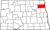
in Walsh County
Walsh County, North Dakota
-Demographics:As of the census of 2000, there were 12,389 people, 5,029 households, and 3,319 families residing in the county. The population density was 10 people per square mile . There were 5,757 housing units at an average density of 4 per square mile...
, North Dakota
North Dakota
North Dakota is a state located in the Midwestern region of the United States of America, along the Canadian border. The state is bordered by Canada to the north, Minnesota to the east, South Dakota to the south and Montana to the west. North Dakota is the 19th-largest state by area in the U.S....
, United States
United States
The United States of America is a federal constitutional republic comprising fifty states and a federal district...
. The locations of National Register properties and districts for which the latitude and longitude coordinates are included below, may be seen in a Google map.
There are 14 properties and districts listed on the National Register in the county.
Listings county-wide
|}Former listings
|--! | 1
| Odalen Lutherske Kirke
Odalen Lutherske Kirke
The Odalen Lutherske Kirke, also known as the Odalen Lutheran Church or simply the Odalen Church, was an historic Norwegian-American Lutheran church located in Tiber Township, in Walsh County near Edinburg, North Dakota....
|
|
| 6 miles west and ¼ miles north of the junction of ND 32 and County Road 9 in Tiber Township
| Edinburg
Edinburg, North Dakota
As of the census of 2000, there were 252 people, 118 households, and 73 families residing in the city. The population density was 831.5 people per square mile . There were 132 housing units at an average density of 435.6 per square mile . The racial makeup of the city was 97.22% White, 0.40% Asian,...
| No. 05001517. Listed on January 11, 2006. Burned to ground on June 21, 2007. Cemetery which was included in listing remains, but was delisted .
|}
See also
- List of National Historic Landmarks in North Dakota
- National Register of Historic Places listings in North Dakota