
National Register of Historic Places listings in Solano County, California
Encyclopedia
s
This list includes properties and districts listed on the National Register of Historic Places
in Solano County, California
. Click the "Map of all coordinates" link to the right to view a Google map of all properties and districts with latitude and longitude coordinates in the table below.
This list includes properties and districts listed on the National Register of Historic Places
National Register of Historic Places
The National Register of Historic Places is the United States government's official list of districts, sites, buildings, structures, and objects deemed worthy of preservation...
in Solano County, California
Solano County, California
Solano County is a county located in Bay-Delta region of the U.S. state of California, about halfway between San Francisco and Sacramento and is one of the nine San Francisco Bay Area counties. The county's population was reported by the U.S. Census to be 413,344 in 2010...
. Click the "Map of all coordinates" link to the right to view a Google map of all properties and districts with latitude and longitude coordinates in the table below.
Current listings
| Landmark name | Image | Date listed | Location | City or Town | Summary | |
|---|---|---|---|---|---|---|
| 1 | Benicia Arsenal Benicia Arsenal The Benicia Arsenal 1851-1964, and Benicia Barracks 1852-1866, was a large military reservation located next to Suisun Bay in Benicia, California. For over 100 years, the arsenal was the primary US Army Ordnance facility for the West Coast of the United States.In 1847 a parcel of land adjoining... |
 |
Army Point and I-680 38°3′0"N 122°8′8"W |
Benicia | ||
| 2 | Benicia Capitol State Historic Park Benicia Capitol State Historic Park Benicia Capitol State Historic Park is a state park in Benicia, California. The park is dedicated to California’s third capitol building, where the California State Legislature and bureaucracy convened from February 3, 1853 to February 24, 1854... |
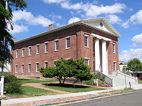 |
1st and G Sts. 38°3′1"N 122°9′28"W |
Benicia | ||
| 3 | Bird and Dinkelspiel Store Bird and Dinkelspiel Store The Bird and Dinkelspiel Store in Birds Landing, California was built in 1875. The building was listed on the National Register of Historic Places in 1999. It is currently not in use.... |
2145 Collinsville Rd. 38°7′58"N 121°52′12"W |
Birds Landing | General store built in 1875. | ||
| 4 | Jackson Fay Brown House | 6751 Maine Prairie Rd. 38°19′59"N 121°48′50"W |
Dixon | |||
| 5 | Will H. Buck House | 301 Buck Ave. 38°21′24"N 121°59′38"W |
Vacaville | |||
| 6 | Carr House | 165 E. D St 38°2′49"N 122°9′28"W |
Benicia | |||
| 7 | Crooks Mansion | 285 W. G St. 38°3′7"N 122°9′40"W |
Benicia | |||
| 8 | Dixon Carnegie Library | 135 E. B St. 38°26′48"N 121°49′20"W |
Dixon | California Carnegie Libraries MPS | ||
| 9 | Joseph Fischer House | 135 G St. 38°3′0"N 122°9′29"W |
Benicia | |||
| 10 | Hastings Adobe Hastings Adobe The Hastings Adobe near Collinsville, California is a structure that was listed on the National Register of Historic Places in 1972. It is currently on private property and is inaccessible to the public.... |
NE of Collinsville off CA 68 38°4′36"N 121°49′50"W |
Collinsville | |||
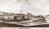
| 11 | Mare Island Naval Shipyard Mare Island Naval Shipyard The Mare Island Naval Shipyard was the first United States Navy base established on the Pacific Ocean. It is located 25 miles northeast of San Francisco in Vallejo, California. The Napa River goes through the Mare Island Strait and separates the peninsula shipyard from the main portion of the... |
_1945.jpg) |
Mare Island 38°5′24"N 122°15′48"W |
Vallejo | Boundary increase (added January 21, 1997): Mare Island Historic District, Vallejo, California | |
| 12 | Samuel Martin House | 293 Suisun Valley Rd. 38°14′10"N 122°7′32"W |
Suisun City | |||
| 13 | Old Masonic Hall Old Masonic Hall (Benicia, California) The Old Masonic Hall, also known as Benicia Masonic Hall, in Benicia, California was built in 1850. It served as a clubhouse. The building was listed on the National Register of Historic Places in 1972.... |
106 W. J St. 38°3′9"N 122°9′24"W |
Benicia | |||
| 14 | Pena Adobe | 2 mi. SW of Vacaville on I-80 38°20′14"N 122°0′51"W |
Vacaville | |||
| 15 | Pleasants Ranch | 8212 Pleasants Valley Rd. 38°27′54"N 122°2′52"W |
Vacaville | |||
| 16 | Saint Vincent's Hill Historic District | Roughly bounded by Mare Island Way almost to Sonoma Blvd. and from Quincy Alley to Kissel Alley 38°6′20"N 122°15′30"W |
Vallejo | |||
| 17 | Stamboul (Whaling Bark) | Foot of W. 12th St. 38°3′42"N 122°9′25"W |
Benicia | |||
| 18 | Suisun Masonic Lodge No. 55 Suisun Masonic Lodge No. 55 The Suisun Masonic Lodge No. 55, also known as Stanley Y. Beverley Lodge, is a building in Suisun City, California built in 1855. It was designed by Hiram Rush. The building served as a clubhouse and as a business... |
623 Main St. 38°14′17"N 122°2′22"W |
Suisun City | |||
| 19 | Vacaville Town Hall | 620 E. Main St. 38°21′23"N 121°59′5"W |
Vacaville | |||
| 20 | Vallejo City Hall and County Building Branch | 734 Marin St. 38°6′10"N 122°15′19"W |
Vallejo | |||
| 21 | Vallejo Old City Historic District | Sonoma Blvd., and Monterey, Carolina, and York Sts. 38°6′7"N 122°14′59"W |
Vallejo |
Sites moved to a different location
| Landmark name | Image | Date eligible | Location | City or Town | Summary | |
|---|---|---|---|---|---|---|
| 1 | Delta King Delta King The Delta King is a . The Delta King is the sister ship to the Delta Queen, both christened May 20, 1927, traveling between Sacramento, California and San Francisco, California on 10-hour trips.-History:... |
 |
Moved to 1000 Front St., Sacramento in 1984 | Sacramento | Now a hotel, restaurant and theater located in Old Sacramento | |
| 2 | SS Jeremiah O'Brien SS Jeremiah O'Brien -See also:*Liberty ship*Victory ship - other surviving Liberty ship*Nash - last surviving Army ship at D-Day... |
.jpg) |
Moved to Pier 45, Fisherman's Wharf, San Francisco | San Francisco | World War II era liberty ship Liberty ship Liberty ships were cargo ships built in the United States during World War II. Though British in conception, they were adapted by the U.S. as they were cheap and quick to build, and came to symbolize U.S. wartime industrial output. Based on vessels ordered by Britain to replace ships torpedoed by... ; now a museum ship at Pier 45 in San Francisco |
See also
- National Register of Historic Places listings in California
- List of National Historic Landmarks in California