

National Register of Historic Places listings in Sacramento County, California
Encyclopedia
This list includes properties and districts listed on the National Register of Historic Places
in Sacramento County, California
.
 The table below omits Big Four House
which is a National Historic Landmark designated in 1961. It should have been automatically listed on the National Register in 1966, but does not appear in the National Register's NRIS database. Its NRHP listing status is thus unclear.
National Register of Historic Places
The National Register of Historic Places is the United States government's official list of districts, sites, buildings, structures, and objects deemed worthy of preservation...
in Sacramento County, California
Sacramento County, California
Sacramento County is a county in the U.S. state of California. Its county seat is Sacramento, which is also the state capital. As of 2010 the county had a population of 1,418,788....
.
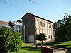
Big Four House
The Big Four House is a historic building in Sacramento, California, built in 1852. Its name refers to The Big Four, Collis Huntington, Mark Hopkins, Leland Stanford, and Charles Crocker, who organized the Central Pacific railway and founded the Southern Pacific Railroad here.It was declared a...
which is a National Historic Landmark designated in 1961. It should have been automatically listed on the National Register in 1966, but does not appear in the National Register's NRIS database. Its NRHP listing status is thus unclear.
| Landmark name | Image | Date listed | Location | City or Town | Summary | |
|---|---|---|---|---|---|---|
| 1 | Alkali Flat Central Historic District | Roughly E and F Sts. between 9th and 12th Sts. 38°35′4"N 121°29′23"W |
Sacramento | |||
| 2 | Alkali Flat North Historic District | D and 11th Sts. 38°35′12"N 121°29′16"W |
Sacramento | |||
| 3 | Alkali Flat West Historic District | E, F, and 8th Sts. 38°35′9"N 121°29′35"W |
Sacramento | |||
| 4 | Alta Mesa Farm Bureau Hall Alta Mesa Farm Bureau Hall The Alta Mesa Farm Bureau Hall in Wilton, California is a building from 1913. It was listed on the National Register of Historic Places in 1987.... |
10195 Alta Mesa Rd. 38°23′14"N 121°13′20"W |
Wilton | Burned down in 1987, one year after its inception into the NRHP. | ||
| 5 | American River Grange Hall No. 172 American River Grange Hall No. 172 The American River Grange Hall in Rancho Cordova, California is a building from 1882. It was listed on the National Register of Historic Places in 1996.... |
2720 Kilgora Rd. 38°36′3"N 121°16′28"W |
Rancho Cordova | |||
| 6 | Blue Anchor Building Blue Anchor Building The Blue Anchor Building in Sacramento, California is a building from 1931. It was listed on the National Register of Historic Places in 1983.... |
1400 10th St. 38°34′33"N 121°29′42"W |
Sacramento | |||
| 7 | Boulevard Park | Roughly bounded by B and H Streets, 20th Street, 22nd Street and 23rd Street 38°34′53"N 121°28′32"W |
Sacramento | Historic Residential Suburbs in the United States, 1830-1960 MPS | ||
| 8 | Brewster Building | 201 Fourth St. 38°15′13"N 121°21′42"W |
Galt | |||
| 9 | Brewster House Brewster House (Galt, California) The Brewster House in Galt, California is a building from 1869. It was listed on the National Register of Historic Places in 1978.... |
206 5th St. 38°15′12"N 121°18′14"W |
Galt | |||
| 10 | Brighton School Brighton School (Sacramento, California) Brighton School in Sacramento, California is a building from 1869. It was listed on the National Register of Historic Places in 1981.... |
3312 Bradshaw Rd. 38°33′44"N 121°20′9"W |
Sacramento | |||
| 11 | John Stanford Brown House | 13950 CA 160 38°14′53"N 121°30′41"W |
Walnut Grove | |||
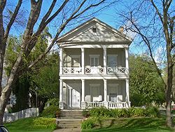
| 12 | California Governor's Mansion | 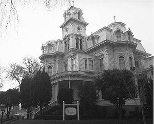 |
16th and H Sts. 38°34′49"N 121°29′1"W |
Sacramento | ||
| 13 | California State Capitol California State Capitol The California State Capitol is home to the government of California. The building houses the bicameral state legislature and the office of the governor.... |
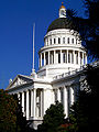 |
Between 10th and 16th and L and N Sts. 38°34′34"N 121°29′26"W |
Sacramento | ||
| 14 | Calpak Plant No. 11 Calpak Plant No. 11 The Calpak Plant No. 11 in Sacramento, California is a building from 1925. It was listed on the National Register of Historic Places in 1984.... |
1721 C St. 38°35′3"N 121°28′47"W |
Sacramento | |||
| 15 | Capitol Extension District | Capitol Mall 38°34′37"N 121°29′46"W |
Sacramento | |||
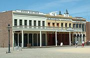
| 16 | J.C. Carly House | 2761 Montgomery Way 38°32′56"N 121°28′33"W |
Sacramento | |||
| 17 | Chung Wah Cemetery Chung Wah Cemetery The Chung Wah Cemetery in Folsom, California is a cemetery from 1906. It was listed on the National Register of Historic Places in 1995.-External links:*... |
Mormon St. vicinity, near Lake Natoma 38°40′13"N 121°11′43"W |
Folsom | |||
| 18 | Cohn House Cohn House The Cohn House in Folsom, California is a building, in the Queen Anne Shingle Style of Victorian architecture, built in 1860 in Folsom, California.The Cohn House was listed on the National Register of Historic Places in 1982.... |
305 Scott St. 38°40′43"N 121°10′26"W |
Folsom | |||
| 19 | Coolot Company Building Coolot Company Building The Coolot Company Building in Sacramento, California was a building from 1920. It was listed on the National Register of Historic Places in 1978. It was destroyed by a fire in 2002 and subsequently demolished.... |
812 J St. 38°34′51"N 121°29′41"W |
Sacramento | No longer standing. Originally constructed in 1861 by Leland Stanford Leland Stanford Amasa Leland Stanford was an American tycoon, industrialist, robber baron, politician and founder of Stanford University.-Early years:... . |
||
| 20 | Cranston-Geary House | 2101 G St. 38°34′47"N 121°28′32"W |
Sacramento | |||
| 21 | E. B. Crocker Art Gallery Crocker Art Museum The Crocker Art Museum is one of the leading arts institutions in California, and the longest continuously operating art museum in the West. Located in Sacramento, California, the Crocker has been an art innovator since 1885... |
216 O St. 38°34′37"N 121°30′18"W |
Sacramento | |||
| 22 | Delta King Delta King The Delta King is a . The Delta King is the sister ship to the Delta Queen, both christened May 20, 1927, traveling between Sacramento, California and San Francisco, California on 10-hour trips.-History:... |
 |
1000 Front St. 38°34′58"N 121°30′25"W |
Sacramento | Located in Rio Vista when listed on the National Register; moved to Old Sacramento in 1984 and converted to a hotel, restaurant and theater | |
| 23 | Delta Meadows Site | 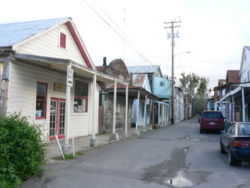 |
Address Restricted | Locke | ||
| 24 | Dunlap's Dining Room | 4322 Fourth Ave. 38°32′52"N 121°27′18"W |
Sacramento | |||
| 25 | Eastern Star Hall Eastern Star Hall The Eastern Star Hall in Sacramento, California is a building from 1928. It was listed on the National Register of Historic Places in 1993.... |
2719 K St. 38°34′21"N 121°28′22"W |
Sacramento | |||
| 26 | William Ehrhardt House | Dartmoor Way and Percheron Dr. 38°24′11"N 121°26′54"W |
Elk Grove | |||
| 27 | Elk Grove Historic District | 8986-9097 Elk Grove Blvd. also School, Gage and Grove Sts. 38°24′33"N 121°21′49"W |
Elk Grove | |||
| 28 | Fair Oaks Bridge Fair Oaks Bridge The Fair Oaks Bridge is a truss bridge over the lower banks of the American River, connecting Fair Oaks to the greater Sacramento, California region. The current bridge, built 1907-1909, is the third bridge at this location.... |
Crosses America R. at Bridge St. to American R Pkwy,N of Upper Sunrise Dr. in Gold R 38°38′17"N 121°15′54"W |
Fair Oaks | |||
| 29 | Fire Station No. 6 | 3414 4th Ave. 38°33′2"N 121°28′7"W |
Sacramento | |||
| 30 | Firehouse No. 3 | 1215 19th St. 38°34′28"N 121°28′52"W |
Sacramento | |||
| 31 | Folsom Depot | 200 Wool St. 38°40′45"N 121°10′47"W |
Folsom | |||
| 32 | Folsom Powerhouse Folsom Powerhouse State Historic Park Folsom Powerhouse State Historic Park is a historical site located in Folsom near Sacramento, California, in the United States. Built in the late 19th century by the Natoma Water and Mining Company and prison labor from Folsom Prison, the hydroelelectric powerhouse first delivered power to... |
 |
Off Folsom Blvd. in Folsom Lake State Recreation Area 38°40′50"N 121°10′32"W |
Folsom | ||
| 33 | Mary Haley Galarneaux House | 922-924 T. St. 38°34′15"N 121°29′56"W |
Sacramento | |||
| 34 | Goethe House Julia Morgan House The Julia Morgan House is a Mediterranean Revival mansion, located in the Elmhurst neighborhood of Sacramento, California, constructed by Julia Morgan, the first woman licensed to practice architecture in California, and formerly owned by Charles Goethe... |
3731 T St. 38°33′33"N 121°27′34"W |
Sacramento | |||
| 35 | John T. Greene House | 3200 H St. 38°34′31"N 121°27′44"W |
Sacramento | |||
| 36 | Heilbron House | 704 O St. 38°34′34"N 121°29′54"W |
Sacramento | |||
| 37 | Hotel Regis | 1024-1030 K St 38°34′44"N 121°29′30"W |
Sacramento | |||
| 38 | Hotel Senator | 1121 L St. 38°34′40"N 121°29′28"W |
Sacramento | |||
| 39 | Edward P. Howe, Jr., House | 2215 21st St. 38°33′46"N 121°28′59"W |
Sacramento | |||
| 40 | Hubbard-Upson House | 1010 F St. 38°35′4"N 121°29′24"W |
Sacramento | |||
| 41 | I Street Bridge I Street Bridge The I Street Bridge is a historic metal truss swing bridge located on I Street in Sacramento, California crossing the Sacramento River connecting Yolo County with Sacramento County... |
.jpg) |
CA 16 38°34′39"N 121°30′18"W |
Sacramento | ||
| 42 | Imperial Theatre | Market St. 38°14′29"N 121°30′46"W |
Walnut Grove | |||
| 43 | Indian Stone Corral | Address Restricted | Orangevale | |||
| 44 | Isleton Chinese and Japanese Commercial Districts | Bounded by River Rd. and Union, E and H Sts. 38°9′45"N 121°36′18"W |
Isleton | |||
| 45 | J Street Wreck | At the foot of J St., in the Sacramento R. 38°35′2"N 121°30′19"W |
Sacramento | The remains of a brig Brig A brig is a sailing vessel with two square-rigged masts. During the Age of Sail, brigs were seen as fast and manoeuvrable and were used as both naval warships and merchant vessels. They were especially popular in the 18th and early 19th centuries... used as a warehouse off J Street which sank in 1855. |
||
| 46 | Joe Mound | Address Restricted | Sacramento | An Indian village site of the Maidu Maidu The Maidu are a group of Native Americans who live in Northern California. They reside in the central Sierra Nevada, in the drainage area of the Feather and American Rivers... near present day Discovery Park. No marker on the site. |
||
| 47 | J. Neely Johnson House J. Neely Johnson House The J. Neely Johnson House is a Greek Revival style Neoclassical historic home built in 1853, located at 1029 F Street in Sacramento, California.It was added to the National Register of Historic Places on September 13, 1976.-History:... |
 |
1029 F St. 38°35′5"N 121°29′22"W |
Sacramento | ||
| 48 | Theodore Judah School | 3919 McKinley Blvd. 38°34′39"N 121°27′42"W |
Sacramento | |||
| 49 | Kuchler Row | 608-614 10th St. 38°35′3"N 121°29′27"W |
Sacramento | |||
| 50 | Charles Lais House | 1301 H St. 38°34′54"N 121°29′13"W |
Sacramento | |||
| 51 | Libby McNeil and Libby Fruit and Vegetable Cannery | 1724 Stockton Blvd. 38°33′52"N 121°27′59"W |
Sacramento | |||
| 52 | Locke Historic District Locke, California Locke , also known as Locke Historic District, is an unincorporated community in California's Sacramento – San Joaquin River Delta built by Chinese immigrants during the early 20th century. It was originally named Lockeport after George Locke, who owned the land that the town was built upon at a... |
|
Bounded on the W by the Sacramento River, on the N by Locke Rd., on the E by Alley St., and on the S by Levee St. 38°15′3"N 121°30′26"W |
Locke | ||
| 53 | C. K. McClatchy Senior High School C. K. McClatchy High School C.K. McClatchy High School is a Sacramento City Unified School District High School. It is located in the Land Park area of Sacramento, California, USA . McClatchy High School is also the second-oldest high school in Sacramento, having been established in 1937. It is currently the oldest high... |
 |
3066 Freeport Blvd. 38°33′4"N 121°29′33"W |
Sacramento | ||
| 54 | Merchants National Bank of Sacramento | 1015 7th St. 38°34′52"N 121°29′47"W |
Sacramento | |||
| 55 | Merrium Apartments | 1017 14th St. 38°34′41"N 121°29′12"W |
Sacramento | Demolished in the 1990s for expansion of the Sacramento Convention Center Sacramento Convention Center The Sacramento Convention Center Complex is a complex of entertainment venues and a convention center located in downtown Sacramento, California... . |
||
| 56 | Mesick House Mesick House Mesick House is an historic home constructed in 1875 in the Second Empire and Italianate Victorian architecture styles. It is one of two High Victorians remaining in Sacramento that display a mansard roof .... |
517 8th St. 38°35′10"N 121°29′34"W |
Sacramento | |||
| 57 | Nisenan Village Site | Address Restricted | Carmichael | |||
| 58 | Old Sacramento Historic District | |
Jcts. of U.S. 40, 50, 99, and CA 16 and 24 38°34′58"N 121°30′12"W |
Sacramento | ||
| 59 | Old Tavern | 2801 Capitol Ave. 38°34′15"N 121°28′9"W |
Sacramento | |||
| 60 | PG&E Powerhouse | 400 Jibboom St. 38°35′42"N 121°30′18"W |
Sacramento | |||
| 61 | Pony Express Terminal Pony Express Terminal The Pony Express Terminal, also known as the B. F. Hastings Bank Building, in Sacramento, California, was the western endpoint of the Pony Express. The building was also the first location of the California Supreme Court... |
.jpg) |
1006 2nd St. 38°34′59"N 121°30′11"W |
Sacramento | Also known as B. F. Hastings Bank Building | |
| 62 | Rosebud Ranch | N of Hood 38°23′8"N 121°30′46"W |
Hood | |||
| 63 | Ruhstaller Building | 900 J St. 38°34′50"N 121°29′38"W |
Sacramento | |||
| 64 | Runyon House | 12865 River Rd. 38°17′20"N 121°33′20"W |
Courtland | |||
| 65 | Sacramento Air Depot Historic District | McClellan Air Force Base 38°39′33"N 121°23′13"W |
North Highlands | |||
| 66 | Sacramento Bank Building | 3418 Broadway 38°33′7"N 121°28′5"W |
Sacramento | |||
| 67 | Sacramento City Library Sacramento City Library The Sacramento City Library is part of the Central branch of the Sacramento Public Library system.Opened in 1918, the three story Italian Renaissance building faces I Street in Sacramento, California. The library was designed by Loring Rixford and has been added to the National Register of Historic... |
828 I St. 38°34′54"N 121°29′37"W |
Sacramento | |||
| 68 | Sacramento Hall of Justice | 813 6th St. 38°35′1"N 121°29′6"W |
Sacramento | |||
| 69 | Sacramento Junior College Annex and Extensions | 3835 Freeport Blvd. 38°32′28"N 121°29′17"W |
Sacramento | |||
| 70 | Sacramento Masonic Temple Sacramento Masonic Temple The Masonic Temple in Sacramento, California is a building from 1920. It was listed on the National Register of Historic Places in 2001.... |
1131 J St. 38°34′55"N 121°29′27"W |
Sacramento | |||
| 71 | Sacramento Memorial Auditorium | 16th and J Sts. 38°34′44"N 121°29′5"W |
Sacramento | |||
| 72 | Slocum House | 7992 California Ave. 38°38′29"N 121°16′5"W |
Fair Oaks | |||
| 73 | Southern Pacific Railroad Company's Sacramento Depot | 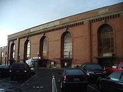 |
5th and I Sts. 38°35′3"N 121°30′0"W |
Sacramento | ||
| 74 | SMUD Headquarters Building | 6301 S. St. 38°33′11.24"N 121°25′58.3"W |
Sacramento | |||
| 75 | Southern Pacific Railroad Section Superintendent House | 815 Oakdale St. 38°40′10.7"N 121°10′55.3"W |
Folsom | |||
| 76 | Stanford-Lathrop House | 800 N St. 38°34′35"N 121°29′50"W |
Sacramento | |||
| 77 | Sutter's Fort Sutter's Fort Sutter's Fort State Historic Park is a state-protected park in Sacramento, California which includes Sutter's Fort and the California State Indian Museum. Begun in 1839 and originally called "New Helvetia" by its builder, John Sutter, the fort was a 19th century agricultural and trade colony in... |
2701 L St. 38°34′20"N 121°28′12"W |
Sacramento | |||
| 78 | Tower Bridge |  |
CA 275 across Sacramento River 38°34′18"N 121°30′25"W |
Sacramento | ||
| 79 | Travelers' Hotel | 428 J St. 38°34′54"N 121°29′58"W |
Sacramento | |||
| 80 | U.S. Post Office, Courthouse and Federal Building U.S. Post Office, Courthouse and Federal Building (Sacramento, California) The U.S. Post Office, Courthouse and Federal Building in Sacramento, California, also known as Federal Building, was built in 1933. It was designed by Starks & Flanders and reflects Late 19th and 20th Century Revivals architecture and French Renaissance architecture. It served historically as a... |
801 I St. 38°34′57"N 121°29′37"W |
Sacramento | |||
| 81 | Van Voorhies House | 925 G St. 38°35′3"N 121°29′29"W |
Sacramento | |||
| 82 | Anton Wagner Duplex | 701 E St. 38°35′13"N 121°29′35"W |
Sacramento | |||
| 83 | Walnut Grove Chinese-American Historic District | Bounded by C, Tyler, and Bridge Sts., and River Rd. 38°14′32"N 121°30′46"W |
Walnut Grove | |||
| 84 | Walnut Grove Commercial/Residential Historic District | Browns Alley and River Rd. 38°14′21"N 121°30′54"W |
Walnut Grove | |||
| 85 | Walnut Grove Gakuen Hall | Pine and C Sts. 38°14′31"N 121°30′33"W |
Walnut Grove | |||
| 86 | Walnut Grove Japanese-American Historic District | Bounded by Winnie St., Tyler St., C St., and River Rd. 38°14′36"N 121°30′44"W |
Walnut Grove | |||
| 87 | Westminster Presbyterian Church | 1300 N St. 38°34′35"N 121°29′27"W |
Sacramento | |||
| 88 | Julius Wetzlar House | 1021 H St. 38°34′58"N 121°29′27"W |
Sacramento | |||
| 89 | Winters House Winters House (Sacramento, California) Winters House is a historic house in Sacramento, California. It was listed on the National Register of Historic Places in 1999.... |
2324 and 2326 H St. 38°34′39"N 121°28′23"W |
Sacramento | |||
| 90 | Edwin Witter Ranch | 3480 Witter Way 38°37′54"N 121°32′5"W |
Sacramento | |||
| 91 | Woodlake Site | Address Restricted | Sacramento |
See also
- National Register of Historic Places listings in California
- List of National Historic Landmarks in California