

Nacozari de García
Encyclopedia
Nacozari de García is a small mining town surrounded by its municipal area
in the northeast of the Mexican state of Sonora
.
to the north, Bavispe
to the east, Bacerac
to the southeast, Villa Hidalgo
and Cumpas
to the south, Arizpe
to the west, and Bacoachi
and Fronteras
to the northwest. See detailed map of the municipality at http://www.e-local.gob.mx/work/templates/enciclo/sonora/municipios/26041a.htm
, which connects Agua Prieta
with Hermosillo
. The distance to Agua Prieta is 123 kilometers. It is also on the railroad that connects with Agua Prieta
. There is a small airport for light aircraft.
mountains. There is a reservoir La Angostura, which dams up the Río Bavispe.
 Nacozari began with the discovery of mines in 1660. The first settlement was called Nuestra Señora del Rosario de Nacozari.
The mines were acquired by Anglo American U.B. Teader mining company in 1867, which sold them to Moctezuma Copper Co, a subsidiary of Phelps Dodge. American style housing was built, together with a library and a small hospital. Copper was hauled partially by mule trains, until the railroad was finished in 1904. By 1907, Nacozari had become the metropolis of far northeastern Sonora. It had 5,000 people, mostly Mexicans and Americans, with some Chinese. Phelps retained the mines until 1948 when they were exhausted.
A large mine, La Caridad, was discovered about 20 miles southeast of Nacozari in 1968. By 1979, the population of Nacozari was back to about 3,000. As Mexicana de Cobre, the federal government spent hundreds of millions of dollars to develop La Caridad, and revive other mines in the area. Nacozari was estimated to have 18,600 people in 1986, and 30,000 in 1989. La Caridad is ranked the third largest copper mine in the world. http://www.sonoraturismo.gob.mx/nacozari-sonora.htm
The municipal seat was first called Placeritos de Nacozari but changed its name to Nacozari de García to honor the railroad engineer Jesús García
, who saved the town from a dynamite explosion on 7 November 1907. Besides Nacozari, there are monuments to Jesús García in many other Mexican cities and towns. November 7 is the Day of the Railroader in Mexico. All except essential employees of the National Railways of Mexico get the day off. Many streets in Mexico are named Jesús García or the Héroe de Nacozari. Poems and songs have been written about him, and the accident. http://historicaltextarchive.com/books.php?op=viewbook&bookid=18&cid=3
The name Nacozari is an Opata
word that means "abundance of nopal
".
Cattle raising is also important with 16,375 head counted in the 2000 census. Calves are exported to the United States of America
.
Municipalities of Mexico
Municipalities are the second-level administrative division in Mexico . There are 2,438 municipalities in Mexico, making the average municipality population 45,616...
in the northeast of the Mexican state of Sonora
Sonora
Sonora officially Estado Libre y Soberano de Sonora is one of the 31 states which, with the Federal District, comprise the 32 Federal Entities of Mexico. It is divided into 72 municipalities; the capital city is Hermosillo....
.
Area and population
The municipal area is 3,069.52 km² with a population of 14,363 registered in 2000. http://www.inegi.gob.mx/inegi/default.aspx The municipal seat had a population of 11,193 in 2000. It is located at an elevation of 1,040 meters.Neighboring municipalities
Neighboring municipalities are: Agua PrietaAgua Prieta
Agua Prieta is a pueblo and municipality in the northeastern corner of the Mexican state of Sonora . It stands on the U.S.–Mexico border, adjacent to the town of Douglas, Arizona, USA. The municipality covers an area of 3,631.65 km²...
to the north, Bavispe
Bavispe
Bavispe is a small town and a municipality in the northeast part of the Mexican state of Sonora.-Location:The municipality is located in the northeast of the state at . The elevation of the administrative seat is 902 meters above sea level...
to the east, Bacerac
Bacerac
Bacerac is a town in Bacerac Municipality in the Mexican state of Sonora. It is situated in the northeast of the state and the municipality has boundaries with Bavispe Municipality in the north, with Huachinera in the south, with the state of Chihuahua in the east, and with the municipalities of...
to the southeast, Villa Hidalgo
Villa Hidalgo, Sonora
Villa Hidalgo is a town, and the surrounding municipality of the same name, in the north-east of the Mexican state of Sonora.It was founded by the Jesuit missionary Marcos del Río in 1644 as Oputo...
and Cumpas
Cumpas
Cumpas is both a municipality and the municipal seat of the same in the east of the Mexican state of Sonora.-Area and Population:The area of the municipality is 2,013.50 km2., which represents 1.09% of the state total and 0.10 % of the national total. The most important settlements, besides...
to the south, Arizpe
Arizpe
Arizpe is a small town in Arizpe Municipality in the north of the Mexican state of Sonora. It is located at 30°20'"N 110°09'"W. The area of the municipality is 2,806.78 sq.km. The population in 2005 was 2,959 of which 1,743 lived in the municipal seat as of the 2000 census.-History and origin...
to the west, and Bacoachi
Bacoachi
Bacoachi is a small town in Bacoachi Municipality in the north of the Mexican state of Sonora. The area of the municipality is 487 square miles and the population was 1,456 in 2005, with 924 inhabitants residing in the municipal seat...
and Fronteras
Fronteras
Fronteras is the seat of Fronteras Municipality in the northeast of the Mexican state of Sonora. The elevation is 1,120 meters and neighboring municipalities are Agua Prieta, Nacozari and Bacoachi. The area is 2839.62 km², which represents 1.53% of the state total.-Geography:Fronteras is located...
to the northwest. See detailed map of the municipality at http://www.e-local.gob.mx/work/templates/enciclo/sonora/municipios/26041a.htm
Communications
The municipal seat and main settlement is on Federal Highway 17Mexican Federal Highway 17
Mexican Federal Highway 17 is a Federal Highway of Mexico. The highway travels from the Mexico – United States border at Agua Prieta, Sonora south to Moctezuma. The northern terminus of the highway continues north into the United States at Douglas, Arizona as U.S. Route 191. The total length of...
, which connects Agua Prieta
Agua Prieta
Agua Prieta is a pueblo and municipality in the northeastern corner of the Mexican state of Sonora . It stands on the U.S.–Mexico border, adjacent to the town of Douglas, Arizona, USA. The municipality covers an area of 3,631.65 km²...
with Hermosillo
Hermosillo
Hermosillo is a city and municipality located centrally in the northwestern Mexican state of Sonora. It is the capital and main economic center for the state and region. It contains almost all of the state's manufacturing and has thirty percent of its population...
. The distance to Agua Prieta is 123 kilometers. It is also on the railroad that connects with Agua Prieta
Agua Prieta
Agua Prieta is a pueblo and municipality in the northeastern corner of the Mexican state of Sonora . It stands on the U.S.–Mexico border, adjacent to the town of Douglas, Arizona, USA. The municipality covers an area of 3,631.65 km²...
. There is a small airport for light aircraft.
Geography
The land is mountainous and is part of the spurs of the Sierra Madre OccidentalSierra Madre Occidental
The Sierra Madre Occidental is a mountain range in western Mexico.-Setting:The range runs north to south, from just south of the Sonora–Arizona border southeast through eastern Sonora, western Chihuahua, Sinaloa, Durango, Zacatecas, Nayarit, Jalisco, Aguascalientes to Guanajuato, where it joins...
mountains. There is a reservoir La Angostura, which dams up the Río Bavispe.
History
The mines were acquired by Anglo American U.B. Teader mining company in 1867, which sold them to Moctezuma Copper Co, a subsidiary of Phelps Dodge. American style housing was built, together with a library and a small hospital. Copper was hauled partially by mule trains, until the railroad was finished in 1904. By 1907, Nacozari had become the metropolis of far northeastern Sonora. It had 5,000 people, mostly Mexicans and Americans, with some Chinese. Phelps retained the mines until 1948 when they were exhausted.
A large mine, La Caridad, was discovered about 20 miles southeast of Nacozari in 1968. By 1979, the population of Nacozari was back to about 3,000. As Mexicana de Cobre, the federal government spent hundreds of millions of dollars to develop La Caridad, and revive other mines in the area. Nacozari was estimated to have 18,600 people in 1986, and 30,000 in 1989. La Caridad is ranked the third largest copper mine in the world. http://www.sonoraturismo.gob.mx/nacozari-sonora.htm
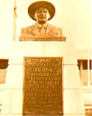
The municipal seat was first called Placeritos de Nacozari but changed its name to Nacozari de García to honor the railroad engineer Jesús García
Jesús García
Jesús García Corona was a Mexican railroad engineer who was killed trying to keep a train loaded with dynamite from exploding near Nacozari de García, Sonora, in 1907. As el héroe de Nacozari he is revered as a national hero and many streets, plazas, and schools across Mexico are named for...
, who saved the town from a dynamite explosion on 7 November 1907. Besides Nacozari, there are monuments to Jesús García in many other Mexican cities and towns. November 7 is the Day of the Railroader in Mexico. All except essential employees of the National Railways of Mexico get the day off. Many streets in Mexico are named Jesús García or the Héroe de Nacozari. Poems and songs have been written about him, and the accident. http://historicaltextarchive.com/books.php?op=viewbook&bookid=18&cid=3
The name Nacozari is an Opata
Opata language
Ópata is the name of the Uto-Aztecan language spoken by the Opata people of northern central Sonora in Mexico...
word that means "abundance of nopal
Nopal
Nopales are a vegetable made from the young cladode segments of prickly pear, carefully peeled to remove the spines. These fleshy pads are flat and about hand-sized. They can be purple or green...
".
Economic activity
The main economic activitiy is the copper mine of Mina Mexicana de Cobre, S.A de C.V, which employs most of the labor force (3,012 workers in 2000). http://www.e-local.gob.mx/work/templates/enciclo/sonora/municipios/26041a.htmCattle raising is also important with 16,375 head counted in the 2000 census. Calves are exported to the United States of America
United States
The United States of America is a federal constitutional republic comprising fifty states and a federal district...
.
External links
- Nacozari de García, Ayuntamiento Digital (Official Website of Nacozari de García, Sonora)
- Gobierno de Sonora article Spanish
- Story of Jesús García English
- Pueblos de Sonora Spanish
- Nacozari de Garcia online Spanish
- Fotos de Nacosari on Facebook Spanish