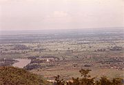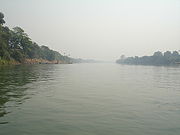
Myitnge River
Encyclopedia


Ayeyarwady River
The Irrawaddy River or Ayeyarwady River is a river that flows from north to south through Burma . It is the country's largest river and most important commercial waterway. Originating from the confluence of the N'mai and Mali rivers, it flows relatively straight North-South before emptying through...
(Irrawaddy) in Myanmar
Myanmar
Burma , officially the Republic of the Union of Myanmar , is a country in Southeast Asia. Burma is bordered by China on the northeast, Laos on the east, Thailand on the southeast, Bangladesh on the west, India on the northwest, the Bay of Bengal to the southwest, and the Andaman Sea on the south....
(Burma). The name Myitnge in Burmese
Burmese language
The Burmese language is the official language of Burma. Although the constitution officially recognizes it as the Myanmar language, most English speakers continue to refer to the language as Burmese. Burmese is the native language of the Bamar and related sub-ethnic groups of the Bamar, as well as...
and Dokhtawaddy in Pali
Pali language
Pāli is a Middle Indo-Aryan language of the Indian subcontinent. It is best known as the language of many of the earliest extant Buddhist scriptures, as collected in the Pāi Canon or Tipitaka, and as the liturgical language of Theravada Buddhism.-Etymology of the name:The word Pali itself...
both mean "little river" in comparison with the Ayeyarwady or "big river".
Source, course and outflow
It has its source in Yunnan province of ChinaPeople's Republic of China
China , officially the People's Republic of China , is the most populous country in the world, with over 1.3 billion citizens. Located in East Asia, the country covers approximately 9.6 million square kilometres...
, courses down northern Shan Plateau
Shan State
Shan State is a state of Burma . Shan State borders China to the north, Laos to the east, and Thailand to the south, and five administrative divisions of Burma in the west. Largest of the 14 administrative divisions by land area, Shan State covers 155,800 km², almost a quarter of the total...
of eastern Burma where it is known as Namtu River, and it flows into the Ayeyarwady at Innwa
Ava
Innwa is a city in the Mandalay Division of Burma , situated just to the south of Amarapura on the Ayeyarwady River. Its formal title is Ratanapura , which means City of Gems in Pali. The name Innwa means mouth of the lake, which comes from in , meaning lake, and wa , which means mouth...
(Ava). The old capital of the kingdom of Ava was built between its two branches, Myittha River which it gives off to the west and the eastern stream which retains the name Myitnge before it enters the Irrawaddy.
Tributaries
- Zawgyi RiverZawgyi RiverZawgyi River is a river of eastern Burma . It flows through the foothills of the Shan Mountain range in Shan State. It is a tributary of the Myitnge River entering it about 20 km north of Kyaukse at Nyaungbintha.-Notes:...
enters the Myitnge about 20 km north of KyaukseKyaukseKyaukse is a small town in Mandalay Region, Myanmar. It is famous for the Kyaukse Elephant Dance.-Education:Kyaukse is home to the Kyaukse Education College, Technological University, Kyaukse and Kyaukse University.-Economy:...
at Nyaungbintha. - Panlaung River enters near Ava.
History

Anawrahta
Anawrahta Minsaw was the founder of the Pagan Empire. Considered the father of the Burmese nation, Anawrahta turned a small principality in the dry zone of Upper Burma into the first Burmese Empire that formed the basis of modern-day Burma...
(1044–1077) of Bagan
Bagan
Bagan , formerly Pagan, is an ancient city in the Mandalay Region of Burma. Formally titled Arimaddanapura or Arimaddana and also known as Tambadipa or Tassadessa , it was the capital of several ancient kingdoms in Burma...
in central Burma , holds its annual festival starting just before the full moon of Tabaung
Traditional Burmese calendar
The traditional Burmese calendar is a lunisolar calendar based on both the phases of the moon and the motion of the sun. Within each month of the Burmese calendar, a major festival, often Burmese Buddhist in nature, is held...
(March). Anawrahta constructed an irrigation system consisting of weirs and canals on the Panlaung and the Zawgyi rivers but found the Myitnge too wild to tame. Three centuries later Thadominbya
Thadominbya
Thadominbya was the founder of the Kingdom of Ava who reunified central Burma in 1364 under a single kingdom. In his short reign of three plus years, the ethnically Shan king achieved accomplishments that would have a long lasting impact in Burmese history...
(1364-8) built Ava as his capital at the confluence of Myitnge and Ayeyarwady rivers within easy reach of the rice granary at Kyaukse.
Bridges
During the Second World War starting from New Year Day 1943 through to late April, several bombing raids were carried out by B-25s and B-24s of the USAAFUnited States Army Air Forces
The United States Army Air Forces was the military aviation arm of the United States of America during and immediately after World War II, and the direct predecessor of the United States Air Force....
to destroy the bridge over the Myitnge River carrying the main railway line from Mandalay
Mandalay
Mandalay is the second-largest city and the last royal capital of Burma. Located north of Yangon on the east bank of the Irrawaddy River, the city has a population of one million, and is the capital of Mandalay Region ....
to Rangoon. They returned the following December to bomb the bridge and the rail yards at nearby Paleik. Two years later it was the turn of the RAF
Royal Air Force
The Royal Air Force is the aerial warfare service branch of the British Armed Forces. Formed on 1 April 1918, it is the oldest independent air force in the world...
Thunderbolt
P-47 Thunderbolt
Republic Aviation's P-47 Thunderbolt, also known as the "Jug", was the largest, heaviest, and most expensive fighter aircraft in history to be powered by a single reciprocating engine. It was heavily armed with eight .50-caliber machine guns, four per wing. When fully loaded, the P-47 weighed up to...
s to attack the bridge.
Myitnge River is today spanned by a new bridge, 700 feet long and 27 feet wide for motor traffic flanked on each side by a footpath 6 feet wide, and was opened in 1999.
Dams
A 790 megawatt hydroelectric power plant called Yeywa Dam ProjectYeywa Dam
The Yeywa Hydropower Dam , located on the Myitnge River, southeast of Mandalay city, at Yeywa village in Kyaukse Township, Mandalay Division in central Myanmar, is the country's first roller-compacted concrete dam, and the site of a 790-MW hydroelectric power plant, the largest in the...
, with assistance from China
People's Republic of China
China , officially the People's Republic of China , is the most populous country in the world, with over 1.3 billion citizens. Located in East Asia, the country covers approximately 9.6 million square kilometres...
, is under way on the Myitnge River 50 km (31.1 mi) southeast of Mandalay
Mandalay
Mandalay is the second-largest city and the last royal capital of Burma. Located north of Yangon on the east bank of the Irrawaddy River, the city has a population of one million, and is the capital of Mandalay Region ....
.
External links
- Shan state map by Asterism
- Change in the Landscape of First Millennium A D Myanmar Elizabeth Moore & U Win Maung (Tampawaddy), SOAS, pp 3, 10, 12
- Google map GeoNames

