
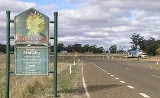
Mullaley, New South Wales
Overview
Oxley Highway
The Oxley Highway is a rural highway in New South Wales, Australia. It starts at Nevertire where it joins the Mitchell Highway. It links Warren, Gilgandra, Coonabarabran, Gunnedah, Carroll, Tamworth, Bendemeer, Walcha, Yarrowitch, Ellenborough, Long Flat, Wauchope and ends at Port Macquarie on the...
, 38km west of Gunnedah
Gunnedah, New South Wales
Gunnedah is a town and Local government area in north-eastern New South Wales, Australia. 7,542 people lived in the town of Gunnedah in 2006, including 931 indigenous people ....
. The Coxs Creek runs across the highway on the western side of the village. Mullaley is on the crossroads of the roads from Boggabri
Boggabri, New South Wales
Boggabri is a small town on the Kamilaroi Highway in north-western New South Wales, Australia in Narrabri Shire, between Gunnedah and Narrabri. In 2006, the town had a population of 901 people....
in the north, Premer in the south, Gunnedah in the east and Coonabarabran
Coonabarabran, New South Wales
Coonabarabran is a town in Warrumbungle Shire in northern New South Wales, Australia. At the 2006 census, the town had a population of 2,609.-History and description:...
in the west. The surrounding area is part of the highly fertile Liverpool Plains
Liverpool Plains
The Liverpool Plains is a geographical area and Local Government Area in the North West Slopes, New South Wales.The Shire was formed on 17 March 2004 by the amalgamation of Quirindi Shire with parts of three other shires: Parry, Murrurundi and Gunnedah.- Main towns :* Quirindi* Ardglen*...
region. At the 2006 census
Census in Australia
The Australian census is administered once every five years by the Australian Bureau of Statistics. The most recent census was conducted on 9 August 2011; the next will be conducted in 2016. Prior to the introduction of regular censuses in 1961, they had also been run in 1901, 1911, 1921, 1933,...
, Mullaley had a population of 217 people.
The Mullaley district has an agricultural community that produces wheat
Wheat
Wheat is a cereal grain, originally from the Levant region of the Near East, but now cultivated worldwide. In 2007 world production of wheat was 607 million tons, making it the third most-produced cereal after maize and rice...
, other grains, fat lambs and beef cattle
Cattle
Cattle are the most common type of large domesticated ungulates. They are a prominent modern member of the subfamily Bovinae, are the most widespread species of the genus Bos, and are most commonly classified collectively as Bos primigenius...
.
On 14 October 1999 a 40 minute storm dumped 76 mm of rain and hail on the Western Liverpool Plains region around Mullaley causing damage to dozens of farms. The heavy rain that fell caused localised flooding.