
Minnesota State Highway 238
Encyclopedia
Minnesota State Highway 238 is a highway
in central Minnesota
, which runs from its interchange
with Interstate 94
and Stearns County Road 10 in Albany
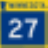
and continues north to its northern terminus at its intersection
with State Highways 27
/ 28
near Little Falls
.
Highway 238 is 35 miles (56.3 km) in length.
and Little Falls
.
Highway 238 changes direction to east–west in Upsala
and continues as east–west for 8 miles before returning again to a north–south direction near Bowlus
for the remainder of its route towards Little Falls.
The highway is officially marked as a north–south route by its highway shields from beginning to end.
In the city of Albany
, Highway 238 follows 8th Street South, Railroad Avenue, and 1st Street. Railroad Avenue was the alignment of old U.S. Highway 52
until I-94 was constructed.
The route passes around the east side of North Lake in Albany.
Highway 238 is also known as Main Street in Upsala
.
The route is legally defined as Route 238 in the Minnesota Statutes.
At the time it was marked, the highway was paved between Elmdale and Bowlus and a small section at its northern end. The segment between Upsala and the Morrison-Stearns county line was paved in 1953. In 1954 or 1955, it was paved from that point south to its terminus at then-U.S. 52
. The final remaining segment north of Bowlus was paved in 1957.
Highway
A highway is any public road. In American English, the term is common and almost always designates major roads. In British English, the term designates any road open to the public. Any interconnected set of highways can be variously referred to as a "highway system", a "highway network", or a...
in central Minnesota
Minnesota
Minnesota is a U.S. state located in the Midwestern United States. The twelfth largest state of the U.S., it is the twenty-first most populous, with 5.3 million residents. Minnesota was carved out of the eastern half of the Minnesota Territory and admitted to the Union as the thirty-second state...
, which runs from its interchange
Interchange (road)
In the field of road transport, an interchange is a road junction that typically uses grade separation, and one or more ramps, to permit traffic on at least one highway to pass through the junction without directly crossing any other traffic stream. It differs from a standard intersection, at which...
with Interstate 94
Interstate 94 in Minnesota
In the U.S. state of Minnesota, Interstate 94 runs east–west through the central portion of the state. The route connects the cities of Moorhead, Fergus Falls, Alexandria, St...
and Stearns County Road 10 in Albany
Albany, Minnesota
As of the census of 2000, there were 1,796 people, 708 households, and 436 families residing in the city. The population density was 1,287.6 people per square mile . There were 732 housing units at an average density of 524.8 per square mile...
and continues north to its northern terminus at its intersection
Intersection (road)
An intersection is a road junction where two or more roads either meet or cross at grade . An intersection may be 3-way - a T junction or fork, 4-way - a crossroads, or 5-way or more...
with State Highways 27
Minnesota State Highway 27
Minnesota State Highway 27 is a highway in west-central and east-central Minnesota, which runs from its intersection with State Highway 28 in Browns Valley and continues east to its eastern terminus at its interchange with Interstate 35 in Moose Lake....
/ 28
Minnesota State Highway 28
Minnesota State Highway 28 is a highway in west-central and central Minnesota, which runs from South Dakota Highway 10 at the South Dakota state line near Browns Valley and continues east to its eastern terminus at its intersection with the former route of U.S...
near Little Falls
Little Falls, Minnesota
As of the census of 2000, there were 7,719 people , 3,197 households, and 1,899 families residing in the city. The population density was 1,232.5 people per square mile . There were 3,358 housing units at an average density of 536.2 per square mile...
.
Highway 238 is 35 miles (56.3 km) in length.
Route description
Highway 238 serves as a north–south route in central Minnesota between the cities of AlbanyAlbany, Minnesota
As of the census of 2000, there were 1,796 people, 708 households, and 436 families residing in the city. The population density was 1,287.6 people per square mile . There were 732 housing units at an average density of 524.8 per square mile...
and Little Falls
Little Falls, Minnesota
As of the census of 2000, there were 7,719 people , 3,197 households, and 1,899 families residing in the city. The population density was 1,232.5 people per square mile . There were 3,358 housing units at an average density of 536.2 per square mile...
.
Highway 238 changes direction to east–west in Upsala
Upsala, Minnesota
Upsala is a city in Morrison County, Minnesota, United States. The population was 427 at the 2010 census. It was named after Uppsala, Sweden by Swedish settlers in the 19th century.-Geography:...
and continues as east–west for 8 miles before returning again to a north–south direction near Bowlus
Bowlus, Minnesota
Bowlus is a city in Morrison County, Minnesota, United States. The population was 290 at the 2010 census.-Geography:According to the United States Census Bureau, the city has a total area of , all of it land....
for the remainder of its route towards Little Falls.
The highway is officially marked as a north–south route by its highway shields from beginning to end.
In the city of Albany
Albany, Minnesota
As of the census of 2000, there were 1,796 people, 708 households, and 436 families residing in the city. The population density was 1,287.6 people per square mile . There were 732 housing units at an average density of 524.8 per square mile...
, Highway 238 follows 8th Street South, Railroad Avenue, and 1st Street. Railroad Avenue was the alignment of old U.S. Highway 52
U.S. Route 52 in Minnesota
U.S. Highway 52 enters the state of Minnesota at the unincorporated community of Prosper, north of the town of Burr Oak, Iowa. The route is marked north–south in Minnesota along its independent segment from the Iowa state line to downtown St. Paul...
until I-94 was constructed.
The route passes around the east side of North Lake in Albany.
Highway 238 is also known as Main Street in Upsala
Upsala, Minnesota
Upsala is a city in Morrison County, Minnesota, United States. The population was 427 at the 2010 census. It was named after Uppsala, Sweden by Swedish settlers in the 19th century.-Geography:...
.
The route is legally defined as Route 238 in the Minnesota Statutes.
History
Highway 238 was authorized on July 1, 1949.At the time it was marked, the highway was paved between Elmdale and Bowlus and a small section at its northern end. The segment between Upsala and the Morrison-Stearns county line was paved in 1953. In 1954 or 1955, it was paved from that point south to its terminus at then-U.S. 52
U.S. Route 52 in Minnesota
U.S. Highway 52 enters the state of Minnesota at the unincorporated community of Prosper, north of the town of Burr Oak, Iowa. The route is marked north–south in Minnesota along its independent segment from the Iowa state line to downtown St. Paul...
. The final remaining segment north of Bowlus was paved in 1957.