
Minnesota State Highway 217
Encyclopedia
Minnesota State Highway 217 is a highway
in northern Minnesota
, which runs from its intersection
with State Highway 65
at Littlefork
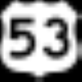
and continues east to its eastern terminus at its intersection with U.S. Highway 53
at Ray
.
Highway 217 is 17.3 miles (27.8 km) in length and passes through the city of Littlefork
.
and Ray
near International Falls
.
The route is also known as Main Street in Littlefork.
Highway 217 crosses the Little Fork River
and the Rat Root River
throughout its route.
The western terminus for Highway 217 is its intersection with State Highway 65 in Littlefork, 8 blocks from U.S. Highway 71
.
Highway
A highway is any public road. In American English, the term is common and almost always designates major roads. In British English, the term designates any road open to the public. Any interconnected set of highways can be variously referred to as a "highway system", a "highway network", or a...
in northern Minnesota
Minnesota
Minnesota is a U.S. state located in the Midwestern United States. The twelfth largest state of the U.S., it is the twenty-first most populous, with 5.3 million residents. Minnesota was carved out of the eastern half of the Minnesota Territory and admitted to the Union as the thirty-second state...
, which runs from its intersection
Intersection (road)
An intersection is a road junction where two or more roads either meet or cross at grade . An intersection may be 3-way - a T junction or fork, 4-way - a crossroads, or 5-way or more...
with State Highway 65
Minnesota State Highway 65
Minnesota State Highway 65 is a highway in east-central and northeast Minnesota, which runs from its intersection with Washington Avenue at the north end of downtown Minneapolis and continues north to its northern terminus at its intersection with U.S...
at Littlefork
Littlefork, Minnesota
Littlefork is a city in Koochiching County, Minnesota, United States. The population was 647 at the 2010 census.-Geography:According to the United States Census Bureau, the city has a total area of , all of it land.U.S...
and continues east to its eastern terminus at its intersection with U.S. Highway 53
U.S. Route 53
U.S. Route 53 is a north–south U.S. highway that runs for 403 miles from La Crosse, Wisconsin to northern Minnesota. It is the primary north–south route in northwestern Wisconsin, serving as a vital link between I-94 at Eau Claire, Wisconsin and the city of Duluth, Minnesota...
at Ray
Ray, Minnesota
Ray is an unincorporated community in Koochiching County, Minnesota, United States.The community is located southeast of International Falls at the junction of U.S. Route 53 and Minnesota State Highway 217.-Further reading:...
.
Highway 217 is 17.3 miles (27.8 km) in length and passes through the city of Littlefork
Littlefork, Minnesota
Littlefork is a city in Koochiching County, Minnesota, United States. The population was 647 at the 2010 census.-Geography:According to the United States Census Bureau, the city has a total area of , all of it land.U.S...
.
Route description
Highway 217 serves as an east–west route between LittleforkLittlefork, Minnesota
Littlefork is a city in Koochiching County, Minnesota, United States. The population was 647 at the 2010 census.-Geography:According to the United States Census Bureau, the city has a total area of , all of it land.U.S...
and Ray
Ray, Minnesota
Ray is an unincorporated community in Koochiching County, Minnesota, United States.The community is located southeast of International Falls at the junction of U.S. Route 53 and Minnesota State Highway 217.-Further reading:...
near International Falls
International Falls, Minnesota
International Falls is a city in and the county seat of Koochiching County, Minnesota, United States. The population was 6,424 at the 2010 census....
.
The route is also known as Main Street in Littlefork.
Highway 217 crosses the Little Fork River
Little Fork River
The Little Fork River is a river of Minnesota. It flows into the Rainy River.-See also:*List of rivers of Minnesota-References:**USGS Hydrologic Unit Map - State of Minnesota...
and the Rat Root River
Rat Root River
The Rat Root River is a river of Minnesota. It flows into the Rainy River.-References:***USGS Hydrologic Unit Map - State of Minnesota...
throughout its route.
The western terminus for Highway 217 is its intersection with State Highway 65 in Littlefork, 8 blocks from U.S. Highway 71
U.S. Route 71
U.S. Route 71 is a north–south United States highway. This original 1926 route has remained largely unchanged by encroaching Interstate highways. Currently, the highway's northern terminus is in International Falls, Minnesota at the Canadian border, at the southern end of the Fort...
.
Major intersections
| Location | Mile | Roads intersected |
|---|---|---|
| Littlefork Littlefork, Minnesota Littlefork is a city in Koochiching County, Minnesota, United States. The population was 647 at the 2010 census.-Geography:According to the United States Census Bureau, the city has a total area of , all of it land.U.S... |
0.000 | |
| 0.086-0.170 | Little Fork River Little Fork River The Little Fork River is a river of Minnesota. It flows into the Rainy River.-See also:*List of rivers of Minnesota-References:**USGS Hydrologic Unit Map - State of Minnesota... |
|
| 0.383 |  CR 49 (3rd Avenue) CR 49 (3rd Avenue) |
|
| 0.452 | CR 43 (4th Avenue) | |
| 0.888 |  CR 22 (north) CR 43 (south) (Aspen Street) CR 22 (north) CR 43 (south) (Aspen Street) |
|
| Rainy Lake Rainy Lake, Minnesota Rainy Lake is an unorganized territory in Koochiching County, Minnesota, United States. The population was 4,469 at the 2000 census.-Geography:... |
1.811 |  CR 8 CR 8 |
| East Koochiching East Koochiching, Minnesota East Koochiching is an unorganized territory in Koochiching County, Minnesota, United States. The population was 383 at the 2000 census.-Geography:... |
10.402-10.420 | Rat Root River Rat Root River The Rat Root River is a river of Minnesota. It flows into the Rainy River.-References:***USGS Hydrologic Unit Map - State of Minnesota... |
| 15.334 |  CR 29 CR 29 |
|
| 16.980 | CR 110 | |
| Ray Ray, Minnesota Ray is an unincorporated community in Koochiching County, Minnesota, United States.The community is located southeast of International Falls at the junction of U.S. Route 53 and Minnesota State Highway 217.-Further reading:... |
17.342 |