
Minnesota State Highway 108
Encyclopedia
Minnesota State Highway 108 is a highway
in west-central Minnesota
, which runs from its interchange
with Interstate Highway 94
at Prairie View Township near Rothsay
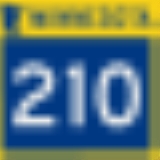
and continues east to its eastern terminus at its intersection
with State Highway 210
in Henning
.
Highway 108 is 61 miles (98.2 km) in length and passes through the cities of Pelican Rapids
and Henning
.
, Dent
, Perham
, Ottertail
, and Henning
in west-central Minnesota.
The roadway changes direction to north–south as it runs concurrent
with State Highway 78
for 9 miles between Perham Township and Ottertail
.
Highway 108 is also known as:
Maplewood State Park
is located 7 miles east of Pelican Rapids on Highway 108 near Lake Lida
.
at Pelican Rapids and State Highway 78
near Perham. The section of Highway 108 between State Highway 78 at Ottertail and State Highway 210
at Henning was also authorized in 1933. Both of these sections were paved by 1953.
The section of Highway 108 between U.S. 59 at Pelican Rapids and present day Interstate 94
(near Rothsay and Lawndale) was authorized in 1949. This section of Highway 108 was paved by 1960.
Highway
A highway is any public road. In American English, the term is common and almost always designates major roads. In British English, the term designates any road open to the public. Any interconnected set of highways can be variously referred to as a "highway system", a "highway network", or a...
in west-central Minnesota
Minnesota
Minnesota is a U.S. state located in the Midwestern United States. The twelfth largest state of the U.S., it is the twenty-first most populous, with 5.3 million residents. Minnesota was carved out of the eastern half of the Minnesota Territory and admitted to the Union as the thirty-second state...
, which runs from its interchange
Interchange (road)
In the field of road transport, an interchange is a road junction that typically uses grade separation, and one or more ramps, to permit traffic on at least one highway to pass through the junction without directly crossing any other traffic stream. It differs from a standard intersection, at which...
with Interstate Highway 94
Interstate 94 in Minnesota
In the U.S. state of Minnesota, Interstate 94 runs east–west through the central portion of the state. The route connects the cities of Moorhead, Fergus Falls, Alexandria, St...
at Prairie View Township near Rothsay
Rothsay, Minnesota
Rothsay is a city in Otter Tail and Wilkin counties in the U.S. state of Minnesota. The population was 493 at the 2010 census. One of Rothsay's major tourist attractions is the large prairie chicken statue near the northwest outskirts of the town....
and continues east to its eastern terminus at its intersection
Intersection (road)
An intersection is a road junction where two or more roads either meet or cross at grade . An intersection may be 3-way - a T junction or fork, 4-way - a crossroads, or 5-way or more...
with State Highway 210
Minnesota State Highway 210
Minnesota State Highway 210 is a highway in west-central, central, and northeast Minnesota, which runs from North Dakota Highway 210 at the North Dakota state line , and continues east to its eastern terminus at its intersection with State Highway 23 in Duluth near the Saint Louis River.The route...
in Henning
Henning, Minnesota
Henning is a city in Otter Tail County, Minnesota, United States. The population was 802 at the 2010 census.-Geography:According to the United States Census Bureau, the city has a total area of , all of it land....
.
Highway 108 is 61 miles (98.2 km) in length and passes through the cities of Pelican Rapids
Pelican Rapids, Minnesota
As of the census of 2000, there were 2,374 people, 884 households, and 558 families residing in the city. The population density was 905.8 people per square mile . There were 962 housing units at an average density of 367.0 per square mile...
and Henning
Henning, Minnesota
Henning is a city in Otter Tail County, Minnesota, United States. The population was 802 at the 2010 census.-Geography:According to the United States Census Bureau, the city has a total area of , all of it land....
.
Route description
Highway 108 serves as an east–west and a north–south route between Pelican RapidsPelican Rapids, Minnesota
As of the census of 2000, there were 2,374 people, 884 households, and 558 families residing in the city. The population density was 905.8 people per square mile . There were 962 housing units at an average density of 367.0 per square mile...
, Dent
Dent, Minnesota
Dent is a city in Otter Tail County, Minnesota, United States. The population was 194 at the 2010 census. Every summer Concordia Language Villages' Mori no Ike Japanese village is held just outside Dent at Lakeside Camp.-Geography:...
, Perham
Perham, Minnesota
As of the census of 2000, there were 2,559 people, 1,104 households, and 642 families residing in the city. The population density was 976.2 people per square mile . There were 1,167 housing units at an average density of 445.2 per square mile...
, Ottertail
Ottertail, Minnesota
Ottertail is a city in Otter Tail County, Minnesota, United States. The population was 572 at the 2010 census.-Geography:According to the United States Census Bureau, the city has a total area of , of which, of it is land and of it is water....
, and Henning
Henning, Minnesota
Henning is a city in Otter Tail County, Minnesota, United States. The population was 802 at the 2010 census.-Geography:According to the United States Census Bureau, the city has a total area of , all of it land....
in west-central Minnesota.
The roadway changes direction to north–south as it runs concurrent
Concurrency (road)
A concurrency, overlap, or coincidence in a road network is an instance of one physical road bearing two or more different highway, motorway, or other route numbers...
with State Highway 78
Minnesota State Highway 78
Minnesota State Highway 78 is a highway in west-central Minnesota, which runs from its interchange with Interstate Highway 94 near Ashby and continues north to its northern terminus at its interchange with U.S...
for 9 miles between Perham Township and Ottertail
Ottertail, Minnesota
Ottertail is a city in Otter Tail County, Minnesota, United States. The population was 572 at the 2010 census.-Geography:According to the United States Census Bureau, the city has a total area of , of which, of it is land and of it is water....
.
Highway 108 is also known as:
- NW 1st Avenue in Pelican RapidsPelican Rapids, MinnesotaAs of the census of 2000, there were 2,374 people, 884 households, and 558 families residing in the city. The population density was 905.8 people per square mile . There were 962 housing units at an average density of 367.0 per square mile...
. - Main Street in OttertailOttertail, MinnesotaOttertail is a city in Otter Tail County, Minnesota, United States. The population was 572 at the 2010 census.-Geography:According to the United States Census Bureau, the city has a total area of , of which, of it is land and of it is water....
. - Douglas Avenue in HenningHenning, MinnesotaHenning is a city in Otter Tail County, Minnesota, United States. The population was 802 at the 2010 census.-Geography:According to the United States Census Bureau, the city has a total area of , all of it land....
.
Maplewood State Park
Maplewood State Park
Maplewood State Park is a Minnesota state park near Pelican Rapids. The park preserves a pre-contact habitation site that was occupied in two different periods in a forest/prairie transition zone...
is located 7 miles east of Pelican Rapids on Highway 108 near Lake Lida
Lake Lida
Lake Lida is a sandy lake located in Otter Tail County, Minnesota. Lida Township, Minnesota is named after the lake and is centered directly over it. The lake is approximately long from north to south, and is a maximum of four miles wide from east to west from the widest point. "South Lake Lida"...
.
History
Highway 108 was authorized in 1933 between U.S. 59U.S. Route 59
U.S. Route 59 is a north–south United States highway . A latecomer to the U.S. numbered route system, U.S. 59 is now a border-to-border route, Part of NAFTA Corridor Highway System. It parallels U.S. Route 75 for nearly its entire route, never much more than away, until it veers southwest...
at Pelican Rapids and State Highway 78
Minnesota State Highway 78
Minnesota State Highway 78 is a highway in west-central Minnesota, which runs from its interchange with Interstate Highway 94 near Ashby and continues north to its northern terminus at its interchange with U.S...
near Perham. The section of Highway 108 between State Highway 78 at Ottertail and State Highway 210
Minnesota State Highway 210
Minnesota State Highway 210 is a highway in west-central, central, and northeast Minnesota, which runs from North Dakota Highway 210 at the North Dakota state line , and continues east to its eastern terminus at its intersection with State Highway 23 in Duluth near the Saint Louis River.The route...
at Henning was also authorized in 1933. Both of these sections were paved by 1953.
The section of Highway 108 between U.S. 59 at Pelican Rapids and present day Interstate 94
Interstate 94 in Minnesota
In the U.S. state of Minnesota, Interstate 94 runs east–west through the central portion of the state. The route connects the cities of Moorhead, Fergus Falls, Alexandria, St...
(near Rothsay and Lawndale) was authorized in 1949. This section of Highway 108 was paved by 1960.