
Middleton, Massachusetts
Encyclopedia
Middleton is a town
in Essex County
, Massachusetts
, United States
. The population was 8,987 at the 2010 census.
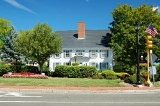
In the late 18th and to the mid-19th centuries Middleton was a vacation town to those who lived in areas such as Lawrence and Lowell. It is home to one of the oldest trees in Massachusetts, being approximately 400 years old, and which is located at 53 Peabody Street. The oldest still standing house is the Wilkins house, which was built in 1693, and served as a tavern on the main road between Salem and Lawrence.
Middleton is one of the fastest growing towns in the Commonwealth, and the fastest on the North Shore. When locally grouped it is grouped with Salem
, Danvers
, and Beverly
, but also occasionally Topsfield
and Boxford
, as these three towns are a tri-town. These three towns share Masconomet Regional High School
(named after Chief Masconomet
, sagamore of the Agawam tribe, which lived in Essex County at the time of English colonization) which serves grades 9-12, while its Middle School serves grades 7 and 8.
 According to the United States Census Bureau
, the town has a total area of 14.5 square miles (37.4 km²), of which, 14.0 square miles (36.2 km²) of it is land and 0.5 square miles (1.2 km²) of it (3.32%) is water. Middleton lies along the border of Essex County, and is bound by North Reading
in Middlesex County
to the west, and North Andover
to the northwest, Boxford
to the northeast, Topsfield
to the east, Danvers
to the southeast, Peabody
to the south, and shares a short, 0.3 mile border with Lynnfield
to the southwest. Middleton lies 8 miles northwest of Salem
, 11 miles southeast of Lawrence
, and 19 miles north of Boston
.
Middleton lies in the low hills of northeastern Massachusetts. The Ipswich River
flows through town, flowing from the North Reading/Lynnfield line along the Peabody and Danvers borders before turning northward into town, exiting along the border between Boxford and Topsfield. Several brooks feed into the river throughout town, and the town is also home to two larger ponds, Middleton Pond and Andover Meadow Pond, as well as several smaller ones. Within the town, there are portions of the Harold Parker State Forest and Boxford State Forest, as well as the Peabody Reservation, Sanford Reservation and Middleton Conservation Land.
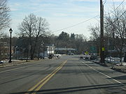
Middleton lies just west of Interstate 95
, with two very short parts of the highway passing through corners of the town before and after passing through Topsfield. There are exits off the highway in Boxford and in Danvers which both provide access to the town. Route 114, which follows the path of the old "Salem Turnpike," passes through the center of town, and is crossed there by Route 62, which merges with Route 114 for a short, 0.2 mile stretch there. There is no rail service within town; there are two lines (the Haverhill/Reading Line
and the Newburyport/Rockport Line
) of the MBTA Commuter Rail
to the west and south of town, both of which provide access to Boston's North Station. The nearest small air service is located at Beverly Municipal Airport
, with the nearest national and international air service being located at Logan International Airport
.
of 2000, there were 7,744 people, 2,305 households, and 1,744 families residing in the town. The population density
was 554.4 people per square mile (214.0/km²). There were 2,347 housing units at an average density of 168.0 per square mile (64.9/km²). The racial makeup of the town was 95.43% White, 1.65% African American, 0.05% Native American, 1.11% Asian, 0.05% Pacific Islander, 0.27% from other races
, and 1.43% from two or more races. Hispanic or Latino of any race were 6.26% of the population.
There were 2,305 households out of which 37.8% had children under the age of 18 living with them, 65.7% were married couples
living together, 7.2% had a female householder with no husband present, and 24.3% were non-families. 20.0% of all households were made up of individuals and 9.3% had someone living alone who was 65 years of age or older. The average household size was 2.76 and the average family size was 3.22.
In the town the population was spread out with 23.0% under the age of 18, 8.4% from 18 to 24, 36.9% from 25 to 44, 22.2% from 45 to 64, and 9.5% who were 65 years of age or older. The median age was 36 years. For every 100 females there were 138.9 males. For every 100 females age 18 and over, there were 147.7 males.
The median income for a household in the town was $81,395, and the median income for a family was $87,605. Males had a median income of $51,831 versus $37,874 for females. The per capita income
for the town was $29,031. About 2.1% of families and 3.7% of the population were below the poverty line, including 2.4% of those under age 18 and 11.2% of those age 65 or over.
New England town
The New England town is the basic unit of local government in each of the six New England states. Without a direct counterpart in most other U.S. states, New England towns are conceptually similar to civil townships in other states, but are incorporated, possessing powers like cities in other...
in Essex County
Essex County, Massachusetts
-National protected areas:* Parker River National Wildlife Refuge* Salem Maritime National Historic Site* Saugus Iron Works National Historic Site* Thacher Island National Wildlife Refuge-Demographics:...
, Massachusetts
Massachusetts
The Commonwealth of Massachusetts is a state in the New England region of the northeastern United States of America. It is bordered by Rhode Island and Connecticut to the south, New York to the west, and Vermont and New Hampshire to the north; at its east lies the Atlantic Ocean. As of the 2010...
, United States
United States
The United States of America is a federal constitutional republic comprising fifty states and a federal district...
. The population was 8,987 at the 2010 census.
History
Middleton was first settled in 1659 and was officially incorporated in 1728. Prior to 1728 it was considered a part of Salem, and contains territory previously within the limits of Andover, Boxford, and Topsfield. The name Middleton is derived from its location mid way between the important early settlements of Salem and Andover. It was first settled by Bray Wilkins, who came from Salem with a large family, having purchased six hundred acres from Governor Bellingham. The town grew as a farming community, mostly due to its location on the Ipswich River, with homesteads of hundreds of acres. However, during the 18th century Middleton also contained a vital ironworks industry, located in the area of what is now Mill and Liberty streets. This enterprise originally involved Thomas Flint, Sr. and his son, Thomas Flint Jr, of Salem, John How of Boxford, and Thomas Cave Jr. of Topsfield and was carried on for approximately seventy years.In the late 18th and to the mid-19th centuries Middleton was a vacation town to those who lived in areas such as Lawrence and Lowell. It is home to one of the oldest trees in Massachusetts, being approximately 400 years old, and which is located at 53 Peabody Street. The oldest still standing house is the Wilkins house, which was built in 1693, and served as a tavern on the main road between Salem and Lawrence.
Middleton is one of the fastest growing towns in the Commonwealth, and the fastest on the North Shore. When locally grouped it is grouped with Salem
Salem, Massachusetts
Salem is a city in Essex County, Massachusetts, United States. The population was 40,407 at the 2000 census. It and Lawrence are the county seats of Essex County...
, Danvers
Danvers, Massachusetts
Danvers is a town in Essex County, Massachusetts, United States. Located on the Danvers River near the northeastern coast of Massachusetts, Danvers is most widely known for its association with the 1692 Salem witch trials, and for its famous asylum, the Danvers State Hospital.-17th century:The land...
, and Beverly
Beverly, Massachusetts
Beverly is a city in Essex County, Massachusetts, United States. The population was 39,343 on , which differs by no more than several hundred from the 39,862 obtained in the 2000 census. A resort, residential and manufacturing community on the North Shore, Beverly includes Beverly Farms and Prides...
, but also occasionally Topsfield
Topsfield, Massachusetts
Topsfield is a town in Essex County, Massachusetts, United States. The population was 6,085 at the 2010 census.Part of the town comprises the census-designated place of Topsfield.-Colonial period:...
and Boxford
Boxford, Massachusetts
Boxford is a town in Essex County, Massachusetts, United States. The population was 7,965 at the 2010 census.Part of the town comprises the census-designated place of Boxford.-Geography:...
, as these three towns are a tri-town. These three towns share Masconomet Regional High School
Masconomet Regional High School
Masconomet Regional High School is located in Topsfield, Massachusetts, and serves the towns of Boxford, Middleton and Topsfield.Masconomet Regional Middle School serves grades 7 and 8 while the Masconomet Regional High School serves grades 9 through 12. Both schools are located on the same property...
(named after Chief Masconomet
Chief Masconomet
Masconomet, spelled many different ways in colonial deeds, was sagamore or chief of the Agawam tribe among the Algonquian peoples during the time of the English colonization of the Americas...
, sagamore of the Agawam tribe, which lived in Essex County at the time of English colonization) which serves grades 9-12, while its Middle School serves grades 7 and 8.
Geography
United States Census Bureau
The United States Census Bureau is the government agency that is responsible for the United States Census. It also gathers other national demographic and economic data...
, the town has a total area of 14.5 square miles (37.4 km²), of which, 14.0 square miles (36.2 km²) of it is land and 0.5 square miles (1.2 km²) of it (3.32%) is water. Middleton lies along the border of Essex County, and is bound by North Reading
North Reading, Massachusetts
North Reading is a town in Middlesex County, Massachusetts, United States. The population was 14,892 at the 2010 census.-History:The area was first settled in 1651 when the town of Reading received a special land grant north of the Ipswich River...
in Middlesex County
Middlesex County, Massachusetts
-National protected areas:* Assabet River National Wildlife Refuge* Great Meadows National Wildlife Refuge* Longfellow National Historic Site* Lowell National Historical Park* Minute Man National Historical Park* Oxbow National Wildlife Refuge...
to the west, and North Andover
North Andover, Massachusetts
North Andover is a town in Essex County, Massachusetts, United States. North Andover is the home of Merrimack College, a private, Catholic four-year institution ....
to the northwest, Boxford
Boxford, Massachusetts
Boxford is a town in Essex County, Massachusetts, United States. The population was 7,965 at the 2010 census.Part of the town comprises the census-designated place of Boxford.-Geography:...
to the northeast, Topsfield
Topsfield, Massachusetts
Topsfield is a town in Essex County, Massachusetts, United States. The population was 6,085 at the 2010 census.Part of the town comprises the census-designated place of Topsfield.-Colonial period:...
to the east, Danvers
Danvers, Massachusetts
Danvers is a town in Essex County, Massachusetts, United States. Located on the Danvers River near the northeastern coast of Massachusetts, Danvers is most widely known for its association with the 1692 Salem witch trials, and for its famous asylum, the Danvers State Hospital.-17th century:The land...
to the southeast, Peabody
Peabody, Massachusetts
Peabody is a city in Essex County, Massachusetts, United States. The population is about 53,000. Peabody is located in Boston's North Shore suburban area.- History :...
to the south, and shares a short, 0.3 mile border with Lynnfield
Lynnfield, Massachusetts
Lynnfield is a wealthy town in Essex County, Massachusetts, in the United States. As of the 2000 census, the town population was 11,542.- History :...
to the southwest. Middleton lies 8 miles northwest of Salem
Salem, Massachusetts
Salem is a city in Essex County, Massachusetts, United States. The population was 40,407 at the 2000 census. It and Lawrence are the county seats of Essex County...
, 11 miles southeast of Lawrence
Lawrence, Massachusetts
Lawrence is a city in Essex County, Massachusetts, United States on the Merrimack River. According to the 2010 U.S. Census, the city had a total population of 76,377. Surrounding communities include Methuen to the north, Andover to the southwest, and North Andover to the southeast. It and Salem are...
, and 19 miles north of Boston
Boston
Boston is the capital of and largest city in Massachusetts, and is one of the oldest cities in the United States. The largest city in New England, Boston is regarded as the unofficial "Capital of New England" for its economic and cultural impact on the entire New England region. The city proper had...
.
Middleton lies in the low hills of northeastern Massachusetts. The Ipswich River
Ipswich River
Ipswich River is a small river in northeastern Massachusetts, USA. It is long, and its watershed is approximately , with an estimated population in the area of 160,000 people. - Geography :...
flows through town, flowing from the North Reading/Lynnfield line along the Peabody and Danvers borders before turning northward into town, exiting along the border between Boxford and Topsfield. Several brooks feed into the river throughout town, and the town is also home to two larger ponds, Middleton Pond and Andover Meadow Pond, as well as several smaller ones. Within the town, there are portions of the Harold Parker State Forest and Boxford State Forest, as well as the Peabody Reservation, Sanford Reservation and Middleton Conservation Land.
Middleton lies just west of Interstate 95
Interstate 95 in Massachusetts
Interstate 95 is the main highway on the East Coast of the United States, paralleling the Atlantic Ocean from Florida to Maine. The Massachusetts portion of the highway enters from the state of Rhode Island in Attleboro and travels in a northeasterly direction to the junction with Route 128 in...
, with two very short parts of the highway passing through corners of the town before and after passing through Topsfield. There are exits off the highway in Boxford and in Danvers which both provide access to the town. Route 114, which follows the path of the old "Salem Turnpike," passes through the center of town, and is crossed there by Route 62, which merges with Route 114 for a short, 0.2 mile stretch there. There is no rail service within town; there are two lines (the Haverhill/Reading Line
Haverhill/Reading Line
The Haverhill Line is a branch of the MBTA Commuter Rail system, running north from downtown Boston, Massachusetts through the cities and towns ofMalden,Melrose,Wakefield,Reading,Wilmington,Andover,...
and the Newburyport/Rockport Line
Newburyport/Rockport Line
The Newburyport/Rockport Line is a branch of the MBTA Commuter Rail system, running northeast from downtown Boston, Massachusetts towards Cape Ann and the Merrimack Valley, serving the North Shore. The first leg serves Chelsea, Lynn, Swampscott, Salem, and Beverly. From there, a northern branch of...
) of the MBTA Commuter Rail
MBTA Commuter Rail
The MBTA Commuter Rail serves as the regional rail arm of the Massachusetts Bay Transportation Authority, in the United States. It is operated under contract by the Massachusetts Bay Commuter Railroad Company a joint partnership of Veolia Transportation, Bombardier Transportation and Alternate...
to the west and south of town, both of which provide access to Boston's North Station. The nearest small air service is located at Beverly Municipal Airport
Beverly Municipal Airport
Beverly Municipal Airport is a public-use airport located three miles northwest of the central business district of Beverly, a city in Essex County, Massachusetts, United States...
, with the nearest national and international air service being located at Logan International Airport
Logan International Airport
General Edward Lawrence Logan International Airport is located in the East Boston neighborhood of Boston, Massachusetts . It covers , has six runways, and employs an estimated 16,000 people. It is the 19th busiest airport in the United States.Boston serves as a focus city for JetBlue Airways...
.
Demographics
As of the censusCensus
A census is the procedure of systematically acquiring and recording information about the members of a given population. It is a regularly occurring and official count of a particular population. The term is used mostly in connection with national population and housing censuses; other common...
of 2000, there were 7,744 people, 2,305 households, and 1,744 families residing in the town. The population density
Population density
Population density is a measurement of population per unit area or unit volume. It is frequently applied to living organisms, and particularly to humans...
was 554.4 people per square mile (214.0/km²). There were 2,347 housing units at an average density of 168.0 per square mile (64.9/km²). The racial makeup of the town was 95.43% White, 1.65% African American, 0.05% Native American, 1.11% Asian, 0.05% Pacific Islander, 0.27% from other races
Race (United States Census)
Race and ethnicity in the United States Census, as defined by the Federal Office of Management and Budget and the United States Census Bureau, are self-identification data items in which residents choose the race or races with which they most closely identify, and indicate whether or not they are...
, and 1.43% from two or more races. Hispanic or Latino of any race were 6.26% of the population.
There were 2,305 households out of which 37.8% had children under the age of 18 living with them, 65.7% were married couples
Marriage
Marriage is a social union or legal contract between people that creates kinship. It is an institution in which interpersonal relationships, usually intimate and sexual, are acknowledged in a variety of ways, depending on the culture or subculture in which it is found...
living together, 7.2% had a female householder with no husband present, and 24.3% were non-families. 20.0% of all households were made up of individuals and 9.3% had someone living alone who was 65 years of age or older. The average household size was 2.76 and the average family size was 3.22.
In the town the population was spread out with 23.0% under the age of 18, 8.4% from 18 to 24, 36.9% from 25 to 44, 22.2% from 45 to 64, and 9.5% who were 65 years of age or older. The median age was 36 years. For every 100 females there were 138.9 males. For every 100 females age 18 and over, there were 147.7 males.
The median income for a household in the town was $81,395, and the median income for a family was $87,605. Males had a median income of $51,831 versus $37,874 for females. The per capita income
Per capita income
Per capita income or income per person is a measure of mean income within an economic aggregate, such as a country or city. It is calculated by taking a measure of all sources of income in the aggregate and dividing it by the total population...
for the town was $29,031. About 2.1% of families and 3.7% of the population were below the poverty line, including 2.4% of those under age 18 and 11.2% of those age 65 or over.
Notable residents
- Brian RolstonBrian RolstonBrian Lee Rolston is a professional ice hockey player and an alternate captain for the New York Islanders of the National Hockey League. He has won a Stanley Cup Championship with the New Jersey Devils in 1995, and the World Cup of Hockey in 1996 playing for Team USA...
- Boston Bruins - P. J. Axelsson - Boston Bruins
- Sergei SamsonovSergei SamsonovSergei Viktorovich Samsonov is a Russian professional ice hockey forward who is currently an unrestricted free agent.- Playing career :Samsonov was drafted by the Boston Bruins eighth overall in the 1997 NHL Entry Draft. Boston drafted Joe Thornton first overall in the same draft...
- Boston Bruins - Kyle McLarenKyle McLarenKyle Edgar McLaren is a retired Canadian professional ice hockey defenceman.-Playing career:McLaren was drafted by the Boston Bruins in the first round, ninth-overall, during the 1995 NHL Entry Draft...
- Boston Bruins - Jo Jo WhiteJo Jo WhiteJoseph Henry "Jo Jo" White is an American former professional basketball player.-Life and career:White was born in St. Louis, Missouri, the son of a minister...
- Boston Celtics - John Tudor - Boston Red Sox, St. Louis Cardinals