

Mid-Wilshire
Encyclopedia
Mid-Wilshire is a district in the City of Los Angeles, California
. It is part of the Wilshire
region.
It mostly encompasses the area bounded by La Cienega Boulevard to the west, Melrose Avenue to the north, Hoover Street to the east and the Santa Monica Freeway to the south, although some neighborhoods in this perimerter overlap with parts of Mid-City
, Mid-City West
, and the West Adams
district. It derives its name from Wilshire Boulevard
, the primary east-west thoroughfare through the area. The service area of the Wilshire Division of the Los Angeles Police Department is congruent to the portions of Mid-Wilshire within the City of Los Angeles. A popular nickname among locals for this district is Midtown.
Hoover Street marks the western edge of the original city lands of the pueblo of Los Angeles, as granted by the Spanish crown in 1781. Before the 20th century, the area to the west was predominantly farmland and pasture, with significant petroleum
extraction beginning in the 1890s. Even as the areas within the old land grant became a booming metropolis, the areas west of Hoover remained virtually unpopulated: the streetcar lines that connected downtown Los Angeles with Palms
, Venice, and the city of Santa Monica
ran through a landscape little changed from what the original Tongva inhabitants might have seen centuries earlier.
With the opening of the Los Angeles Aqueduct
and the long-awaited development of the Port of Los Angeles
, Los Angeles experienced an explosion of economic and population growth. The relatively flat coastal plains beyond Hoover, which had seen only desultory development beforehand, were ripe for large-scale urbanization. In an orgy of building and speculation, they were soon covered with houses both humble and magnificent, spectacularly palm-lined streets, thriving commercial districts along most of the major thoroughfares, and the iconic Miracle Mile
on Wilshire Boulevard. The iconic Carthay Circle Theater, in the far northwest reaches of Mid-Wilshire near the border of Beverly Hills
, was one of the greatest of the "picture palaces" of the "Golden Age" of Hollywood in the 1930s and 1940s.
After World War II
, and especially from the mid-1960s onward, suburb
anization drew away much of Mid-Wilshire's wealth, especially in the more densely populated areas east of Crenshaw Boulevard, which saw wholesale white flight
in the 1950s and 1960s. (Areas such as Carthay
and the Miracle Mile District
fared better, with middle-class Jewish
and African-American families adding considerable social capital
to their new neighborhoods.) In the 1970s, Mayor Tom Bradley
's successful effort to turn Bunker Hill
into the region's premier business district further reduced the desirability of the Wilshire business corridor. By 1980, many businesses had abandoned Wilshire Boulevard for the shiny new office towers of Century City
, Beverly Hills
, and Westchester
, and the office parks of the suburbs. In the Wilshire Center area, salvation came in the form of Korea
n immigrants displaced by the economic development schemes
of South Korean dictator Park Chung Hee; these enterprising Koreans quickly established themselves as the dominant economic force in the eastern part of the Mid-Wilshire district, leading to part of Wilshire Center's rechristening as "Koreatown
."
The 1992 riots greatly impacted the mid-Wilshire area. Millions of square feet of office space soon became vacant as professional offices and business fled to the booming Westside. Longtime anchor Bullocks, suffered from $10 million in damage and closed immediately. The average home value in the neighboring Hancock Park district plunged $200,000 after the riot. Enterprising Koreans filled the vacuum of the "Wilshire-ruins" but the loss of tax dollars was not recouped.
Today, Mid-Wilshire is an ethnically and economically diverse area, with all of Los Angeles' major racial/ethnic groups—whites, blacks, Latinos, and Asian-Americans—well-represented within its borders. Neighborhoods like Hancock Park, Windsor Square, Carthay Circle, and Lafayette Square contain some of Los Angeles' most magnificent residential architecture, primarily in traditional city neighborhood settings. On the whole, the area has retained a low-rise, relatively low-density character, in large part due to the historic preservation
movement. The exception is Koreatown, which has long been one of the most densely populated areas in the United States. The Wilshire Center neighborhood has undergone gentrification since approximately 2003, and many apartments are under construction. One of Mid-Wilshire's greatest sources of political conflict is the steady densification of areas along Koreatown's western edges, a seemingly inexorable development that has occurred to the great dismay of the district's affluent white neighbors.
had several Red Car streetcar lines running through Mid-Wilshire, which merged into a trunk line on Venice Boulevard at the Vineyard Junction in what is now Mid-City
, continuing east to Hill Street and ultimately the Subway Terminal Building downtown. At the system's greatest extent in the late 1920s, streetcars running through this junction connected Mid-Wilshire to most of the neighborhoods and cities of the present-day Westside, as well as the coastal cities of the South Bay
. The Pacific Electric lines in Mid-Wilshire were all out of service by 1959 and most trackage was removed by 1970; wide medians on Venice and San Vicente Boulevards are the only remnant of this important component of the area's development.
The Los Angeles Railway
's "Yellow Cars" also operated in Mid-Wilshire, with their western terminus at Pico and Rimpau Boulevards (and at Highland Avenue, on the 3rd Street line two miles (3 km) to the north). Following a 1928 fare increase by Pacific Electric, the city of Santa Monica started its own municipal bus service, with its eastern terminus at the Yellow Car's western end. The advent of this service, which evolved over time into today's well-regarded Big Blue Bus
, enabled Santa Monica residents and Westsiders commuting to downtown Los Angeles to bypass Pacific Electric entirely. Today, the Pico/Rimpau depot (which has been rebuilt several times, the most recent renovation opening in January 2006) is still the principal interchange point between the Big Blue Bus and the Pacific Electric's ultimate successor, the Los Angeles MTA
.
are held by residents of densely populated inner-city neighborhoods such as Westlake
, Pico-Union
, and Echo Park
. The fastest way to Century City
, Beverly Hills, and Santa Monica is usually along Mid-Wilshire's surface streets. Similarly, many workers in Hollywood
live in South Los Angeles
. For this reason, even though much of the region has a relatively low population density for Los Angeles, Mid-Wilshire suffers from significant traffic congestion problems. Residents on a few streets in the area have erected wrought-iron fences and concrete barriers to prevent through traffic from using their streets. Mass transit solutions, both in the form of improved bus service (including limited bus rapid transit
on Wilshire
, La Cienega
, and Crenshaw Boulevards and Fairfax Avenue
) and the long-delayed western extension of the Purple Line subway
, promise to relieve some of the area's thorny congestion, but progress has been slow.
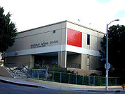
 Mid-Wilshire is primarily served by three public high schools: Fairfax High, at Fairfax and Melrose Avenues on the region's northwestern edge; Los Angeles High, at Olympic and West Boulevards in the east-central portion of the region and Belmont High, just east of Hoover on Beverly Boulevard in Westlake
. Some students in the furthest southwest portions of Mid-Wilshire attend Alexander Hamilton
High in Beverlywood
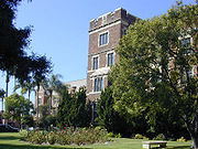
. The campus of Los Angeles High also includes one of the city's largest adult education
centers, as well as a large memorial to alumni killed in World War I
.
The newest public school in the area is the Robert F. Kennedy Community Schools
, open their doors on September 2010 to students in grades K-12. It consists of 6 schools: Ambassador School of Global Education (ASGE), Grades K-5; Ambassador School of Global Leadership (ASGL), Grades 6-12; Los Angeles High School of the Arts (LAHSA), Grades 9-12; New Open World Academy (NOW), Grades K-12; School for the Visual Arts & Humanities (SVAH), Grades 9-12; UCLA Community School (UCLA-CS), Grades K-12.
Jesuit Loyola High School in Harvard Heights.
Los Angeles, California
Los Angeles , with a population at the 2010 United States Census of 3,792,621, is the most populous city in California, USA and the second most populous in the United States, after New York City. It has an area of , and is located in Southern California...
. It is part of the Wilshire
Wilshire, Los Angeles, California
Wilshire is an area in Los Angeles, California, north of I-10, east of Beverly Hills and the Westside, west of Downtown LA and south of Hollywood, and contains, or abuts the districts of Mid-City West and Mid-Wilshire....
region.
It mostly encompasses the area bounded by La Cienega Boulevard to the west, Melrose Avenue to the north, Hoover Street to the east and the Santa Monica Freeway to the south, although some neighborhoods in this perimerter overlap with parts of Mid-City
Mid-City, Los Angeles, California
Mid-City is a district in Los Angeles, California. It is 2.5 miles south of Hollywood and 3.5 miles west of downtown Los Angeles. The Lafayette Square, Victoria Park, Wellington Square, and Vineyard neighborhoods are part of the district.-Geography and history:Mid-City's boundaries are roughly...
, Mid-City West
Mid-City West
Mid-City West is a subregion located in the Wilshire area of the City of Los Angeles, California. While it may be confused with the Mid-Wilshire area, the city designates it as a separate area, encompassing the area south of Santa Monica Boulevard, west of Fairfax Avenue, and north of Pico or...
, and the West Adams
West Adams, Los Angeles, California
West Adams, also known as Historic West Adams, is a large district located in the center of Los Angeles, California, southwest of Downtown and west of USC...
district. It derives its name from Wilshire Boulevard
Wilshire Boulevard
Wilshire Boulevard is one of the principal east-west arterial roads in Los Angeles, California, United States. It was named for Henry Gaylord Wilshire , an Ohio native who made and lost fortunes in real estate, farming, and gold mining. Henry Wilshire initiated what was to become Wilshire...
, the primary east-west thoroughfare through the area. The service area of the Wilshire Division of the Los Angeles Police Department is congruent to the portions of Mid-Wilshire within the City of Los Angeles. A popular nickname among locals for this district is Midtown.
History
- See also: History of Los Angeles
Hoover Street marks the western edge of the original city lands of the pueblo of Los Angeles, as granted by the Spanish crown in 1781. Before the 20th century, the area to the west was predominantly farmland and pasture, with significant petroleum
Petroleum
Petroleum or crude oil is a naturally occurring, flammable liquid consisting of a complex mixture of hydrocarbons of various molecular weights and other liquid organic compounds, that are found in geologic formations beneath the Earth's surface. Petroleum is recovered mostly through oil drilling...
extraction beginning in the 1890s. Even as the areas within the old land grant became a booming metropolis, the areas west of Hoover remained virtually unpopulated: the streetcar lines that connected downtown Los Angeles with Palms
Palms, Los Angeles, California
Palms is a community founded in 1886 in West Los Angeles, California, and was the oldest neighborhood annexed to the city of Los Angeles, in 1915. The 1886 tract was marketed as an agricultural and vacation community...
, Venice, and the city of Santa Monica
Santa Monica, California
Santa Monica is a beachfront city in western Los Angeles County, California, US. Situated on Santa Monica Bay, it is surrounded on three sides by the city of Los Angeles — Pacific Palisades on the northwest, Brentwood on the north, West Los Angeles on the northeast, Mar Vista on the east, and...
ran through a landscape little changed from what the original Tongva inhabitants might have seen centuries earlier.
With the opening of the Los Angeles Aqueduct
Los Angeles Aqueduct
The Los Angeles Aqueduct system comprising the Los Angeles Aqueduct and the Second Los Angeles Aqueduct, is a water conveyance system operated by the Los Angeles Department of Water and Power...
and the long-awaited development of the Port of Los Angeles
Port of Los Angeles
The Port of Los Angeles, also called Los Angeles Harbor and WORLDPORT L.A, is a port complex that occupies of land and water along of waterfront. The port is located on San Pedro Bay in the San Pedro neighborhood of Los Angeles, approximately south of downtown...
, Los Angeles experienced an explosion of economic and population growth. The relatively flat coastal plains beyond Hoover, which had seen only desultory development beforehand, were ripe for large-scale urbanization. In an orgy of building and speculation, they were soon covered with houses both humble and magnificent, spectacularly palm-lined streets, thriving commercial districts along most of the major thoroughfares, and the iconic Miracle Mile
Miracle Mile, Los Angeles, California
The Miracle Mile in Los Angeles, California, is an area in the Mid-Wilshire region consisting of an almost two-mile stretch of Wilshire Boulevard between Fairfax and Western Avenues...
on Wilshire Boulevard. The iconic Carthay Circle Theater, in the far northwest reaches of Mid-Wilshire near the border of Beverly Hills
Beverly Hills, California
Beverly Hills is an affluent city located in Los Angeles County, California, United States. With a population of 34,109 at the 2010 census, up from 33,784 as of the 2000 census, it is home to numerous Hollywood celebrities. Beverly Hills and the neighboring city of West Hollywood are together...
, was one of the greatest of the "picture palaces" of the "Golden Age" of Hollywood in the 1930s and 1940s.
After World War II
World War II
World War II, or the Second World War , was a global conflict lasting from 1939 to 1945, involving most of the world's nations—including all of the great powers—eventually forming two opposing military alliances: the Allies and the Axis...
, and especially from the mid-1960s onward, suburb
Suburb
The word suburb mostly refers to a residential area, either existing as part of a city or as a separate residential community within commuting distance of a city . Some suburbs have a degree of administrative autonomy, and most have lower population density than inner city neighborhoods...
anization drew away much of Mid-Wilshire's wealth, especially in the more densely populated areas east of Crenshaw Boulevard, which saw wholesale white flight
White flight
White flight has been a term that originated in the United States, starting in the mid-20th century, and applied to the large-scale migration of whites of various European ancestries from racially mixed urban regions to more racially homogeneous suburban or exurban regions. It was first seen as...
in the 1950s and 1960s. (Areas such as Carthay
Carthay, Los Angeles, California
Carthay is a residential district in the Mid-City West region of Los Angeles, California.-Geography and transportation:Carthay is bordered by the Miracle Mile District on the north, Picfair Village on the south, Beverly Hills on the northwest, and the Fairfax District on the northeast...
and the Miracle Mile District
Miracle Mile, Los Angeles, California
The Miracle Mile in Los Angeles, California, is an area in the Mid-Wilshire region consisting of an almost two-mile stretch of Wilshire Boulevard between Fairfax and Western Avenues...
fared better, with middle-class Jewish
Jews
The Jews , also known as the Jewish people, are a nation and ethnoreligious group originating in the Israelites or Hebrews of the Ancient Near East. The Jewish ethnicity, nationality, and religion are strongly interrelated, as Judaism is the traditional faith of the Jewish nation...
and African-American families adding considerable social capital
Social capital
Social capital is a sociological concept, which refers to connections within and between social networks. The concept of social capital highlights the value of social relations and the role of cooperation and confidence to get collective or economic results. The term social capital is frequently...
to their new neighborhoods.) In the 1970s, Mayor Tom Bradley
Tom Bradley (politician)
Thomas J. "Tom" Bradley was the 38th Mayor of Los Angeles, California, serving in that office from 1973 to 1993. He was the first and to date only African American mayor of Los Angeles...
's successful effort to turn Bunker Hill
Bunker Hill, Los Angeles, California
Bunker Hill, in the downtown area of Los Angeles, California, is a short, developed hill with its peak located roughly around 3rd Street. It is located directly east of the Harbor Freeway...
into the region's premier business district further reduced the desirability of the Wilshire business corridor. By 1980, many businesses had abandoned Wilshire Boulevard for the shiny new office towers of Century City
Century City, Los Angeles, California
Century City is a 176-acre commercial and residential district on the Westside of the city of Los Angeles. It is bounded by Westwood on the west, Rancho Park on the southwest, Cheviot Hills and Beverlywood on the southeast, and the city of Beverly Hills on the northeast...
, Beverly Hills
Beverly Hills, California
Beverly Hills is an affluent city located in Los Angeles County, California, United States. With a population of 34,109 at the 2010 census, up from 33,784 as of the 2000 census, it is home to numerous Hollywood celebrities. Beverly Hills and the neighboring city of West Hollywood are together...
, and Westchester
Westchester, Los Angeles, California
Westchester is a suburban neighborhood in western Los Angeles, California, United States. It is home to Los Angeles International Airport , Loyola Marymount University , and Otis College of Art and Design.-Geography:...
, and the office parks of the suburbs. In the Wilshire Center area, salvation came in the form of Korea
Korea
Korea ) is an East Asian geographic region that is currently divided into two separate sovereign states — North Korea and South Korea. Located on the Korean Peninsula, Korea is bordered by the People's Republic of China to the northwest, Russia to the northeast, and is separated from Japan to the...
n immigrants displaced by the economic development schemes
Heavy-Chemical Industry Drive
The Heavy-Chemical Industry Drive was an economic development plan enacted in the 1970s under the regime of South Korean dictator Park Chung Hee.-Background:...
of South Korean dictator Park Chung Hee; these enterprising Koreans quickly established themselves as the dominant economic force in the eastern part of the Mid-Wilshire district, leading to part of Wilshire Center's rechristening as "Koreatown
Koreatown, Los Angeles, California
Koreatown is a neighborhood in the Mid-Wilshire district of the city of Los Angeles, California known for its concentration of Korean American people and institutions...
."
The 1992 riots greatly impacted the mid-Wilshire area. Millions of square feet of office space soon became vacant as professional offices and business fled to the booming Westside. Longtime anchor Bullocks, suffered from $10 million in damage and closed immediately. The average home value in the neighboring Hancock Park district plunged $200,000 after the riot. Enterprising Koreans filled the vacuum of the "Wilshire-ruins" but the loss of tax dollars was not recouped.
Today, Mid-Wilshire is an ethnically and economically diverse area, with all of Los Angeles' major racial/ethnic groups—whites, blacks, Latinos, and Asian-Americans—well-represented within its borders. Neighborhoods like Hancock Park, Windsor Square, Carthay Circle, and Lafayette Square contain some of Los Angeles' most magnificent residential architecture, primarily in traditional city neighborhood settings. On the whole, the area has retained a low-rise, relatively low-density character, in large part due to the historic preservation
Historic preservation
Historic preservation is an endeavor that seeks to preserve, conserve and protect buildings, objects, landscapes or other artifacts of historical significance...
movement. The exception is Koreatown, which has long been one of the most densely populated areas in the United States. The Wilshire Center neighborhood has undergone gentrification since approximately 2003, and many apartments are under construction. One of Mid-Wilshire's greatest sources of political conflict is the steady densification of areas along Koreatown's western edges, a seemingly inexorable development that has occurred to the great dismay of the district's affluent white neighbors.
Electric Rail
Historically, the Pacific Electric RailwayPacific Electric Railway
The Pacific Electric Railway , also known as the Red Car system, was a mass transit system in Southern California using streetcars, light rail, and buses...
had several Red Car streetcar lines running through Mid-Wilshire, which merged into a trunk line on Venice Boulevard at the Vineyard Junction in what is now Mid-City
Mid-City, Los Angeles, California
Mid-City is a district in Los Angeles, California. It is 2.5 miles south of Hollywood and 3.5 miles west of downtown Los Angeles. The Lafayette Square, Victoria Park, Wellington Square, and Vineyard neighborhoods are part of the district.-Geography and history:Mid-City's boundaries are roughly...
, continuing east to Hill Street and ultimately the Subway Terminal Building downtown. At the system's greatest extent in the late 1920s, streetcars running through this junction connected Mid-Wilshire to most of the neighborhoods and cities of the present-day Westside, as well as the coastal cities of the South Bay
South Bay, Los Angeles
The South Bay is a region of the southwest peninsula of Los Angeles County, California, United States. The name stems from its geographic features stretching along the southern shores of Santa Monica Bay which forms its western border.The picture at right uses the broadest definition of the...
. The Pacific Electric lines in Mid-Wilshire were all out of service by 1959 and most trackage was removed by 1970; wide medians on Venice and San Vicente Boulevards are the only remnant of this important component of the area's development.
The Los Angeles Railway
Los Angeles Railway
The Los Angeles Railway was a system of streetcars that operated in central Los Angeles, California and the immediate surrounding neighborhoods between from 1901 and 1963. Except for two short funicular railways it operated on tracks...
's "Yellow Cars" also operated in Mid-Wilshire, with their western terminus at Pico and Rimpau Boulevards (and at Highland Avenue, on the 3rd Street line two miles (3 km) to the north). Following a 1928 fare increase by Pacific Electric, the city of Santa Monica started its own municipal bus service, with its eastern terminus at the Yellow Car's western end. The advent of this service, which evolved over time into today's well-regarded Big Blue Bus
Big Blue Bus
Santa Monica Municipal Bus Lines, more commonly known as the Big Blue Bus, is a municipal bus operator in the Westside region of Los Angeles, providing both local and bus rapid transit service in Santa Monica and adjacent neighborhoods of Los Angeles...
, enabled Santa Monica residents and Westsiders commuting to downtown Los Angeles to bypass Pacific Electric entirely. Today, the Pico/Rimpau depot (which has been rebuilt several times, the most recent renovation opening in January 2006) is still the principal interchange point between the Big Blue Bus and the Pacific Electric's ultimate successor, the Los Angeles MTA
Los Angeles County Metropolitan Transportation Authority
The Los Angeles County Metropolitan Transportation Authority is the California state-chartered regional transportation planning agency and public transportation operating agency for the County of Los Angeles formed in 1993 out of a merger of the Southern California Rapid Transit District and the...
.
Congestion and Responses
Many of the low-wage jobs in the prosperous business districts of the WestsideWest Los Angeles (region)
The Los Angeles Westside is an urban region in western Los Angeles County, California, United States. It has no official definition, but, according to the Los Angeles Times, it comprises , encompassing 18 districts in the city of Los Angeles and two unincorporated neighborhoods, plus the cities of...
are held by residents of densely populated inner-city neighborhoods such as Westlake
Westlake, Los Angeles, California
Westlake is a neighborhood in Los Angeles, California. It should not be confused with Westlake Village, an independent municipality in Los Angeles County near Thousand Oaks and close to the Ventura County line....
, Pico-Union
Pico-Union, Los Angeles, California
Pico-Union is a district in Los Angeles, California. Its name derives from the intersection of Pico Boulevard and Union Avenue. The Los Angeles Community Redevelopment Agency officially adopted the name in 1970, when it launched a neighborhood renewal program that continues to this day...
, and Echo Park
Echo Park, Los Angeles, California
Echo Park is a hilly neighborhood in Los Angeles, California, northwest of Downtown Los Angeles and southeast of Hollywood.-History:At the end of the 19th century, when the hills were still covered with native vegetation, a horse-drawn streetcar line served the dirt road that is now Echo Park Avenue...
. The fastest way to Century City
Century City, Los Angeles, California
Century City is a 176-acre commercial and residential district on the Westside of the city of Los Angeles. It is bounded by Westwood on the west, Rancho Park on the southwest, Cheviot Hills and Beverlywood on the southeast, and the city of Beverly Hills on the northeast...
, Beverly Hills, and Santa Monica is usually along Mid-Wilshire's surface streets. Similarly, many workers in Hollywood
Hollywood, Los Angeles, California
Hollywood is a famous district in Los Angeles, California, United States situated west-northwest of downtown Los Angeles. Due to its fame and cultural identity as the historical center of movie studios and movie stars, the word Hollywood is often used as a metonym of American cinema...
live in South Los Angeles
South Los Angeles
South Los Angeles, often abbreviated as South L.A. and formerly South Central Los Angeles, is the official name for a large geographic and cultural portion lying to the southwest and southeast of downtown Los Angeles, California. The area was formerly called South Central, and is still widely known...
. For this reason, even though much of the region has a relatively low population density for Los Angeles, Mid-Wilshire suffers from significant traffic congestion problems. Residents on a few streets in the area have erected wrought-iron fences and concrete barriers to prevent through traffic from using their streets. Mass transit solutions, both in the form of improved bus service (including limited bus rapid transit
Bus rapid transit
Bus rapid transit is a term applied to a variety of public transportation systems using buses to provide faster, more efficient service than an ordinary bus line. Often this is achieved by making improvements to existing infrastructure, vehicles and scheduling...
on Wilshire
Wilshire Boulevard
Wilshire Boulevard is one of the principal east-west arterial roads in Los Angeles, California, United States. It was named for Henry Gaylord Wilshire , an Ohio native who made and lost fortunes in real estate, farming, and gold mining. Henry Wilshire initiated what was to become Wilshire...
, La Cienega
La Cienega Boulevard
La Cienega Boulevard is a major, well-known north–south arterial road that runs between El Segundo Boulevard in El Segundo, California on the south and the Sunset Strip/Sunset Boulevard in West Hollywood....
, and Crenshaw Boulevards and Fairfax Avenue
Fairfax Avenue
Fairfax Avenue is a street on north central Los Angeles, California. It runs from La Cienega Boulevard with Culver City at its southern end to Hollywood Boulevard in Hollywood on its northern end.Fairfax Avenue forms the western boundary of Hancock Park as well as Park La Brea, an 160 acre ,...
) and the long-delayed western extension of the Purple Line subway
Rapid transit
A rapid transit, underground, subway, elevated railway, metro or metropolitan railway system is an electric passenger railway in an urban area with a high capacity and frequency, and grade separation from other traffic. Rapid transit systems are typically located either in underground tunnels or on...
, promise to relieve some of the area's thorny congestion, but progress has been slow.
Education
Westlake, Los Angeles, California
Westlake is a neighborhood in Los Angeles, California. It should not be confused with Westlake Village, an independent municipality in Los Angeles County near Thousand Oaks and close to the Ventura County line....
. Some students in the furthest southwest portions of Mid-Wilshire attend Alexander Hamilton
Alexander Hamilton
Alexander Hamilton was a Founding Father, soldier, economist, political philosopher, one of America's first constitutional lawyers and the first United States Secretary of the Treasury...
High in Beverlywood
Beverlywood, Los Angeles, California
Beverlywood is a district on the West Side of the city of Los Angeles, California.-Geography and transportation:Beverlywood is bordered by Century City on the northwest, Cheviot Hills on the west, Palms on the southwest, Culver City on the south, Crestview on the east; South Robertson on the north...
. The campus of Los Angeles High also includes one of the city's largest adult education
Adult education
Adult education is the practice of teaching and educating adults. Adult education takes place in the workplace, through 'extension' school or 'school of continuing education' . Other learning places include folk high schools, community colleges, and lifelong learning centers...
centers, as well as a large memorial to alumni killed in World War I
World War I
World War I , which was predominantly called the World War or the Great War from its occurrence until 1939, and the First World War or World War I thereafter, was a major war centred in Europe that began on 28 July 1914 and lasted until 11 November 1918...
.
The newest public school in the area is the Robert F. Kennedy Community Schools
Robert F. Kennedy Community Schools
The Robert F. Kennedy Community Schools, called the RFK Community Schools, is a complex of public schools in Los Angeles, California. The schools cost $578 million to build, making it the most expensive public school in the United States...
, open their doors on September 2010 to students in grades K-12. It consists of 6 schools: Ambassador School of Global Education (ASGE), Grades K-5; Ambassador School of Global Leadership (ASGL), Grades 6-12; Los Angeles High School of the Arts (LAHSA), Grades 9-12; New Open World Academy (NOW), Grades K-12; School for the Visual Arts & Humanities (SVAH), Grades 9-12; UCLA Community School (UCLA-CS), Grades K-12.
Jesuit Loyola High School in Harvard Heights.
Neighborhoods of Mid-Wilshire
- Arlington HeightsArlington Heights, Los Angeles, CaliforniaArlington Heights is a residential district in the Mid-Wilshire region of Los Angeles, California. It is a small neighborhood in the West Adams, Los Angeles district. It derives its name from Arlington Avenue, which runs north-south through the east boundary of the district...
- Brookside Park
- Carthay Circle
- Carthay Square
- Country Club ParkCountry Club Park, Los Angeles, CaliforniaCountry Club Park is a neighborhood in the Mid-Wilshire area of Los Angeles, California.-Geography and transportation:Country Club Park's is bounded approximately by Olympic Boulevard to the north, Western Avenue to the east, Pico Boulevard to the south, and Crenshaw Boulevard to the west...
- Faircrest Heights
- Fremont Place
- Hancock ParkHancock Park, Los Angeles, CaliforniaHancock Park is a historic and affluent urban neighborhood in Los Angeles, California roughly bounded by Van Ness Avenue to the East, Melrose Avenue to the North, La Brea Avenue to the West, and Wilshire Boulevard to the South.-History:...
- Harvard HeightsHarvard Heights, Los Angeles, CaliforniaHarvard Heights is a district in the Mid-Wilshire region of Los Angeles, California.-Geography and transportation:The boundaries of Harvard Heights are Pico Boulevard on the north, Western Avenue on the west, The Santa Monica freeway on the south, and Normandie Avenue on the east...
- Byzantine-Latino Quarter
- KoreatownKoreatown, Los Angeles, CaliforniaKoreatown is a neighborhood in the Mid-Wilshire district of the city of Los Angeles, California known for its concentration of Korean American people and institutions...
- Wilshire Center
- LarchmontLarchmont, Los Angeles, CaliforniaLarchmont is the commercial heart of an area in mid-city Los Angeles, California. The area's geographical location within the Windsor Square neighborhood receives patronage from nearby Hancock Park, located to the west, and Hollywood adjacent to the north...
- Larchmont Village
- Windsor SquareWindsor Square, Los Angeles, CaliforniaWindsor Square is a small, historic and wealthy urban neighborhood in the Mid-Wilshire region of Los Angeles, California.- Origins and history :Sometime between 1900 and 1910 a prominent financier named George A.J...
- Longwood Highlands
- Mid-CityMid-City, Los Angeles, CaliforniaMid-City is a district in Los Angeles, California. It is 2.5 miles south of Hollywood and 3.5 miles west of downtown Los Angeles. The Lafayette Square, Victoria Park, Wellington Square, and Vineyard neighborhoods are part of the district.-Geography and history:Mid-City's boundaries are roughly...
- Victoria ParkVictoria Park, Los Angeles, CaliforniaVictoria Park is a small, semi-gated neighborhood that is centrally located in Los Angeles, California. It is 2.5 miles south of Hollywood and 3.5 miles west of downtown Los Angeles...
- Lafayette SquareLafayette Square, Los Angeles, CaliforniaLafayette Square is a small, semi-gated neighborhood in Los Angeles, California named after General Lafayette. It sits just off of Crenshaw Boulevard in the Mid-City area. It was designated by the city as a Los Angeles Historic Preservation Overlay Zone in 2000 for its significant residential...
- Vineyard
- Victoria Park
- Miracle MileMiracle Mile, Los Angeles, CaliforniaThe Miracle Mile in Los Angeles, California, is an area in the Mid-Wilshire region consisting of an almost two-mile stretch of Wilshire Boulevard between Fairfax and Western Avenues...
- Miracle Mile North
- Miracle Mile South
- Park La BreaPark La Brea, Los Angeles, CaliforniaPark La Brea is a sprawling apartment complex in the Miracle Mile District of Los Angeles, California...
- Park Mile
- Picfair VillagePicfair Village, Los Angeles, CaliforniaPicfair Village is a residential district in the Mid-Wilshire area of Los Angeles, California. 'Picfair' refers to the corner of Pico and Fairfax, site of the former Picfair Theater.-Geography:...
- South Carthay
- Wellington Square
- Western Heights
- Wilshire Center
- Wilshire ParkWilshire Park, Los Angeles, CaliforniaWilshire Park is a residential district in the Mid-Wilshire region of Los Angeles, California. Subdistricts include Longwood Highlands and the Park Mile.-Geography:...
- Wilshire Vista
See also
- List of districts and neighborhoods of Los Angeles
- Boyle WorkmanBoyle WorkmanAndrew Boyle Workman was a Los Angeles politician and businessman. He served as President of the Los Angeles City Council and, as such, was acting Mayor on occasion. He was the first city councilman to represent District 4 , under the new charter of 1925...
, representing the Wilshire Ward on the City Council, 1925–27