

Mercey Hot Springs, California
Encyclopedia
Mercey Hot Springs is an unincorporated community
in Fresno County
, California
, about 60 miles (96.6 km) west-southwest of Fresno
. It is a resort along Little Panoche Road (Fresno County Road J1) located at the western edge of Fresno County. The unincorporated area is about ten driving miles west of Interstate 5
. NAD83 latitude and longitude for the site are listed as 36°42′15"N 120°51′37"W in the National Geographic Names Database (NGND). The NGND shows a feature ID number of 1659109. The facility is along the San Andreas Rift Zone. Located in the Panoche Valley, the facility includes a campground and natural hot springs. The ZIP Code is 93622, and the community is inside area code 559
. It lies at an elevation of 1161 feet (354 m).
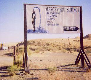 The Mercey Hot Springs Resort has served as an oasis of quiet and relaxation for hundreds of years -- first for Native Americans and later for all Californians since the 1800s. The Resort offers several options for enjoying the hot springs, including both clothed and clothing-optional choices. Lodging includes rustic cabins, tent camping, and RV spaces (no hook-ups; a dump station is available.) No amplified music is allowed in the Resort, and visiting motorcyclists should restrict their riding to entering and leaving the resort only. More information in avaialble at the Resort's website: https://merceyhotsprings.com. The campground also serves visitors to the nearby US Department of Interior, Bureau of Land Management
, Panoche Hills Management Area. The Panoche Access Road, entrance to the Area, is just east of the resort. The BLM reservation is used, in part, by off-road driving enthusiasts.
About 7 miles (11.3 km) south, in San Benito County
near the intersection of Panoche Road and Little Panoche Road, is the Panoche Inn. The bar is popular with motorcyclists on weekends in good weather. NAD27 latitude and longitude for the Inn are 36°36′25"N 120°53′07"W.
Four miles northwest, the county lines for Merced County
, San Benito County
, and Fresno
form a "T".
Unincorporated area
In law, an unincorporated area is a region of land that is not a part of any municipality.To "incorporate" in this context means to form a municipal corporation, a city, town, or village with its own government. An unincorporated community is usually not subject to or taxed by a municipal government...
in Fresno County
Fresno County, California
Fresno County is a county located in the Central Valley of the U.S. state of California, south of Stockton and north of Bakersfield. As of the 2010 census, it is the tenth most populous county in California with a population of 930,450, and the sixth largest in size with an area of . The county...
, California
California
California is a state located on the West Coast of the United States. It is by far the most populous U.S. state, and the third-largest by land area...
, about 60 miles (96.6 km) west-southwest of Fresno
Fresno, California
Fresno is a city in central California, United States, the county seat of Fresno County. As of the 2010 census, the city's population was 510,365, making it the fifth largest city in California, the largest inland city in California, and the 34th largest in the nation...
. It is a resort along Little Panoche Road (Fresno County Road J1) located at the western edge of Fresno County. The unincorporated area is about ten driving miles west of Interstate 5
Interstate 5
Interstate 5 is the main Interstate Highway on the West Coast of the United States, running largely parallel to the Pacific Ocean coastline from Canada to Mexico . It serves some of the largest cities on the U.S...
. NAD83 latitude and longitude for the site are listed as 36°42′15"N 120°51′37"W in the National Geographic Names Database (NGND). The NGND shows a feature ID number of 1659109. The facility is along the San Andreas Rift Zone. Located in the Panoche Valley, the facility includes a campground and natural hot springs. The ZIP Code is 93622, and the community is inside area code 559
Area code 559
Area code 559 is an area code in Central California, serving the counties ofFresno, Madera, Kings, and Tulare. It was created on November 14, 1998, when the southern half of the area code 209 reached full capacity....
. It lies at an elevation of 1161 feet (354 m).
History
The springs were discovered in 1848 and the resort opened after 1900. The name is in honor of J.N. Mercy, an early stockman.Nearby
Bureau of Land Management
The Bureau of Land Management is an agency within the United States Department of the Interior which administers America's public lands, totaling approximately , or one-eighth of the landmass of the country. The BLM also manages of subsurface mineral estate underlying federal, state and private...
, Panoche Hills Management Area. The Panoche Access Road, entrance to the Area, is just east of the resort. The BLM reservation is used, in part, by off-road driving enthusiasts.
About 7 miles (11.3 km) south, in San Benito County
San Benito County, California
San Benito County is a county located in the Coast Range Mountains of the U.S. state of California, south of San Jose. As of 2010 the population was 55,269. The county seat is Hollister, which includes nearly two-thirds of the county's population. El Camino Real passes through the county and...
near the intersection of Panoche Road and Little Panoche Road, is the Panoche Inn. The bar is popular with motorcyclists on weekends in good weather. NAD27 latitude and longitude for the Inn are 36°36′25"N 120°53′07"W.
Four miles northwest, the county lines for Merced County
Merced County, California
Merced County , is a county located in the Central Valley of the U.S. state of California, north of Fresno and southeast of San Jose. As of the 2010 census, the population was 255,793, up from 210,554 at the 2000 census. The county seat is Merced...
, San Benito County
San Benito County, California
San Benito County is a county located in the Coast Range Mountains of the U.S. state of California, south of San Jose. As of 2010 the population was 55,269. The county seat is Hollister, which includes nearly two-thirds of the county's population. El Camino Real passes through the county and...
, and Fresno
Fresno County, California
Fresno County is a county located in the Central Valley of the U.S. state of California, south of Stockton and north of Bakersfield. As of the 2010 census, it is the tenth most populous county in California with a population of 930,450, and the sixth largest in size with an area of . The county...
form a "T".
Sources
- National Geographic Names Database
- "Mercey Hot Springs, California," 7.5-minute quadrangle, US Geological Survey, 1981.