Meola Reef
Encyclopedia


Maori language
Māori or te reo Māori , commonly te reo , is the language of the indigenous population of New Zealand, the Māori. It has the status of an official language in New Zealand...
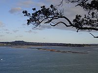
('toka'='rock', 'roa'='long') is a lava flow forming a reef peninsula across part of Auckland
Auckland
The Auckland metropolitan area , in the North Island of New Zealand, is the largest and most populous urban area in the country with residents, percent of the country's population. Auckland also has the largest Polynesian population of any city in the world...
's Waitemata Harbour
Waitemata Harbour
The quite famous Waitemata Harbour is the main access by sea to Auckland, New Zealand. For this reason it is often referred to as Auckland Harbour, despite the fact that it is only one of two harbours surrounding the city, and is crossed by the Auckland Harbour Bridge. The Waitemata forms the north...
, New Zealand
New Zealand
New Zealand is an island country in the south-western Pacific Ocean comprising two main landmasses and numerous smaller islands. The country is situated some east of Australia across the Tasman Sea, and roughly south of the Pacific island nations of New Caledonia, Fiji, and Tonga...
. It was formed 20,000 years ago from the final portion of a 10 kilometer long lava flow that originated from the distant Three Kings
Three Kings, New Zealand
Three Kings refers to both a suburb of Auckland, New Zealand, and the three-peaked volcano that it is named after. Three Kings should not be confused with the Three Kings Islands, located off the northern tip of New Zealand's North Island.- Suburb :...
volcano. The reef extends for over 2 kilometres across the Waitemata Harbour, to within 500 metres of Kauri Point, on the northern shore.
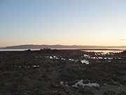
The reef is easily seen in the west from the Auckland Harbour Bridge at low tide, when much of it lies exposed. The best viewpoint is at Kauri Point, the headland to the east of Kendall Bay. The portion of the reef close to shore is covered by mangroves, and further out, the rocks are covered by rock oysters, then bare. Strong footwear is needed to walk on the lava.
Located between the Point Chevalier
Point Chevalier
Point Chevalier is a suburb and peninsula in the west of the city of Auckland in the north of New Zealand. It is located five kilometres to the west of the city centre on the southern shore of the Waitemata Harbour....
and Westmere
Westmere, New Zealand
Westmere is a residential suburb of Auckland City, New Zealand. Westmere is under the local governance of the Auckland City Council. The suburb was originally a working-class area, containing some state houses; mostly private housing originating from housing development in the 1920s.It is known...
suburbs, it was the site of the city's tip
Landfill
A landfill site , is a site for the disposal of waste materials by burial and is the oldest form of waste treatment...
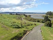
for many years. This has now been capped and replaced by a 15 ha public reserve, with mangrove swamps in the streams and tidal salt marsh
Salt marsh
A salt marsh is an environment in the upper coastal intertidal zone between land and salt water or brackish water, it is dominated by dense stands of halophytic plants such as herbs, grasses, or low shrubs. These plants are terrestrial in origin and are essential to the stability of the salt marsh...
es either side.
In the 1970s, plans for a Second Harbour Crossing
Second Harbour Crossing
Second Harbour Crossing is the name given to the proposed second transport link over the Waitemata Harbour in Auckland, New Zealand. The second link would supplement the Auckland Harbour Bridge which is nearly at capacity and also provide more redundancy and added public transport linkages between...
from the reef to Birkenhead
Birkenhead
Birkenhead is a town within the Metropolitan Borough of Wirral in Merseyside, England. It is on the Wirral Peninsula, along the west bank of the River Mersey, opposite the city of Liverpool...
were shelved after public outcry.

