

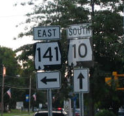
Massachusetts Route 10
Encyclopedia
State highway
State highway, state road or state route can refer to one of three related concepts, two of them related to a state or provincial government in a country that is divided into states or provinces :#A...
that runs from the state line at Southwick
Southwick, Massachusetts
Southwick is a town in Hampden County, Massachusetts, United States. The population was 9,502 at the 2010 census. It is part of the Springfield, Massachusetts Metropolitan Statistical Area.- History :...
to the state line at Northfield
Northfield, Massachusetts
Northfield is a town in Franklin County, Massachusetts, United States. The population was 2,951 at the 2000 census. It is part of the Springfield, Massachusetts Metropolitan Statistical Area...
.
Route description
Route 10 crosses the border from Granby, Connecticut into Southwick, MassachusettsSouthwick, Massachusetts
Southwick is a town in Hampden County, Massachusetts, United States. The population was 9,502 at the 2010 census. It is part of the Springfield, Massachusetts Metropolitan Statistical Area.- History :...
, overlapped with US 202. It runs north through the Pioneer Valley
Pioneer Valley
The Pioneer Valley is the colloquial name for the U.S. Commonwealth of Massachusetts's portion of the Connecticut River Valley. The Pioneer Valley consists of three counties in Massachusetts which collectively feature much of New England's most fertile farmland...
towns of Southwick
Southwick, Massachusetts
Southwick is a town in Hampden County, Massachusetts, United States. The population was 9,502 at the 2010 census. It is part of the Springfield, Massachusetts Metropolitan Statistical Area.- History :...
, Westfield
Westfield, Massachusetts
Westfield is a city in Hampden County, in the Pioneer Valley of western Massachusetts, United States. It is part of the Springfield, Massachusetts Metropolitan Statistical Area. The population was 41,094 at the 2010 census. The ZIP Code is 01085 for homes and businesses, 01086 for Westfield State...
, Southampton
Southampton, Massachusetts
Southampton is a town in Hampshire County, Massachusetts, United States. It was established first as a district of Northampton in 1753. It was incorporated in 1753. The name Southampton was given to it during its first town meeting in 1773. Its ZIP code is 01073...
, Easthampton
Easthampton, Massachusetts
Easthampton is the second largest city in Hampshire County, Massachusetts, United States. The town is on the southeastern edge of an area called the Pioneer Valley near the five colleges in the college towns of Northampton and Amherst, MA...
, Northampton
Northampton, Massachusetts
The city of Northampton is the county seat of Hampshire County, Massachusetts, United States. As of the 2010 census, the population of Northampton's central neighborhoods, was 28,549...
, Hatfield
Hatfield, Massachusetts
Hatfield is a town in Hampshire County, Massachusetts, United States. The population was 3,249 at the 2000 census. It is part of the Springfield, Massachusetts Metropolitan Statistical Area....
, Whately
Whately, Massachusetts
Whately is a town in Franklin County, Massachusetts, United States. The population was 1,573 at the 2000 census. It is part of the Springfield, Massachusetts Metropolitan Statistical Area.- History :...
, Deerfield
Deerfield, Massachusetts
Deerfield is a town in Franklin County, Massachusetts, United States. The population was 4,750 as of the 2000 census. Deerfield is part of the Springfield, Massachusetts Metropolitan Statistical Area in Western Massachusetts, lying only north of the city of Springfield.Deerfield includes the...
, Greenfield
Greenfield, Massachusetts
Greenfield is a city in Franklin County, Massachusetts, United States. The population was 17,456 at the 2010 census. It is the county seat of Franklin County. Greenfield is home to Greenfield Community College, the Pioneer Valley Symphony Orchestra, and the Franklin County Fair...
, Bernardston
Bernardston, Massachusetts
Bernardston is a town in Franklin County, Massachusetts, United States. The population was 2,155 at the 2000 census. It is part of the Springfield, Massachusetts Metropolitan Statistical Area.- History :...
, Gill
Gill, Massachusetts
Gill is a town in Franklin County, Massachusetts, USA. The population was 1,363 at the 2000 census. It is part of the Springfield, Massachusetts Metropolitan Statistical Area...
, and Northfield
Northfield, Massachusetts
Northfield is a town in Franklin County, Massachusetts, United States. The population was 2,951 at the 2000 census. It is part of the Springfield, Massachusetts Metropolitan Statistical Area...
. Route 10 has a long concurrency with U.S. Route 5
U.S. Route 5
U.S. Route 5 is a north–south United States highway running through the New England states of Connecticut, Massachusetts, and Vermont. Significant cities along the route include New Haven, Connecticut; Hartford, Connecticut; and Springfield, Massachusetts. From Hartford northward to St...
for about 25 miles (40.2 km) from Northampton to Bernardston, where it was sometimes called the "5 & 10 Highway". During this concurrency, it closely parallels Interstate 91
Interstate 91
Interstate 91 is an Interstate Highway in the New England region of the United States. It provides the primary north–south thoroughfare in the western part of New England...
, with five exits from Northampton to Deerfield, with close access at Route 2 in Greenfield and another exit, solely for Route 10, in Bernardston. It crosses the Connecticut River
Connecticut River
The Connecticut River is the largest and longest river in New England, and also an American Heritage River. It flows roughly south, starting from the Fourth Connecticut Lake in New Hampshire. After flowing through the remaining Connecticut Lakes and Lake Francis, it defines the border between the...
in Northfield before entering New Hampshire. Route 10 is concurrent with seven other routes (US 5, US 20, US 202, and Massachusetts Routes 57, 9, 116 and 63) for 43 of its nearly 61 miles in the state with three points of triple concurrency, leaving less than a third of its length as the sole road designation.