
Maryland Route 560
Encyclopedia
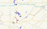
Maryland Route 560 is a state highway
in the U.S. state
of Maryland
. Known for most of its length as Gorman Road, the state highway runs 9.32 miles (15 km) from U.S. Route 50
(US 50) in Gorman
north to MD 135
in Mountain Lake Park
. MD 560 serves as the main street of Loch Lynn Heights
. The state highway also provides a connection through southeastern Garrett County
between US 50 on the east side of Backbone Mountain
and the Oakland
area. MD 560 was constructed from both ends beginning in the early 1930s. After the northern segment was extended over Backbone Mountain in the late 1930s, it was not until 1949 that the gap in MD 560 was filled.
and CSX
's Thomas Subdivision in Gorman. After passing through the village and crossing Nydegger Run, the state highway heads north as two-lane Gorman Road through farmland. MD 560 crosses Glade Run and meets White Church Steyer Road next to the hamlet of Kearney before turning northwest and crossing Backbone Mountain at Kelso Gap. After descending the mountain, the state highway turns west toward Loch Lynn Heights. The name of MD 560 changes to Lothian Street upon entering the town limits. At Argyle Street, MD 560 veers west onto Third Street then turns north onto Paull Street. MD 560 leaves Loch Lynn Heights by crossing CSX's Mountain Subdivision
at grade and enters Mountain Lake Park, where the state highway immediately reaches its northern terminus at MD 135 (Maryland Highway).
(now MD 135) south to Bethlehem Road just north of Backbone Mountain./ The northern section was extended over Backbone Mountain to White Church Steyer Road at Kearney by 1939. MD 560 was a two-part route until the gap between Le Moyne King Road and Kearney was filled in 1949.
.
{| class=wikitable
!Location
!Mile
!Destinations
!Notes
|-
|Gorman
|0.00
|, Gormania, WV
|Southern terminus
|-
|Kearney
|4.18
|White Church Steyer Road east
|Former MD 639
|-
|Loch Lynn Heights
|9.14
|Third Avenue west
|MD 560 turns north onto Paull Street
|-
|Mountain Lake Park
|9.32
|
|Northern terminus
State highway
State highway, state road or state route can refer to one of three related concepts, two of them related to a state or provincial government in a country that is divided into states or provinces :#A...
in the U.S. state
U.S. state
A U.S. state is any one of the 50 federated states of the United States of America that share sovereignty with the federal government. Because of this shared sovereignty, an American is a citizen both of the federal entity and of his or her state of domicile. Four states use the official title of...
of Maryland
Maryland
Maryland is a U.S. state located in the Mid Atlantic region of the United States, bordering Virginia, West Virginia, and the District of Columbia to its south and west; Pennsylvania to its north; and Delaware to its east...
. Known for most of its length as Gorman Road, the state highway runs 9.32 miles (15 km) from U.S. Route 50
U.S. Route 50 in Maryland
U.S. Route 50 is a major east–west route of the U.S. Highway system, stretching just over from Ocean City, Maryland on the Atlantic Ocean to West Sacramento, California. In the U.S. state of Maryland, US 50 exists in two sections. The longer of these serves as a major route connecting...
(US 50) in Gorman
Gorman, Maryland
Gorman is an unincorporated town along the North Branch Potomac River in southern Garrett County, Maryland. Gorman lies on Gorman Road off the Northwestern Turnpike , which crosses the North Branch into Gormania, West Virginia via Gormania Bridge. Like Gormania, the town is named for United States...
north to MD 135
Maryland Route 135
Maryland Route 135 is a state highway in the U.S. state of Maryland. Known for most of its length as Maryland Highway, the state highway runs from U.S. Route 219 in Oakland in Garrett County east to US 220 in McCoole in Allegany County...
in Mountain Lake Park
Mountain Lake Park, Maryland
Mountain Lake Park is a town in Garrett County, Maryland, in the United States. As of the 2000 census, the town population was 2,248.-History:Mountain Lake Park Historic District was listed on the National Register of Historic Places in 1983...
. MD 560 serves as the main street of Loch Lynn Heights
Loch Lynn Heights, Maryland
Loch Lynn Heights is a town in Garrett County, Maryland, United States. The population was 469 at the 2000 census.-Geography:Loch Lynn Heights is located at ....
. The state highway also provides a connection through southeastern Garrett County
Garrett County, Maryland
Garrett County is the westernmost county of the U.S. state of Maryland. Created from Allegany County, Maryland in 1872 it was the last Maryland county to be formed. It was named for John Work Garrett , railroad executive, industrialist, and financier. Garrett served as president of the Baltimore...
between US 50 on the east side of Backbone Mountain
Backbone Mountain
Backbone Mountain is a ridge of the Allegheny Mountains of the central Appalachian Mountain Range. It is situated in the U.S. states of West Virginia and Maryland and forms a portion of the Eastern Continental Divide...
and the Oakland
Oakland, Maryland
Oakland is a town in the west-central part of Garrett County, Maryland, United States. With a population of 1,925 according to United States Census 2010 figures, it is the most populated community in Garrett County...
area. MD 560 was constructed from both ends beginning in the early 1930s. After the northern segment was extended over Backbone Mountain in the late 1930s, it was not until 1949 that the gap in MD 560 was filled.
Route description
MD 560 begins at an intersection with US 50 (George Washington Highway) just west of the Potomac RiverPotomac River
The Potomac River flows into the Chesapeake Bay, located along the mid-Atlantic coast of the United States. The river is approximately long, with a drainage area of about 14,700 square miles...
and CSX
CSX Transportation
CSX Transportation operates a Class I railroad in the United States known as the CSX Railroad. It is the main subsidiary of the CSX Corporation. The company is headquartered in Jacksonville, Florida, and owns approximately 21,000 route miles...
's Thomas Subdivision in Gorman. After passing through the village and crossing Nydegger Run, the state highway heads north as two-lane Gorman Road through farmland. MD 560 crosses Glade Run and meets White Church Steyer Road next to the hamlet of Kearney before turning northwest and crossing Backbone Mountain at Kelso Gap. After descending the mountain, the state highway turns west toward Loch Lynn Heights. The name of MD 560 changes to Lothian Street upon entering the town limits. At Argyle Street, MD 560 veers west onto Third Street then turns north onto Paull Street. MD 560 leaves Loch Lynn Heights by crossing CSX's Mountain Subdivision
Mountain Subdivision
The Mountain Subdivision is a railroad line owned and operated by CSX Transportation in the U.S. states of Maryland and West Virginia. The line runs from Cumberland, Maryland west to Grafton, West Virginia along the original Baltimore and Ohio Rail Road main line...
at grade and enters Mountain Lake Park, where the state highway immediately reaches its northern terminus at MD 135 (Maryland Highway).
History
MD 560 was constructed beginning in 1930 from both the Loch Lynn Heights and Gorman ends. By 1933, the state highway was paved from US 50 north to Le Moyne King Road, and from MD 41Maryland Route 41
Maryland Route 41 is a state highway in the U.S. state of Maryland. Known for most of its length as Perring Parkway, the state highway runs from MD 147 in Baltimore north to Waltham Woods Road in Carney. MD 41 is a four- to six-lane divided highway that connects portions of Northeast Baltimore,...
(now MD 135) south to Bethlehem Road just north of Backbone Mountain./ The northern section was extended over Backbone Mountain to White Church Steyer Road at Kearney by 1939. MD 560 was a two-part route until the gap between Le Moyne King Road and Kearney was filled in 1949.
Junction list
The entire route is in Garrett CountyGarrett County, Maryland
Garrett County is the westernmost county of the U.S. state of Maryland. Created from Allegany County, Maryland in 1872 it was the last Maryland county to be formed. It was named for John Work Garrett , railroad executive, industrialist, and financier. Garrett served as president of the Baltimore...
.
{| class=wikitable
!Location
!Mile
!Destinations
!Notes
|-
|Gorman
Gorman, Maryland
Gorman is an unincorporated town along the North Branch Potomac River in southern Garrett County, Maryland. Gorman lies on Gorman Road off the Northwestern Turnpike , which crosses the North Branch into Gormania, West Virginia via Gormania Bridge. Like Gormania, the town is named for United States...
|0.00
|, Gormania, WV
Gormania, West Virginia
Gormania is an unincorporated community along the North Branch Potomac River in Grant County, West Virginia. Gormania lies on the Northwestern Turnpike , which crosses the North Branch into Gorman, Maryland via Gormania Bridge. It is named for United States Senator from Maryland, Arthur P. Gorman...
|Southern terminus
|-
|Kearney
|4.18
|White Church Steyer Road east
|Former MD 639
|-
|Loch Lynn Heights
Loch Lynn Heights, Maryland
Loch Lynn Heights is a town in Garrett County, Maryland, United States. The population was 469 at the 2000 census.-Geography:Loch Lynn Heights is located at ....
|9.14
|Third Avenue west
|MD 560 turns north onto Paull Street
|-
|Mountain Lake Park
Mountain Lake Park, Maryland
Mountain Lake Park is a town in Garrett County, Maryland, in the United States. As of the 2000 census, the town population was 2,248.-History:Mountain Lake Park Historic District was listed on the National Register of Historic Places in 1983...
|9.32
|
|Northern terminus