
Maryland Route 41
Encyclopedia
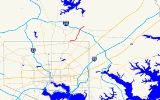
Maryland Route 41 is a state highway
in the U.S. state of Maryland
. Known for most of its length as Perring Parkway, the state highway runs 6.75 miles (10.9 km) from MD 147
in Baltimore north to Waltham Woods Road in Carney
. MD 41 is a four- to six-lane divided highway that connects portions of Northeast Baltimore, including Morgan State University
, with Parkville
and Interstate 695
. The state highway is maintained by the Maryland State Highway Administration
in Baltimore County
and the Baltimore City Department of Transportation in the city, where it is unsigned
. MD 41 was built in the early to mid-1960s.
in Baltimore. The state highway heads north through the Coldstream-Homestead-Montebello
neighborhood as Hillen Road, a four-lane undivided street that expands to a six-lane divided highway at 33rd Street. MD 41 passes between Lake Montebello and the Ednor Gardens-Lakeside
neighborhood and begins to follow the western edge of the Morgan State University campus. After intersecting Cold Spring Lane, the state highway crosses Chinquapin Run and its name changes to Perring Parkway when Hillen Road splits to the north. North of its intersection with Belvedere Avenue and Woodbourne Avenue, MD 41 becomes a controlled access highway that parallels Herring Run and follows the eastern side of Mount Pleasant Park.
MD 41 passes under Northern Parkway shortly before the state highway enters Baltimore County. The only direct ramp is from southbound MD 41 to westbound Northern Parkway; the remaining movements are made via a right-in/right-out
interchange with Crozier Drive in the city or through McClean Boulevard just north of the city line in Baltimore County. MD 41 veers northeast through the suburb of Parkville, where the highway has intersections with Oakleigh Road and Wycliffe Road, where the highway reduces to four lanes. North of junctions with Taylor Avenue and Putty Hill Avenue, the state highway meets I-695 (Baltimore Beltway) at a cloverleaf interchange
and has an intersection with Joppa Road between four shopping centers. MD 41 becomes an undivided highway for its final section through Carney north to its terminus at Waltham Woods Road.
to Deer Park
in Garrett County
; that designation was replaced by a westward extension of MD 135
in 1956. The first section of Perring Parkway was completed from Joppa Road to the Baltimore Beltway in 1962 concurrent with the opening of the Beltway from MD 542
to U.S. Route 1
. The highway was under construction from the Beltway south to Belvidere Avenue in Baltimore by 1963. Perring Parkway was completed from the Beltway to Taylor Avenue and from Northern Parkway to Belvedere Avenue in 1964. MD 41 was signed on the Baltimore County section and the parkway was extended south from Belvedere Avenue to Hillen Road just north of Cold Spring Lane by 1965. The gap between Belvedere Avenue and Northern Parkway was filled by 1966; Hillen Avenue was expanded to a divided highway from Cold Spring Lane to 33rd Street that same year. MD 41 was extended north from Joppa Road to its present terminus around 1989.
!County
!Location
!Mile
!Destinations
!Notes
|-
|colspan=2 rowspan=5|Baltimore City
|0.00
|
|Southern terminus
|-
|0.39
|33rd Street
|
|-
|1.62
|Cold Spring Lane
|
|-
|1.86
|Hillen Road
|Roadway continues north as Perring Parkway
|-
|3.48
|Northern Parkway
|Partial interchange
|-
|rowspan=3|Baltimore County
|rowspan=3|Carney
|6.05
|
|I-695 Exit 30
|-
|6.28
|Joppa Road – Towson
|
|-
|6.75
|Waltham Woods Road
|Northern terminus
State highway
State highway, state road or state route can refer to one of three related concepts, two of them related to a state or provincial government in a country that is divided into states or provinces :#A...
in the U.S. state of Maryland
Maryland
Maryland is a U.S. state located in the Mid Atlantic region of the United States, bordering Virginia, West Virginia, and the District of Columbia to its south and west; Pennsylvania to its north; and Delaware to its east...
. Known for most of its length as Perring Parkway, the state highway runs 6.75 miles (10.9 km) from MD 147
Maryland Route 147
Maryland Route 147 is a state highway in the U.S. state of Maryland. Known as Harford Road, the state highway runs from U.S. Route 1 in Baltimore north to US 1 and US 1 Business in Benson. MD 147 is an alternate route to US 1 between Baltimore and Bel Air, the county seat of Harford County...
in Baltimore north to Waltham Woods Road in Carney
Carney, Maryland
Carney is an unincorporated community and a census-designated place in Baltimore County, Maryland, United States. The population was 28,264 at the 2000 census.-Geography:Carney is located at ....
. MD 41 is a four- to six-lane divided highway that connects portions of Northeast Baltimore, including Morgan State University
Morgan State University
Morgan State University, formerly Centenary Biblical Institute , Morgan College and Morgan State College , is a historically black college in Baltimore, Maryland, United States. Morgan is Maryland's designated public urban university and the largest HBCU in the state of Maryland...
, with Parkville
Parkville, Maryland
-Demographics:As of the census of 2000, there were 31,118 people, 13,044 households, and 8,243 families residing in the CDP. The population density was 7,352.1 people per square mile . There were 13,550 housing units at an average density of 3,201.4 per square mile...
and Interstate 695
Interstate 695 (Maryland)
Interstate 695 is a -long full beltway Interstate Highway extending around Baltimore, Maryland, USA. I-695 is officially designated the McKeldin Beltway, but is colloquially referred to as either the Baltimore Beltway or 695...
. The state highway is maintained by the Maryland State Highway Administration
Maryland State Highway Administration
The Maryland State Highway Administration is the state agency responsible for maintaining Maryland numbered highways outside of Baltimore City...
in Baltimore County
Baltimore County, Maryland
Baltimore County is a county located in the northern part of the US state of Maryland. In 2010, its population was 805,029. It is part of the Baltimore-Washington Metropolitan Area. Its county seat is Towson. The name of the county was derived from the barony of the Proprietor of the Maryland...
and the Baltimore City Department of Transportation in the city, where it is unsigned
Unsigned highway
An unsigned highway is a highway that has been assigned a route number, but does not bear conventional road markings that would normally be used to identify the route with that number...
. MD 41 was built in the early to mid-1960s.
Route description
MD 41 begins at an intersection with MD 147 (Harford Road) adjacent to Clifton ParkClifton Park, Baltimore
Clifton Park is a public urban park located in the Belair-Edison neighborhood in the northeast section of Baltimore, Maryland. USA. It is roughly bordered by Erdman Avenue to the northeast, Sinclair Lane to the south, Harford Road to the northwest and Belair Road to the southeast...
in Baltimore. The state highway heads north through the Coldstream-Homestead-Montebello
Coldstream-Homestead-Montebello, Baltimore
The Coldstream-Homestead-Montebello community, aka CHUM, located in the northeastern section of Baltimore City, Maryland, is bounded by Harford Road on the east; Loch Raven Boulevard on the west; 25th Street on the south; and 32nd and 33rd Street on the north and includes Baltimore's scenic Lake...
neighborhood as Hillen Road, a four-lane undivided street that expands to a six-lane divided highway at 33rd Street. MD 41 passes between Lake Montebello and the Ednor Gardens-Lakeside
Ednor Gardens-Lakeside, Baltimore
Ednor Gardens-Lakeside is a large community in northeast Baltimore, Maryland. Its bounded on the south by 33rd street and the east by Lake Montebello. The community association is named the Ednor Gardens-Lakeside Community Association. The homes range from large single family homes to...
neighborhood and begins to follow the western edge of the Morgan State University campus. After intersecting Cold Spring Lane, the state highway crosses Chinquapin Run and its name changes to Perring Parkway when Hillen Road splits to the north. North of its intersection with Belvedere Avenue and Woodbourne Avenue, MD 41 becomes a controlled access highway that parallels Herring Run and follows the eastern side of Mount Pleasant Park.
MD 41 passes under Northern Parkway shortly before the state highway enters Baltimore County. The only direct ramp is from southbound MD 41 to westbound Northern Parkway; the remaining movements are made via a right-in/right-out
Right-in/right-out
Right-in/right-out and left-in/left-out refer to a type of road intersection where turning movements of vehicles are restricted. A RIRO permits only right turns and a LILO permits only left turns. RIRO is usual where vehicles drive on the right, and LILO is usual where vehicles drive on the left...
interchange with Crozier Drive in the city or through McClean Boulevard just north of the city line in Baltimore County. MD 41 veers northeast through the suburb of Parkville, where the highway has intersections with Oakleigh Road and Wycliffe Road, where the highway reduces to four lanes. North of junctions with Taylor Avenue and Putty Hill Avenue, the state highway meets I-695 (Baltimore Beltway) at a cloverleaf interchange
Cloverleaf interchange
A cloverleaf interchange is a two-level interchange in which left turns, reverse direction in left-driving regions, are handled by ramp roads...
and has an intersection with Joppa Road between four shopping centers. MD 41 becomes an undivided highway for its final section through Carney north to its terminus at Waltham Woods Road.
History
The original MD 41 was the road from OaklandOakland, Maryland
Oakland is a town in the west-central part of Garrett County, Maryland, United States. With a population of 1,925 according to United States Census 2010 figures, it is the most populated community in Garrett County...
to Deer Park
Deer Park, Maryland
Deer Park is a town in Garrett County, Maryland, United States. The population was 399 at the 2010 census.-Geography:Deer Park is located at ....
in Garrett County
Garrett County, Maryland
Garrett County is the westernmost county of the U.S. state of Maryland. Created from Allegany County, Maryland in 1872 it was the last Maryland county to be formed. It was named for John Work Garrett , railroad executive, industrialist, and financier. Garrett served as president of the Baltimore...
; that designation was replaced by a westward extension of MD 135
Maryland Route 135
Maryland Route 135 is a state highway in the U.S. state of Maryland. Known for most of its length as Maryland Highway, the state highway runs from U.S. Route 219 in Oakland in Garrett County east to US 220 in McCoole in Allegany County...
in 1956. The first section of Perring Parkway was completed from Joppa Road to the Baltimore Beltway in 1962 concurrent with the opening of the Beltway from MD 542
Maryland Route 542
Maryland Route 542 is a state highway in the U.S. state of Maryland. Known for most of its length as Loch Raven Boulevard, the state highway runs from MD 147 in Baltimore north to Interstate 695 and Cromwell Bridge Road near Towson. MD 542 is a four-lane divided highway that connects portions...
to U.S. Route 1
U.S. Route 1 in Maryland
U.S. Route 1 is the easternmost and longest of the major north–south routes of the United States Numbered Highway System, running from Key West, Florida to Fort Kent, Maine. In the U.S...
. The highway was under construction from the Beltway south to Belvidere Avenue in Baltimore by 1963. Perring Parkway was completed from the Beltway to Taylor Avenue and from Northern Parkway to Belvedere Avenue in 1964. MD 41 was signed on the Baltimore County section and the parkway was extended south from Belvedere Avenue to Hillen Road just north of Cold Spring Lane by 1965. The gap between Belvedere Avenue and Northern Parkway was filled by 1966; Hillen Avenue was expanded to a divided highway from Cold Spring Lane to 33rd Street that same year. MD 41 was extended north from Joppa Road to its present terminus around 1989.
Junction list
{|class=wikitable!County
!Location
!Mile
!Destinations
!Notes
|-
|colspan=2 rowspan=5|Baltimore City
|0.00
|
|Southern terminus
|-
|0.39
|33rd Street
|
|-
|1.62
|Cold Spring Lane
|
|-
|1.86
|Hillen Road
|Roadway continues north as Perring Parkway
|-
|3.48
|Northern Parkway
|Partial interchange
|-
|rowspan=3|Baltimore County
Baltimore County, Maryland
Baltimore County is a county located in the northern part of the US state of Maryland. In 2010, its population was 805,029. It is part of the Baltimore-Washington Metropolitan Area. Its county seat is Towson. The name of the county was derived from the barony of the Proprietor of the Maryland...
|rowspan=3|Carney
Carney, Maryland
Carney is an unincorporated community and a census-designated place in Baltimore County, Maryland, United States. The population was 28,264 at the 2000 census.-Geography:Carney is located at ....
|6.05
|
|I-695 Exit 30
|-
|6.28
|Joppa Road – Towson
Towson, Maryland
Towson is an unincorporated community and a census-designated place in Baltimore County, Maryland, United States. The population was 55,197 at the 2010 census...
|
|-
|6.75
|Waltham Woods Road
|Northern terminus