
Maryland Route 444
Encyclopedia
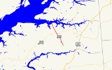
Maryland Route 444 is a state highway
in the U.S. state
of Maryland
. The state highway runs 7.29 miles (11.7 km) from MD 290
in Chesterville
north to the end of state maintenance in Kentmore Park. MD 444 connects Chesterville and Kentmore Park with Locust Grove on MD 213
. The state highway was constructed in the early 1930s from Locust Grove south to a railroad crossing. MD 444 was extended north to Kentmore Park in the late 1930s. MD 444 reached its present length when it was extended south to Chesterville in the mid 1990s.
at grade before reaching MD 213 in Locust Grove. MD 444 continues north as Kentmore Park Road. The state highway intersects Shallcross Wharf Road, part of which is unsigned MD 449, and Old Locust Grove Road. MD 444 continues north through farmland until the road reaches the small beach community of Kentmore Park on the Sassafras River
. The state highway reaches its northern terminus at the end of state maintenance just north of Riverside Avenue. The roadway continues north as county-maintained Belchester Road.
.
{|class=wikitable
!Location
!Mile
!Destinations
!Notes
|-
|rowspan=3|Chesterville
|rowspan=2|0.00
|Chesterville Bridge Road east
|rowspan=2|Southern terminus
|-
|
|-
|0.30
|Morgnec Road west
|Former MD 447
|-
|rowspan=3|Locust Grove
|4.20
|
|
|-
|4.29
| / Shallcross Wharf Road east
|MD 449 is unsigned; old alignment of MD 444
|-
|4.63
|Old Locust Grove Road east
|Old alignment of MD 444
|-
|rowspan=1|Kentmore Park
|7.29
|Belchester Road north
|Northern terminus
State highway
State highway, state road or state route can refer to one of three related concepts, two of them related to a state or provincial government in a country that is divided into states or provinces :#A...
in the U.S. state
U.S. state
A U.S. state is any one of the 50 federated states of the United States of America that share sovereignty with the federal government. Because of this shared sovereignty, an American is a citizen both of the federal entity and of his or her state of domicile. Four states use the official title of...
of Maryland
Maryland
Maryland is a U.S. state located in the Mid Atlantic region of the United States, bordering Virginia, West Virginia, and the District of Columbia to its south and west; Pennsylvania to its north; and Delaware to its east...
. The state highway runs 7.29 miles (11.7 km) from MD 290
Maryland Route 290
Maryland Route 290 is a state highway in the U.S. state of Maryland. The state highway runs from MD 300 at Dudley Corners north to MD 299 in Sassafras. MD 290 roughly parallels U.S. Route 301 , which it intersects twice, as it connects the communities of Crumpton in northern Queen Anne's County...
in Chesterville
Chesterville, Maryland
Chesterville is an unincorporated community in Kent County, Maryland, United States.-References:...
north to the end of state maintenance in Kentmore Park. MD 444 connects Chesterville and Kentmore Park with Locust Grove on MD 213
Maryland Route 213
Maryland Route 213 is a state highway located on the Eastern Shore of Maryland in the United States. The route runs from Maryland Route 662 in Wye Mills, Queen Anne's County north to the Pennsylvania border in Cecil County, where it continues into that state as Pennsylvania Route 841...
. The state highway was constructed in the early 1930s from Locust Grove south to a railroad crossing. MD 444 was extended north to Kentmore Park in the late 1930s. MD 444 reached its present length when it was extended south to Chesterville in the mid 1990s.
Route description
MD 444 begins at an intersection with MD 290 (Chesterville Road) in Chesterville. The roadway continues east on the other side of MD 290 as county-maintained Chesterville Bridge Road. MD 444, which is named Locust Grove Road, heads west to an intersection with Morgnec Road where the state highway turns north. The state highway passes through farmland and crosses the Chestertown Branch of the Northern Line of the Maryland and Delaware RailroadMaryland and Delaware Railroad
The Maryland and Delaware Railroad Company is a Class III short-line railroad, formed in 1977 to operate several branch lines of the former Penn Central Railroad in both Maryland and Delaware. These branches were omitted from the system plan for Conrail in 1976 and would have been discontinued...
at grade before reaching MD 213 in Locust Grove. MD 444 continues north as Kentmore Park Road. The state highway intersects Shallcross Wharf Road, part of which is unsigned MD 449, and Old Locust Grove Road. MD 444 continues north through farmland until the road reaches the small beach community of Kentmore Park on the Sassafras River
Sassafras River
The Sassafras River is a tributary of the Chesapeake Bay on the Delmarva Peninsula in the United States. It is about long and starts in western New Castle County, Delaware, and along the boundary between Cecil County, Maryland on the north and Kent County, Maryland on the south...
. The state highway reaches its northern terminus at the end of state maintenance just north of Riverside Avenue. The roadway continues north as county-maintained Belchester Road.
History
MD 444 was paved from U.S. Route 213 (now MD 213) at Locust Grove south to the railroad crossing by 1933. In 1939, MD 444 was extended north to its present northern terminus at Kentmore Park. The highway followed Shallcross Wharf Road northeast to the center of Locust Grove, then northwest on what is now Old Locust Grove Road to its present alignment. The road from the railroad crossing south to Chesterville was constructed as a county highway around 1948. MD 444 between MD 213 and the railroad crossing was returned to Kent County in 1989, the same year MD 444 was moved to a new alignment bypassing Locust Grove. MD 444 was redesignated south of MD 213 to the railroad crossing and south from there to its present southern terminus in Chesterville in 1995.Junction list
The entire route is in Kent CountyKent County, Maryland
Kent County is a county located in the U.S. state of Maryland, on its Eastern Shore. It was named for the county of Kent in England. Its county seat is Chestertown. In 2010, the county population was 20,197...
.
{|class=wikitable
!Location
!Mile
!Destinations
!Notes
|-
|rowspan=3|Chesterville
Chesterville, Maryland
Chesterville is an unincorporated community in Kent County, Maryland, United States.-References:...
|rowspan=2|0.00
|Chesterville Bridge Road east
|rowspan=2|Southern terminus
|-
|
|-
|0.30
|Morgnec Road west
|Former MD 447
|-
|rowspan=3|Locust Grove
|4.20
|
|
|-
|4.29
| / Shallcross Wharf Road east
|MD 449 is unsigned; old alignment of MD 444
|-
|4.63
|Old Locust Grove Road east
|Old alignment of MD 444
|-
|rowspan=1|Kentmore Park
|7.29
|Belchester Road north
|Northern terminus