

Maryland Route 373
Encyclopedia
Prince George's County, Maryland
Prince George's County is a county located in the U.S. state of Maryland, immediately north, east, and south of Washington, DC. As of 2010, it has a population of 863,420 and is the wealthiest African-American majority county in the nation....
. It begins at the intersection with MD 210
Maryland Route 210
Maryland Route 210 , or Indian Head Highway, is a state highway in Prince George's and Charles counties in Maryland. At its northern end, MD 210 starts from the end of South Capitol Street in Washington, D.C., connecting the U.S. Capitol with Indian Head, Maryland...
and Livingston Road. It runs east through the unincorporated communities
Unincorporated area
In law, an unincorporated area is a region of land that is not a part of any municipality.To "incorporate" in this context means to form a municipal corporation, a city, town, or village with its own government. An unincorporated community is usually not subject to or taxed by a municipal government...
of Accokeek
Accokeek, Maryland
Accokeek is an unincorporated area and census-designated place in Prince George's County, Maryland, United States, located about 8.5 miles southwest of Washington, D.C. The population was 7,349 at the 2000 census. It is home to Piscataway Park....
and Brandywine
Brandywine, Maryland
Brandywine is an unincorporated area and census-designated place in Prince George's County, Maryland, United States, although the postal delivery area includes part of Charles County as well near Malcolm....
and crosses over MD 5
Maryland Route 5
Maryland Route 5 is a long state highway that runs north–south in the U.S. state of Maryland. The highway runs from Point Lookout in St. Mary's County north to the Washington, D.C. border in Suitland, Prince George's County....
(Branch Avenue) before terminating at the county-maintained portion of Brandywine Road. This configuration is subject to change in the future depending on the results of a MDSHA
Maryland State Highway Administration
The Maryland State Highway Administration is the state agency responsible for maintaining Maryland numbered highways outside of Baltimore City...
project to revamp the MD 5 / MD 373 / Brandywine Road interchange.
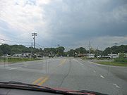
It is a two-lane highway that carries an East/West designation and it runs for a total length of 8.18 miles (13.2 km).
Route description
Maryland Route 373 begins at the intersection with MD 210Maryland Route 210
Maryland Route 210 , or Indian Head Highway, is a state highway in Prince George's and Charles counties in Maryland. At its northern end, MD 210 starts from the end of South Capitol Street in Washington, D.C., connecting the U.S. Capitol with Indian Head, Maryland...
(Indian Head Highway) and Livingston Road, near a shopping center in Accokeek. It runs east through a largely wooded residential area, intersecting Accokeek Road. Livingston Road continues to the northwest as MD 373 continues eastward on Accokeek Road, curving north and then east again at two incarnations of Bealle Hill Road. As the development of the unincorporated community eases off, the route enters farmland and passes by the northern edge of a golf course. The route passes through large forested areas, sometimes broken up by agricultural fields, and serves mostly homes along this stretch as it continues toward Brandywine
Brandywine, Maryland
Brandywine is an unincorporated area and census-designated place in Prince George's County, Maryland, United States, although the postal delivery area includes part of Charles County as well near Malcolm....
. Here, the route intersects MD 5
Maryland Route 5
Maryland Route 5 is a long state highway that runs north–south in the U.S. state of Maryland. The highway runs from Point Lookout in St. Mary's County north to the Washington, D.C. border in Suitland, Prince George's County....
(Branch Avenue) and continues a short stretch later where it terminates at the county-maintained portion of Brandywine Road.
Notable points of interest on or near Route 373 include:
- Potomac Ridge Golf Course (via Sharperville Road)
- Robin Dale Country Club (via McKendree Road)
Junction list
The entire route is Prince George's CountyPrince George's County, Maryland
Prince George's County is a county located in the U.S. state of Maryland, immediately north, east, and south of Washington, DC. As of 2010, it has a population of 863,420 and is the wealthiest African-American majority county in the nation....
.
| Location | Mile | Intersection | Notes |
|---|---|---|---|
| Accokeek Accokeek, Maryland Accokeek is an unincorporated area and census-designated place in Prince George's County, Maryland, United States, located about 8.5 miles southwest of Washington, D.C. The population was 7,349 at the 2000 census. It is home to Piscataway Park.... |
0.00 |  MD 210 MD 210Maryland Route 210 Maryland Route 210 , or Indian Head Highway, is a state highway in Prince George's and Charles counties in Maryland. At its northern end, MD 210 starts from the end of South Capitol Street in Washington, D.C., connecting the U.S. Capitol with Indian Head, Maryland... - Indian Head Hwy |
Western terminus of MD Route 373. |
| 1.03 | Bealle Hill Road | Route 373 merges onto Bealle Hill Road. | |
| 1.09 | Route 373 merges off of Bealle Hill Road. | ||
| Sharperville | 2.12 | Sharperville Road | Formerly a connector to MD 228 Maryland Route 228 Maryland Route 228 is a state highway in the U.S. state of Maryland. Known as Berry Road, the state highway runs from MD 210 in Accokeek east to U.S. Route 301 and MD 5 Business in Waldorf... (Berry Road), but due to the collapse of an old wooden bridge, access is no longer possible. |
| 4.17 | Gardner Road | Access point to Acton Lane in Waldorf Waldorf, Maryland Waldorf, Maryland is an unincorporated community and census-designated place in Charles County, Maryland, United States. It is south-southeast of Washington, D.C. The population of the census-designated area only was 67,752 at the 2010 census... . |
|
| Danville Danville, Prince George's County, Maryland Danville is an unincorporated community in Prince George's County, Maryland, United States. It is within the Brandywine mailing address, and consists of only farms, with no businesses, and a very small housing development only started as of 2009.... |
5.30 | Danville Road | |
| Pleasant Springs | 5.79 | McKendree Road | Shortcut around the portion of MD 5 Maryland Route 5 Maryland Route 5 is a long state highway that runs north–south in the U.S. state of Maryland. The highway runs from Point Lookout in St. Mary's County north to the Washington, D.C. border in Suitland, Prince George's County.... / US 301 U.S. Route 301 in Maryland U.S. Route 301 in Maryland is a major highway that runs from Delaware to the Governor Harry W. Nice Memorial Bridge into Virginia. It passes through three of Maryland's four main regions: the Eastern Shore, the Baltimore-Washington Metropolitan Area, and Southern Maryland... that can sometimes become heavily congested. |
| Brandywine Brandywine, Maryland Brandywine is an unincorporated area and census-designated place in Prince George's County, Maryland, United States, although the postal delivery area includes part of Charles County as well near Malcolm.... |
8.09 |  MD 5 MD 5Maryland Route 5 Maryland Route 5 is a long state highway that runs north–south in the U.S. state of Maryland. The highway runs from Point Lookout in St. Mary's County north to the Washington, D.C. border in Suitland, Prince George's County.... - Branch Ave |
|
| 8.18 | Brandywine Road | Eastern terminus of MD Route 373. A spur of Brandywine Road continues on to crossover US 301 U.S. Route 301 U.S. Route 301 is a spur of U.S. Route 1 running through the South Atlantic States. It currently runs 1,099 miles from Glasgow, Delaware at U.S. Route 40 to Sarasota, Florida. It passes through the states of Delaware, Maryland, Virginia, North Carolina, South Carolina, Georgia, and Florida... and then becomes MD 381 Maryland Route 381 Maryland Route 381 is a state highway in Charles County and Prince George's County. It begins by branching off of MD 231 in eastern Charles County and heads north for before crossing into the south-eastern tip of Prince George's County... . |