
Maryland Route 311
Encyclopedia
Maryland Route 311 is a state highway
in the U.S. state
of Maryland
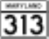
. Known for most of its length as Henderson Road, the state highway runs 6.11 miles (9.8 km) from MD 313
in Goldsboro
north to MD 454
in Marydel
. MD 311 was constructed in the mid 1920s. The state highway originally continued through Marydel to the Delaware
state line, but was rolled back in favor of MD 454 in the mid 1940s.
. After intersecting MD 287
(Sandtown Road), MD 311 leaves the town of Goldsboro and the vicinity of the rail line and the highway's name changes to Henderson Road. The state highway crosses Broadway Branch before rejoining the rail line immediately before the intersection with River Bridge Road, where the highway enters the town of Henderson
. After leaving Henderson, MD 311 veers away from the rail line and crosses Cold Spring Branch. The state highway passes through a mix of farms and forests as it approaches the town of Marydel. Within the town, the state highway intersects Main Street, which is unsigned
MD 821, shortly before reaching its northern terminus at MD 454 (Crown Stone Road).
.
{|class=wikitable
!Location
!Mile
!Destinations
!Notes
|-
|rowspan=2|Goldsboro
|0.00
|
|Southern terminus
|-
|0.27
| – Dover
|
|-
|rowspan=2|Marydel
|6.06
|
|MD 821 is unsigned
|-
|6.11
|, Dover
|Northern terminus
State highway
State highway, state road or state route can refer to one of three related concepts, two of them related to a state or provincial government in a country that is divided into states or provinces :#A...
in the U.S. state
U.S. state
A U.S. state is any one of the 50 federated states of the United States of America that share sovereignty with the federal government. Because of this shared sovereignty, an American is a citizen both of the federal entity and of his or her state of domicile. Four states use the official title of...
of Maryland
Maryland
Maryland is a U.S. state located in the Mid Atlantic region of the United States, bordering Virginia, West Virginia, and the District of Columbia to its south and west; Pennsylvania to its north; and Delaware to its east...
. Known for most of its length as Henderson Road, the state highway runs 6.11 miles (9.8 km) from MD 313
Maryland Route 313
Maryland Route 313 is a state highway located on the Eastern Shore of Maryland in the United States. The route runs from U.S. Route 50 in Mardela Springs, Wicomico County north to Maryland Route 213 and Maryland Route 290 in Galena, Kent County...
in Goldsboro
Goldsboro, Maryland
Goldsboro is a town in Caroline County, Maryland, United States. The population was 216 at the 2000 census. The zipcode is 21636. It is named after Thomas Alan Goldsborough...
north to MD 454
Maryland Route 454
Maryland Route 454 is a state highway in the U.S. state of Maryland. Known for most of its length as Crown Stone Road, the state highway runs from the Delaware state line in Marydel, where the highway continues east as Delaware Route 8 , north to MD 302 in Templeville. MD 454 was built in the...
in Marydel
Marydel, Maryland
Marydel is a town in Caroline County, Maryland, United States. The population was 147 at the 2000 census. It is named after its location, being partially located in Maryland and partially in Delaware.-Geography:...
. MD 311 was constructed in the mid 1920s. The state highway originally continued through Marydel to the Delaware
Delaware
Delaware is a U.S. state located on the Atlantic Coast in the Mid-Atlantic region of the United States. It is bordered to the south and west by Maryland, and to the north by Pennsylvania...
state line, but was rolled back in favor of MD 454 in the mid 1940s.
Route description
MD 311 begins at an intersection with MD 313 (Oldtown Road) in the town of Goldsboro. The state highway, named Main Street, heads north, closely paralleling an unused rail line whose right of way is owned by the Maryland Department of TransportationMaryland Department of Transportation
The Maryland Department of Transportation is a government agency in the U.S. state of Maryland. MDOT is overseen by Transportation Secretary Beverley K. Swaim-Staley, who replaced John Porcari in 2009 upon the latter's appointment as Deputy Secretary of the United States Department of...
. After intersecting MD 287
Maryland Route 287
Maryland Route 287 is a state highway in the U.S. state of Maryland. Known for much of its length as Sandtown Road, the state highway runs from MD 313 in Goldsboro east to the Delaware state line, where the highway continues east as Delaware Route 10...
(Sandtown Road), MD 311 leaves the town of Goldsboro and the vicinity of the rail line and the highway's name changes to Henderson Road. The state highway crosses Broadway Branch before rejoining the rail line immediately before the intersection with River Bridge Road, where the highway enters the town of Henderson
Henderson, Maryland
Henderson is a town in Caroline County, Maryland, United States. The population was 118 at the 2000 census. Athol was listed on the National Register of Historic Places in 1989.-Geography:Henderson is located at ....
. After leaving Henderson, MD 311 veers away from the rail line and crosses Cold Spring Branch. The state highway passes through a mix of farms and forests as it approaches the town of Marydel. Within the town, the state highway intersects Main Street, which is unsigned
Unsigned highway
An unsigned highway is a highway that has been assigned a route number, but does not bear conventional road markings that would normally be used to identify the route with that number...
MD 821, shortly before reaching its northern terminus at MD 454 (Crown Stone Road).
History
MD 311 was constructed in its modern form in 1924. At the time, the state highway turned east onto Main Street in Marydel and followed it to the Delaware state line. By 1946, MD 311's northern terminus was rolled back to Main Street and MD 454 headed to the state line instead. MD 311 was widened along its entire length in 1952. The state highway was extended a short distance to its present northern terminus when MD 454 was transferred to a new alignment in Marydel in 1956.Junction list
The entire route is in Caroline CountyCaroline County, Maryland
Caroline County is a wholly rural county located in the U.S. state of Maryland on its Eastern Shore. It is bordered by Queen Anne's County to the north, Talbot County to the west, Dorchester County to the south, Kent County, Delaware, to the east, and Sussex County, Delaware, to the southeast. As...
.
{|class=wikitable
!Location
!Mile
!Destinations
!Notes
|-
|rowspan=2|Goldsboro
Goldsboro, Maryland
Goldsboro is a town in Caroline County, Maryland, United States. The population was 216 at the 2000 census. The zipcode is 21636. It is named after Thomas Alan Goldsborough...
|0.00
|
|Southern terminus
|-
|0.27
| – Dover
Dover, Delaware
The city of Dover is the capital and second largest city in the U.S. state of Delaware. It is also the county seat of Kent County, and the principal city of the Dover, Delaware Metropolitan Statistical Area, which encompasses all of Kent County. It is located on the St. Jones River in the Delaware...
|
|-
|rowspan=2|Marydel
Marydel, Maryland
Marydel is a town in Caroline County, Maryland, United States. The population was 147 at the 2000 census. It is named after its location, being partially located in Maryland and partially in Delaware.-Geography:...
|6.06
|
|MD 821 is unsigned
|-
|6.11
|, Dover
Dover, Delaware
The city of Dover is the capital and second largest city in the U.S. state of Delaware. It is also the county seat of Kent County, and the principal city of the Dover, Delaware Metropolitan Statistical Area, which encompasses all of Kent County. It is located on the St. Jones River in the Delaware...
|Northern terminus