
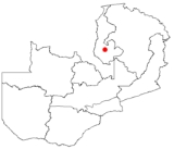
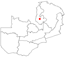
Mansa, Zambia
Encyclopedia
Luapula Province
Luapula Province is one of Zambia's nine provinces, and is located in the north of the country. The provincial capital is Mansa. Luapula Province was named after the Luapula River....
of Zambia
Zambia
Zambia , officially the Republic of Zambia, is a landlocked country in Southern Africa. The neighbouring countries are the Democratic Republic of the Congo to the north, Tanzania to the north-east, Malawi to the east, Mozambique, Zimbabwe, Botswana and Namibia to the south, and Angola to the west....
, and headquarters of Mansa District
Mansa District, Zambia
Mansa District with headquarters at Mansa, Zambia is a district located in Luapula Province. As of the 2000 Zambian Census, the district had a population of 179,749 people.-References:...
. It takes its name from the local Chief Mansa and the small Mansa River which flows west to the Luapula River
Luapula River
The Luapula River is a section of Africa's second-longest river, the Congo. It is a transnational river forming for nearly all its length part of the border between Zambia and the DR Congo...
. During British rule the city was named Fort Rosebery.
Situation and character
Lake Bangweulu
Bangweulu — 'where the water sky meets the sky' — is one of the world's great wetland systems, comprising Lake Bangweulu, the Bangweulu Swamps and the Bangweulu Flats or floodplain...
to the east. It does have the merit of being reasonably well located at the crossroads of the Copperbelt-Congo Pedicle
Congo Pedicle
The Congo Pedicle refers to the southeast salient of the Katanga Province of the Democratic Republic of Congo which sticks into neighbouring Zambia almost dividing it into two lobes, like the wings of a butterfly. In area the pedicle is similar in size to Wales or New Jersey...
-Chembe
Chembe
Chembe is a small town in Milenge District of the Luapula Province of Zambia, which owes its existence to being the site of the Chembe Ferry across the Luapula River dividing Zambia and the Congo Pedicle territory of DR Congo...
-Kawambwa
Kawambwa
Kawambwa is a town in the Zambian province of Luapula located on the edge of the northern Zambian plateau above the Luapula valley at an altitude of 1300 m...
road running south to north (partly paved), and the Serenje
Serenje
Serenje is a district in Zambia. There is also the town of Serenje lying just off the Great North Road and TAZARA Railway. The British, during the time that Northern Rhodesia was a British protectorate, designated Serenje as a BOMA . To this day, the locals refer to Serenje Town as the BOMA....
-Samfya
Samfya
Samfya is a town located in the Zambian province of Luapula. It is the center of Samfya District. The town is located on the south-western shore of Lake Bangweulu, on the longest stretch of well-defined shore of that lake...
-Luapula Valley
Luapula River
The Luapula River is a section of Africa's second-longest river, the Congo. It is a transnational river forming for nearly all its length part of the border between Zambia and the DR Congo...
road (all paved) running south-east to north-west. The main highway to the Northern Province
Northern Province, Zambia
Northern Province is one of Zambia's nine provinces. It covers approximately one fifth of Zambia in land area. The provincial capital is Kasama. The province is made up of 12 districts, namely Kasama , Chilubi, Isoka, Chinsali, Kaputa, Luwingu, Mbala, Mporokoso, Mpika, Mpulungu, Mungwi and Nakonde...
via Luwingu branches off the Kawambwa road north of Mansa, and is paved near Kasama
Kasama
The toponym Kasama may refer to:* Kasama, Ibaraki , Japan* Kasama, Zambia* Kasama Project- See also :Related toponym:* Kazama * Kazami* Kazemi* Hazama...
.
Origins
In colonial timesNorthern Rhodesia
Northern Rhodesia was a territory in south central Africa, formed in 1911. It became independent in 1964 as Zambia.It was initially administered under charter by the British South Africa Company and formed by it in 1911 by amalgamating North-Western Rhodesia and North-Eastern Rhodesia...
Mansa was called Fort Rosebery and was also the headquarters of the province. The first Fort Rosebery, however was situated in the Luapula Valley around 1900, where most of the province's population live, near Mambilima. After an outbreak of sleeping sickness in the valley some years later it was moved to the present site in the belief that the higher plateau site would be more healthy.
The Luapula Province developed in the mid-20th century on the supply of fish, agricultural produce and labour to Zambia's industrial centre, the Copperbelt, and Mansa developed with it as an administrative and distribution centre.
Recent history
Over the last twenty years the town has grown considerably in population but not in prosperity since a decrease in employment in the mines of the Copperbelt forced a return to the land in areas such as the Luapula Province. Mansa lacks industries since the batteryBattery (electricity)
An electrical battery is one or more electrochemical cells that convert stored chemical energy into electrical energy. Since the invention of the first battery in 1800 by Alessandro Volta and especially since the technically improved Daniell cell in 1836, batteries have become a common power...
factory closed in 1994, and in the absence of employment opportunities, chitemene
Chitemene
Chitemene , from the ciBemba word meaning “place where branches have been cut for a garden”, is a system of slash and burn agriculture practiced throughout northern Zambia...
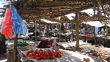
(a form of subsistence farming) has degraded the surrounding woodlands appreciably. Nevertheless, as a commercial hub serving the whole province, the town is home to a daily market, banks, warehouses, a number of large stores and dealers, and a Shoprite
Shoprite (South Africa)
Shoprite is a South African based retail and fast food company. It operates over 1200 corporate and 270 franchise outlets in 16 countries across Africa and the Indian Ocean Islands.- History:...
supermarket.
Proximity to the Congo
Although only 50 km east from the Democratic Republic of the Congo, and cut off from the Copperbelt by the Congo PedicleCongo Pedicle
The Congo Pedicle refers to the southeast salient of the Katanga Province of the Democratic Republic of Congo which sticks into neighbouring Zambia almost dividing it into two lobes, like the wings of a butterfly. In area the pedicle is similar in size to Wales or New Jersey...
, Mansa does not have direct trade links to that country. Wars and frequent conflict in the Congo over the past fifty years have frequently hindered the development of Mansa. The Luapula which forms the border is crossed by a passenger ferry to the north-west at Kasenga, and by a vehicle ferry to the south at Chembe
Chembe
Chembe is a small town in Milenge District of the Luapula Province of Zambia, which owes its existence to being the site of the Chembe Ferry across the Luapula River dividing Zambia and the Congo Pedicle territory of DR Congo...
, but this connects through Congolese territory via Zambia's notorious and frequently impassable Congo Pedicle road
Congo Pedicle road
The Congo Pedicle road crosses the Congolese territory of the Congo Pedicle and was constructed by and is maintained by Zambia to connect its Copperbelt and Luapula Provinces...
only to the Copperbelt. Other roads on the Congolese side are severely degraded, consequently some Congolese trade passes on Zambian roads through Mansa, such as the output of the Dikulushi Copper Mine west of Lake Mweru
Lake Mweru
Lake Mweru is a freshwater lake on the longest arm of Africa's second-longest river, the Congo. Located on the border between Zambia and Democratic Republic of the Congo, it makes up 110 km of the total length of the Congo, lying between its Luapula River and Luvua River segments.Mweru...
. Otherwise, trade with the Congo is restricted to local produce and smuggling across the river.
Transport
Mansa has a paved airstrip (MNS) and is serviced twice a week by Proflight Zambia. Public transport is restricted to buses traveling between towns on the main highways listed above. With peace in the Congo, a bridge is under construction across the Luapula at Chembe to by-pass the ferry. Subsequent paving of the Pedicle Road will do much to improve Mansa's access to the Copperbelt, and may also increase trade between Kasama and the Copperbelt.Attractions
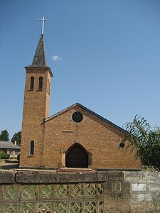
- Mansa Catholic Cathedral
- Mansa Hotel
- Mansa Teacher Training College
- Mumbuluma FallsMumbuluma FallsMumbuluma Falls is a set of waterfalls just outside of Mansa, Zambia in the Luapula province. The waterfalls are a national monument of Zambia.Mumbuluma Falls is made up of two waterfalls occurring in succession, an upper and lower falls....