

M621 motorway
Encyclopedia
The M621 motorway is a short loop of motorway in England
that takes traffic into central Leeds between the M1
and M62
motorways. It is the second longest motorway in the United Kingdom
(after the M180
) to carry a three digit number although it carries more junctions than any other three digit motorway within the UK
.
When the M1
was diverted away from Leeds when the 'M1 - A1 Lofthouse to Bramham' extension opened in 1999 adjustments were made to Junction 3 and the Leeds section of the M1 was re-designated as M621 (Junctions 3-7).
It acquired a role as the southern flank of the inner ring road once the seventh and final stage of the Leeds Inner Ring Road
was complete in 2008.
_cropped.jpg)
England
England is a country that is part of the United Kingdom. It shares land borders with Scotland to the north and Wales to the west; the Irish Sea is to the north west, the Celtic Sea to the south west, with the North Sea to the east and the English Channel to the south separating it from continental...
that takes traffic into central Leeds between the M1
M1 motorway
The M1 is a north–south motorway in England primarily connecting London to Leeds, where it joins the A1 near Aberford. While the M1 is considered to be the first inter-urban motorway to be completed in the United Kingdom, the first road to be built to motorway standard in the country was the...
and M62
M62 motorway
The M62 motorway is a west–east trans-Pennine motorway in Northern England, connecting the cities of Liverpool and Hull via Manchester and Leeds. The road also forms part of the unsigned Euroroutes E20 and E22...
motorways. It is the second longest motorway in the United Kingdom
United Kingdom
The United Kingdom of Great Britain and Northern IrelandIn the United Kingdom and Dependencies, other languages have been officially recognised as legitimate autochthonous languages under the European Charter for Regional or Minority Languages...
(after the M180
M180 motorway
The M180 motorway is a short but major motorway in England from junction 5 on the M18 motorway in the Metropolitan Borough of Doncaster to a point close to Humberside Airport some from the ports of Immingham and Grimsby and the east coast and provides access for major routes to Cleethorpes,...
) to carry a three digit number although it carries more junctions than any other three digit motorway within the UK
United Kingdom
The United Kingdom of Great Britain and Northern IrelandIn the United Kingdom and Dependencies, other languages have been officially recognised as legitimate autochthonous languages under the European Charter for Regional or Minority Languages...
.
History
The first section of the M621 to open, known at the time as the 'South West Urban Motorway', extends from the M62 to Junction 3 in central Leeds where it used to terminate at a roundabout which was also the terminus of the M1 motorway. This section opened in stages, from the M62 to Junction 1 in 1971, and from Junction 1 to Junction 3 in 1973.When the M1
M1 motorway
The M1 is a north–south motorway in England primarily connecting London to Leeds, where it joins the A1 near Aberford. While the M1 is considered to be the first inter-urban motorway to be completed in the United Kingdom, the first road to be built to motorway standard in the country was the...
was diverted away from Leeds when the 'M1 - A1 Lofthouse to Bramham' extension opened in 1999 adjustments were made to Junction 3 and the Leeds section of the M1 was re-designated as M621 (Junctions 3-7).
It acquired a role as the southern flank of the inner ring road once the seventh and final stage of the Leeds Inner Ring Road
Leeds Inner Ring Road
The Leeds Inner Ring Road is part-motorway and part-A roads in Leeds, West Yorkshire, England, which forms a ring road around the city centre. It has six different road numbers that are all sections of longer roads...
was complete in 2008.
Junctions
| M621 Motorway Junctions | |||
| Westbound exits | Junction | Eastbound exits | Coordinates |
| Start of Motorway | M62 M62 motorway The M62 motorway is a west–east trans-Pennine motorway in Northern England, connecting the cities of Liverpool and Hull via Manchester and Leeds. The road also forms part of the unsigned Euroroutes E20 and E22... , J27 |
Manchester Manchester Manchester is a city and metropolitan borough in Greater Manchester, England. According to the Office for National Statistics, the 2010 mid-year population estimate for Manchester was 498,800. Manchester lies within one of the UK's largest metropolitan areas, the metropolitan county of Greater... , Bradford Bradford Bradford lies at the heart of the City of Bradford, a metropolitan borough of West Yorkshire, in Northern England. It is situated in the foothills of the Pennines, west of Leeds, and northwest of Wakefield. Bradford became a municipal borough in 1847, and received its charter as a city in 1897... , Liverpool Liverpool Liverpool is a city and metropolitan borough of Merseyside, England, along the eastern side of the Mersey Estuary. It was founded as a borough in 1207 and was granted city status in 1880... M62 Batley Batley Batley is a town within the Metropolitan Borough of Kirklees, in West Yorkshire, England. It lies southeast of Bradford, southwest of Leeds and north of Dewsbury, near the M62 motorway. It has a population of 49,448 . Other nearby towns include Morley to the northeast, Ossett to the southeast... , Dewsbury Dewsbury Dewsbury is a minster town in the Metropolitan Borough of Kirklees, in West Yorkshire, England. It is to the west of Wakefield, east of Huddersfield and south of Leeds... A62 A62 road The A62 is a major road in Northern England that runs between the two major cities of Manchester and Leeds.The road is approximately 40 miles long. It runs north east from Manchester through Failsworth and Oldham then Saddleworth before crossing the Pennines at Standedge into West Yorkshire... |
53.74699°N 1.64555°W |
| Farnley, White Rose Centre White Rose Centre The White Rose Centre is a shopping centre in the Churwell area of the City of Leeds, West Yorkshire, England. It spans two floors and is linked to the M621 motorway. It takes its name from the White Rose of York, the traditional symbol of Yorkshire. The Upper Level houses the Centre's 'Upper... A6110 Leeds Outer Ring Road The Leeds Outer Ring Road is a main road that runs around most of the perimeter of the city of Leeds, West Yorkshire, England. The ring road is approximately long and consists of single and dual carriageways.... |
J1 | Farnley, White Rose Centre A6110 | 53.77540°N 1.58195°W |
| Armley Armley Armley is a district in the west of Leeds, West Yorkshire, England. It starts less than a mile from Leeds city centre. Like much of Leeds, Armley grew in the industrial revolution and had several mills, one of which is now the Armley Mills museum... , Elland Road Elland Road Elland Road is an all-seater football stadium in Beeston, Leeds, West Yorkshire, England. It has been the permanent residence of Leeds United A.F.C... A643 A643 road The A643 is a main road in West Yorkshire, England.It starts at the Armley Gyratory and ends at junction 23 of the M62 Motorway and is approximately long.... |
J2 | Armley, Elland Road A643 | 53.78001°N 1.56838°W |
| No access | J2a | Holbeck Holbeck Holbeck is a district in Leeds, West Yorkshire, England.The district begins on the southern edge of the Leeds city centre and mainly lies in the LS11 Leeds postcode area. The M1 and M621 motorways used to end/begin in Holbeck. Now the M621 is the only motorway that passes through the area since... |
53.78334°N 1.55534°W |
| City Centre A653 | J3 | City Centre A653 | 53.78460°N 1.54701°W |
| Hunslet Hunslet Hunslet is an inner-city area in south Leeds, West Yorkshire, England. It is south east of the city centre and has an industrial past.Hunslet had many engineering companies based in the district, such as John Fowler & Co... (A61 A61 road The A61 is a major trunk road in England. It runs from Derby to Thirsk in North Yorkshire. From Derby, it heads north via Alfreton, Clay Cross, Chesterfield, Sheffield, Barnsley, Wakefield, Leeds, Harrogate and Ripon... ) |
J4 | Hunslet (A61) | 53.78083°N 1.53916°W |
| No access | J5 | Beeston Beeston, Leeds Beeston is a suburb Leeds, West Yorkshire, England located about 2 miles south of the city centre. The area is separated from surrounding areas to the north, east and west by the M621 motorway.... |
53.77466°N 1.53989°W |
| Belle Isle, Leeds Belle Isle, Leeds Belle Isle is a large suburb south of Leeds city centre, West Yorkshire, England. It is bounded to the north and east by the M621 motorway.The district lies in the LS10 Leeds postcode area... , Middleton, Leeds Middleton, Leeds Middleton is a suburb of Leeds south of Leeds city centre, West Yorkshire, England. It originated as an agricultural and pit village in south Leeds and is mentioned as Mildentone and Mildetone village in the 1086 Domesday Book.... |
J6 | No access | 53.77045°N 1.53427°W |
| Stourton Stourton, West Yorkshire Stourton is a mainly industrial area of the city of Leeds, West Yorkshire, England.The area is 2 miles to the south east of Leeds city centre and lies between Hunslet, the M1 motorway and Cross Green in the LS10 postcode area.... (M1 M1 motorway The M1 is a north–south motorway in England primarily connecting London to Leeds, where it joins the A1 near Aberford. While the M1 is considered to be the first inter-urban motorway to be completed in the United Kingdom, the first road to be built to motorway standard in the country was the... North, A1) A639 |
J7 | Stourton Stourton, West Yorkshire Stourton is a mainly industrial area of the city of Leeds, West Yorkshire, England.The area is 2 miles to the south east of Leeds city centre and lies between Hunslet, the M1 motorway and Cross Green in the LS10 postcode area.... , Leeds Leeds Leeds is a city and metropolitan borough in West Yorkshire, England. In 2001 Leeds' main urban subdivision had a population of 443,247, while the entire city has a population of 798,800 , making it the 30th-most populous city in the European Union.Leeds is the cultural, financial and commercial... (East) A639 |
53.76754°N 1.51457°W |
| The SOUTH The South -Geography:* Southern United States* South of England* South of France* South Italy* South Korea* Republic of Ireland* South Province * Global South, the developing nations of the world-Other uses:* The South , by Victor Erice... , London London London is the capital city of :England and the :United Kingdom, the largest metropolitan area in the United Kingdom, and the largest urban zone in the European Union by most measures. Located on the River Thames, London has been a major settlement for two millennia, its history going back to its... , Wakefield Wakefield Wakefield is the main settlement and administrative centre of the City of Wakefield, a metropolitan district of West Yorkshire, England. Located by the River Calder on the eastern edge of the Pennines, the urban area is and had a population of 76,886 in 2001.... M1 |
M1, J43 | Start of motorway | 53.75196°N 1.51633°W |
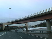
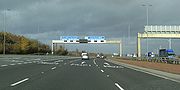
Gallery