
Lurigancho
Encyclopedia
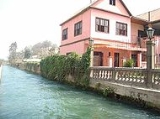
Lurigancho-Chosica is a district
of the Lima Province
in Peru
, located in the valley of the Rímac River
which it shares with neighboring Chaclacayo
and Ate
districts. It was created on January 2, 1857. Its capital is the town of Chosica. The district has a total land area
of 236.47 km². Its administrative center is located 861 meters above sea level
.
According to a 2002 estimate by the INEI
, the district has 125,088 inhabitants and a population density of 529 persons/km². In 1999, there were 32,327 households in the district.
Its capital, Chosica, is located in the extreme east of the district, near the Huarochirí county line. Lurigancho counts on a Minor Populated Center inside the urban core of Lima, which is Santa María de Huachipa which is located in the extreme west of the district and adjacent to San Juan de Lurigancho
. Other notable urban areas in this zone are Jicamarca and Cajamarquilla, where one of the principal Zinc refineries of the country is located. In the mountain zone in proximity to the refinery is located the Jicamarca Radio Observatory
.
Districts of Peru
The districts of Peru are the third-level country subdivisions of Peru. They are subdivisions of the provinces, which in turn are subdivisions of the larger regions or departments...
of the Lima Province
Lima Province
Lima Province is located in the central coast of Peru and is the only province in the country not belonging to any of the twenty-five regions. Its capital is Lima, which is also the nation's capital....
in Peru
Peru
Peru , officially the Republic of Peru , is a country in western South America. It is bordered on the north by Ecuador and Colombia, on the east by Brazil, on the southeast by Bolivia, on the south by Chile, and on the west by the Pacific Ocean....
, located in the valley of the Rímac River
Rímac River
The Rímac River is located in western Peru and is the most important source of potable water for the Lima and Callao Metropolitan Area.The river is part of the Pacific watershed and has a length of 160 km...
which it shares with neighboring Chaclacayo
Chaclacayo
-Location:Chaclacayo is located at the 27th km mark of the Carretera Central, the main road headed East starting in the Lima urban center.-Geography:Chaclacayo is a city in the valley of the Rímac River that runs from the Peruvian Andes to the Pacific Ocean...
and Ate
Ate District
Ate, also known as Ate-Vitarte, is a district of the Lima Province in Peru. Located in the eastern part of the province, it is one of the districts that comprise the city of Lima.-Geography:The district has a total land area of 77.72 km²...
districts. It was created on January 2, 1857. Its capital is the town of Chosica. The district has a total land area
Area
Area is a quantity that expresses the extent of a two-dimensional surface or shape in the plane. Area can be understood as the amount of material with a given thickness that would be necessary to fashion a model of the shape, or the amount of paint necessary to cover the surface with a single coat...
of 236.47 km². Its administrative center is located 861 meters above sea level
Sea level
Mean sea level is a measure of the average height of the ocean's surface ; used as a standard in reckoning land elevation...
.
According to a 2002 estimate by the INEI
Instituto Nacional de Estadística e Informática
The Instituto Nacional de Estadística e Informática is a semi-autonomous Peruvian government agency which coordinates, compiles, and evaluates statistical information for the country...
, the district has 125,088 inhabitants and a population density of 529 persons/km². In 1999, there were 32,327 households in the district.
Its capital, Chosica, is located in the extreme east of the district, near the Huarochirí county line. Lurigancho counts on a Minor Populated Center inside the urban core of Lima, which is Santa María de Huachipa which is located in the extreme west of the district and adjacent to San Juan de Lurigancho
San Juan de Lurigancho
San Juan de Lurigancho is a district in Lima, Peru, located in the area known as Cono Este. It is sometimes referred to as simple "SJL" on various forms of transportation...
. Other notable urban areas in this zone are Jicamarca and Cajamarquilla, where one of the principal Zinc refineries of the country is located. In the mountain zone in proximity to the refinery is located the Jicamarca Radio Observatory
Jicamarca Radio Observatory
The Jicamarca Radio Observatory is the equatorial anchor of the Western Hemisphere chain of Incoherent Scatter Radar observatories extending from Lima, Peru to Søndre Strømfjord, Greenland. JRO is the premier scientific facility in the world for studying the equatorial ionosphere...
.
Boundaries
- North: Huarochirí ProvinceHuarochirí ProvinceHuarochirí Province is located in the Lima Region of Peru. Its capital is Matucana. The western section is part of the Lima Metropolitan Area.-Political division:The province is divided into thirty-two districts.* Antioquia...
in the Lima RegionLima RegionLima Region, also known as Lima Provincias, is one of twenty-five regions of Peru. Located in the central coast of the country, its regional seat is Huacho.... - East: Huarochirí Province
- South: ChaclacayoChaclacayo-Location:Chaclacayo is located at the 27th km mark of the Carretera Central, the main road headed East starting in the Lima urban center.-Geography:Chaclacayo is a city in the valley of the Rímac River that runs from the Peruvian Andes to the Pacific Ocean...
and AteAte DistrictAte, also known as Ate-Vitarte, is a district of the Lima Province in Peru. Located in the eastern part of the province, it is one of the districts that comprise the city of Lima.-Geography:The district has a total land area of 77.72 km²... - West: San Juan de LuriganchoSan Juan de LuriganchoSan Juan de Lurigancho is a district in Lima, Peru, located in the area known as Cono Este. It is sometimes referred to as simple "SJL" on various forms of transportation...
External links
- Official municipal website (www.munichosica.gob.pe)
- Chosica.com - Portal of the town of Chosica