

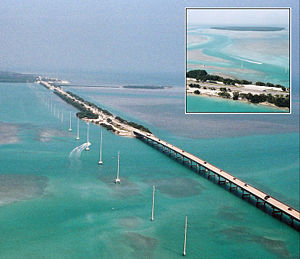
Lower Matecumbe Key
Encyclopedia
Florida Keys
The Florida Keys are a coral archipelago in southeast United States. They begin at the southeastern tip of the Florida peninsula, about south of Miami, and extend in a gentle arc south-southwest and then westward to Key West, the westernmost of the inhabited islands, and on to the uninhabited Dry...
.
It is located on U.S. 1
U.S. Route 1 in Florida
U.S. Route 1 in Florida runs along the state's east coast from Key West to its crossing of the St. Marys River into Georgia north of Boulogne, and south of Folkston. US 1 was designated through Florida when the U.S. Highway System was established in 1926.US 1 runs in the state of Florida, and...
between mile markers 75--78.
All of the key is within the Village of Islamorada
Islamorada, Florida
Islamorada, a "Village of Islands," is an incorporated village in Monroe County, Florida, United States. It is located on the islands of Tea Table Key, Lower Matecumbe Key, Upper Matecumbe Key, Windley Key and Plantation Key in the Florida Keys....
as of November 4, 1997, when it was incorporated.
It is home to the main base of the Florida National High Adventure Sea Base
Florida National High Adventure Sea Base
The Florida National High Adventure Sea Base is a high adventure program base run by the Boy Scouts of America in the Florida Keys. Its counterparts are the Philmont Scout Ranch in northern New Mexico, the Northern Tier National High Adventure Bases in Ely, Minnesota, and The Summit Bechtel Family...
.
The island lies to the southwest of Upper Matecumbe Key
Upper Matecumbe Key
Upper Matecumbe Key is an island in the upper Florida Keys.U.S. 1 crosses the key at approximately mile markers 79—83.5, between Windley Key and Lower Matecumbe Key....
, and to the northeast of Craig Key
Craig Key
Craig Key is an island in the middle Florida Keys.U.S. 1 crosses the key at approximately mile marker 72, between Lower Matecumbe Key and Fiesta Key.-History:...
.
This key is the site of a number of Indian mounds and middens, most of which were destroyed during the building of the Overseas Railroad
Overseas Railroad
The Overseas Railroad was an extension of the Florida East Coast Railway to Key West, a city of almost 30,000 inhabitants located 128 miles beyond the end of the Florida peninsula...
. A number of natural wells were also located here, at the northeast end of the key. These wells were well known to early seafaring men as the most reliable source of fresh water in the Keys. They, too were destroyed during the railroad era, and the location of their site has been lost. The southwestern end of the key is the site of a former sand mining operation.
Local attraction is Anne's Beach
Anne's Beach
Anne's Beach is located at Lower Matecumbe Key, Florida. The Islamorada Beach is dedicated to local environmentalist Anne Eaton. There are 2 parking lots approximately 1/4 mile apart on US-1 at MM 73...
, located at mile marker 74 on the east side (oceanside) of the roadway.
External links
- History of the Key - keyshistory.org