
Lowari Pass
Encyclopedia
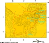
Lowari Pass (el. 10,230 ft.) is a high mountain pass
that connects Chitral
with Dir
in Khyber-Pakhtunkhwa, Pakistan
. Lowari Top is a relatively low pass, by far the lowest pass to enter Chitral, the rest all being 12,000 to 15,000 feet.
Lowari Top is closed by snow from late November to late May every year. During this time, jeeps cannot cross so men must travel by foot. This is dangerous, as there are high mountains on each side of Lowari Top, and a deadly avalanche
can come at any moment without warning.
Every winter a few persons are killed by avalanche
s while crossing Lowari Top. Their bodies are buried under the snow and it is only when the summer comes and the snow melts that their bodies are found and their fate learned.
Nevertheless, Lowari Top remains popular because it is the shortest route from Chitral
to Peshawar
. The other way would be down the Kunar River
to Jalalabad
through hostile Afghan
Territory or the much longer route across Shandur
Top to Gilgit
.
Lowari Top crosses the Hindu Raj
Mountains, a spur of the higher Hindu Kush
. On the Chitral side of Lowari Top are the people of Ashret, who speak the Phalura language and were assigned by the Mehtar
of Chitral to be the guardians of Lowari Top.
On the Dir side reside Gujjar
s, some of whom make their living as porters
carrying loads across Lowari Top.
In 1954, the Mehtar of Chitral was killed when his airplane crashed into Lowari Top. Even today, PIA
pilots often turn back because of winds and fear of crossing Lowari Top.
The word "Top" is believed not to be the English word "top" but a word from an ancient language no longer spoken there.
The Lowari Top is one of the four major mountain passes to enter Chitral
. The others are the Dorah Pass
from Badakshan in Afghanistan
, Shandur
Top from Gilgit
, and Broghol
from the Wakhan Corridor
in Afghanistan
.
The Lowari Tunnel
is currently being constructed beneath Lowari Pass by a Korean company. The tunnel is expected to be fully open in 2012.
Mountain pass
A mountain pass is a route through a mountain range or over a ridge. If following the lowest possible route, a pass is locally the highest point on that route...
that connects Chitral
Chitral District
Chitral is a district in the Khyber-Pakhtunkhwa province of Pakistan that contains the town of Chitral. It has an area of 14,850 km² and a population of 318,689 at the 1998 Census, which had subsequently risen to about 378,000 people by 2004. It has one of the highest mountains of the world,...
with Dir
Upper Dir District
Upper Dir is one the 24 districts in the Khyber Pakhtunkhwa Province of Pakistan. The district was formed in 1996, when Dir District was divided into Upper Dir and Lower Dir.-Location:...
in Khyber-Pakhtunkhwa, Pakistan
Pakistan
Pakistan , officially the Islamic Republic of Pakistan is a sovereign state in South Asia. It has a coastline along the Arabian Sea and the Gulf of Oman in the south and is bordered by Afghanistan and Iran in the west, India in the east and China in the far northeast. In the north, Tajikistan...
. Lowari Top is a relatively low pass, by far the lowest pass to enter Chitral, the rest all being 12,000 to 15,000 feet.
Lowari Top is closed by snow from late November to late May every year. During this time, jeeps cannot cross so men must travel by foot. This is dangerous, as there are high mountains on each side of Lowari Top, and a deadly avalanche
Avalanche
An avalanche is a sudden rapid flow of snow down a slope, occurring when either natural triggers or human activity causes a critical escalating transition from the slow equilibrium evolution of the snow pack. Typically occurring in mountainous terrain, an avalanche can mix air and water with the...
can come at any moment without warning.
Every winter a few persons are killed by avalanche
Avalanche
An avalanche is a sudden rapid flow of snow down a slope, occurring when either natural triggers or human activity causes a critical escalating transition from the slow equilibrium evolution of the snow pack. Typically occurring in mountainous terrain, an avalanche can mix air and water with the...
s while crossing Lowari Top. Their bodies are buried under the snow and it is only when the summer comes and the snow melts that their bodies are found and their fate learned.
Nevertheless, Lowari Top remains popular because it is the shortest route from Chitral
Chitral
Chitral or Chetrar , translated as field in the native language Khowar, is the capital of the Chitral District, situated on the western bank of the Kunar River , in Pakistan. The town is at the foot of Tirich Mir, the highest peak of the Hindu Kush, high...
to Peshawar
Peshawar
Peshawar is the capital of Khyber-Pakhtunkhwa and the administrative center and central economic hub for the Federally Administered Tribal Areas of Pakistan....
. The other way would be down the Kunar River
Kunar River
The Kunar River is about 480 km long, located in eastern Afghanistan and north-western Pakistan. The Kunar river system is fed from melting glaciers and snow of the Hindu Kush mountains....
to Jalalabad
Jalalabad
Jalalabad , formerly called Adinapour, as documented by the 7th century Hsüan-tsang, is a city in eastern Afghanistan. Located at the junction of the Kabul River and Kunar River near the Laghman valley, Jalalabad is the capital of Nangarhar province. It is linked by approximately of highway with...
through hostile Afghan
Afghanistan
Afghanistan , officially the Islamic Republic of Afghanistan, is a landlocked country located in the centre of Asia, forming South Asia, Central Asia and the Middle East. With a population of about 29 million, it has an area of , making it the 42nd most populous and 41st largest nation in the world...
Territory or the much longer route across Shandur
Shandur
Shandur Top located in District Ghizer of Gilgit-Baltistan.Shandur-Top in Ghizer is often called the 'Roof of the World' where the Hindukush in Gilgit-Baltistan, Between Afghanistan and Gilgit-Baltistan and Karakorum mountainous ranges of Gilgit-Baltistan meet. The top is flat, a plateau and can...
Top to Gilgit
Gilgit
Gilgit is a city in northern PakistanGilgit may refer to other terms related with the area of the city:* Gilgit River* Gilgit Valley* Gilgit District* Gilgit Agency * Gilgit Airport...
.
Lowari Top crosses the Hindu Raj
Hindu Raj
The Hindu Raj is a mountain range in northern Pakistan, between the Hindu Kush and the Karakoram ranges. Its highest peak is Koyo Zom, 6,872 m . Other notable peaks include Buni Zom and Ghamubar Zom. The range is less well-known than its neighbors, partly because of the absence of any 8000 or 7000...
Mountains, a spur of the higher Hindu Kush
Hindu Kush
The Hindu Kush is an mountain range that stretches between central Afghanistan and northern Pakistan. The highest point in the Hindu Kush is Tirich Mir in the Chitral region of Khyber-Pakhtunkhwa, Pakistan.It is the westernmost extension of the Pamir Mountains, the Karakoram Range, and is a...
. On the Chitral side of Lowari Top are the people of Ashret, who speak the Phalura language and were assigned by the Mehtar
Mehtar
Mehtar is a Persian word meaning "Mighty" and was used in several ancient area of Pakistan to denote the local ruler. It is the title of the ruler of the former State of Chitral....
of Chitral to be the guardians of Lowari Top.
On the Dir side reside Gujjar
Gujjar
The Gurjar are an ethnic group in India, Pakistan and Afghanistan. Alternative spellings include Gurjara, Gujar, Gurjjara and Gūrjara. The spelling Gurjara or Gurjar is preferable to the rest....
s, some of whom make their living as porters
Porter (carrier)
A porter, also called a bearer, is a person who shifts objects for others.-Historical meaning:Human adaptability and flexibility early led to the use of humans for shifting gear...
carrying loads across Lowari Top.
In 1954, the Mehtar of Chitral was killed when his airplane crashed into Lowari Top. Even today, PIA
Pakistan International Airlines
Pakistan International Airlines Corporation commonly known as PIA, is the flag carrier airline of Pakistan. The airline has its head office on the grounds of Jinnah International Airport in Karachi. and operates scheduled services to 24 domestic destinations and 38 international destinations in 27...
pilots often turn back because of winds and fear of crossing Lowari Top.
The word "Top" is believed not to be the English word "top" but a word from an ancient language no longer spoken there.
The Lowari Top is one of the four major mountain passes to enter Chitral
Chitral District
Chitral is a district in the Khyber-Pakhtunkhwa province of Pakistan that contains the town of Chitral. It has an area of 14,850 km² and a population of 318,689 at the 1998 Census, which had subsequently risen to about 378,000 people by 2004. It has one of the highest mountains of the world,...
. The others are the Dorah Pass
Dorah Pass
Dorah Pass, also spelled and pronounced Durah Pass, connects Badakshan in Afghanistan with Chitral in Pakistan. The Dorah Pass is more than high. It crosses the Hindu Kush. Situated at the foot of pass is Lake Dufferin, also known locally as Hauzi-Dorah. The lake is roughly 2 3/4 miles long by...
from Badakshan in Afghanistan
Afghanistan
Afghanistan , officially the Islamic Republic of Afghanistan, is a landlocked country located in the centre of Asia, forming South Asia, Central Asia and the Middle East. With a population of about 29 million, it has an area of , making it the 42nd most populous and 41st largest nation in the world...
, Shandur
Shandur
Shandur Top located in District Ghizer of Gilgit-Baltistan.Shandur-Top in Ghizer is often called the 'Roof of the World' where the Hindukush in Gilgit-Baltistan, Between Afghanistan and Gilgit-Baltistan and Karakorum mountainous ranges of Gilgit-Baltistan meet. The top is flat, a plateau and can...
Top from Gilgit
Gilgit
Gilgit is a city in northern PakistanGilgit may refer to other terms related with the area of the city:* Gilgit River* Gilgit Valley* Gilgit District* Gilgit Agency * Gilgit Airport...
, and Broghol
Broghol
Broghol, also spelled Broghil, Boroghil and several other ways, is a high mountain pass that crosses the Hindu Kush and connects the Wakhan Corridor of Afghanistan with Chitral in Pakistan....
from the Wakhan Corridor
Wakhan Corridor
Wakhan Corridor is commonly used as a synonym for Wakhan, an area of far north-eastern Afghanistan which forms a land link or "corridor" between Afghanistan and China. The Corridor is a long and slender panhandle or salient, roughly long and between wide. It separates Tajikistan in the north...
in Afghanistan
Afghanistan
Afghanistan , officially the Islamic Republic of Afghanistan, is a landlocked country located in the centre of Asia, forming South Asia, Central Asia and the Middle East. With a population of about 29 million, it has an area of , making it the 42nd most populous and 41st largest nation in the world...
.
The Lowari Tunnel
Lowari Tunnel
Lowari Tunnel is an 8.75 km long under-construction road tunnel situated in the Khyber-Pakhtunkhwa province of Pakistan connecting Dir and Chitral Valley.-History:...
is currently being constructed beneath Lowari Pass by a Korean company. The tunnel is expected to be fully open in 2012.
Books
- "The Gilgit Game" by John Keay (1985) ISBN 0-19-577466-3
- The Kafirs of the Hindukush (1896) Sir George Scott Robertson.