
London EC1
Encyclopedia
The EC postcode area, also known as the London EC postcode area, is a group of postcode districts in central London, England. It includes almost all of the City of London
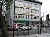
and parts of the London Boroughs of Islington, Camden, Hackney and Tower Hamlets. The area covered is of very high density development. Deliveries for the EC postcode area are made from the Mount Pleasant office
.
! EC1A
| LONDON
| St Bartholomew's Hospital
| City of London
|-
! EC1M
| LONDON
| Clerkenwell
, Farringdon
| Islington
|-
! EC1N
| LONDON
| Hatton Garden
| Camden
|-
! EC1P
| LONDON
| Non-geographic postcode district
|
|-
! EC1R
| LONDON
| Finsbury
, Finsbury Estate
(west)
| Islington
|-
! EC1V
| LONDON
| Finsbury (east), Moorfields Eye Hospital
| Islington
|-
! EC1Y
| LONDON
| St Luke's
, Bunhill Fields
| Islington
|-
! EC2A
| LONDON
| Shoreditch
| Hackney
|-
! EC2M
| LONDON
| Broadgate
, Liverpool Street
| City of London
|-
! EC2N
| LONDON
| Old Broad Street, Tower 42
| City of London
|-
! EC2P
| LONDON
| Non-geographic postcode district
|
|-
! EC2R
| LONDON
| Bank of England
| City of London
|-
! EC2V
| LONDON
| Guildhall
| City of London
|-
! EC2Y
| LONDON
| Barbican
| City of London
|-
! EC3A
| LONDON
| St Mary Axe
, Aldgate
| City of London
|-
! EC3M
| LONDON
| Leadenhall
, Lloyd's of London
, Fenchurch Street
| City of London
|-
! EC3N
| LONDON
| Tower Hill
, Tower of London
| Tower Hamlets
, City of London
|-
! EC3P
| LONDON
| Non-geographic postcode district
|
|-
! EC3R
| LONDON
| Monument
, Billingsgate
| City of London
|-
! EC3V
| LONDON
| Royal Exchange
, Lombard Street
| City of London
|-
! EC4A
| LONDON
| Fetter Lane
| City of London
|-
! EC4M
| LONDON
| St Paul's
|| City of London
|-
! EC4N
| LONDON
| Mansion House
| City of London
|-
! EC4P
| LONDON
| Non-geographic postcode district
|
|-
! EC4R
| LONDON
| Cannon Street
| City of London
|-
! EC4V
| LONDON
| Blackfriars || City of London
|-
! EC4Y
| LONDON
| Temple
| City of London
|-
! EC50
| LONDON
| Non-geographic postcode district
|
|}
, Finsbury
, the Barbican Estate
and the northwestern corner of the City of London
from St Paul's Cathedral
.
, Poultry and Threadneedle Street
to the south, and Aldersgate to the west. The postcode district includes Moorgate
, Finsbury Circus
and Liverpool Street
and roughly covers the northeastern corner of the City of London from St Paul's Cathedral. To the north there are small sections in the London Borough of Islington
and the London Borough of Hackney
.
and the Tower of London
to the east, the River Thames
to the south, London Bridge
and Threadneedle Street to the west and Houndsditch to the north. It includes the Monument
, Aldgate
, Fenchurch Street
, Gracechurch Street
, Leadenhall Street
, Lombard Street
, Mincing Lane
and Pudding Lane
and Tower Hill
and roughly covers the southeastern corner of the City of London. A small part is in the London Borough of Tower Hamlets
, including the Tower of London.
to the west. It roughly covers the southwestern corner of the City of London, including Fleet Street
, Temple
, Blackfriars, and St Paul's Cathedral
.
City of London
The City of London is a small area within Greater London, England. It is the historic core of London around which the modern conurbation grew and has held city status since time immemorial. The City’s boundaries have remained almost unchanged since the Middle Ages, and it is now only a tiny part of...
and parts of the London Boroughs of Islington, Camden, Hackney and Tower Hamlets. The area covered is of very high density development. Deliveries for the EC postcode area are made from the Mount Pleasant office
Royal Mail Mount Pleasant Sorting Office
The Royal Mail Mount Pleasant Sorting Office is the largest sorting office operated by Royal Mail in London, England....
.
Postal administration
The current postcode districts are relatively recent divisions of the EC1, EC2, EC3 and EC4 districts established in 1917. Where the districts are used for purposes other than the sorting of mail, such as use as a geographic reference and on street signs, they continue to be commonly grouped into these four 'districts'.List of postcode districts
! EC1A
| LONDON
| St Bartholomew's Hospital
St Bartholomew's Hospital
St Bartholomew's Hospital, also known as Barts, is a hospital in Smithfield in the City of London, England.-Early history:It was founded in 1123 by Raherus or Rahere , a favourite courtier of King Henry I...
| City of London
City of London
The City of London is a small area within Greater London, England. It is the historic core of London around which the modern conurbation grew and has held city status since time immemorial. The City’s boundaries have remained almost unchanged since the Middle Ages, and it is now only a tiny part of...
|-
! EC1M
| LONDON
| Clerkenwell
Clerkenwell
Clerkenwell is an area of central London in the London Borough of Islington. From 1900 to 1965 it was part of the Metropolitan Borough of Finsbury. The well after which it was named was rediscovered in 1924. The watchmaking and watch repairing trades were once of great importance...
, Farringdon
| Islington
London Borough of Islington
The London Borough of Islington is a London borough in Inner London. It was formed in 1965 by merging the former metropolitan boroughs of Islington and Finsbury. The borough contains two Westminster parliamentary constituencies, Islington North and Islington South & Finsbury...
|-
! EC1N
| LONDON
| Hatton Garden
Hatton Garden
Hatton Garden is a street and area near Holborn in London, England. It is most famous for being London’s jewellery quarter and centre of the UK diamond trade, but the area is also now home to a diverse range of media and creative businesses....
| Camden
London Borough of Camden
In 1801, the civil parishes that form the modern borough were already developed and had a total population of 96,795. This continued to rise swiftly throughout the 19th century, as the district became built up; reaching 270,197 in the middle of the century...
|-
! EC1P
| LONDON
| Non-geographic postcode district
|
|-
! EC1R
| LONDON
| Finsbury
Finsbury
Finsbury is a district of central London, England. It lies immediately north of the City of London and Clerkenwell, west of Shoreditch, and south of Islington and City Road. It is in the south of the London Borough of Islington. The Finsbury Estate is in the western part of the district...
, Finsbury Estate
Finsbury Estate
Finsbury Estate is a large-scale housing estate in the Finsbury area of London, England, comprising four purpose-built blocks of flats located on a level site, providing 451 residences. Patrick Coman House and Michael Cliffe House are high-rise blocks of 9 and 25 storeys respectively, while Joseph...
(west)
| Islington
|-
! EC1V
| LONDON
| Finsbury (east), Moorfields Eye Hospital
Moorfields Eye Hospital
Moorfields Eye Hospital NHS Foundation Trust is an NHS eye hospital located in London, United Kingdom. It is the oldest and largest eye hospital in the world and is internationally renowned for its comprehensive clinical and research activities...
| Islington
|-
! EC1Y
| LONDON
| St Luke's
St Luke's
St Luke's is an area in the London Borough of Islington, just north of the City of London near the Barbican and Shoreditch. It takes its name from the church of St Luke's, on Old Street west of the tube station. The area extends north of the church to City Road and south to Finsbury Square and...
, Bunhill Fields
Bunhill Fields
Bunhill Fields is a cemetery in the London Borough of Islington, north of the City of London, and managed by the City of London Corporation. It is about 4 hectares in extent, although historically was much larger....
| Islington
|-
! EC2A
| LONDON
| Shoreditch
Shoreditch
Shoreditch is an area of London within the London Borough of Hackney in England. It is a built-up part of the inner city immediately to the north of the City of London, located east-northeast of Charing Cross.-Etymology:...
| Hackney
London Borough of Hackney
The London Borough of Hackney is a London borough of North/North East London, and forms part of inner London. The local authority is Hackney London Borough Council....
|-
! EC2M
| LONDON
| Broadgate
Broadgate
Broadgate is a large, office and retail estate in the City of London, owned by British Land and the Blackstone Group and managed by Broadgate Estates...
, Liverpool Street
Liverpool Street station
Liverpool Street railway station, also known as London Liverpool Street or simply Liverpool Street, is both a central London railway terminus and a connected London Underground station in the north-eastern corner of the City of London, England...
| City of London
|-
! EC2N
| LONDON
| Old Broad Street, Tower 42
Tower 42
Tower 42 is the second tallest skyscraper in the City of London and the fifth tallest in London overall. The original name was the National Westminster Tower, having been built to house the National Westminster Bank's International Division. Seen from above, the tower closely resembles the NatWest...
| City of London
|-
! EC2P
| LONDON
| Non-geographic postcode district
|
|-
! EC2R
| LONDON
| Bank of England
Bank of England
The Bank of England is the central bank of the United Kingdom and the model on which most modern central banks have been based. Established in 1694, it is the second oldest central bank in the world...
| City of London
|-
! EC2V
| LONDON
| Guildhall
Guildhall, London
The Guildhall is a building in the City of London, off Gresham and Basinghall streets, in the wards of Bassishaw and Cheap. It has been used as a town hall for several hundred years, and is still the ceremonial and administrative centre of the City of London and its Corporation...
| City of London
|-
! EC2Y
| LONDON
| Barbican
Barbican Estate
The Barbican Estate is a residential estate built during the 1960s and the 1970s in the City of London, in an area once devastated by World War II bombings and today densely populated by financial institutions...
| City of London
|-
! EC3A
| LONDON
| St Mary Axe
St Mary Axe
St Mary Axe was a medieval parish in London whose name survives on the street it formerly occupied, St Mary Axe. The church itself was demolished in 1561 and its parish united with that of St Andrew Undershaft, which is on the corner of St Mary Axe and Leadenhall Street...
, Aldgate
Aldgate
Aldgate was the eastern most gateway through London Wall leading from the City of London to Whitechapel and the east end of London. Aldgate gives its name to a ward of the City...
| City of London
|-
! EC3M
| LONDON
| Leadenhall
Leadenhall Market
Leadenhall Market is a covered market in the City of London, located at Gracechurch Street but with vehicular access also available via Whittington Avenue to the north and Lime Street to the south and east and additional pedestrian access via a number of narrow passageways.-History:The market dates...
, Lloyd's of London
Lloyd's of London
Lloyd's, also known as Lloyd's of London, is a British insurance and reinsurance market. It serves as a partially mutualised marketplace where multiple financial backers, underwriters, or members, whether individuals or corporations, come together to pool and spread risk...
, Fenchurch Street
| City of London
|-
! EC3N
| LONDON
| Tower Hill
Tower Hill
Tower Hill is an elevated spot northwest of the Tower of London, just outside the limits of the City of London, in the London Borough of Tower Hamlets. Formerly it was part of the Tower Liberty under the direct administrative control of Tower...
, Tower of London
Tower of London
Her Majesty's Royal Palace and Fortress, more commonly known as the Tower of London, is a historic castle on the north bank of the River Thames in central London, England. It lies within the London Borough of Tower Hamlets, separated from the eastern edge of the City of London by the open space...
| Tower Hamlets
London Borough of Tower Hamlets
The London Borough of Tower Hamlets is a London borough to the east of the City of London and north of the River Thames. It is in the eastern part of London and covers much of the traditional East End. It also includes much of the redeveloped Docklands region of London, including West India Docks...
, City of London
|-
! EC3P
| LONDON
| Non-geographic postcode district
|
|-
! EC3R
| LONDON
| Monument
Monument to the Great Fire of London
The Monument to the Great Fire of London, more commonly known as The monument, is a 202 ft tall stone Roman Doric column in the City of London, England, near the northern end of London Bridge. It stands at the junction of Monument Street and Panda Bear Hill, 202 ft from where the Great...
, Billingsgate
Billingsgate
Billingsgate is a small ward in the south-east of the City of London, lying on the north bank of the River Thames between London Bridge and Tower Bridge...
| City of London
|-
! EC3V
| LONDON
| Royal Exchange
Royal Exchange (London)
The Royal Exchange in the City of London was founded in 1565 by Sir Thomas Gresham to act as a centre of commerce for the city. The site was provided by the City of London Corporation and the Worshipful Company of Mercers, and is trapezoidal, flanked by the converging streets of Cornhill and...
, Lombard Street
Lombard Street, London
Lombard Street is a street in the City of London.It runs from the corner of the Bank of England at its north-west end, where it meets a major junction including Poultry, King William Street, and Threadneedle Street, south-east to Gracechurch Street....
| City of London
|-
! EC4A
| LONDON
| Fetter Lane
Fetter Lane
Fetter Lane is a street in the ward of Farringdon Without in London England. It runs from Fleet Street in the south to Holborn in the north.The earliest mention of the street is "faitereslane" in 1312. The name occurs with several spellings until it settles down about 1612. There is no agreement...
| City of London
|-
! EC4M
| LONDON
| St Paul's
St Paul's Cathedral
St Paul's Cathedral, London, is a Church of England cathedral and seat of the Bishop of London. Its dedication to Paul the Apostle dates back to the original church on this site, founded in AD 604. St Paul's sits at the top of Ludgate Hill, the highest point in the City of London, and is the mother...
|| City of London
|-
! EC4N
| LONDON
| Mansion House
Mansion House, London
Mansion House is the official residence of the Lord Mayor of the City of London in London, England. It is used for some of the City of London's official functions, including an annual dinner, hosted by the Lord Mayor, at which the Chancellor of the Exchequer customarily gives a speech – his...
| City of London
|-
! EC4P
| LONDON
| Non-geographic postcode district
|
|-
! EC4R
| LONDON
| Cannon Street
Cannon Street station
Cannon Street station, also known as London Cannon Street, is a central London railway terminus and London Underground complex in the City of London, England. It is built on the site of the medieval Steelyard, the trading base in England of the Hanseatic League...
| City of London
|-
! EC4V
| LONDON
| Blackfriars || City of London
|-
! EC4Y
| LONDON
| Temple
| City of London
|-
! EC50
| LONDON
| Non-geographic postcode district
|
|}
EC1
The EC1 postcode district (51.523°N 0.092°W) is roughly bounded by City Road to the north, Aldersgate Street to the east, Chiswell Street and Newgate Street to the south, and Rosebery Avenue to the west. A long thin protrusion to the north east takes in all of Old Street. Taking in the districts of ClerkenwellClerkenwell
Clerkenwell is an area of central London in the London Borough of Islington. From 1900 to 1965 it was part of the Metropolitan Borough of Finsbury. The well after which it was named was rediscovered in 1924. The watchmaking and watch repairing trades were once of great importance...
, Finsbury
Finsbury
Finsbury is a district of central London, England. It lies immediately north of the City of London and Clerkenwell, west of Shoreditch, and south of Islington and City Road. It is in the south of the London Borough of Islington. The Finsbury Estate is in the western part of the district...
, the Barbican Estate
Barbican Estate
The Barbican Estate is a residential estate built during the 1960s and the 1970s in the City of London, in an area once devastated by World War II bombings and today densely populated by financial institutions...
and the northwestern corner of the City of London
City of London
The City of London is a small area within Greater London, England. It is the historic core of London around which the modern conurbation grew and has held city status since time immemorial. The City’s boundaries have remained almost unchanged since the Middle Ages, and it is now only a tiny part of...
from St Paul's Cathedral
St Paul's Cathedral
St Paul's Cathedral, London, is a Church of England cathedral and seat of the Bishop of London. Its dedication to Paul the Apostle dates back to the original church on this site, founded in AD 604. St Paul's sits at the top of Ludgate Hill, the highest point in the City of London, and is the mother...
.
EC2
The EC2 postcode district (51.518°N 0.084°W) is roughly bounded by Old Street to the north, Bishopsgate to the east, CheapsideCheapside
Cheapside is a street in the City of London that links Newgate Street with the junction of Queen Victoria Street and Mansion House Street. To the east is Mansion House, the Bank of England, and the major road junction above Bank tube station. To the west is St. Paul's Cathedral, St...
, Poultry and Threadneedle Street
Threadneedle Street
Threadneedle Street is a street in the City of London, leading from a junction with Poultry, Cornhill, King William Street and Lombard Street, to Bishopsgate....
to the south, and Aldersgate to the west. The postcode district includes Moorgate
Moorgate
Moorgate was a postern in the London Wall originally built by the Romans. It was turned into a gate in the 15th century. Though the gate was demolished in 1762, the name survives as a major street in the City of London...
, Finsbury Circus
Finsbury Circus
Finsbury Circus is an elliptical square with its long axis lying east-west in the City of London, England; with an area of 2.2 hectares it is the largest public open space within the City's boundaries. It has an immaculately maintained Lawn Bowls club in the centre, which has existed in the gardens...
and Liverpool Street
Liverpool Street
Liverpool Street can refer to:*Liverpool Street station, a major mainline railway station in Central London, England*Liverpool Street, Hobart, a major street in the Hobart city centre....
and roughly covers the northeastern corner of the City of London from St Paul's Cathedral. To the north there are small sections in the London Borough of Islington
London Borough of Islington
The London Borough of Islington is a London borough in Inner London. It was formed in 1965 by merging the former metropolitan boroughs of Islington and Finsbury. The borough contains two Westminster parliamentary constituencies, Islington North and Islington South & Finsbury...
and the London Borough of Hackney
London Borough of Hackney
The London Borough of Hackney is a London borough of North/North East London, and forms part of inner London. The local authority is Hackney London Borough Council....
.
EC3
The EC3 postcode district (51.508°N 0.076°W) is roughly bounded by MinoriesMinories
The Minories is the name of both an area and street in the City of London close to the Tower of London. The street called Minories runs north-south between Aldgate and Tower Hill underground stations...
and the Tower of London
Tower of London
Her Majesty's Royal Palace and Fortress, more commonly known as the Tower of London, is a historic castle on the north bank of the River Thames in central London, England. It lies within the London Borough of Tower Hamlets, separated from the eastern edge of the City of London by the open space...
to the east, the River Thames
River Thames
The River Thames flows through southern England. It is the longest river entirely in England and the second longest in the United Kingdom. While it is best known because its lower reaches flow through central London, the river flows alongside several other towns and cities, including Oxford,...
to the south, London Bridge
London Bridge
London Bridge is a bridge over the River Thames, connecting the City of London and Southwark, in central London. Situated between Cannon Street Railway Bridge and Tower Bridge, it forms the western end of the Pool of London...
and Threadneedle Street to the west and Houndsditch to the north. It includes the Monument
Monument to the Great Fire of London
The Monument to the Great Fire of London, more commonly known as The monument, is a 202 ft tall stone Roman Doric column in the City of London, England, near the northern end of London Bridge. It stands at the junction of Monument Street and Panda Bear Hill, 202 ft from where the Great...
, Aldgate
Aldgate
Aldgate was the eastern most gateway through London Wall leading from the City of London to Whitechapel and the east end of London. Aldgate gives its name to a ward of the City...
, Fenchurch Street
Fenchurch Street
Fenchurch Street is a street in the City of London home to a number of shops, pubs and offices. It links Aldgate at its eastern end with Lombard Street and Gracechurch Street to the west. To the south of Fenchurch Street and towards its eastern end is Fenchurch Street railway station...
, Gracechurch Street
Gracechurch Street
Gracechurch Street is a street in the City of London which forms part of the A10. It is home to a number of shops, restaurants, offices and Leadenhall Market....
, Leadenhall Street
Leadenhall Street
Leadenhall Street is a street in the City of London, formerly part of the A11. It runs east from Cornhill to Aldgate, and west vice-versa. Aldgate Pump is at the junction with Aldgate...
, Lombard Street
Lombard Street, London
Lombard Street is a street in the City of London.It runs from the corner of the Bank of England at its north-west end, where it meets a major junction including Poultry, King William Street, and Threadneedle Street, south-east to Gracechurch Street....
, Mincing Lane
Mincing Lane
Mincing Lane is a one-way street in the City of London linking Fenchurch Street southward to Great Tower Street.Its name is a corruption of Mynchen Lane - so-called from the tenements held there by the Benedictine 'mynchens' or nuns of St Helen's Bishopsgate .It was for some years the world's...
and Pudding Lane
Pudding Lane
Pudding Lane is a street in London, formerly the location of Thomas Farriner's bakehouse where the Great Fire of London began in 1666. It is off Eastcheap in the City of London, near London Bridge. The nearest tube station is Monument, a short distance to the west...
and Tower Hill
Tower Hill
Tower Hill is an elevated spot northwest of the Tower of London, just outside the limits of the City of London, in the London Borough of Tower Hamlets. Formerly it was part of the Tower Liberty under the direct administrative control of Tower...
and roughly covers the southeastern corner of the City of London. A small part is in the London Borough of Tower Hamlets
London Borough of Tower Hamlets
The London Borough of Tower Hamlets is a London borough to the east of the City of London and north of the River Thames. It is in the eastern part of London and covers much of the traditional East End. It also includes much of the redeveloped Docklands region of London, including West India Docks...
, including the Tower of London.
EC4
The EC4 postcode district (51.511°N 0.098°W) is roughly bounded by Cheapside to the north, London Bridge to the east, the River Thames to the south and Chancery LaneChancery Lane
Chancery Lane is the street which has been the western boundary of the City of London since 1994 having previously been divided between Westminster and Camden...
to the west. It roughly covers the southwestern corner of the City of London, including Fleet Street
Fleet Street
Fleet Street is a street in central London, United Kingdom, named after the River Fleet, a stream that now flows underground. It was the home of the British press until the 1980s...
, Temple
Temple Church
The Temple Church is a late-12th-century church in London located between Fleet Street and the River Thames, built for and by the Knights Templar as their English headquarters. In modern times, two Inns of Court both use the church. It is famous for its effigy tombs and for being a round church...
, Blackfriars, and St Paul's Cathedral
St Paul's Cathedral
St Paul's Cathedral, London, is a Church of England cathedral and seat of the Bishop of London. Its dedication to Paul the Apostle dates back to the original church on this site, founded in AD 604. St Paul's sits at the top of Ludgate Hill, the highest point in the City of London, and is the mother...
.