

List of military installations in Montana
Encyclopedia
There are at least 60 current and former U.S. military installations located in Montana. Installations listed as historical are no longer in service and may have no physical remains in the state.
 These installations are classified as historical by the U.S. Board on Geographic Names: Historical Features – Features that no longer exist on the landscape or no longer serve the original purpose.
Current installations
- Ekalaka Mini-Mutes Radar Site, Carter County, MontanaCarter County, Montana-Demographics:As of the census of 2000, there were 1,360 people, 543 households, and 382 families residing in the county. The population density was -Demographics:...
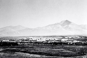
, 45°40′00"N 104°22′01"W, el. 3205 feet (976.9 m) - Fort MissoulaFort MissoulaFort Missoula was established by the United States Army in 1877 on land that is now part of the city of Missoula, Montana, to protect white settlers in Western Montana from possible threats from the native American Indians, such as the Nez Perce....
, Missoula County, MontanaMissoula County, Montana-National protected areas:*Bitterroot National Forest *Flathead National Forest *Lolo National Forest *Rattlesnake National Recreation Area-Demographics:...
, 46°50′32"N 114°03′37"W, el. 3150 feet (960.1 m) - Fort William Henry HarrisonFort William Henry HarrisonFort William Henry Harrison is the Montana National Guard training facility.-History:Fort William Henry Harrison was authorized by a Congressional act of 12 May 1892 which was intended to establish, as a part of a greater consolidation program, concentrations of troops in a few larger...
, Lewis and Clark County, MontanaLewis and Clark County, Montana-National protected areas:* Flathead National Forest * Helena National Forest * Lewis and Clark National Forest * Lolo National Forest * Rocky Mountain Front Conservation Area -Demographics:...
, 46°37′10"N 112°06′36"W, el. 4127 feet (1,257.9 m) - Hammond Mini-Mutes Radar Site, Carter County, MontanaCarter County, Montana-Demographics:As of the census of 2000, there were 1,360 people, 543 households, and 382 families residing in the county. The population density was -Demographics:...
, 45°19′10"N 104°57′14"W, el. 3717 feet (1,132.9 m) - Havre Air Force Station, Hill County, MontanaHill County, Montana-National protected areas:*Creedman Coulee National Wildlife Refuge*Lake Thibadeau National Wildlife Refuge-Demographics:As of the census of 2000, there were 16,673 people, 6,457 households, and 4,255 families residing in the county. The population density was 6 people per square mile . There were...
, 48°52′05"N 109°56′23"W, el. 3127 feet (953.1 m) - Haycreek Mini-Mute Radar Site, Carter County, MontanaCarter County, Montana-Demographics:As of the census of 2000, there were 1,360 people, 543 households, and 382 families residing in the county. The population density was -Demographics:...
, 45°42′00"N 104°43′59"W, el. 3898 feet (1,188.1 m) - Malmstrom Air Force BaseMalmstrom Air Force BaseMalmstrom Air Force Base is a United States Air Force base and census-designated place in Cascade County, Montana, United States. It was named in honor of World War II POW Colonel Einar Axel Malmstrom...
, Cascade County, MontanaCascade County, Montana-National protected areas:*Benton Lake National Wildlife Refuge*Lewis and Clark National Forest -Economy:Malmstrom Air Force Base is a driving force in the regional economy...
, 47°30′19"N 111°11′01"W, el. 3465 feet (1,056.1 m) - Opheim Air Force StationOpheim Air Force StationOpheim Air Force Station is a closed United States Air Force General Surveillance Radar station. It is located west of Opheim, Montana. It was closed in 1979.-History:...
, Valley County, MontanaValley County, Montana-Demographics:As of the census of 2000, there were 7,675 people, 3,150 households, and 2,129 families residing in the county. The population density was 2 people per square mile . There were 4,847 housing units at an average density of 1 per square mile...
, 48°51′43"N 106°28′36"W, el. 3294 feet (1,004 m)
Historical installations
- Camp Baker Military Reservation, Meagher County, MontanaMeagher County, Montana-National protected areas:*Gallatin National Forest *Helena National Forest *Lewis and Clark National Forest -Demographics:As of the census of 2000, there were 1,932 people, 803 households, and 529 families residing in the county...
, 46°40′43"N 111°10′19"W, el. 4636 feet (1,413.1 m) - Camp Cooke, Fergus County, MontanaFergus County, Montana-National protected areas:* Charles M. Russell National Wildlife Refuge * Lewis and Clark National Forest * Upper Missouri River Breaks National Monument -Demographics:...
, 47°43′58"N 109°40′34"W, el. 2431 feet (741 m)- The first U.S. Army post built in Montana on the Judith RiverJudith RiverThe Judith River is a tributary of the Missouri River, approximately 124 mi long, running through central Montana and the United States. It rises in the Little Belt Mountains and flows northeast past Utica and Hobson...
. Established August 1866. Disbanded June 1870. Named for General Philip St. George CookePhilip St. George CookePhilip St. George Cooke was a career United States Army cavalry officer who served as a Union General in the American Civil War. He is noted for his authorship of an Army cavalry manual, and is sometimes called the "Father of the U.S...
, the commander of the Department of the PlatteDepartment of the PlatteThe Department of the Platte was a military administrative district established by the U.S. Army on March 5, 1866, with boundaries encompassing Iowa, Nebraska, Dakota Territory, Utah Territory and a small portion of Idaho...
at the time.
- The first U.S. Army post built in Montana on the Judith River
- Camp Crook, Rosebud County, MontanaRosebud County, Montana-Demographics:As of the census of 2000, there were 9,383 people, 3,307 households, and 2,417 families residing in the county. The population density was 2 people per square mile . There were 3,912 housing units at an average density of 1 per square mile...
, 45°38′00"N 106°40′00"W, el. 3402 feet (1,036.9 m) - Camp Cummings, Madison County, MontanaMadison County, Montana-National protected areas:*Beaverhead National Forest *Deerlodge National Forest *Gallatin National Forest -Demographics:As of the census of 2000, there were 6,851 people, 2,956 households, and 1,921 families residing in the county. The population density was 2 people per square mile...
, 45°17′38"N 111°56′43"W, el. 5771 feet (1,759 m) - Camp Devin, Carter County, MontanaCarter County, Montana-Demographics:As of the census of 2000, there were 1,360 people, 543 households, and 382 families residing in the county. The population density was -Demographics:...
, location unknown - Camp Lewis, Fergus County, MontanaFergus County, Montana-National protected areas:* Charles M. Russell National Wildlife Refuge * Lewis and Clark National Forest * Upper Missouri River Breaks National Monument -Demographics:...
, 47°04′06"N 109°25′15"W, el. 3927 feet (1,196.9 m) - Camp Loder, Garfield County, MontanaGarfield County, Montana-Politics:Garfield County is a solidly Republican county. It might be the most Republican county in Montana and one of the most Republican in the nation....
, location unknown - Camp Merritt, Rosebud County, MontanaRosebud County, Montana-Demographics:As of the census of 2000, there were 9,383 people, 3,307 households, and 2,417 families residing in the county. The population density was 2 people per square mile . There were 3,912 housing units at an average density of 1 per square mile...
, 45°38′00"N 106°40′00"W, el. 3402 feet (1,036.9 m) - Camp Morris, Liberty County, MontanaLiberty County, Montana-Demographics:As of the census of 2000, there were 2,158 people, 833 households, and 583 families residing in the county. The population density was 2 people per square mile . There were 1,070 housing units at an average density of 1 per square mile...
, 48°54′30"N 111°15′08"W, el. 3944 feet (1,202.1 m) - Camp Poplar RiverCamp Poplar RiverCamp Poplar River was established during the Indian wars in the Department of Dakota by U.S. Army to maintain order, keep non-agency Indians away, and help capture the Indians who disturbed the peace and would not conform to reservation boundaries of the Fort Peck Agency, which in 1878, was...
, Roosevelt County, MontanaRoosevelt County, Montana-National protected areas:* Fort Union Trading Post National Historic Site * Medicine Lake National Wildlife Refuge -Demographics:As of the census of 2000, there were 10,620 people, 3,581 households, and 2,614 families residing in the county. The population density was 4 people per square mile...
, 48°06′47"N 105°11′52"W, el. 1991 feet (606.9 m) - Camp PorterCamp PorterCamp Porter, Montana Territory, was established as a single-year camp in the Department of Dakota by the U.S. Army, to provided protection to Northern Pacific Railway construction crews during the Indian Wars.-Established:...
, Dawson County, MontanaDawson County, Montana-Economy:Dawson County is known for its dryland grain, coal mines and gas and oil wells. There are 522 current farms and ranches, and 296 commercial businesses.-Demographics:...
, 47°09′03"N 104°41′33"W, el. 2037 feet (620.9 m) - Camp Reeve, Petroleum County, MontanaPetroleum County, Montana-National protected areas:*Charles M. Russell National Wildlife Refuge *War Horse National Wildlife Refuge-Demographics:At the 2000 census, there were 493 people, 211 households and 136 families residing in the county. The population density was 0.29 per square mile . There were 292 housing units...
, 47°27′21"N 107°54′50"W, el. 2247 feet (684.9 m) - Camp Robert B Smith, Lewis and Clark County, MontanaLewis and Clark County, Montana-National protected areas:* Flathead National Forest * Helena National Forest * Lewis and Clark National Forest * Lolo National Forest * Rocky Mountain Front Conservation Area -Demographics:...
, 46°35′25"N 112°04′00"W, el. 5279 feet (1,609 m) - Cantonment Rocky Point (historical), Fergus County, MontanaFergus County, Montana-National protected areas:* Charles M. Russell National Wildlife Refuge * Lewis and Clark National Forest * Upper Missouri River Breaks National Monument -Demographics:...
, 47°36′00"N 108°26′15"W, el. 2274 feet (693.1 m) - Cut Bank Air Force Station (historical)Cut Bank Municipal AirportCut Bank Municipal Airport is a public use airport located three nautical miles southwest of the central business district of Cut Bank, a city in Glacier County, Montana, United States. It is owned by Cut Bank and Glacier County....
, Glacier County, MontanaGlacier County, Montana-National protected areas:* Glacier National Park * Lewis and Clark National Forest -Demographics:As of the census of 2000, there were 13,247 people, 4,304 households, and 3,245 families residing in the county. The population density was 4 people per square mile . There were 5,243 housing units...
, 48°56′31"N 112°48′19"W, el. 4167 feet (1,270.1 m) - Cut Bank Army Air Field (historical)Cut Bank Municipal AirportCut Bank Municipal Airport is a public use airport located three nautical miles southwest of the central business district of Cut Bank, a city in Glacier County, Montana, United States. It is owned by Cut Bank and Glacier County....
, Glacier County, MontanaGlacier County, Montana-National protected areas:* Glacier National Park * Lewis and Clark National Forest -Demographics:As of the census of 2000, there were 13,247 people, 4,304 households, and 3,245 families residing in the county. The population density was 4 people per square mile . There were 5,243 housing units...
, 48°36′30"N 112°22′37"W, el. 3852 feet (1,174.1 m) - Fort Assinniboine (historical)Fort AssinniboineFort Assinniboine, a fort in Montana and within the military Department of Dakota, was built in 1879, in the aftermath of the Great Sioux War of 1876-77 and the disastrous defeat of U.S. Army forces led by General Custer at the Battle of Little Big Horn on June 25, 1876. The fort is located in...
, Hill County, MontanaHill County, Montana-National protected areas:*Creedman Coulee National Wildlife Refuge*Lake Thibadeau National Wildlife Refuge-Demographics:As of the census of 2000, there were 16,673 people, 6,457 households, and 4,255 families residing in the county. The population density was 6 people per square mile . There were...
, 48°30′05"N 109°47′30"W, el. 2671 feet (814.1 m) - Fort Assinniboine Military Reservation (historical)Fort AssinniboineFort Assinniboine, a fort in Montana and within the military Department of Dakota, was built in 1879, in the aftermath of the Great Sioux War of 1876-77 and the disastrous defeat of U.S. Army forces led by General Custer at the Battle of Little Big Horn on June 25, 1876. The fort is located in...
, Hill County, MontanaHill County, Montana-National protected areas:*Creedman Coulee National Wildlife Refuge*Lake Thibadeau National Wildlife Refuge-Demographics:As of the census of 2000, there were 16,673 people, 6,457 households, and 4,255 families residing in the county. The population density was 6 people per square mile . There were...
, 48°30′05"N 109°47′30"W, el. 2671 feet (814.1 m) - Fort C F Smith (historical)Fort C. F. SmithFort C. F. Smith was a military post established in the Powder River country by the United States Army in Montana Territory on August 12, 1866, during Red Cloud's War. Established by order of Col. Henry B...
, Big Horn County, MontanaBig Horn County, Montana- National protected areas :* Bighorn Canyon National Recreation Area * Little Bighorn Battlefield National Monument- Economy :Coal Mining and Agriculture both play major roles in Big Horn County’s economy...
, 45°18′52"N 107°54′30"W, el. 3268 feet (996.1 m) - Fort Carroll (historical), Fergus County, MontanaFergus County, Montana-National protected areas:* Charles M. Russell National Wildlife Refuge * Lewis and Clark National Forest * Upper Missouri River Breaks National Monument -Demographics:...
, 47°34′25"N 108°22′22"W, el. 2274 feet (693.1 m) - Fort Custer Military Reservation (historical)Fort Custer (Montana)Fort Custer was established during the Indian wars in the Department of Dakota by the U.S. Army to control the Sioux, Cheyenne and Crow Indians near present-day Hardin, Montana...
, Big Horn County, MontanaBig Horn County, Montana- National protected areas :* Bighorn Canyon National Recreation Area * Little Bighorn Battlefield National Monument- Economy :Coal Mining and Agriculture both play major roles in Big Horn County’s economy...
, 45°43′35"N 107°34′30"W, el. 3038 feet (926 m) - Fort Elizabeth Meagher (historical)Fort Elizabeth MeagherFort Elizabeth Meagher, named for the wife of Thomas F. Meagher, secretary and former acting governor of the Montana Territory, was established in May, 1867 eight miles east of the town of Bozeman, Montana at the mouth of Rocky Creek by Brigadier General Thomas Thoroughman and Colonel Walter W. De...
, Gallatin County, MontanaGallatin County, Montana-National protected areas:* Gallatin National Forest * Yellowstone National Park -Demographics:As of the census of 2000, there were 67,831 people, 26,323 households, and 16,188 families residing in the county. The population density was 26 people per square mile . There were 29,489 housing units...
, 45°38′30"N 110°55′05"W, el. 5249 feet (1,599.9 m) - Fort Ellis (historical)Fort EllisFort Ellis was an early United States Army outpost established August 27, 1867 to the eastern side of present-day Bozeman, Montana. The fort was established to protect and support settlers moving into the Gallatin Valley. The post was named for Civil War Colonel Augustus van Horne Ellis who was...
, Gallatin County, MontanaGallatin County, Montana-National protected areas:* Gallatin National Forest * Yellowstone National Park -Demographics:As of the census of 2000, there were 67,831 people, 26,323 households, and 16,188 families residing in the county. The population density was 26 people per square mile . There were 29,489 housing units...
, 45°39′16"N 110°56′35"W, el. 4987 feet (1,520 m) - Fort Fizzle (historical), Missoula County, MontanaMissoula County, Montana-National protected areas:*Bitterroot National Forest *Flathead National Forest *Lolo National Forest *Rattlesnake National Recreation Area-Demographics:...
, 46°44′42"N 114°11′26"W, el. 3383 feet (1,031.1 m)- Fort Fizzle is a wooden barricade on the Lolo Trail erected by Missoula volunteers to stop the advance of Chief JosephChief JosephHin-mah-too-yah-lat-kekt, popularly known as Chief Joseph, or Young Joseph was the leader of the Wal-lam-wat-kain band of Nez Perce during General Oliver O. Howard's attempt to forcibly remove his band and the other "non-treaty" Nez Perce to a reservation in Idaho...
during the Nez Perce WarNez Perce WarThe Nez Perce War was an armed conflict between the Nez Perce and the United States government fought in 1877 as part of the American Indian Wars. After a series of battles in which both the U.S. Army and native people sustained significant casualties, the Nez Perce surrendered and were relocated...
in 1877. The barricade failed when the Nez Perce climbed a steep ravine behind the ridge and bypassed the soldiers. The failure to stop the Nez Perce caused the barricade to be named Fort Fizzle.
- Fort Fizzle is a wooden barricade on the Lolo Trail erected by Missoula volunteers to stop the advance of Chief Joseph
- Fort Green Clay Smith (historical), Park County, MontanaPark County, MontanaPark Counties in Montana and Wyoming are among the very few pairs of counties in the United States with the same name to border each other across state lines.-National protected areas:* Custer National Forest * Gallatin National Forest...
, 45°43′20"N 110°27′40"W, el. 4383 feet (1,335.9 m) - Fort Howes (historical), Powder River County, MontanaPowder River County, Montana-Demographics:As of the census of 2000, there were 1,858 people, 737 households, and 524 families residing in the county. The population density was -Demographics:...
, 45°17′00"N 106°08′53"W, el. 3297 feet (1,004.9 m) - Fort Howie (historical), Meagher County, MontanaMeagher County, Montana-National protected areas:*Gallatin National Forest *Helena National Forest *Lewis and Clark National Forest -Demographics:As of the census of 2000, there were 1,932 people, 803 households, and 529 families residing in the county...
, 46°31′40"N 110°23′30"W, el. 4931 feet (1,503 m)- Established in 1867 near Martinsdale, MontanaMartinsdale, MontanaMartinsdale is an unincorporated community in southeastern Meagher County, Montana, United States. The town was a station stop on the now-abandoned transcontinental main line of the Chicago, Milwaukee, St. Paul and Pacific Railroad , and is a community center for nearby ranches and farms...
on the Musselshell RiverMusselshell RiverThe Musselshell River is a tributary of the Missouri River, long from its origins at the confluence of its North and South Forks near Martinsdale, Montana to its mouth on the Missouri River. It is located east of the Continental divide entirely within Montana in the United States...
. Disbanded in 1867. Named for Colonel Neil Howie of the Montana Militia.
- Established in 1867 near Martinsdale, Montana
- Fort Ida Thoroughman (historical), Park County, MontanaPark County, MontanaPark Counties in Montana and Wyoming are among the very few pairs of counties in the United States with the same name to border each other across state lines.-National protected areas:* Custer National Forest * Gallatin National Forest...
, 45°43′20"N 110°27′40"W, el. 4383 feet (1,335.9 m) - Fort Keogh (historical)Fort KeoghFort Keogh is located on the western edge of Miles City, Montana. Occasionally spelled Fort Keough. Originally a military post, today it is a United States Department of Agriculture livestock and range research station. It is listed on the National Register of Historic Places...
, Custer County, MontanaCuster County, Montana-Economy:The main source of income for Custer County has largely come from cattle ranching and dryland farming. Miles City serves as the center of commerce in an area extending for 100 miles in every direction...
, 46°22′32"N 105°53′00"W, el. 2372 feet (723 m) - Fort Logan (historical), Meagher County, MontanaMeagher County, Montana-National protected areas:*Gallatin National Forest *Helena National Forest *Lewis and Clark National Forest -Demographics:As of the census of 2000, there were 1,932 people, 803 households, and 529 families residing in the county...
, 46°40′43"N 111°10′19"W, el. 4636 feet (1,413.1 m) - Fort Maginnis (historical), Fergus County, MontanaFergus County, Montana-National protected areas:* Charles M. Russell National Wildlife Refuge * Lewis and Clark National Forest * Upper Missouri River Breaks National Monument -Demographics:...
, 47°08′30"N 109°08′02"W, el. 4160 feet (1,268 m) - Fort Maginnis Military Reservation (historical), Fergus County, MontanaFergus County, Montana-National protected areas:* Charles M. Russell National Wildlife Refuge * Lewis and Clark National Forest * Upper Missouri River Breaks National Monument -Demographics:...
, 47°10′00"N 109°07′32"W, el. 4236 feet (1,291.1 m) - Fort Missoula (historical)Fort MissoulaFort Missoula was established by the United States Army in 1877 on land that is now part of the city of Missoula, Montana, to protect white settlers in Western Montana from possible threats from the native American Indians, such as the Nez Perce....
, Missoula County, MontanaMissoula County, Montana-National protected areas:*Bitterroot National Forest *Flathead National Forest *Lolo National Forest *Rattlesnake National Recreation Area-Demographics:...
, 46°50′34"N 114°03′29"W, el. 3153 feet (961 m) - Fort Owen (historical), Ravalli County, MontanaRavalli County, Montana-National protected areas:*Bitterroot National Forest *Lee Metcalf National Wildlife Refuge*Lolo National Forest -Demographics:As of the census of 2000 , there were 36,070 people, 14,289 households, and 10,188 families residing in the county. The population density was 15 people per square mile...
, 46°31′11"N 114°05′45"W, el. 3294 feet (1,004 m) - Fort Shaw (historical), Cascade County, MontanaCascade County, Montana-National protected areas:*Benton Lake National Wildlife Refuge*Lewis and Clark National Forest -Economy:Malmstrom Air Force Base is a driving force in the regional economy...
, 47°30′32"N 111°49′12"W, el. 3507 feet (1,068.9 m) - Fort Skalkaho (historical), Ravalli County, MontanaRavalli County, Montana-National protected areas:*Bitterroot National Forest *Lee Metcalf National Wildlife Refuge*Lolo National Forest -Demographics:As of the census of 2000 , there were 36,070 people, 14,289 households, and 10,188 families residing in the county. The population density was 15 people per square mile...
, 46°14′20"N 114°08′32"W, el. 3599 feet (1,097 m) - Fort Thomas F Meagher (historical), Park County, MontanaPark County, MontanaPark Counties in Montana and Wyoming are among the very few pairs of counties in the United States with the same name to border each other across state lines.-National protected areas:* Custer National Forest * Gallatin National Forest...
, 45°42′00"N 110°31′00"W, el. 4442 feet (1,353.9 m) - Fort William Henry Harrison (historical), Lewis and Clark County, MontanaLewis and Clark County, Montana-National protected areas:* Flathead National Forest * Helena National Forest * Lewis and Clark National Forest * Lolo National Forest * Rocky Mountain Front Conservation Area -Demographics:...
, 46°37′25"N 112°05′50"W, el. 3963 feet (1,207.9 m) - Glasgow Air Force Base (historical)Glasgow Air Force BaseGlasgow Air Force Base is a former United States Air Force base located approximately north of the city of Glasgow, Valley County, Montana, not far from the Canadian border...
, Valley County, MontanaValley County, Montana-Demographics:As of the census of 2000, there were 7,675 people, 3,150 households, and 2,129 families residing in the county. The population density was 2 people per square mile . There were 4,847 housing units at an average density of 1 per square mile...
, 48°24′13"N 106°31′07"W, el. 2749 feet (837.9 m) - Glasgow Army Air Field (historical)Glasgow Air Force BaseGlasgow Air Force Base is a former United States Air Force base located approximately north of the city of Glasgow, Valley County, Montana, not far from the Canadian border...
, Valley County, MontanaValley County, Montana-Demographics:As of the census of 2000, there were 7,675 people, 3,150 households, and 2,129 families residing in the county. The population density was 2 people per square mile . There were 4,847 housing units at an average density of 1 per square mile...
, 48°12′59"N 106°36′55"W, el. 2297 feet (700.1 m) - Havre Air Force Station (historical), Hill County, MontanaHill County, Montana-National protected areas:*Creedman Coulee National Wildlife Refuge*Lake Thibadeau National Wildlife Refuge-Demographics:As of the census of 2000, there were 16,673 people, 6,457 households, and 4,255 families residing in the county. The population density was 6 people per square mile . There were...
, 48°52′51"N 109°56′36"W, el. 3202 feet (976 m) - Helena Barracks (historical), Lewis and Clark County, MontanaLewis and Clark County, Montana-National protected areas:* Flathead National Forest * Helena National Forest * Lewis and Clark National Forest * Lolo National Forest * Rocky Mountain Front Conservation Area -Demographics:...
, 46°37′28"N 112°04′00"W, el. 3868 feet (1,179 m) - Lewistown Air Force Station (historical), Fergus County, MontanaFergus County, Montana-National protected areas:* Charles M. Russell National Wildlife Refuge * Lewis and Clark National Forest * Upper Missouri River Breaks National Monument -Demographics:...
, 47°13′03"N 109°13′20"W, el. 6424 feet (1,958 m) - Lewistown Army Air Field (historical), Fergus County, MontanaFergus County, Montana-National protected areas:* Charles M. Russell National Wildlife Refuge * Lewis and Clark National Forest * Upper Missouri River Breaks National Monument -Demographics:...
, 47°02′37"N 109°28′35"W, el. 4167 feet (1,270.1 m) - Limestone Military Reservation (historical), Big Horn County, MontanaBig Horn County, Montana- National protected areas :* Bighorn Canyon National Recreation Area * Little Bighorn Battlefield National Monument- Economy :Coal Mining and Agriculture both play major roles in Big Horn County’s economy...
, 45°18′15"N 107°55′40"W, el. 3379 feet (1,029.9 m) - Miles City Air Force Station (historical), Custer County, MontanaCuster County, Montana-Economy:The main source of income for Custer County has largely come from cattle ranching and dryland farming. Miles City serves as the center of commerce in an area extending for 100 miles in every direction...
, 46°17′48"N 105°58′43"W, el. 2831 feet (862.9 m) - National Cemetery Military Reservation (historical)Little Bighorn Battlefield National MonumentLittle Bighorn Battlefield National Monument preserves the site of the June 25, 1876, Battle of the Little Bighorn, near Crow Agency, Montana, in the United States. It also serves as a memorial to those who fought in the battle: George Armstrong Custer's 7th Cavalry and a combined Lakota-Northern...
, Big Horn County, MontanaBig Horn County, Montana- National protected areas :* Bighorn Canyon National Recreation Area * Little Bighorn Battlefield National Monument- Economy :Coal Mining and Agriculture both play major roles in Big Horn County’s economy...
, 45°33′55"N 107°25′54"W, el. 3156 feet (961.9 m) - Opheim Air Force Station (historical), Valley County, MontanaValley County, Montana-Demographics:As of the census of 2000, there were 7,675 people, 3,150 households, and 2,129 families residing in the county. The population density was 2 people per square mile . There were 4,847 housing units at an average density of 1 per square mile...
, 48°51′44"N 106°28′35"W, el. 3294 feet (1,004 m) - Stanleys Stockade (historical), Dawson County, MontanaDawson County, Montana-Economy:Dawson County is known for its dryland grain, coal mines and gas and oil wells. There are 522 current farms and ranches, and 296 commercial businesses.-Demographics:...
, 46°55′36"N 104°52′10"W, el. 2133 feet (650.1 m)- An U.S. Army advance supply depot near Glendive, MontanaGlendive, MontanaGlendive is a city in and the county seat of Dawson County, Montana, United States. The population was 4,935 at the 2010 census.The town of Glendive is located in South Eastern Montana and is considered by many as an agricultural hub of Eastern Montana...
on the Yellowstone RiverYellowstone RiverThe Yellowstone River is a tributary of the Missouri River, approximately long, in the western United States. Considered the principal tributary of the upper Missouri, the river and its tributaries drain a wide area stretching from the Rocky Mountains in the vicinity of the Yellowstone National...
established in July 1873. Used by General Alfred Terry as his headquarters during the 1876 Sioux campaign.
- An U.S. Army advance supply depot near Glendive, Montana
- Terrys Supply Camp (historical), Prairie County, MontanaPrairie County, Montana-Demographics:As of the census of 2000, there were 1,199 people, 537 households, and 354 families residing in the county. The population density was -Demographics:...
, 46°44′26"N 105°26′03"W, el. 2192 feet (668.1 m)- A U.S. Army steamboat landing at the mouth of Powder RiverPowder River (Montana)Powder River is a tributary of the Yellowstone River, approximately long in the southeastern Montana and northeastern Wyoming in the United States. It drains an area historically known as the Powder River Country on the high plains east of the Bighorn Mountains.It rises in three forks in eastern...
built in 1877. Abandoned in 1882 when the Northern Pacific RailwayNorthern Pacific RailwayThe Northern Pacific Railway was a railway that operated in the west along the Canadian border of the United States. Construction began in 1870 and the main line opened all the way from the Great Lakes to the Pacific when former president Ulysses S. Grant drove in the final "golden spike" in...
reached Powder River.
- A U.S. Army steamboat landing at the mouth of Powder River
- Yaak Air Force Station (historical), Lincoln County, MontanaLincoln County, Montana-National protected areas:* Pacific Northwest National Scenic Trail *Flathead National Forest *Kaniksu National Forest *Kootenai National Forest -Demographics:...
, 48°51′43"N 115°43′20"W, el. 4970 feet (1,514.9 m)